e99 Online Shopping Mall

Geometry.Net - the online learning center Help  
Home  - Basic A - Arizona Geography (Books)

  Back | 61-80 of 110 | Next 20
A  B  C  D  E  F  G  H  I  J  K  L  M  N  O  P  Q  R  S  T  U  V  W  X  Y  Z  

click price to see details     click image to enlarge     click link to go to the store

 
61. Geology and geography of the Zion
$12.73
62. Geography of Pima County, Arizona:
$14.13
63. Geography of Pinal County, Arizona:
$14.13
64. Geography of Navajo County, Arizona:
$14.13
65. Geography of Maricopa County,
$14.13
66. Geography of Greenlee County,
$14.13
67. Geography of Gila County, Arizona:
$14.13
68. Geography of Yuma County, Arizona:
$14.13
69. Geography of Apache County, Arizona:
$14.13
70. Geography of Cochise County, Arizona:
$19.99
71. Geography of Mohave County, Arizona:
$19.99
72. Geography of Yavapai County, Arizona:
$18.04
73. Geography of Coconino County,
$17.95
74. Thomas Guide 2006 Phoenix, Arizona:
 
75. Geography and regional development
 
76. Geography of Arizona
 
77. Arizona "jography": "geography
 
78. The historical geography of Arizona
 
79. A typology of Arizona communities
 
80. The geography of Arizona

61. Geology and geography of the Zion Park region, Utah and Arizona: A comprehensive report on a scenic and historic region of the Southwest (United States. Geological Survey. Professional paper 220)
by Herbert E Gregory
 Unknown Binding: 200 Pages (1950)

Asin: B0007EDZYW
Canada | United Kingdom | Germany | France | Japan

62. Geography of Pima County, Arizona: Coronado National Forest
Paperback: 46 Pages (2010-09-15)
list price: US$14.14 -- used & new: US$12.73
(price subject to change: see help)
Asin: 1156750318
Canada | United Kingdom | Germany | France | Japan
Editorial Review

Product Description
Chapters: Coronado National Forest. Source: Wikipedia. Pages: 45. Not illustrated. Free updates online. Purchase includes a free trial membership in the publisher's book club where you can select from more than a million books without charge. Excerpt: Coronado National Forest -Wilderness areas in the Coronado National ForestThe Coronado National Forest contains eight designated wilderness areas, with at least one in each Ranger District. Congress defines Wilderness as an area "untrammeled by man." Common activities in the Coronado National Forest wilderness areas include hiking, horseback riding, camping, hunting, and fishing. The use of mechanized or motorized equipment, including bicycles, generators, and chain saws, is prohibited. Below is a table displaying all public campgrounds located within the Coronado National Forest. Most requiring a daily/nightly fee (see Coronado National Forest official website for accurate and current details), though some do not. * Information is accurate as of Tuesday, 17 June 2008 at 13:39:50 EDT Huachuca National Forest was established as the Huachuca Forest Reserve by the U.S. Forest Service in Arizona on November 6, 1906 with 314,125 acres. It became a National Forest on March 4, 1907. On July 1, 1908 the entire forest was combined with Baboquivari National Forest and Tumacacori National Forest to establish Garces National Forest, and the name was discontinued. The lands are presently included in Coronado National Forest. ...More: http://booksllc.net/?id=1494532 ... Read more


63. Geography of Pinal County, Arizona: Coronado National Forest
Paperback: 48 Pages (2010-09-15)
list price: US$14.14 -- used & new: US$14.13
(price subject to change: see help)
Asin: 1156750326
Canada | United Kingdom | Germany | France | Japan
Editorial Review

Product Description
Chapters: Coronado National Forest. Source: Wikipedia. Pages: 47. Not illustrated. Free updates online. Purchase includes a free trial membership in the publisher's book club where you can select from more than a million books without charge. Excerpt: Coronado National Forest -Wilderness areas in the Coronado National ForestThe Coronado National Forest contains eight designated wilderness areas, with at least one in each Ranger District. Congress defines Wilderness as an area "untrammeled by man." Common activities in the Coronado National Forest wilderness areas include hiking, horseback riding, camping, hunting, and fishing. The use of mechanized or motorized equipment, including bicycles, generators, and chain saws, is prohibited. Below is a table displaying all public campgrounds located within the Coronado National Forest. Most requiring a daily/nightly fee (see Coronado National Forest official website for accurate and current details), though some do not. * Information is accurate as of Tuesday, 17 June 2008 at 13:39:50 EDT Huachuca National Forest was established as the Huachuca Forest Reserve by the U.S. Forest Service in Arizona on November 6, 1906 with 314,125 acres. It became a National Forest on March 4, 1907. On July 1, 1908 the entire forest was combined with Baboquivari National Forest and Tumacacori National Forest to establish Garces National Forest, and the name was discontinued. The lands are presently included in Coronado National Forest. ...More: http://booksllc.net/?id=1494532 ... Read more


64. Geography of Navajo County, Arizona: Petrified Forest National Park, Navajo National Monument, Hopi Reservation, Fort Apache Indian Reservation
Paperback: 34 Pages (2010-09-15)
list price: US$14.14 -- used & new: US$14.13
(price subject to change: see help)
Asin: 1157217060
Canada | United Kingdom | Germany | France | Japan
Editorial Review

Product Description
Chapters: Petrified Forest National Park, Navajo National Monument, Hopi Reservation, Fort Apache Indian Reservation, Black Mesa, Arizona, Sitgreaves National Forest, Comb Ridge. Source: Wikipedia. Pages: 32. Not illustrated. Free updates online. Purchase includes a free trial membership in the publisher's book club where you can select from more than a million books without charge. Excerpt: Petrified Forest National Park -The Petrified Forest area was designated a National Monument on December 8, 1906. The Painted Desert was added later. On December 9, 1962, the whole monument was made a National Park. It covers 218,533 acres (341.458 sq mi; 884.37 km). Hiking opportunities are varied: the longest established trail in the park extends for only 2 miles (3.2 km); the others are 1 mile (1.6 km) or less, but there are exciting backcountry possibilities. About 50,620 acres (79.09 sq mi; 204.9 km) of the Painted Desert is protected as the Petrified Forest National Wilderness Area, accessible to anyone who wants to explore the stark, colorful moonscapes of the badlands. This surreal playground is easily entered by a wilderness access trail at Kachina Point/The Painted Desert Inn. After a series of switchbacks the trail fades and visitors may explore wherever they would like. No permit is needed for day hikes, but a free overnight permit must be obtained at any of the visitor's centers for overnight adventures. A 28-mile (45 km) long road runs through much of the park. Landmarks include the Agate House, built of petrified wood, and the Agate Bridge, a petrified log spanning a wash. The pieces of permineralized wood are fossil Araucariaceae, a family of trees that is extinct in the Northern Hemisphere but survives in isolated stands in the Southern Hemisphere. During the Late Triassic, this desert region was located in the tropics and was seasonally wet and dry. In seasonal flooding, the trees washed from where they grew and accum...More: http://booksllc.net/?id=276241 ... Read more


65. Geography of Maricopa County, Arizona: White Tank Mountain Regional Park, Sonoran Desert National Monument, Gila River Indian Community
Paperback: 30 Pages (2010-09-15)
list price: US$14.14 -- used & new: US$14.13
(price subject to change: see help)
Asin: 1157217052
Canada | United Kingdom | Germany | France | Japan
Editorial Review

Product Description
Chapters: White Tank Mountain Regional Park, Sonoran Desert National Monument, Gila River Indian Community, Salt River Pima-Maricopa Indian Community, Painted Rocks, Hells Canyon Wilderness, Desert Breeze Lake. Source: Wikipedia. Pages: 28. Not illustrated. Free updates online. Purchase includes a free trial membership in the publisher's book club where you can select from more than a million books without charge. Excerpt: The White Tank Mountain Regional Park is a large regional park located in west-central Maricopa County, Arizona. Encompassing 29,271 acres (45.736 sq mi; 118.456 km) of desert and mountain landscape, it is the largest regional park in the county. The bulk of the White Tank Mountains range are located within the park's boundaries. The developed portion of the park provides a number of outdoor recreational activities. Ramadas (generally shaded tables), picnic areas and campgrounds are available and often used for informal gathering places. Several of the campground areas are available for RV access and are semi-developed, including picnic tables, barbecue grills and restroom facilities equipped with showers. The park is more well-renowned for an extensive network of hiking trails. Nearly 26 miles (42 km) of hiking trails wind through the terrain in the park, ranging in difficulty from a simple walk to moderately challenging. The most commonly used is the Waterfall trail, a 0.9 miles (1.4 km) walk that culminates in a narrow canyon featuring a seasonal waterfall. Bicycling and horseback riding are permitted on many of the trails. In addition to the network of hiking trails there is a 10 miles (16 km) competitive track designed for "high speeds, challenging one's skills, and racing". Clear weather typical of the desert environment combined with darker skies due to the semi-rural setting provide for stargazing and amateur astronomy opportunities. The park hosts an organized stargazing event at various dates th...More: http://booksllc.net/?id=3268223 ... Read more


66. Geography of Greenlee County, Arizona: Landforms of Greenlee County, Arizona, Settlements in Greenlee County, Arizona, Clifton, Arizona, Duncan
Paperback: 34 Pages (2010-06-14)
list price: US$14.14 -- used & new: US$14.13
(price subject to change: see help)
Asin: 1158206100
Canada | United Kingdom | Germany | France | Japan
Editorial Review

Product Description
Purchase includes free access to book updates online and a free trial membership in the publisher's book club where you can select from more than a million books without charge. Chapters: Landforms of Greenlee County, Arizona, Settlements in Greenlee County, Arizona, Clifton, Arizona, Duncan, Arizona, Safford Micropolitan Area, Blue River, Apache National Forest, Aker Lake, Eagle Creek, San Francisco River, Gila Box Riparian National Conservation Area, Blue Vista, Arizona. Excerpt: Duncan, Arizona - Wikipedia, the free encyclopedia Duncan is located at (32.725828, -109.097686). According to the United States Census Bureau, the town has a total area of 2.6 square miles (6.6 km²), all of it land. As of the census of 2000, there were 812 people, 294 households, and 206 families residing in the town. The population density was 317.6 people per square mile (122.5/km²). There were 384 housing units at an average density of 150.2/sq mi (57.9/km²). The racial makeup of the town was 81.77% White, 0.49% Black or African American, 0.86% Native American, 0.12% Asian, 13.55% from other races, and 3.20% from two or more races. 31.53% of the population were Hispanic or Latino of any race. There were 294 households out of which 42.2% had children under the age of 18 living with them, 46.3% were married couples living together, 17.7% had a female householder with no husband present, and 29.6% were non-families. 25.9% of all households were made up of individuals and 12.9% had someone living alone who was 65 years of age or older. The average household size was 2.76 and the average family size was 3.33. In the town the population was spread out with 35.2% under the age of 18, 10.6% from 18 to 24, 22.2% from 25 to 44, 21.2% from 45 to 64, and 10.8% who were 65 years of age or older. The median age was 28 years. For every 100 females there were 90.6 males. For every 100 females age 18 and over, there were 91.3 males. The median income for a hous... More: http://booksllc.net/?id=106627 ... Read more


67. Geography of Gila County, Arizona: Coconino National Forest, San Carlos Apache Indian Reservation, Tonto National Monument
Paperback: 32 Pages (2010-09-15)
list price: US$14.14 -- used & new: US$14.13
(price subject to change: see help)
Asin: 1157217028
Canada | United Kingdom | Germany | France | Japan
Editorial Review

Product Description
Chapters: Coconino National Forest, San Carlos Apache Indian Reservation, Tonto National Monument, Fort Apache Indian Reservation, Needle's Eye Wilderness, Salt River Canyon Wilderness, Salome Wilderness, Sierra Ancha Wilderness. Source: Wikipedia. Pages: 31. Not illustrated. Free updates online. Purchase includes a free trial membership in the publisher's book club where you can select from more than a million books without charge. Excerpt: Coconino National Forest -The elevation in the forest ranges from 2,600 feet (800 m) in the southern part of the forest near the Verde River to 12,633 feet (3,851 m) at the summit of Humphreys Peak, the highest point in the state of Arizona. Much of the forest is a high altitude plateau (average elevation is roughly 7,000 feet (2,100 m) on the plateau) that is located in the midst of the largest contiguous ponderosa pine forest in North America. The southern border of this plateau is the Mogollon Rim, a nearly 400 mile (640 km) long escarpment running across central Arizona that also marks the southern boundary of the Colorado Plateau. The Coconino National Forest is divided into four districts that each possess their own distinct geography and environments. Inner Basin of San Francisco Peaks in the summer. Agassiz Peak at center, and Fremont Peak at left.The northern most district, known as the Peaks District, is home to the San Francisco Peaks, an ancient group of volcanic summits. The highest peak, Humphreys Peak, is the highest point in Arizona at 12,633 feet (3,851 m). The second, third, and fourth highest peaks in Arizona are found nearby. The San Francisco Peaks are the dominant structure of the San Francisco Volcanic Field, an 1,800 square mile (4,700 km²) volcanic field that contains more than 600 volcanic features. The Coconino National Forest encompasses a large portion of the volcanic field and so the forest landscape around Flagstaff is dotted with tree-covered cinder con...More: http://booksllc.net/?id=2054605 ... Read more


68. Geography of Yuma County, Arizona: Kofa National Wildlife Refuge, Cabeza Prieta National Wildlife Refuge, Imperial National Wildlife Refuge
Paperback: 26 Pages (2010-09-15)
list price: US$14.14 -- used & new: US$14.13
(price subject to change: see help)
Asin: 1157217095
Canada | United Kingdom | Germany | France | Japan
Editorial Review

Product Description
Chapters: Kofa National Wildlife Refuge, Cabeza Prieta National Wildlife Refuge, Imperial National Wildlife Refuge, Yuma Desert, Cabeza Prieta Wilderness. Source: Wikipedia. Pages: 25. Not illustrated. Free updates online. Purchase includes a free trial membership in the publisher's book club where you can select from more than a million books without charge. Excerpt: Kofa National Wildlife Refuge -In 1936, the Arizona boy scouts mounted a state-wide campaign to save the Bighorn Sheep, leading to the creation of Kofa. The Scouts first became interested in the sheep through the efforts of Major Frederick Russell Burnham, the noted conservationist who has been called the Father of Scouting. Burnham observed that fewer than 150 of these sheep still lived in the Arizona mountains. He called George F. Miller, then scout executive of the boy scout council headquartered in Phoenix, with a plan to save the sheep. Burnham put it this way:I want you to save this majestic animal, not only because it is in danger of extinction, but of more importance, some day it might provide domestic sheep with a strain to save them from disaster at the hands of a yet unknown virus. Several other prominent Arizonans joined the movement and a save the bighorns poster contest was started in schools throughout the state. Burnham provided prizes and appeared in store windows from one end of Arizona to the other. The contest-winning bighorn emblem was made up into neckerchief slides for the 10,000 boy scouts, and talks and dramatizations were given at school assemblies and on radio. The National Wildlife Federation, the Izaak Walton League, and the Audubon Society also joined the effort. On January 18, 1939, over 1.5 million acres (6,100 km) were set aside at Kofa and at Cabeza Prieta National Wildlife Refuge combined and a civilian conservation corp side camp was setup to develop high mountain waterholes for the sheep. On April 2, 1939, Kofa National ...More: http://booksllc.net/?id=13192990 ... Read more


69. Geography of Apache County, Arizona: Petrified Forest National Park
Paperback: 42 Pages (2010-09-15)
list price: US$14.14 -- used & new: US$14.13
(price subject to change: see help)
Asin: 1156750245
Canada | United Kingdom | Germany | France | Japan
Editorial Review

Product Description
Chapters: Petrified Forest National Park. Source: Wikipedia. Pages: 41. Not illustrated. Free updates online. Purchase includes a free trial membership in the publisher's book club where you can select from more than a million books without charge. Excerpt: Petrified Forest National Park -The Petrified Forest area was designated a National Monument on December 8, 1906. The Painted Desert was added later. On December 9, 1962, the whole monument was made a National Park. It covers 218,533 acres (341.458 sq mi; 884.37 km). Hiking opportunities are varied: the longest established trail in the park extends for only 2 miles (3.2 km); the others are 1 mile (1.6 km) or less, but there are exciting backcountry possibilities. About 50,620 acres (79.09 sq mi; 204.9 km) of the Painted Desert is protected as the Petrified Forest National Wilderness Area, accessible to anyone who wants to explore the stark, colorful moonscapes of the badlands. This surreal playground is easily entered by a wilderness access trail at Kachina Point/The Painted Desert Inn. After a series of switchbacks the trail fades and visitors may explore wherever they would like. No permit is needed for day hikes, but a free overnight permit must be obtained at any of the visitor's centers for overnight adventures. A 28-mile (45 km) long road runs through much of the park. Landmarks include the Agate House, built of petrified wood, and the Agate Bridge, a petrified log spanning a wash. The pieces of permineralized wood are fossil Araucariaceae, a family of trees that is extinct in the Northern Hemisphere but survives in isolated stands in the Southern Hemisphere. During the Late Triassic, this desert region was located in the tropics and was seasonally wet and dry. In seasonal flooding, the trees washed from where they grew and accumulated in sandy river channels, where they were buried periodically by layers of gravely sand, rich in volcanic ash from volcanoes furthe...More: http://booksllc.net/?id=276241 ... Read more


70. Geography of Cochise County, Arizona: Coronado National Forest, Kartchner Caverns State Park, Malpai Borderlands, Coronado National Memorial
Paperback: 40 Pages (2010-09-15)
list price: US$14.14 -- used & new: US$14.13
(price subject to change: see help)
Asin: 1157307469
Canada | United Kingdom | Germany | France | Japan
Editorial Review

Product Description
Chapters: Coronado National Forest, Kartchner Caverns State Park, Malpai Borderlands, Coronado National Memorial, Chiricahua National Monument, San Bernardino National Wildlife Refuge, Leslie Canyon National Wildlife Refuge, Chiricahua National Forest, Tombstone Historic District, Peloncillo National Forest, Dragoon National Forest, San Pedro Riparian National Conservation Area. Source: Wikipedia. Pages: 39. Not illustrated. Free updates online. Purchase includes a free trial membership in the publisher's book club where you can select from more than a million books without charge. Excerpt: Coronado National Forest -Wilderness areas in the Coronado National ForestThe Coronado National Forest contains eight designated wilderness areas, with at least one in each Ranger District. Congress defines Wilderness as an area "untrammeled by man." Common activities in the Coronado National Forest wilderness areas include hiking, horseback riding, camping, hunting, and fishing. The use of mechanized or motorized equipment, including bicycles, generators, and chain saws, is prohibited. Below is a table displaying all public campgrounds located within the Coronado National Forest. Most requiring a daily/nightly fee (see Coronado National Forest official website for accurate and current details), though some do not. * Information is accurate as of Tuesday, 17 June 2008 at 13:39:50 EDT Huachuca National Forest was established as the Huachuca Forest Reserve by the U.S. Forest Service in Arizona on November 6, 1906 with 314,125 acres. It became a National Forest on March 4, 1907. On July 1, 1908 the entire forest was combined with Baboquivari National Forest and Tumacacori National Forest to establish Garces National Forest, and the name was discontinued. The lands are presently included in Coronado National Forest. ...More: http://booksllc.net/?id=1494532 ... Read more


71. Geography of Mohave County, Arizona: Mojave Desert
Paperback: 104 Pages (2010-09-15)
list price: US$19.99 -- used & new: US$19.99
(price subject to change: see help)
Asin: 1156750296
Canada | United Kingdom | Germany | France | Japan
Editorial Review

Product Description
Chapters: Mojave Desert. Source: Wikipedia. Pages: 103. Not illustrated. Free updates online. Purchase includes a free trial membership in the publisher's book club where you can select from more than a million books without charge. Excerpt: Mojave Desert -Mojave Desert scene in Joshua Tree National ParkThe Mojave Desert receives less than 10 inches (254 mm) of rain a year and is generally between 3,000 and 6,000 feet (1,000 and 2,000 m) in elevation. The Mojave Desert also contains the Mojave National Preserve, as well as the lowest and hottest place in North America: Death Valley, where the temperature normally surpasses 120°F (49°C) in late July and early August. Zion National Park, in Utah, lies at the junction of the Mojave, the Great Basin Desert, and the Colorado Plateau. Despite its aridity, the Mojave (and particularly the Antelope Valley in its southwest) has long been a center of alfalfa production, fed by irrigation coming from groundwater and (in the 20th century) from the California Aqueduct. The Mojave is a desert of temperature extremes and four distinct seasons. Winter months bring temperatures dipping to below 20 °F (-7 °C) on valley floors, and below 0 °F (-18 °C) at higher elevations. Storms moving from the Pacific Northwest can bring rain and snow across the region more often, the rain shadow created by the Sierra Nevada as well as mountain ranges within the desert such as the Spring Mountains bring only clouds and wind. In longer periods between storm systems, winter temperatures in valleys can approach 80 °F (27 °C). Spring weather continues to be influenced by Pacific storms, but rainfall is more widespread and occurs less frequently after April. By early June, it is rare for another Pacific storm to have a significant impact on the region's weather, and temperatures after mid-May are normally above 90 °F (32 °C) and frequently above 100 °F (38 °C). Sand blowing off a crest in the Kelso Dunes of the...More: http://booksllc.net/?id=239055 ... Read more


72. Geography of Yavapai County, Arizona: Coconino National Forest
Paperback: 70 Pages (2010-09-15)
list price: US$19.99 -- used & new: US$19.99
(price subject to change: see help)
Asin: 1156750334
Canada | United Kingdom | Germany | France | Japan
Editorial Review

Product Description
Chapters: Coconino National Forest. Source: Wikipedia. Pages: 69. Not illustrated. Free updates online. Purchase includes a free trial membership in the publisher's book club where you can select from more than a million books without charge. Excerpt: Coconino National Forest -The elevation in the forest ranges from 2,600 feet (800 m) in the southern part of the forest near the Verde River to 12,633 feet (3,851 m) at the summit of Humphreys Peak, the highest point in the state of Arizona. Much of the forest is a high altitude plateau (average elevation is roughly 7,000 feet (2,100 m) on the plateau) that is located in the midst of the largest contiguous ponderosa pine forest in North America. The southern border of this plateau is the Mogollon Rim, a nearly 400 mile (640 km) long escarpment running across central Arizona that also marks the southern boundary of the Colorado Plateau. The Coconino National Forest is divided into four districts that each possess their own distinct geography and environments. Inner Basin of San Francisco Peaks in the summer. Agassiz Peak at center, and Fremont Peak at left.The northern most district, known as the Peaks District, is home to the San Francisco Peaks, an ancient group of volcanic summits. The highest peak, Humphreys Peak, is the highest point in Arizona at 12,633 feet (3,851 m). The second, third, and fourth highest peaks in Arizona are found nearby. The San Francisco Peaks are the dominant structure of the San Francisco Volcanic Field, an 1,800 square mile (4,700 km²) volcanic field that contains more than 600 volcanic features. The Coconino National Forest encompasses a large portion of the volcanic field and so the forest landscape around Flagstaff is dotted with tree-covered cinder cones, lava flows, and underground lava tubes (such as Lava River Cave). The Peaks District surrounds two United States National Monuments near Flagstaff, Walnut Canyon National Monument and Sunset...More: http://booksllc.net/?id=2054605 ... Read more


73. Geography of Coconino County, Arizona: Coconino National Forest
Paperback: 96 Pages (2010-09-15)
list price: US$19.99 -- used & new: US$18.04
(price subject to change: see help)
Asin: 1156750253
Canada | United Kingdom | Germany | France | Japan
Editorial Review

Product Description
Chapters: Coconino National Forest. Source: Wikipedia. Pages: 94. Not illustrated. Free updates online. Purchase includes a free trial membership in the publisher's book club where you can select from more than a million books without charge. Excerpt: Coconino National Forest -The elevation in the forest ranges from 2,600 feet (800 m) in the southern part of the forest near the Verde River to 12,633 feet (3,851 m) at the summit of Humphreys Peak, the highest point in the state of Arizona. Much of the forest is a high altitude plateau (average elevation is roughly 7,000 feet (2,100 m) on the plateau) that is located in the midst of the largest contiguous ponderosa pine forest in North America. The southern border of this plateau is the Mogollon Rim, a nearly 400 mile (640 km) long escarpment running across central Arizona that also marks the southern boundary of the Colorado Plateau. The Coconino National Forest is divided into four districts that each possess their own distinct geography and environments. Inner Basin of San Francisco Peaks in the summer. Agassiz Peak at center, and Fremont Peak at left.The northern most district, known as the Peaks District, is home to the San Francisco Peaks, an ancient group of volcanic summits. The highest peak, Humphreys Peak, is the highest point in Arizona at 12,633 feet (3,851 m). The second, third, and fourth highest peaks in Arizona are found nearby. The San Francisco Peaks are the dominant structure of the San Francisco Volcanic Field, an 1,800 square mile (4,700 km²) volcanic field that contains more than 600 volcanic features. The Coconino National Forest encompasses a large portion of the volcanic field and so the forest landscape around Flagstaff is dotted with tree-covered cinder cones, lava flows, and underground lava tubes (such as Lava River Cave). The Peaks District surrounds two United States National Monuments near Flagstaff, Walnut Canyon National Monument and Sunset...More: http://booksllc.net/?id=2054605 ... Read more


74. Thomas Guide 2006 Phoenix, Arizona: Including Maricopa County; Street Guide (Phoenix Metro Street Guide)
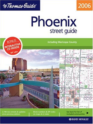
Spiral-bound: Pages (2005-09-12)
list price: US$24.95 -- used & new: US$17.95
(price subject to change: see help)
Asin: 0528855379
Average Customer Review: 5.0 out of 5 stars
Canada | United Kingdom | Germany | France | Japan

Customer Reviews (1)

5-0 out of 5 stars great map
Thomas Guide makes great maps! i use to use them religiously. i have a GPS now and don't use them anymore, but for those who drive a lot and don't have a GPS i highly recommend a Thomas Guide. ... Read more


75. Geography and regional development at the University of Arizona: A centennial history
by Leland R Pederson
 Unknown Binding: 41 Pages (1984)

Asin: B00070OL3U
Canada | United Kingdom | Germany | France | Japan

76. Geography of Arizona
by Alva Otis Neal
 Unknown Binding: Pages (1922)

Asin: B00086LSTI
Canada | United Kingdom | Germany | France | Japan

77. Arizona "jography": "geography fun!"
by Carole Marsh
 Unknown Binding: Pages (1993)

Asin: B0006P2818
Canada | United Kingdom | Germany | France | Japan

78. The historical geography of Arizona
by Rufus Kay Wyllys
 Unknown Binding: 217 Pages (1952)

Asin: B0007JTW76
Canada | United Kingdom | Germany | France | Japan

79. A typology of Arizona communities (Economic geography)
by Wilfred C Bailey
 Unknown Binding: Pages (1950)

Asin: B0007H8BCK
Canada | United Kingdom | Germany | France | Japan

80. The geography of Arizona
by J. W Hoover
 Unknown Binding: 44 Pages (1936)

Asin: B00086DJ04
Canada | United Kingdom | Germany | France | Japan

  Back | 61-80 of 110 | Next 20
A  B  C  D  E  F  G  H  I  J  K  L  M  N  O  P  Q  R  S  T  U  V  W  X  Y  Z  

Prices listed on this site are subject to change without notice.
Questions on ordering or shipping? click here for help.

site stats