e99 Online Shopping Mall

Geometry.Net - the online learning center Help  
Home  - Basic C - California Maps Geography (Books)

  Back | 21-40 of 92 | Next 20
A  B  C  D  E  F  G  H  I  J  K  L  M  N  O  P  Q  R  S  T  U  V  W  X  Y  Z  

click price to see details     click image to enlarge     click link to go to the store

 
21. California: Patterns on the Land
$17.40
22. Thomas Guide 2006 San Bernardino
 
23. The cylindrical equal-area projection
24. John Tallis Map of Mexico, California
25. John Tallis Map of Mexico, California
 
26. An analysis of the distortion
 
27. Accompaniment to Gibbes' new map
 
28. Studies in the Pleistocene glaciation
 
29. Teacher's manual in map geography:
 
30. Map geography: Exercise book no.
 
31. MAP: Map activity program : California
 
32. A map of the marked historical
33. GEOGRAPHY ANATOMIZ'D: OR, THE
$23.43
34. Historical Atlas of California
$41.45
35. San Francisco in Maps & Views
 
$17.96
36. California Geography/Grade 4
$5.69
37. Pocket China Atlas: Maps and Facts
 
38. The earth: Maps and globes
 
$116.34
39. The Compleat Plattmaker: Essays
$55.40
40. Cartographica Extraordinaire:

21. California: Patterns on the Land
by Robert W. Durrenberger
 Paperback: 134 Pages (1976-10)
list price: US$19.95
Isbn: 0874843855
Canada | United Kingdom | Germany | France | Japan

22. Thomas Guide 2006 San Bernardino & Riverside Counties, California: Street Guide (San Bernardino and Riverside Counties Street Guide and Directory)
by Thomas Guide
Spiral-bound: 5855 Pages (2005-06-20)
list price: US$32.95 -- used & new: US$17.40
(price subject to change: see help)
Asin: 0528857185
Canada | United Kingdom | Germany | France | Japan

23. The cylindrical equal-area projection for a new map of Eurasia and Africa (University of California, Berkeley. University of California publications in geography)
by C. W Thornthwaite
 Unknown Binding: Pages (1968)

Asin: B0007EPVXK
Canada | United Kingdom | Germany | France | Japan

24. John Tallis Map of Mexico, California and Texas 1851: Photographic Print of Map of Mexico, California and Texas 1851 by John Tallis
by John Tallis
Map: 1 Pages (2010-01-01)

Isbn: 1844911772
Canada | United Kingdom | Germany | France | Japan

25. John Tallis Map of Mexico, California and Texas 1851: Colour Print of Map of Mexico, California and Texas 1851 by John Tallis
by John Tallis
Map: 1 Pages (2010-01-01)

Isbn: 1844913880
Canada | United Kingdom | Germany | France | Japan

26. An analysis of the distortion and fuzziness of cognitive maps by location (Discussion paper / Dept. of Geography, University of California, Santa Barbara)
by Nathan Daniel Gale
 Unknown Binding: Pages (1980)

Asin: B0006YCTEU
Canada | United Kingdom | Germany | France | Japan

27. Accompaniment to Gibbes' new map of the gold region of California
by Charles Drayton Gibbes
 Unknown Binding: 16 Pages (1851)

Asin: B0008C9C1S
Canada | United Kingdom | Germany | France | Japan

28. Studies in the Pleistocene glaciation of the Sierra Nevada, California: I. Topographic map of the Pleistocene glacial deposits in the Mammoth embayment, ... of California publications in geography)
by John Ernst Kesseli
 Unknown Binding: 1 Pages (1941)

Asin: B0007IT024
Canada | United Kingdom | Germany | France | Japan

29. Teacher's manual in map geography: To accompany pupils' exercise books : adapted to individual teaching (Self-instruction series / San Francisco State Normal School)
by F. W Hoffman
 Unknown Binding: 52 Pages (1914)

Asin: B0008BO070
Canada | United Kingdom | Germany | France | Japan

30. Map geography: Exercise book no. 2 (Pupil's self-instruction series / San Francisco State Normal School)
by F. W Hoffman
 Unknown Binding: 61 Pages (1914)

Asin: B0008BO06Q
Canada | United Kingdom | Germany | France | Japan

31. MAP: Map activity program : California
by Jerry R Williams
 Unknown Binding: 115 Pages (1991)

Asin: B0006PBBI4
Canada | United Kingdom | Germany | France | Japan

32. A map of the marked historical sites of California
by Lowell Butler
 Unknown Binding: Pages (1952)

Asin: B0007FF9XQ
Canada | United Kingdom | Germany | France | Japan

33. GEOGRAPHY ANATOMIZ'D: OR, THE GEOGRAPHICAL GRAMMAR.BEING A SHORT AND EXACT ANALYSIS...THE EIGHTEENTH EDITION, CORRECTED, AND SOMEWHAT ENLARGED; AND A SET OF NEW MAPS, BY MR. SENEX
by Pat. Gordon
Leather Bound: Pages (1744)

Asin: B000TMB0QC
Canada | United Kingdom | Germany | France | Japan
Editorial Review

Product Description
8vo - over 7 3/4"-9 34/4" tall, (xxiv) + 432pp + 17 extending maps: World, Europe, Scandinavia, Muscovy, France, Germany, Poland, Spain and Portugal, Italy, Turkey in Europe, Scotland, England, Ireland, Asia, Africa, North America, and South America, each uncolored and approximately 20 x 23 cm, except the World map which is 20 x 33 cm. Includes half title, title (in red & black), dedications, and preface, parts I & II, and supplement. In the original blind tooled and panelled calf binding. Both the World map and the Morth America map depict the Isle of California. ... Read more


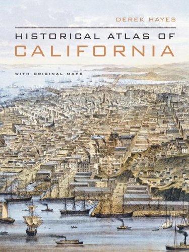
34. Historical Atlas of California
by Derek Hayes
Hardcover: 256 Pages (2007-10-30)
list price: US$39.95 -- used & new: US$23.43
(price subject to change: see help)
Asin: 0520252586
Average Customer Review: 4.5 out of 5 stars
Canada | United Kingdom | Germany | France | Japan
Editorial Review

Product Description
Using nearly five hundred historical maps and many other illustrations--from rough sketches drawn in the field to commercial maps to beautifully rendered works of art--this lavishly illustrated volume is the first to tell the story of California's past from a unique visual perspective. Covering five hundred years of history, it offers a compelling and informative look at the transformation of the state from before European contact through the Gold Rush and up to the present. The maps are accompanied by a concise, engaging narrative and by extended captions that elucidate the stories and personalities behind their creation. At once a valuable reference and an exhilarating adventure through history, the Historical Atlas of California, featuring many rare and unusual maps, will be a treasured addition to any library. Distilling an enormous amount of information into one volume, it presents a fascinating chronicle of how California came to be what it is today.
Copub: Douglas & McIntyre ... Read more

Customer Reviews (8)

5-0 out of 5 stars Derek Hayes Map Book of California
It was great when it was talking about the history of California, from the time of Cortes. It had great explanations about each of its maps, and the maps showed the California culture, with the Spanish maps, and cartoons.

5-0 out of 5 stars A "must have" book for serious people
Hayes' "Historical Atlas of California" is a real treasure.
His book spans 500 years of the history of CA.
It is very readable and a "must have" for any student of historical geography. I strongly recommend it. It is well written and very well illustrated. A real find.
Anybody interested in California's past and future would be well advised to at least peruse this "coffee table" sized book.
It has a wealth of information and lots of rare maps.

4-0 out of 5 stars Cartographical cornucopia
This chronologically depicts California's discovery, development, and divisions. It follows the guesses of the earliest European explorers (I wonder what a native map would look like, but none's represented) and you see the island gradually become a peninsula or archipelago before assuming over the centuries its coastline. Then, the interior begins to take shape, and cities and farms and railroads fill the spaces. A sort of time-lapse ideologically and practically from the past five centuries.

You better understand the gaps: Virginia is shown a few days from California in one early attempt, while the Gold Rush pioneers used routes that were narrowly drawn and could not be deviated from-- around the rest of the West there might be empty spaces, figuratively or cartographically. San Francisco benefits especially throughout its growth, and a 1906 aerial drawing shows dramatically the fire sweeping some--but not all-- of The City. Hayes informs us in his text how the fatalities had been underreported (under 500) when they may have been three or even six thousand. The speculators and profiteers did not want to ruin their chances of rebuilding and selling to new residents. Such chicanery can also be found in the early Spanish who kept their findings off the maps, or kept the maps secret, to avoid tipping off discoveries to the rival British.

Not only rail and auto and industrial, but oil, military, and unusual maps appear. Those in which the patterns of Los Angeles 125 years ago can be found in the train routes, and how these mirror the freeways today, are instructive. I also learned that a 185-mile interurban line once ran from Chico to the Bay Area, to my great surprise. Among other finds: the color-coded charts directing the Japanese relocations during WWII, Jo Mora's Sierra cartoon (but his Hollywood one's not here), and a 1887 Hollywood real estate map from its first booster who, typically, showed many more mountains than even a pre-smoggy day could be glimpsed from Tinseltown-- let alone the beaches!

The text is informative, but I caught an error: Henry Kaiser's steel mill would have not been built at Fontana "eight miles inland" to avoid Japanese attack. Perhaps Hayes meant "eighty"? I do wish some of the maps were larger; the book's affordable and portable enough, but this invariably cuts down the ability even with magnification to discern the kinds of precision that any lover of maps likely has who'd buy this book.

5-0 out of 5 stars Highly recommended
I was delighted with the book. It is a treasure trove of information provided you use it properly. I use a magnifying glass to view the maps in close detail to get the most out of the book. If you look closely at the maps you are treated to an "evolution" of the state from the time that it was thought to be an island to the present. By inspecting each map very closely you see places that now don't exist, lakes that have disappeared, and roads that have gone from dirt paths to super highways. If you love history as I do, you'll love this book, I also recommend "the Historical Atlas of the United States" by the same author. Same format, same great look at the nation through time.

5-0 out of 5 stars Historical Atlas of California
This beautiful book contains copies of 476 historic maps dealing with California history from the earliest times to the present. This book is for any historian interested in California history, and any individual interested in maps. These are located in repositories all over the United States, thus we can virtually travel and update our history by reading this wonderful book. I was particularly delighted to find an 1847 rendering of the battle of Los Angeles between the Americans and the Mexicans. Each map is thoroughly cataloged in an appendix along with a fine bibliograhy. ... Read more


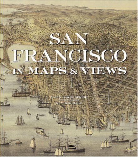
35. San Francisco in Maps & Views
by Sally B. Woodbridge
Hardcover: 176 Pages (2006-12-05)
list price: US$50.00 -- used & new: US$41.45
(price subject to change: see help)
Asin: 0847828719
Canada | United Kingdom | Germany | France | Japan
Editorial Review

Product Description
San Francisco in Maps documents the evolution of this fascinating and beautiful city through 72 breathtaking antiquarian maps, spanning four centuries.The gorgeous maps, many of them hand colored and rarely seen, bring alivethe history of this vibrant city. These maps range from the early days when they served to aid ship navigation of this unfamiliar and frequently foggy harbor; to the gold rush era in the mid-1800s, when the city's population grew exponentially and it saw the beginnings of neighborhoods like Chinatown, many of which persist to today; to the period before and after the great earthquake of 1906, which destroyed 80 percent of the city, and from out of which modern San Francisco emerged. ... Read more


36. California Geography/Grade 4
by Randy L. Womack
 Paperback: 80 Pages (1994-06)
list price: US$8.95 -- used & new: US$17.96
(price subject to change: see help)
Asin: 1565000285
Canada | United Kingdom | Germany | France | Japan

37. Pocket China Atlas: Maps and Facts at Your Fingertips
by Stephanie Hemelryk Donald, Robert Benewick
Paperback: 64 Pages (2008-03-01)
list price: US$10.95 -- used & new: US$5.69
(price subject to change: see help)
Asin: 0520254686
Canada | United Kingdom | Germany | France | Japan
Editorial Review

Product Description
For China-watchers worldwide, this concise volume vividly and efficiently offers a wealth of information on the world's largest nation by population. Based on the highly acclaimed State of China Atlas, it contains more than 25 full-color topical maps, clear graphics, and an informative, readable text that together chart the profound changes within China and trace their implications for the world at large.
* Maps and facts for the 2008 Beijing Olympics *
Topics include:
* China and the USA
* Growth of cities
* Trade and investment
* Tourism
* Population and the one-child family
* Business and entrepreneurs
* Human rights and political stability
* Energy needs and the environment
* Chronology of events since 1949
... Read more


38. The earth: Maps and globes
by Amelia Martucci
 Hardcover: 94 Pages (1967)

Asin: B0007HJMVO
Canada | United Kingdom | Germany | France | Japan

39. The Compleat Plattmaker: Essays on Chart, Map, and Globe Making in England in the Seventeenth and Eighteenth Centuries (Publications from the Clark Library professorship, UCLA ; 3)
by Samuel Pepys
 Hardcover: 272 Pages (1978-10)
list price: US$34.50 -- used & new: US$116.34
(price subject to change: see help)
Asin: 0520035224
Canada | United Kingdom | Germany | France | Japan

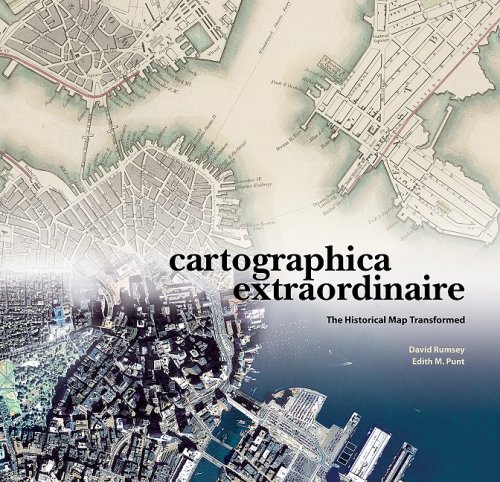
40. Cartographica Extraordinaire: The Historical Map Transformed
by David Rumsey, Edith M. Punt
Hardcover: 200 Pages (2004-03)
list price: US$79.95 -- used & new: US$55.40
(price subject to change: see help)
Asin: 1589480449
Average Customer Review: 4.5 out of 5 stars
Canada | United Kingdom | Germany | France | Japan
Editorial Review

Product Description
David Rumsey's collection of historical maps is one of the largest and most complete of its kind. Focused for the most part on North and South America in the eighteenth and nineteenth centuries, the collection is comprised of more than 150,000 items: maps, atlases, and contextual supporting documents. Unlike similar collections, the delicacy and rarity of which necessitate careful storage and restricted use policies, The Rumsey Collection is available in its entirety on the Web and it is this conjunction of old and new technologies that is the heart of Cartographica Extraordinaire.

The maps selected for Cartographica Extraordinaire tell a hundred distinct, exciting, important, and sometimes controversial stories, along two main paths of inquiry: how did a continental wilderness become a civilization, and how has the development of cartographic science changed the ways we perceive, describe, study, and use that land?Geographic information systems have come, as part of the digital revolution, to dominate the cartography of today, but GIS didn't leap into being out of nowhere; all its processes and capabilities have precursors in historical maps. Old maps can therefore tell us not only the stories of their subject matter, but stories about the nature of mapmaking as well: its exigencies and limitations, trends and developments-its theory and practice and what that tells us about the people we were, are, and will be. ... Read more

Customer Reviews (6)

4-0 out of 5 stars Gorgeous.
David Rumsey, Cartographica Extraordinaire: The Historical Map Transformed (ESRI, 2004)

This massive coffee table book is all about maps (mostly of the United States, with a few from other parts of North America thrown in for good measure) and how they change over time, not only as people discover more about the world they live in, but as progress takes its toll, measuring tools improve, etc. Simply put, it's fascinating. Rumsey's stated goal, both with this book and with his website, is to bring historical maps back into prominence as tools to understand history and change, and this is certainly a fine start. The writing (there isn't much, but what there is is always on point) is engaging, the maps are fascinating, and the book itself is quite nicely put together; given its size, I'd have expected some binding defects or the like. A wonderful piece of work, worth every penny. I wish it had gone into a little greater detail in some of the framing text, but that's hardly something to quibble over in a project of this magnitude. ****

5-0 out of 5 stars map lovers, look out!
this is truly an extraordinary book, with excellent reproductions of all types of maps. the index provides the original map dimensions, which i found helpful. this book would be a great additional to any library, young or old.

5-0 out of 5 stars History Through Illuminating Maps
David Rumsey was fascinated by maps as a kid, and they were always papered onto the walls of his room.The fascination with maps did not leave him, through several degrees in fine art and a career in real estate.He amassed one of the largest private collections of maps, The David Rumsey Historical Map Collection, 150,000 catalogued items stored on the ground floor of his house in San Francisco, which is a working library for people to use.The items are wall maps, folding maps, globes, map puzzles, and many others.There is a sampling of the collection in _Cartographica Extraordinaire: The Historical Map Transformed_ (ESRI Press) by David Rumsey and Edith M. Punt, a slim but large-paged, handsome volume containing all kinds of maps concentrating on North America.They show the history of America, to be sure, but are also a history of mapmaking.Rumsey has painstakingly put items in his collection on the Internet, so he himself is participating in mapmaking history, and some pages of this beautiful book demonstrate what can be done with maps transformed into pixels.

Looking at these lovely maps is to participate a bit in Rumsey's enthusiasm, which one can pick up from his introduction: "A map, especially a historical map, ... communicates both above and below the narrow bands of language and observation."There are only a hundred and twenty or so maps selected here, but besides being beautiful objects to contemplate, they show an amazingly diverse range of ideas: how people explored coasts, or how train schedules were arranged before we had standard time zones, or how we claimed, organized, and sold the land.For those of us who only look at highway maps, there is an enormous education here.It is barely possible to mention the subjects of some of these maps; if this subject matter at all interests you, nothing will do except to get the book itself and look through the pages.For instance, the map by William Clark (of Lewis and Clark) of the trek across western America is here, but in a version issued by Rumsey in celebration of the 200th anniversary of their travels.It shows the original drawing, seamlessly enclosed within the General Land Survey's first map of the area, which is itself within a 1971 map of a US Geographic Survey National Atlas, which in turn is within a Landsat mosaic from NASA.The joins of the maps are seamless because they all were turned into computer data that could be massaged in just the right way, and because they are "georectified" to match up perfectly.This was hardest to do with Clark's 1814 map, which because of survey and navigation limitations of his time (not because of sloppy mapmaking) had accurate latitudes and distorted longitudes.

Rumsey's collection exists physically, of course, but access to the historical maps entailed the basic problem of "many hands taking hold of rare and delicate objects."Digital photography and computer storage have opened his collection for anyone who wants to look, and you don't even have to be there physically.He has found that magnified images of the maps can show details that were obscure even in the originals.Astonishingly, information compression has meant that a picture that originally required 400 megabytes can actually be stored in 3% of that size without loss of image quality.By digitizing his maps and making them available, Rumsey has himself stepped into cartographic history.This book is a demonstration in book form of what Geographic Information Systems can do, and Rumsey sees the "digital wizardry of GIS not as a break from the past and old mapping traditions," but part of those traditions.If you go to the website, you can look around anywhere; there is no guide._Cartographica Extraordinaire_, on the other hand, has the job of demonstrating the progress of history and of information display, and does both engagingly and handsomely.

5-0 out of 5 stars An outstanding and representative collection
The impressively collaborative work of David Rumsey (President of Cartography Associates, a San Francisco-based digital publishing company, and Director of Luna Imaging, a provider of enterprise software for online image collections) and Edith M. Punt (professional cartographer and recipient of the 1996 National Geographic Award in Cartography), Cartographica Extraordinaire: The Historical Map Transformed is a 160-page, hardcover, coffee-table book printed on archival paper which showcases how technology has literally transformed the restoration, re-creation and reproduction of historical maps. The specific focus is upon maps (and the people who made them) that reflect American history and ranges from a 1736 atlas depicting California as an island, to a Civil War era "bird's-eye" view of military positions on the southeastern seaboard. This is an outstanding and representative collection drawn from the David Rumsey Map Collection and illustrates early American history from a uniquely geographic perspective. With it's informed and informative text, Cartographica Extraordinaire is clearly recommended for inclusion into professional, academic and community library Cartography Studies or American History collections. Indeed, Cartographica Extraordinaire would make an excellent selection for a truly unique Library Memorial Fund acquisition.

5-0 out of 5 stars Not just extraordinary, it's amazing
At first sight, this is a gorgeous book. It exhibits historical maps made in nineteenth century America, and the reader might expect a reverential approach of the map collector that David Rumsey exemplifies. But David Rumsey is also the person who provides amazing open access to his collection through the highest tech web site. He sees maps not just as curiosities, but as a way to get inside the past. With Edith Punt, they have tied the maps into the social, environmental and technological changes that are shown. They use the most current geographic information systems technology to spark a connection to the current landscape. The old fragile maps come alive. While this book has the format and polish of your average coffee table book, this is a book to read and reread. ... Read more


  Back | 21-40 of 92 | Next 20
A  B  C  D  E  F  G  H  I  J  K  L  M  N  O  P  Q  R  S  T  U  V  W  X  Y  Z  

Prices listed on this site are subject to change without notice.
Questions on ordering or shipping? click here for help.

site stats