e99 Online Shopping Mall

Geometry.Net - the online learning center Help  
Home  - Basic C - Cartography Geography (Books)

  Back | 21-40 of 102 | Next 20
A  B  C  D  E  F  G  H  I  J  K  L  M  N  O  P  Q  R  S  T  U  V  W  X  Y  Z  

click price to see details     click image to enlarge     click link to go to the store

$175.98
21. Cybercartography: Theory and Practice
$65.37
22. Elements of Cartography
$101.59
23. Art and Cartography: Six Historical
$19.70
24. Mapping the World: Stories of
$270.00
25. The History of Cartography, Volume
 
26. General cartography (McGraw-Hill
$289.00
27. Location Based Services and TeleCartography
 
$17.00
28. Integrated Environment Cartography:
 
29. Basic Cartography for Students
$169.00
30. Information Fusion and Geographic
 
$65.00
31. Keyguide to Information Sources
 
$240.00
32. The Mapmaker's Art: An Illustrated
$49.20
33. A History of Spaces: Cartographic
$22.00
34. Thematic Cartography and Visualization
$102.34
35. Location Based Services and TeleCartography
 
$5.95
36. Recent literature.(bibliography
 
$9.95
37. Literature review.(Bibliography):
 
$5.95
38. Geography, Cartography and Nautical
 
39. The Atlas of Israel: Cartography,
 
$3.45
40. CARTOGRAPHY AND GEOGRAPHY: An

21. Cybercartography: Theory and Practice (Modern Cartography Series)
Hardcover: 594 Pages (2006-02-09)
list price: US$223.00 -- used & new: US$175.98
(price subject to change: see help)
Asin: 0444516298
Canada | United Kingdom | Germany | France | Japan
Editorial Review

Product Description
For generations, the map has been central to how societies function all over the world. Cybercartography is a new paradigm for maps and mapping in the information era. Defined as "the organization, presentation, analysis and communication of spatially referenced information on a wide variety of topics of interest to society," cybercartography is presented in an interactive, dynamic, multisensory format with the use of multimedia and multimodal interfaces.

Cybercartography: Theory and Practice examines the major elements of cybercartography and emphasizes the importance of interaction between theory and practice in developing a paradigm which moves beyond the concept of Geographic Information Systems and Geographical Information Science. It argues for the centrality of the map as part of an integrated information, communication, and analytical package.

This volume is a result of a multidisciplinary team effort and has benefited from the input of partners from government, industry and other organizations. The international team reports on major original cybercartographic research and practice from a variety of disciplinary perspectives, including the humanities, social sciences including human factors psychology, cybernetics, English literature, cultural mediation, cartography, and geography. This new synthesis has intrinsic value for industries, the general public, and the relationships between mapping and the development of user-centered multimedia interfaces.

* Discusses the centrality of the map and its importance in the information era
* Provides an interdisciplinary approach with contributions from psychology, music, and language and literature
* Describes qualitative and quantitative aspects of cybercartography and the importance of societal context in the interaction between theory and practice
* Contains an interactive CD-Rom containing color images, links to websites, plus other important information to capture the dynamic and interactive elements of cybercartography ... Read more


22. Elements of Cartography
by Arthur H. Robinson, Joel L. Morrison, Phillip C. Muehrcke, A. Jon Kimerling, Stephen C. Guptill
Hardcover: 688 Pages (1995-03-03)
-- used & new: US$65.37
(price subject to change: see help)
Asin: 0471555797
Average Customer Review: 4.0 out of 5 stars
Canada | United Kingdom | Germany | France | Japan
Editorial Review

Product Description
Recognized as the classic resource in cartography, this text continues to integrate the latest modern technology with traditional cartographic principles. The balanced author team provides a solid conceptual foundation in the basic principles of cartography while introducing the newest technological advances which have greatly altered modern cartographic techniques. New features include a complete updating of topical data and a shift in emphasis from ``small-scale to all-scale maps.'' Systematic coverage is given to both theory and applications with all basic mapmaking tools presented including formulas, tables and constants. ... Read more

Customer Reviews (6)

4-0 out of 5 stars Elements Of Cartography
It is a very good entry level cartography book that is needed for GIS students. Though i'd say 1995 is a bit old

5-0 out of 5 stars Good for teaching
Is a very good book for help to teachers in cartography classroom. Good examples. Goods ilustrations. Good structure. Althoug is a old book is updated. Its have a part for GIS and not forget the traditional cartography process. Just a problem that I can see, its not have a luxurous edition althoug the price is high.

3-0 out of 5 stars A Little Surprised...
I am currently reading/studying this book and have found it be a bit choppy and not very well written.For a book of this magnitude I would have expected that a outline of the book to be written in chapter one.This book is about cartography but no definition is given until chapter two (it is assumed in the intro and panels).I just expected more and am currently looking for a supplimentary book to this one.

5-0 out of 5 stars Cartography - must have title
This book is very valuable source of information for anyone wanting to learn or refresh his knowledge of cartographic principles. Great variety of topics is covered in details and well illustrated so understanding of topics should not be too difficult to grasp.

It is a little bit weak on modern GIS systems section and cartographic capabilities of those. It is understandable since it is 10 years old now. It would be good to have more pictures in the full colour section.

This book is used as a reference book for lot of other materials and for a good reason.

5-0 out of 5 stars Still recognized as an important text
The sixth edition of "Elements" was published in 1995, and reviewers familiar with the advances in cartographic technology would be familiar with the great upheaval the field was going through at that time.Work on a seventh edition of this seminal text is currently underway, which should bring the content of the book up to par with recent changes.The book remains an important source of information for both the novice and seasoned cartographer. ... Read more


23. Art and Cartography: Six Historical Essays (The Kenneth Nebenzahl, Jr., Lectures in the History of Cartography)
Hardcover: 266 Pages (1987-02-01)
list price: US$102.00 -- used & new: US$101.59
(price subject to change: see help)
Asin: 0226907228
Canada | United Kingdom | Germany | France | Japan
Editorial Review

Product Description
The contributors--Svetlana Alpers, Samuel Y. Edgerton, Jr., Ulla Ehrensvard, Juergen Schulz, James A. Welu, and David Woodward--examine the historical links between art and cartography from varied perspectives. ... Read more


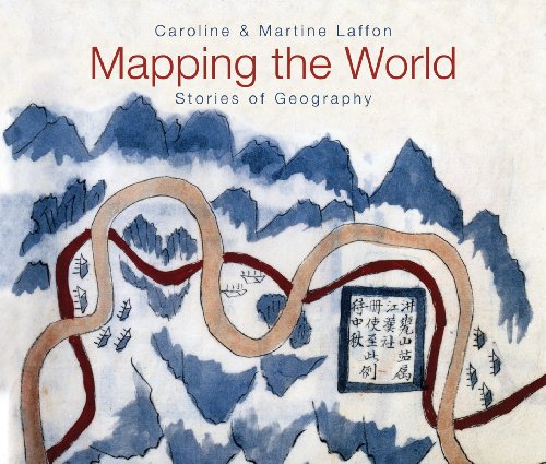
24. Mapping the World: Stories of Geography
by Caroline Laffon, Martine Laffon
Hardcover: 192 Pages (2009-09-10)
list price: US$39.95 -- used & new: US$19.70
(price subject to change: see help)
Asin: 1554075254
Average Customer Review: 5.0 out of 5 stars
Canada | United Kingdom | Germany | France | Japan
Editorial Review

Product Description

An illustrated history of explorers' maps and the questions they answer.

More than the detailed representation of the geographical areas that their makers explored, maps reveal their makers' worldview as well as the myths, beliefs and legends of their times. By patiently creating maps, globes, charts and atlases, humans have sought to understand the universe and our place in it.

Mapping the World explores many rare and fascinating mapping artifacts, beginning with the first crude drawings and progressing to the stunning satellite views of today. Many of these examples will be unfamiliar even to serious cartographers and collectors. Thirty essays answer the questions map-makers have asked and reveal the roles their maps played in finding those answers.

Color reproductions of beautiful maps and charts include:

  • A Chinese map dated to 1229 that shows the city's bridges, pagodas and gardens
  • A French 15th-century interpretation of the four corners of the Earth
  • A painted silk map of the universe dating from the 1830s
  • A modern "inverse" world map from Australia's perspective
  • The cosmos as imagined in 1750.

With 87 maps in all, Mapping the World will fascinate general readers, map collectors, geographers, cartographers and historians.

... Read more

Customer Reviews (1)

5-0 out of 5 stars Thoughtful, innovative
Although I believe this book is intended for a young audience, I is incredibly thought-provoking, creative, and innovative, but above all accessible. I bought this for a nephew and then turned around and got one for myself. ... Read more


25. The History of Cartography, Volume 3: Cartography in the European Renaissance
Hardcover: 2272 Pages (2007-09-01)
list price: US$400.00 -- used & new: US$270.00
(price subject to change: see help)
Asin: 0226907325
Canada | United Kingdom | Germany | France | Japan
Editorial Review

Product Description

When the University of Chicago Press launched the landmark History of Cartography series nearly thirty years ago, founding editors J.B. Harley and David Woodward hoped to create a new basis for map history. They did not, however, anticipate the larger renaissance in map studies that the series would inspire. But as the renown of the series and the comprehensiveness and acuity of the present volume demonstrate, the history of cartography has proven to be unexpectedly fertile ground.

Cartography in the European Renaissance treats the period from 1450 to 1650, long considered the most important in the history of European mapping. This period witnessed a flowering in the production of maps comparable to that in the fields of literature and fine arts. Scientific advances, appropriations of classical mapping techniques, burgeoning trade routes—all such massive changes drove an explosion in the making and using of maps. While this volume presents detailed histories of mapping in such well-documented regions as Italy and Spain, it also breaks significant new ground by treating Renaissance Europe in its most expansive geographical sense, giving careful attention to often-neglected regions like Scandinavia, East-Central Europe, and Russia, and by providing innovative interpretive essays on the technological, scientific, cultural, and social aspects of cartography.

Lavishly illustrated with more than a thousand maps, many in color, the two volumes of Cartography in the European Renaissance will be the unsurpassable standard in its field, both defining it and propelling it forward.
(20080620) ... Read more

26. General cartography (McGraw-Hill series in geography)
by Erwin Raisz
 Hardcover: 354 Pages (1948)

Asin: B0007DNF4I
Canada | United Kingdom | Germany | France | Japan

27. Location Based Services and TeleCartography (Lecture Notes in Geoinformation and Cartography)
Paperback: 605 Pages (2010-11-02)
list price: US$289.00 -- used & new: US$289.00
(price subject to change: see help)
Asin: 3642071791
Canada | United Kingdom | Germany | France | Japan
Editorial Review

Product Description

This book presents a general picture of research-driven activities related to location- and map-based services. This type of research has emerged in recent years in the areas of positioning, spatial modeling, and cartographic communication as well as in the emerging fields of ubiquitous cartography, geopervasive services and user-centered modeling. The innovative and contemporary character of these areas of research results in a great variety of interdisciplinary contributions, from academia to business, and computer science to geodesy. While contemporary cartography is exploring new and efficient ways of communicating spatial information, the development and availability of mobile devices, mobile networking and short-range sensors lead to interesting new means of conveying locational information. By attempting to make use of the available technology, cartographers and a variety of researchers from related disciplines look specifically at user-centered and context-aware system development as well as new forms of supporting wayfinding and navigational systems.

... Read more

28. Integrated Environment Cartography: A Tool for Research and Land-Use Planning (Mab Technical Notes, No 16)
by A. Journaux
 Paperback: 53 Pages (1987-06)
list price: US$17.00 -- used & new: US$17.00
(price subject to change: see help)
Asin: 9231023470
Canada | United Kingdom | Germany | France | Japan

29. Basic Cartography for Students and Technicians
by R.W. Anson, F.J. Ormeling
 Paperback: Pages (1984-06)
list price: US$38.00
Isbn: 9070310058
Canada | United Kingdom | Germany | France | Japan
Editorial Review

Product Description
Cartography, until recently considered to be a discipline founded upon convention, is now enjoying a remarkably rapid rate of development. Techniques and points of view that were taken for granted two decades ago are being questioned or have been superseded by new methods and ideas. Today the discipline is in the middle of a revolution and little of its complex field remains unaffected by change. Man's general preoccupation during the last 20 years with "communications" and "information" has greatly influenced cartography: a well researched, designed and produced map certainly being one of the best methods for the graphic communication of information. It is now recognised that the cartographic process is concerned with data collection and manipulation, information display and image processing, rather than just drawing maps! In line with the professional broadening of cartography it became evident that an effort was required to establish an international education and training scheme aimed at the technician, undergraduate and postgraduate. Until comparatively recently both teachers and students were forced to rely on specialist manuals and articles appearing in learned journals.What textbooks were produced tended to relate to specific aspects of the discipline and were, in the main, too specialist for use by students and technicians. In order to produce the training literature required, the ICA assembled a team of internationally known academic and professional cartographers to produce a work suitable for use in education and training and which, with appropriate teacher input, could be used by those with varying intended levels of knowledge and ability. A highly graphic approach has been deliberately adopted in order to enhance understanding of technical detail incorporated in the text, and to illustrate the graphic potential of the theory described. This updated second edition takes into account the recent developments relating to the subject and the practices employed in the 1990s, recognizing the increased usage of electronic-based information technology and the employment of digital databases. ... Read more


30. Information Fusion and Geographic Information Systems: Proceedings of the Third International Workshop (Lecture Notes in Geoinformation and Cartography)
Paperback: 335 Pages (2010-11-02)
list price: US$169.00 -- used & new: US$169.00
(price subject to change: see help)
Asin: 3642072291
Canada | United Kingdom | Germany | France | Japan
Editorial Review

Product Description

These Proceedings of the Third International Workshop introduce research results in the areas of information integration, development of GIS and GIS-applications for a wide spectrum of information systems varying considerably in purpose and scale. The new class of GIS - intelligent GIS - is considered, including principles of their building and programming technologies. Special attention is drawn to the development of ontologies and their use in GIS and GIS-applications.

... Read more

31. Keyguide to Information Sources in Cartography (Mansell's keyguide series)
by A. G. Hodgkiss
 Hardcover: 253 Pages (1986-01)
list price: US$30.00 -- used & new: US$65.00
(price subject to change: see help)
Asin: 0720117682
Canada | United Kingdom | Germany | France | Japan

32. The Mapmaker's Art: An Illustrated History of Cartography
by John Goss
 Hardcover: 376 Pages (1993-08)
list price: US$25.00 -- used & new: US$240.00
(price subject to change: see help)
Asin: 052883620X
Canada | United Kingdom | Germany | France | Japan

33. A History of Spaces: Cartographic Reason, Mapping and the Geo-Coded World (Frontiers of Human Geography)
by John Pickles
Paperback: 256 Pages (2003-12-09)
list price: US$59.95 -- used & new: US$49.20
(price subject to change: see help)
Asin: 0415144981
Average Customer Review: 5.0 out of 5 stars
Canada | United Kingdom | Germany | France | Japan
Editorial Review

Product Description
Provides an essential reading of the practices and ideas of mapping and mapmaking and explores the way cartographic reason has coded our world. ... Read more

Customer Reviews (1)

5-0 out of 5 stars Quality & Efficient
Good price, good product, and good shipping. What more does a buyer want? ... Read more


34. Thematic Cartography and Visualization
by Terry A. Slocum
Hardcover: 293 Pages (1998-12-04)
list price: US$84.00 -- used & new: US$22.00
(price subject to change: see help)
Asin: 0132097761
Average Customer Review: 5.0 out of 5 stars
Canada | United Kingdom | Germany | France | Japan
Editorial Review

Product Description
This comprehensive book bridges the evolution in cartography by presenting both traditional methods and recently developed computer-based cartographic techniques.Covers a range of mapping methods, including traditional univariate mapping methods; recently developed approaches for visualizing spatial data; and bivariate and multivariate mapping techniques. The book also emphasizes computer-based symbolization reflecting the shift toward technology. This discussion covers hardware considerations in map production, the use of digital methods for interpolating between point locations on isarithmic maps, how digital methods of GIS and remote sensing assist in creating dot and dasymetric maps, and tools programmers can use to develop their own software.It also presents the relationship between statistical and graphical methods. Finally, the book provides sources to help readers locate the software mentioned throughout the book.An essential resource for any professional who would benefit from methods of presenting data visually, rather than numerically. ... Read more

Customer Reviews (1)

5-0 out of 5 stars The Best Geography Textbook I've ever read.Ever.
This book: an excellent example of a work fueld by the academic's interest in the subject, and not his career ambitions.Technical and for the person well-informed in the minutiae of cartographic design, this book is thefountain head of information on technique, method and management ofthematic mapping, drawing on a wide range of resource material and sources. Concise, un-self conscious, this book will tell the serious cartophile orgeography-loving person more than they could ever have thought they couldknow, with aplomb. ... Read more


35. Location Based Services and TeleCartography II: From Sensor Fusion to Context Models (Lecture Notes in Geoinformation and Cartography) (v. 2)
Hardcover: 456 Pages (2008-12-08)
list price: US$209.00 -- used & new: US$102.34
(price subject to change: see help)
Asin: 3540873929
Canada | United Kingdom | Germany | France | Japan
Editorial Review

Product Description

This book gives a general view of research-driven activities related to the location and map-based services. Such activities emerged in the last years especially concerning issues of positioning, spatial modelling, cartographic communication as well as in the fields of ubiquitous cartography, geo-pervasive services, user-centered modelling or geo-wiki activities. The innovative and contemporary character of the topics leads to a great variety of contributions in terms of interdisciplinarity, with such varying backgrounds as from academia to business, from computer science to geodesy, covering an enormous number of topics with a heterogenous relation to the conference's main topic. While contemporary cartography aims to look at new and efficient ways of communication in spatial information, the development and availability of technologies such as mobile networking, mobile devices or short-range sensors lead to interesting new possibilities of attaining this goal. By trying to make use of available technologies, cartographers and a variety of related disciplines look specifically at user-centered and context-aware system development as well as new forms of supporting wayfinding and navigation systems.

... Read more

36. Recent literature.(bibliography of cartographic related literature)(Bibliography): An article from: Cartography and Geographic Information Science
by Jovanka R. Ristic
 Digital: 9 Pages (2003-10-01)
list price: US$5.95 -- used & new: US$5.95
(price subject to change: see help)
Asin: B0008GEBTW
Canada | United Kingdom | Germany | France | Japan
Editorial Review

Product Description
This digital document is an article from Cartography and Geographic Information Science, published by American Congress on Surveying & Mapping on October 1, 2003. The length of the article is 2538 words. The page length shown above is based on a typical 300-word page. The article is delivered in HTML format and is available in your Amazon.com Digital Locker immediately after purchase. You can view it with any web browser.

Citation Details
Title: Recent literature.(bibliography of cartographic related literature)(Bibliography)
Author: Jovanka R. Ristic
Publication: Cartography and Geographic Information Science (Refereed)
Date: October 1, 2003
Publisher: American Congress on Surveying & Mapping
Volume: 30Issue: 4Page: 355(4)

Article Type: Bibliography

Distributed by Thomson Gale ... Read more


37. Literature review.(Bibliography): An article from: Cartography and Geographic Information Science
by Gale Reference Team
 Digital: 9 Pages (2007-01-01)
list price: US$9.95 -- used & new: US$9.95
(price subject to change: see help)
Asin: B000SSFQC6
Canada | United Kingdom | Germany | France | Japan
Editorial Review

Product Description
This digital document is an article from Cartography and Geographic Information Science, published by Thomson Gale on January 1, 2007. The length of the article is 2585 words. The page length shown above is based on a typical 300-word page. The article is delivered in HTML format and is available in your Amazon.com Digital Locker immediately after purchase. You can view it with any web browser.

Citation Details
Title: Literature review.(Bibliography)
Author: Gale Reference Team
Publication: Cartography and Geographic Information Science (Magazine/Journal)
Date: January 1, 2007
Publisher: Thomson Gale
Volume: 34Issue: 1Page: 63(4)

Article Type: Bibliography

Distributed by Thomson Gale ... Read more


38. Geography, Cartography and Nautical Science in the Renaissance: The Impact of the Great Discoveries. .(Book Review): An article from: Renaissance Quarterly
by David Woodward
 Digital: 3 Pages (2003-03-22)
list price: US$5.95 -- used & new: US$5.95
(price subject to change: see help)
Asin: B000DN5MTS
Canada | United Kingdom | Germany | France | Japan
Editorial Review

Product Description
This digital document is an article from Renaissance Quarterly, published by Thomson Gale on March 22, 2003. The length of the article is 719 words. The page length shown above is based on a typical 300-word page. The article is delivered in HTML format and is available in your Amazon.com Digital Locker immediately after purchase. You can view it with any web browser.

Citation Details
Title: Geography, Cartography and Nautical Science in the Renaissance: The Impact of the Great Discoveries. .(Book Review)
Author: David Woodward
Publication: Renaissance Quarterly (Magazine/Journal)
Date: March 22, 2003
Publisher: Thomson Gale
Volume: 56Issue: 1Page: 206(3)

Article Type: Book Review

Distributed by Thomson Gale ... Read more


39. The Atlas of Israel: Cartography, Physical and Human Geography
by Karta (Firm)
 Hardcover: 80 Pages (1985-10)
list price: US$210.00
Isbn: 002905950X
Average Customer Review: 5.0 out of 5 stars
Canada | United Kingdom | Germany | France | Japan

Customer Reviews (1)

5-0 out of 5 stars This is all there is to know
This book simply has all there is to know about Israeli physical and human georgaphy as of the early 1980s.The hundreds of maps are wonderfully printed in color. These include a set called Israel 1:250,000 pages.Most of the labels are in Hebrew. This is not for you UNLESS you want to know all about Israel presented as map data displays. ... Read more


40. CARTOGRAPHY AND GEOGRAPHY: An entry from Macmillan Reference USA's <i>Encyclopedia of Islam and the Muslim World</i>
by Karen C. Pinto
 Digital: 5 Pages (2004)
list price: US$3.45 -- used & new: US$3.45
(price subject to change: see help)
Asin: B000M4QPLM
Canada | United Kingdom | Germany | France | Japan
Editorial Review

Product Description

“Islam and the Muslim World” will help people understand the fastest growing religion in the United States and the dominant religion in a wide area of the rest of the world. This informative and interesting new encyclopedia explores an increasingly important force in the modern world, looking at Islam's role in the modern world, in the context of the religion's history and development over the last 13 centuries, and contains thematic articles, biographies of key figures, definitions, and more, filling a need in this key area of religious studies and serving as a resource for those eager to become better informed.

... Read more

  Back | 21-40 of 102 | Next 20
A  B  C  D  E  F  G  H  I  J  K  L  M  N  O  P  Q  R  S  T  U  V  W  X  Y  Z  

Prices listed on this site are subject to change without notice.
Questions on ordering or shipping? click here for help.

site stats