e99 Online Shopping Mall

Geometry.Net - the online learning center Help  
Home  - Basic G - Genealogy Maps & Atlases (Books)

  Back | 21-40 of 100 | Next 20
A  B  C  D  E  F  G  H  I  J  K  L  M  N  O  P  Q  R  S  T  U  V  W  X  Y  Z  

click price to see details     click image to enlarge     click link to go to the store

 
21. County atlas of Muskegon Michigan:
 
22. An Atlas of Ripley County, Indiana,
 
23. An illustrated historical atlas
 
24. Campbell's new atlas of Missouri
25. Philip's World Flags Wall Map
 
26. Saxon and Viking Britain: Map
$18.00
27. A New Genealogical Atlas of Ireland,
$7.96
28. Irish Family Names Map (Collins
29. Atlas of British Surnames: With
$16.56
30. Maps for Historians
$36.59
31. Historical Atlas of Norfolk
 
$12.50
32. Every Name Index to the 1900 Standard
 
33. County Atlases of the British
34. Ancient Britain (Historical Map
$10.09
35. A Street Map of London 1843: A
$1.38
36. Southampton (West) 1908: Hampshire
 
$11.99
37. Roman and Mediaeval Canterbury
$13.99
38. The Oarsman's and Angler's Map
 
$15.95
39. Georgian Bath (Historical Map
 
40. Roman and Anglian York (Historical

21. County atlas of Muskegon Michigan: From recent and actual surveys and records
by F. W Beers
 Unknown Binding: Pages (1983)

Asin: B0006YIEU8
Canada | United Kingdom | Germany | France | Japan

22. An Atlas of Ripley County, Indiana, 1883
by B. N Griffing
 Unknown Binding: Pages (1973)

Asin: B00071W9D8
Canada | United Kingdom | Germany | France | Japan

23. An illustrated historical atlas of Des Moines County, Iowa
by A. T Andreas
 Unknown Binding: 92 Pages (1992)

Asin: B0006P5X8I
Canada | United Kingdom | Germany | France | Japan

24. Campbell's new atlas of Missouri
by R. A Campbell
 Unknown Binding: Pages (1874)

Asin: B0008AKD1S
Canada | United Kingdom | Germany | France | Japan

25. Philip's World Flags Wall Map
Map: Pages (2003-03-17)

Isbn: 054008316X
Canada | United Kingdom | Germany | France | Japan

26. Saxon and Viking Britain: Map
 Map: Pages (1979-05)

Isbn: 0540031631
Canada | United Kingdom | Germany | France | Japan

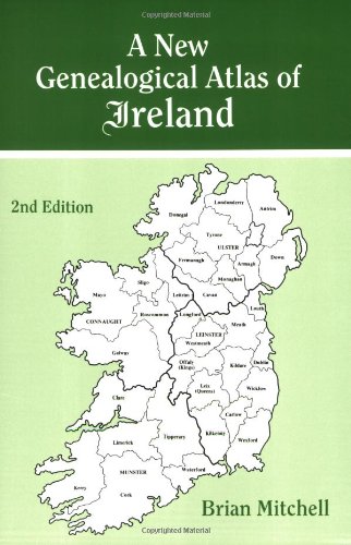
27. A New Genealogical Atlas of Ireland, Second Edition
by Brian Mitchell
Paperback: 176 Pages (2009-12-08)
list price: US$20.00 -- used & new: US$18.00
(price subject to change: see help)
Asin: 0806316845
Average Customer Review: 4.5 out of 5 stars
Canada | United Kingdom | Germany | France | Japan
Editorial Review

Product Description
Since its publication in 1986, A New Genealogical Atlasof Ireland has established itself as a key resource in Irishgenealogical research. Now, with the addition of maps detailing thelocation of Roman Catholic parishes in all thirty-two counties ofIreland and Presbyterian congregations in the nine counties ofNorthern Ireland, this new 2nd Edition moves the book to the forefrontof Irish genealogical research.Also, for the first time ever, thisone volume contains a complete geographical picture of the three majorreligious denominations in Ireland during the middle years of the 19thcentury.

And just what is the importance of this?Civil registration foreveryone in Ireland didn't begin until 1864. Prior to that, the onlyrecords of births, marriages, and deaths were found in localparishes. Therefore, the first step in any Irish research for thefirst half of the 19th century and before should be to identify thereligious denomination and parish of your ancestor. Although any ofthe Townland Indexes from 1851, 1871, or 1901 will show the locationof each civil parish (which generally corresponds to the boundaries ofthe Church of Ireland parishes), it has been much more difficult touncover the corresponding Catholic parish or Presbyteriancongregation. Until now!

This new 2nd Edition is not only invaluable for tracing your pre-1864ancestors in church records but also for locating your post-1864ancestor in civil records, for this volume provides descriptions andmaps of the parochial and civil administrative divisions to which allmajor Irish record sources are linked. To aid the researcher inidentifying the precise location of the administrative divisions, andthus their jurisdiction, Mr. Mitchell has drawn at least four, andsometimes five, maps for every county. The first county map depictsthe civil/Church of Ireland parishes; the second shows the baroniesand Church of Ireland dioceses; the third map illustrates the poor lawunions and the parishes included within the probate districts servingthat county; the fourth plots Roman Catholic parishes and dioceses;and the fifth locates Presbyterian congregations for the nine countiesof Northern Ireland. Three maps of Ireland are also included to showthe area covered by each county, diocese, and probate district. Inaddition, the book describes all of the major record sources ofIreland.

These maps provide the clues to the Irish origins of millions ofAmericans, making this atlas indispensable for tracing ancestors inIreland! ... Read more

Customer Reviews (8)

4-0 out of 5 stars A book of little maps with numbers
This book contains nothing except outlines of maps, then inside maps are various sections with numbers on them. A list follows indexing the map number to a place. Not what I thought it would be ... but will most likely prove worth the heft price for a small paperback at some point.

4-0 out of 5 stars Fantastic Irish Genealogy Tool
Very easy to read maps, great helper when your trying to figure out Baronies, Poor Unions and Parishes for anyone whether starting or revisiting their Irish genealogy projects.

5-0 out of 5 stars A New Genealogical Atlas of Ireland2nd Edition
This publication perfectly fills my need as a tool to visually orient myself with Ireland's complicated system of local area boundaries.Invaluable when sorting through parishes, townlands, poor law unions and baronies.

3-0 out of 5 stars Very thorough resource...
This book is just what it is called: an atlas.It does not give advice or information about irish history, genealogy, or anything of the sort (which is what I had mistakenly hoped for). It is a very, very detailed atlas of the counties, parishes, and every other conceivable subdivision of the land of Ireland over the last 200 years.It could be a valuable resource for anyone who has their genealogical research within Ireland already. If you are like me, and have traced the family to the boat ride but no further, this will not help you quite yet.

Thank you still to the author for the extensive research that must have gone into this!

4-0 out of 5 stars Genealogy Atlas of Ireland Review
This book doesn't give me all the answers I needed, but it has been a trememdous help in getting closer to finding my Irish Ancestors.Worth adding to my bookshelf. ... Read more


28. Irish Family Names Map (Collins British Isles and Ireland Maps)
by Nora O'Shea
Map: Pages (1995-06)
list price: US$9.95 -- used & new: US$7.96
(price subject to change: see help)
Asin: 0004486862
Average Customer Review: 4.5 out of 5 stars
Canada | United Kingdom | Germany | France | Japan
Editorial Review

Product Description
This pictorial map illustrates almost 200 medieval coats of arms of Ireland's main families. This map makes a wonderful addition to any home and is suitalble for gift-giving and framing. ... Read more

Customer Reviews (2)

4-0 out of 5 stars Irelandand its names at a glance
The map is a must for anyone who is tring to put together a family tree. It is well laid out and clear. Gives one a solid grasp on where the family lived/originated. I found it very helpful

5-0 out of 5 stars Family Coats of Arms and Home Counties
Our Irish heritage group searched high and low for this item for years and years.The single mounted copy that we had was a source of endless fascination for members and for visitors when we set up at the local highland games and other festivals.It is also a good, basic map of Ireland and its counties.We bought two.
Note to the Scottish: Collins publishes a similar map for Scotland with clan crests instead of coats of arms.A must buy for any convener or clan commissioner. ... Read more


29. Atlas of British Surnames: With 154 Maps of Selected Surnames
by Gabriel Ward Lasker
Paperback: 86 Pages (1990-06)
list price: US$18.95
Isbn: 0814322530
Canada | United Kingdom | Germany | France | Japan

30. Maps for Historians
by Paul Hindle
Hardcover: 160 Pages (1995-01-01)
list price: US$25.00 -- used & new: US$16.56
(price subject to change: see help)
Asin: 0850339340
Canada | United Kingdom | Germany | France | Japan
Editorial Review

Product Description
A revised and updated edition of the author's Maps for Local History which was published in 1988. This is a practical, comprehensive, and user-friendly guide to the provenance, content, accuracy, location and uses of English and Welsh historical maps, which also charts their development from medieval times to the Ordnance Survey. The text is richly illustrated with examples of each type of map discussed. ... Read more


31. Historical Atlas of Norfolk
Hardcover: 224 Pages (2005-10-01)
list price: US$60.00 -- used & new: US$36.59
(price subject to change: see help)
Asin: 1860773494
Canada | United Kingdom | Germany | France | Japan
Editorial Review

Product Description
Norfolks topography is largely gentle and understated, but it is by no means as flat as is often claimed. Bounded on three sides by the sea and the Wash fenlands, its subtle diversity and beauty is matched by a fascinating human heritage. People can live almost anywhere in the county except on the marshlands and evidence illustrates that they have done so in times past. This atlas reveals distinctive prehistoric and Romano-British remains, and valuable evidence for Anglo-Saxon and Danish incursions, which show that the area has been continuously inhabited. From c. AD 1000 until 1600 Norfolk was the most densely populated English county, and Norwich became Englands second city. This third, re-illustrated, edition shows the maps reprodu ced to a superlative standard. The 93 map topics range from the earliest evidence for human occupation, which is over 450,000 years old, to the urban environment of Norfolk today. The editors have skilfully combined the results of historical research and archaeological excavation with fascinating new material, making this atlas a contemporary classic for all Norfolk, local and landscape historians. ... Read more


32. Every Name Index to the 1900 Standard Atlas of Grant County, Minnesota: With Reprints of Selected Maps
by Virginia Swartz, Ginny Swartz
 Hardcover: 42 Pages (1995-09)
list price: US$12.50 -- used & new: US$12.50
(price subject to change: see help)
Asin: 091570921X
Canada | United Kingdom | Germany | France | Japan

33. County Atlases of the British Isles, 1579-1850: A Bibliography
by R. A. Skelton
 Hardcover: 311 Pages (1978-01)

Isbn: 0712908730
Canada | United Kingdom | Germany | France | Japan

34. Ancient Britain (Historical Map and Guide)
by Ordnance Survey
Map: Pages (1997-03)
list price: US$12.95
Isbn: 031929028X
Canada | United Kingdom | Germany | France | Japan
Editorial Review

Product Description
Historical Maps.Only two maps in this series, comprising Ancient Britain and Roman Britain.Produced in conjunction with the Royal Commissions on Historical Monuments for England, Scotland and Wales. ... Read more


35. A Street Map of London 1843: A facsimile colour reproduction covering the full extent of the metropolis from the Chelsea orchards in the west to the marshes of the Isle of Dogs in the east.
Map: 1 Pages (2006-12-15)
list price: US$20.00 -- used & new: US$10.09
(price subject to change: see help)
Asin: 1873590008
Average Customer Review: 5.0 out of 5 stars
Canada | United Kingdom | Germany | France | Japan
Editorial Review

Product Description
An early coloured street map of London published over a century and a half ago so that passengers in Hansom cabs could check that they were being taken by the shortest route. It shows street names, prominent buildings, docks, factories, canals and the earliest railways in minute detail. Beyond the built up area can be seen the orchards and market gardens of Chelsea and Southwark, the marshes of the Isle of Dogs and the outlying villages of Earls Court, Kentish Town and Bow. Each map has a history of London in 1843. Use it to set the scene as you explore the capital in early Victorian times or research the lives of your forebears.Folded in a protective wallet. ... Read more

Customer Reviews (1)

5-0 out of 5 stars Four corners of London
The map is divided into four separate units, one each for the N, E, S, and W quadrants of London; and it can be a drag trying to figure out which of the four quadrants to open up to find the street you're looking for in Central London (the center point of the four maps is a spot slightly to the east of Lambeth Palace). This said, the printing of these reproductions is crisp and pleasing, and the map folds are logical; refolding them after use is easy. Recommended! ... Read more


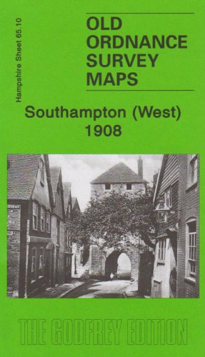
36. Southampton (West) 1908: Hampshire Sheet 65.10 (Old Ordnance Survey Maps of Hampshire)
by Alan Godfrey
Map: Pages (2007-11-22)
list price: US$3.55 -- used & new: US$1.38
(price subject to change: see help)
Asin: 1847840752
Canada | United Kingdom | Germany | France | Japan

37. Roman and Mediaeval Canterbury (Historical Map and Guide)
by Ordnance Survey
 Pamphlet: 1 Pages (1990-12-01)
-- used & new: US$11.99
(price subject to change: see help)
Asin: 0319290263
Canada | United Kingdom | Germany | France | Japan
Editorial Review

Product Description
Historical Maps.Only two maps in this series, comprising Ancient Britain and Roman Britain.Produced in conjunction with the Royal Commissions on Historical Monuments for England, Scotland and Wales. ... Read more


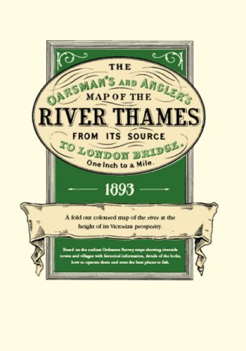
38. The Oarsman's and Angler's Map of the River Thames from It Source to London Bridge: A Fold Out Coloured Map of the River at the Height of Its Prosperity
Map: 1 Pages (2006-12-15)
list price: US$19.00 -- used & new: US$13.99
(price subject to change: see help)
Asin: 1873590016
Canada | United Kingdom | Germany | France | Japan
Editorial Review

Product Description
Explore Britain's best loved waterway with the map that must surely have been used by the Three Men in a Boat. Very detailed, one inch to the mile and over 8 feet in length, it shows all 164 miles from the source to London. Riverside towns and villages are marked with historical information and details of the locks and how to operate them. For fishermen, the best pools where trout, pike, perch and others were to be found. There are also details of toll charges and angling laws and a description of life on the river over a century ago when the Thames was the nation's favourite place for recreation and sport. The map is concertina folded in a protective wallet. ... Read more


39. Georgian Bath (Historical Map and Guide)
by Ordnance Survey
 Map: Pages (1989-12)
-- used & new: US$15.95
(price subject to change: see help)
Asin: 0319290239
Canada | United Kingdom | Germany | France | Japan
Editorial Review

Product Description
Historical Maps.Only two maps in this series, comprising Ancient Britain and Roman Britain.Produced in conjunction with the Royal Commissions on Historical Monuments for England, Scotland and Wales. ... Read more


40. Roman and Anglian York (Historical Map and Guide)
by Ordnance Survey
 Map: Pages (1988-12)

Isbn: 0319290174
Canada | United Kingdom | Germany | France | Japan

  Back | 21-40 of 100 | Next 20
A  B  C  D  E  F  G  H  I  J  K  L  M  N  O  P  Q  R  S  T  U  V  W  X  Y  Z  

Prices listed on this site are subject to change without notice.
Questions on ordering or shipping? click here for help.

site stats