e99 Online Shopping Mall

Geometry.Net - the online learning center Help  
Home  - Basic G - Genealogy Maps & Atlases (Books)

  Back | 41-60 of 100 | Next 20
A  B  C  D  E  F  G  H  I  J  K  L  M  N  O  P  Q  R  S  T  U  V  W  X  Y  Z  

click price to see details     click image to enlarge     click link to go to the store

$7.98
41. Saxmundham, Aldeburgh and Southwold
 
$13.99
42. Roman and Mediaeval Bath (Historical
$12.62
43. Middlesbrough (Cassini Popular
 
$22.98
44. Dalkeith (East) 1905: Edinburghshire
 
$4.66
45. Liverpool (Shaw Street) 1848:
$8.00
46. Nottingham and Loughborough (Cassini
$8.02
47. Alnwick and Morpeth (Cassini Popular
$18.71
48. Maps for Family and Local History.
49. A to Z of Georgian London
 
50. Historical Atlas of Kent (None)
$212.74
51. Birmingham: A History in Maps
$6.23
52. Torbay and South Dartmoor (Cassini
 
53. Printed Maps and Town Plans of
$20.15
54. Atlas of Kentucky
 
$30.00
55. Index to the Map of McLean County:
$53.69
56. Map Guide to the U.S. Federal
 
57. Atlas of Lycoming County, Pennsylvania
 
58. A genealogical atlas of Ireland
59. Roman Britain (Historical Map
60. Scotland of Old: Clan Names Map

41. Saxmundham, Aldeburgh and Southwold (Cassini Popular Edition Historical Map)
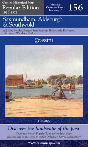
Map: 1 Pages (2007-04-26)
list price: US$12.67 -- used & new: US$7.98
(price subject to change: see help)
Asin: 1847361730
Canada | United Kingdom | Germany | France | Japan

42. Roman and Mediaeval Bath (Historical Map and Guide)
by Ordnance Survey
 Map: Pages (1989-12)
-- used & new: US$13.99
(price subject to change: see help)
Asin: 0319290220
Canada | United Kingdom | Germany | France | Japan
Editorial Review

Product Description
Historical Maps.Only two maps in this series, comprising Ancient Britain and Roman Britain.Produced in conjunction with the Royal Commissions on Historical Monuments for England, Scotland and Wales. ... Read more


43. Middlesbrough (Cassini Popular Edition Historical Map)
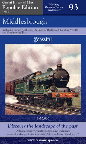
Map: 1 Pages (2007-05-30)
list price: US$12.62 -- used & new: US$12.62
(price subject to change: see help)
Asin: 1847362184
Canada | United Kingdom | Germany | France | Japan

44. Dalkeith (East) 1905: Edinburghshire Sheet 8.07 (Old Ordnance Survey Maps of Edinburghshire)
by Barbara Morris
 Map: Pages (2007-12-28)
-- used & new: US$22.98
(price subject to change: see help)
Asin: 1847840922
Canada | United Kingdom | Germany | France | Japan

45. Liverpool (Shaw Street) 1848: Liverpool Sheet 20 (Old Ordnance Survey Maps - Yard to the Mile)
by Kay Parrott
 Map: Pages (2008-02-29)
list price: US$3.55 -- used & new: US$4.66
(price subject to change: see help)
Asin: 1847841090
Canada | United Kingdom | Germany | France | Japan

46. Nottingham and Loughborough (Cassini Popular Edition Historical Map)
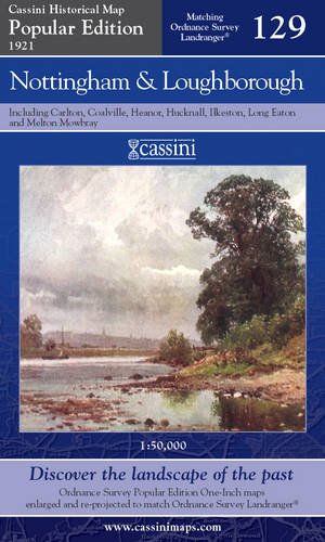
Map: 1 Pages (2007-04-26)
list price: US$12.62 -- used & new: US$8.00
(price subject to change: see help)
Asin: 1847361595
Canada | United Kingdom | Germany | France | Japan

47. Alnwick and Morpeth (Cassini Popular Edition Historical Map)
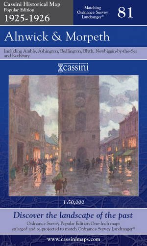
Map: 1 Pages (2007-05-30)
list price: US$12.62 -- used & new: US$8.02
(price subject to change: see help)
Asin: 1847362095
Canada | United Kingdom | Germany | France | Japan

48. Maps for Family and Local History. (2nd Edition, Revised)
by William Foot, Geraldine Beech, Rose Mitchell
Paperback: 112 Pages (2004-04-01)
list price: US$23.99 -- used & new: US$18.71
(price subject to change: see help)
Asin: 1550025066
Canada | United Kingdom | Germany | France | Japan
Editorial Review

Product Description

Maps for Family and Local History shows how three great land surveys can provide information on ancestral homes, as well as fascinating historical snapshots of specific areas. Covering 1836 to 1943, the Tithe, Valuation Office, and National Farm Surveys provide a wealth of information on rural and urban localities, on dwellings, settlements, and landscapes as well as the status of householders. The text gives the rationale behind the surveys and covers each in detail. Fully updated by map experts from The National Archives, this illustrated guide is the perfect companion to researching those maps.

... Read more

49. A to Z of Georgian London
by John Rocque
Hardcover: 88 Pages (1985-12)

Isbn: 0903541343
Canada | United Kingdom | Germany | France | Japan

50. Historical Atlas of Kent (None)
by David Killingray
 Hardcover: 200 Pages (2005-01-30)
list price: US$45.00
Isbn: 1860772552
Canada | United Kingdom | Germany | France | Japan
Editorial Review

Product Description
All eighty maps in this collection are completely new and original. They plot a huge diversity of subject matter, ranging from prehistoric times to the present day and each is accompanied by a text which places it in context and reveals a remarkable amount of new research. ... Read more


51. Birmingham: A History in Maps
by Paul Line
Hardcover: 120 Pages (2009-09-01)
-- used & new: US$212.74
(price subject to change: see help)
Asin: 0752452819
Canada | United Kingdom | Germany | France | Japan
Editorial Review

Product Description
From the exceptional town plans and maps contained within this unique volume emerges a social picture of Birmingham; a town quickly developing in size and population in the eighteenth century; along with the changes brought about by urbanisation. Land was bought up for development; hundreds of 'courts' were built to home the industrial workers pouring in from the many outlying villages. The many gardens, orchards and wide expanses of open space detailed on Wesley's 1731 plan of Birmingham were soon to be transformed into a sprawling mass of habitation. By 1765 Matthew Boulton, a leading entrepreneur and pioneer of the Industrial Revolution, had built his famous Soho Manufactory on Handsworth Heath. Shortly afterwards, the town plans of Birmingham in the first quarter of the 1800s chart the arrival of the railway; a plan from 1832 is the last glimpse of the city before the arrival of the Grand Junction Railway and other main line stations.Accompanied with informative text and pictures of the cityscape, the many detailed plans contained in this historic atlas of Birmingham are a gateway to its past, allowing the reader and researcher to visually observe the journey of this historic town to city status in 1887 and beyond. ... Read more


52. Torbay and South Dartmoor (Cassini Popular Edition Historical Map)
Map: 1 Pages (2007-06-06)
list price: US$12.62 -- used & new: US$6.23
(price subject to change: see help)
Asin: 1847361501
Canada | United Kingdom | Germany | France | Japan

53. Printed Maps and Town Plans of Bedfordshire, 1576-1900 (Publications of the Bedfordshire Historical Record Society)
by Betty Chambers
 Hardcover: 250 Pages (1983-01)

Isbn: 0851550444
Canada | United Kingdom | Germany | France | Japan

54. Atlas of Kentucky
Hardcover: 336 Pages (1998-05-14)
list price: US$39.95 -- used & new: US$20.15
(price subject to change: see help)
Asin: 0813120055
Average Customer Review: 3.0 out of 5 stars
Canada | United Kingdom | Germany | France | Japan
Editorial Review

Product Description
Based on the latest U.S. Census and information from a variety of sources, this volume is an authoritative reference guide for use in schools and colleges, libraries, businesses and industries, planning agencies, and local and state governments. 205 illustrations. 622 maps. 171 charts, tables & graphs. ... Read more

Customer Reviews (2)

1-0 out of 5 stars Atlas of Kentucky
This is a geo-political publication, NOT an atlas in the normal sense of the word.In fact, calling it an atlas without further clarification of its true nature is extremely misleading.

5-0 out of 5 stars Superb example of what a state atlas should be like.
Chock full of information. Very colorful, lots of photos, maps, and graphs. This should be used as a standard for every state atlas. ... Read more


55. Index to the Map of McLean County: By J.L. Spaulding, 1866
 Paperback: 295 Pages (1994-12)
list price: US$30.00 -- used & new: US$30.00
(price subject to change: see help)
Asin: 0943788064
Canada | United Kingdom | Germany | France | Japan

56. Map Guide to the U.S. Federal Censuses, 1790-1920
by William Thorndale, William Dollarhide
Paperback: 445 Pages (1995-01)
list price: US$59.95 -- used & new: US$53.69
(price subject to change: see help)
Asin: 0806311886
Average Customer Review: 5.0 out of 5 stars
Canada | United Kingdom | Germany | France | Japan
Editorial Review

Product Description
The county has always been used as the basic Federal census unit. Genealogical research in the census, therefore, begins with identifying the correct county jurisdictions. This work shows all U.S. county boundaries from 1790 to 1920. On each of the nearly 400 maps the old county lines are superimposed over the modern ones to highlight the boundary changes at ten-year intervals. Also included are (1) a history of census growth; (2) the technical facts about each census; (3) a discussion of census accuracy; (4) an essay on available sources for each state's old county lines; and (5) a statement with each map indicating which county census lines exist and which are lost. Then there is an index listing all present-day counties, plus nearly all defunct counties or counties later re-named. With each map there is data on boundary changes, notes about the census, and locality finding keys. There also are inset maps that clarify territorial lines, a state-by-state bibliography of sources, and an appendix outlining pitfalls in mapping county boundaries. The detail in this work is exhaustive and of such impeccable standards that there is little wonder why this award-winning publication is the number one tool in U.S. census research. ... Read more

Customer Reviews (19)

5-0 out of 5 stars Must have for serious genealogists
If you spend any time in the census records over several states, then this book is essential.I wish I had found it years ago.County boundaries changed many times, especially in the early census records and this book gives you current county boundaries with overlays for each census year showing the changes.Your ancestor may never have moved but lived in several different counties.Well worth the money if you do a lot of genealogy research.

5-0 out of 5 stars Map Guide to US Census
Product was delivered in a timely manner and the whole transaction was as to be expected.The book was in great shape and the description by the seller was very accurate.

Very positive experience.

5-0 out of 5 stars Map Guide to the U.S. Federal Censuses, 1790-1920, second printing, 1988, Authors William Thorndale & William Dollarhide
I am very pleased with this purchase.My book, which is in excellent shape, arrived sooner than I expected.The order was placed Oct. 1 and the book was received Oct. 5.I will order from 4-bookwurms again.

5-0 out of 5 stars This book an absolute must for genealogists.
This book of Map Guide to the U.S. Federal Censuses 1790-1920 is absolutely essential when researching one's ancestors.It is possible to trace their migration across this land in the earlier years of settlement.In fact, because of the differing boundries of counties and State divisions, it is necessary to place the ancestor in the correct location in his/her day rather than as the current maps show it today.It is the difference sometimes of locating a correct ancestor by a certain name and confusing another person with the same name in a slightly different location who is not kin at all.I am 100% delighted with this book.

Susanna

5-0 out of 5 stars Map Guide to the Federal Censuses 1790-1920
This book is a wonderful tool for genealogists to see the boundary changes for each county in each state for each Census year. It gives the dates when changes were made which helps in knowing where to look for vital records, land records, probate records etc. The book is very easy to read and understand. ... Read more


57. Atlas of Lycoming County, Pennsylvania From Actual Surveys (1873) WITH History of Lycoming County (1876)
by Beach Nichols
 Hardcover: 226 Pages (1979)

Asin: B000727EZ0
Canada | United Kingdom | Germany | France | Japan

58. A genealogical atlas of Ireland
by David E Gardner
 Paperback: 106 Pages (1972)

Asin: B0007FLYF8
Canada | United Kingdom | Germany | France | Japan

59. Roman Britain (Historical Map and Guide)
by Ordnance Survey
Map: Pages (1995-02)

Isbn: 0319290271
Canada | United Kingdom | Germany | France | Japan
Editorial Review

Product Description
Historical Maps.Only two maps in this series, comprising Ancient Britain and Roman Britain.Produced in conjunction with the Royal Commissions on Historical Monuments for England, Scotland and Wales. ... Read more


60. Scotland of Old: Clan Names Map
by Iain Moncreiffe of that Ilk
Map: 1 Pages (1991-08-05)
list price: US$9.95
Isbn: 0702817090
Average Customer Review: 4.0 out of 5 stars
Canada | United Kingdom | Germany | France | Japan
Editorial Review

Product Description
This map shows the ancient territories of Scottish clans and families, usually about the time of King James VI, but taking the history of each district or family as a whole. It also shows the arms, the insignia of the clan chiefs and crests - with each chiefs motto or slogan. ... Read more

Customer Reviews (1)

4-0 out of 5 stars Scottish Heritage on paper
This was given as a gift and for framing and hanging on a prominent wall.My sister-in-law is a hard to please and convince person but she really took to this map and the information it showed on where her family history comes from.It went over better than expected even if it was a previously loved map; hence the four stars. ... Read more


  Back | 41-60 of 100 | Next 20
A  B  C  D  E  F  G  H  I  J  K  L  M  N  O  P  Q  R  S  T  U  V  W  X  Y  Z  

Prices listed on this site are subject to change without notice.
Questions on ordering or shipping? click here for help.

site stats