e99 Online Shopping Mall

Geometry.Net - the online learning center Help  
Home  - Basic H - Historical Maps (Books)

  Back | 21-40 of 100 | Next 20
A  B  C  D  E  F  G  H  I  J  K  L  M  N  O  P  Q  R  S  T  U  V  W  X  Y  Z  

click price to see details     click image to enlarge     click link to go to the store

$185.38
21. Maps of Texas and the Southwest,
 
$40.00
22. Historical Maps of North America
 
$228.24
23. Bibliography of the printed maps
$30.99
24. Historical Atlas of the North
 
25. Atlas of Texas (Cultural and historical
 
26. The battle of Chickamauga: Historical
$21.96
27. Minnesota on the Map: A Historical
$9.97
28. Historical Maps of Civil War Battlefields
29. Philip's Atlas of World History
$7.69
30. The Palgrave Concise Historical
$20.00
31. City of London Map 1520: 500 years
$14.99
32. Africa Executive Wall Map (tubed)
 
$105.23
33. England and Wales Historical Map
$36.46
34. Placing History: How Maps, Spatial
$20.77
35. Historic Maps and Views of Berlin
$10.15
36. Historical Atlas of the Holy Lands
$4.95
37. Pittsburgh at the Millennium:
$9.50
38. Historical Italy (National Geographic
$1.00
39. Little Big Horn Battlefield, Montana
$8.65
40. Bradshaw's Railway Map 1907: Great

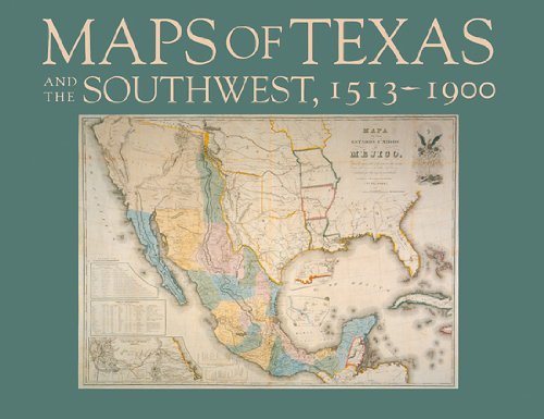
21. Maps of Texas and the Southwest, 1513-1900 (Repr of 1984 ed) (Fred H. and Ella Mae Moore Texas History Reprint Series, No 18)
by James Martin, Robert S. Martin
Hardcover: 184 Pages (1999-05-01)
list price: US$39.95 -- used & new: US$185.38
(price subject to change: see help)
Asin: 087611169X
Average Customer Review: 4.0 out of 5 stars
Canada | United Kingdom | Germany | France | Japan

Customer Reviews (2)

5-0 out of 5 stars A Useful, Well Written Book
This useful and well written book is a staple among students of the history of cartography (HoC) in Texas.It was written as a companion piece to the first major HoC exhibit on Texas maps, put on by the Amon Carter Museum in Fort Worth.The exhibit then went on the road, showing at libraries and other venues throughout the state.The book was greeted with critical acclaim by scholars and lay readers alike, and the first edition quickly sold out.Its resale value shot up due to demand, until the Texas State Historical Society took it under wing and produced this reprint edition.Clearly then, in the view of many readers from diverse backgrounds, this is a very useful and worthwhile book.

When it was first published (1984), there was not much written about the HoC of Texas.The book quickly became the standard reference for HoC scholars and map collectors interested in Texas, a role its authors never foresaw.Indeed, they wrote in their Preface that "...our first goal has been to stimulate further inquiry and to add to the appreciation of the value of historic maps as tools in learning about any place, at any time."The book did just that.It has been one of several catalysts in the intervening years for a tremendous growth in appreciation, study, and publications dealing with Texas antiquarian maps.Unfortunately this has not yet led to a definitive catalogue of Texas maps, so Martin & Martin (as it is commonly known) continues play this role to which it never aspired.

The work is divided into three parts.The first is a series of brief introductory pieces, about 40 total pages.These trace, in terms accessible to the average reader, the evolution of maps and their role in Texas from the earliest period of exploration through the 20th century.While of interest to most readers, for those unfamiliar with the history of either Texas or cartography, they are especially helpful.The second section contains 16 color plates with no commentary.Following that there are 50 black and white plates.Each is a full page, faced by a page of well researched, easy to read commentary.The 16 color plates are repeated here so that commentary can be inserted.This may be puzzling at first, but was undoubtedly done to reduce costs.It was cheaper to place all the color in one "signature" for binding than to intersperse color printing throughout, even at the cost of repeating some pages.This is why this book retails on Amazon for under $30 instead of twice the price.

I hope this helps the prospective buyer appreciate the book and decide more easily whether this is the book you're looking for.

3-0 out of 5 stars Expected something better
I paid over $45.00 I couldn't afford to spend on this book because I love maps and thought this book was going to be a bonanza of information and would serve as a great reference forever. Well, there are a lot of maps in this book, but not at all useful in the way I'd hoped. The most interesting (to me) thing that I learned from this book was a one-pager about the U.S. Coast Survey and its history. I keep thinking that one day, I will value this book more than I do now. As it is, I wish I'd spent the money having my cat spayed. ... Read more


22. Historical Maps of North America
by Michael Swift
 Hardcover: 144 Pages (2001-12-31)
list price: US$24.95 -- used & new: US$40.00
(price subject to change: see help)
Asin: 1856485927
Average Customer Review: 5.0 out of 5 stars
Canada | United Kingdom | Germany | France | Japan
Editorial Review

Product Description
Travel back to a time when North America was largely unexplored and mapmakers could not rely on computers or aerial photographs. Featuring more than one hundred beautifully crafted antique maps and charts, previously available only to researchers, this engrossing volume celebrates the art of cartography and the evolution of North America. Dating back to the early 17th century, the maps are arranged chronologically and trace history through the turn of the 19th century. Extended captions put each map in context and explain its significance. Fascinating insights into American history are revealed, including details about early New York, Boston, and Pennsylvania and about military engagements of the Revolutionary and Civil Wars. Take a look at Virginia in 1612, Florida in 1722, Quebec in 1767, the Virgin Islands circa 1800, Alaska in 1849, and many other sites. A wonderful resource for those interested in cartography, geography, and American history.
... Read more

Customer Reviews (1)

5-0 out of 5 stars From Cee of BooksbyCee
The Historical Maps of North America, written by Michael SWIFT published by PRC is an excellent book on old North American maps and Canada is included in this book, too! If you're into family history buffand you're researching your old lineages dating back to the early 1700's - then this book is for you!You'll learn fast about border changes and whether the French or Britsh ruled any particular area which will also help you understand why "example": your MYERS were MOYER in one part of the country, as compared to seeing it spelled as MEYER or even MEIER in another part. This book is simple and easy to understand, as well, if you're anything like me you like to keep it simple. I love mine so much so, that I'll probably never part with it because I still refer back to it time and time again. It's the next best thing to being able to "afford" the chance to get up to the Library of Congress and the National Archives and hunting down and copying the old maps yourself. NOTE: This isn't a bad book for your school aged children aiding them with their history homework, either! ... Read more


23. Bibliography of the printed maps of Michigan, 1804-1880,: With a series of over one hundred reproductions of maps constituting an historical atlas of the Great lakes and Michigan,
by Louis Charles Karpinski
 Unknown Binding: 539 Pages (1931)
-- used & new: US$228.24
(price subject to change: see help)
Asin: B0006ALI96
Canada | United Kingdom | Germany | France | Japan

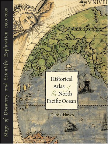
24. Historical Atlas of the North Pacific Ocean: Maps of Discovery and Scientific Exploration, 1500-2000
by Derek Hayes
Hardcover: 224 Pages (2002-01-16)
list price: US$40.00 -- used & new: US$30.99
(price subject to change: see help)
Asin: 1570613117
Canada | United Kingdom | Germany | France | Japan
Editorial Review

Product Description
Map junkies rejoice! Derek Hayes, author of Historical Atlas of the Pacific Northwest, delivers another stunning atlas filled with stories of explorations and exquisite historical maps. Over five hundred years of maps depicting the North Pacific Ocean and the lands that border it—the United States, Canada, Alaska, Russia, Japan, Korea, and China—have been collected into this new atlas. From antique maps of the sixteenth century to modern satellite images, this volume covers all the major explorations, such as Magellan, Bering, Cook, and Vancouver; Perry’s opening of Japan; and the U.S. North Pacific Exploring Expedition. It also includes modern maps that use the latest technology to show ocean currents, fault lines, and the seabed in astounding detail. ... Read more


25. Atlas of Texas (Cultural and historical maps of Texas)
by Stanley Alan Arbingast
 Paperback: 179 Pages (1976-06)
list price: US$29.95
Isbn: 0877552614
Canada | United Kingdom | Germany | France | Japan

26. The battle of Chickamauga: Historical map and guide book
by Joseph C McElroy
 Unknown Binding: 25 Pages (1895)

Asin: B00089TO96
Canada | United Kingdom | Germany | France | Japan

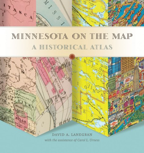
27. Minnesota on the Map: A Historical Atlas
by David Lanegran
Hardcover: 224 Pages (2008-08-15)
list price: US$34.95 -- used & new: US$21.96
(price subject to change: see help)
Asin: 0873515935
Average Customer Review: 4.5 out of 5 stars
Canada | United Kingdom | Germany | France | Japan
Editorial Review

Product Description

The tiny region of the globe now known as Minnesota has appeared on maps for more than five centuries-in the sketchy first impressions of explorers, exuberant promotions of boosters, and analytical tools of planners and managers. This lavish treasury of almost 100 maps illuminates the imagined, real, and changing landscape of Minnesota.

Preeminent geographer David Lanegran embarks on his words-and-maps journey by introducing attempts to find a route to China around the American continent. Changes in early military and political maps measured the country's expanding boundaries, and increasingly detailed maps encouraged settlement.

Lanegran offers stories of the fascinating controversies that fueled the state's development and how maps made a difference in their outcome. Readers learn about Duluth's port war with Superior, Wisconsin, how railroads dictated the shape of cities like Brainerd, the importance of the state's first 1919 highway map, and how Boundary Waters maps created a tourism bonanza.

David A Lanegran holds the John S. Holl Endowed Chair of Geography at Macalester College in St. Paul. Carol Urness is curator emerita at the James Ford Bell Library at the University of Minnesota.
... Read more

Customer Reviews (2)

5-0 out of 5 stars Great History/Maps/Minnesota Book!
Saw this book in my college's quarterly magazine, as it was put out by a Macalester alum.Got it as a Xmas gift for my parents, so I didn't look at it that much.But they told me they absolutely loved it and it's really interesting.Nice balance of photos and text.My mom was especially impressed that Native American history was properly addressed.I purchased the book new and thought the price was fair.

4-0 out of 5 stars Wish for even more
Great volume for the price: excellent array of maps, especially promotional/tourist maps, of Minnesota from years past & (near-)present.Details often shown as insets just whet my appetite for seeing more.Originals must be truly fascinating.Probably for the price and size of reproduction this is the best that can be managed. ... Read more


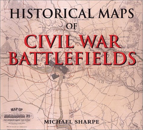
28. Historical Maps of Civil War Battlefields
by Michael Sharpe
Hardcover: 144 Pages (2001-01-01)
list price: US$12.99 -- used & new: US$9.97
(price subject to change: see help)
Asin: 1571451331
Average Customer Review: 3.0 out of 5 stars
Canada | United Kingdom | Germany | France | Japan
Editorial Review

Product Description
As a defining moment in the history of the United States, the Civil War has no equal. Historical Maps of Civil War Battlefields provides a unique view of the war. In over 120 maps this historical record looks at the broad sweep of events from the Southern capture of Ft. Sumter through to the Battle of Gettysburg and Appomattox.Every map has been drawn from the collections of the Library of Congress and the National Archive. ... Read more

Customer Reviews (1)

3-0 out of 5 stars Fairly Good Book
I found this book very helpful; however some of the maps were hard to read.More historical information on the maps and battles show in them would have made this book a must buy. ... Read more


29. Philip's Atlas of World History (Historical Atlas)
Hardcover: 368 Pages (1999-01)
list price: US$82.65
Isbn: 0540075833
Average Customer Review: 4.5 out of 5 stars
Canada | United Kingdom | Germany | France | Japan
Editorial Review

Product Description
This atlas presents the story of civilization in physical setting. Specially designed to help the reader visualize great historical themes and decisive moments. It combines 400 specially drawn maps depicting the scope of these events. The atlas features 135 double-page spreads, each of which potrays key develppments in a world region over a specific period of time. Each spread features maps together with complementary text discussing and explaining the historical, political, geographical, social, cultural and relgious themes behind each topic. ... Read more

Customer Reviews (19)

5-0 out of 5 stars Fascinating
As a person with a casual interest in history, I was hoping that a book summarizing everything would exist. This is that book. The development and changes of borders in world history is something that interests me and Atlas of World History did not disappoint. Through the pages are the stories of the rise and fall of great empires. There are more maps than I could have ever wanted. The text itself is interesting, albeit in the expected textbook format. The book is almost always non-biased towards historical events. There are also summaries of larger scale wars such as the World Wars, the American Civil War, and so on. I imagine that one could spend a lot of time just thumbing through the pages looking at the maps which are all beautifully and clearly illustrated.

As far as I can tell, there are very few errors in the book. Some of this comes from the fact that borders were sometimes in a constant state of flux (see Byzantine Empire). Also important to note is that the goal of this book is summarizing. For example, the Roman Empire gets only two pages.

In conclusion, if you like history and want a visualization of the borders and people's movement throughout the times but you are not looking for something in-depth, buy this book.

5-0 out of 5 stars Great purchase
I have been reading a book on Genghis Khan, and tried this book to provide more understanding. Beyond this, it was excellent, and better than I expected in covering various other historical times and events.

4-0 out of 5 stars Recommended Atlas
Was looking for a good yet comprehensive historical atlas to pick up to have a newer one on hand (for self and kids).Looked through many varieties at indy and big box bookstores and decided on this one.It has many, many maps of cultural, economic, linguistic, religious, and sociopolitical events beyond the scope of general history and geography that most atlases cover.Simply put it had more to offer than its similar competitors.

Recommended.

5-0 out of 5 stars A must for the history fan or an educator
This book is not your ordinary historical atlas.This atlas has highly intelligent commentary that accompanies the maps.The quality of the commentary places it far above other intelligent historical atlases, such as the giant Dorling Kindersley atlas of world history.
It has thematic maps and commentary, such as on modern economic trends.
The maps have very good accuracy of boundaries.The atlas is comprehensive attention; it does not only concentrate on Europe or the United States.

4-0 out of 5 stars good product
Atlas allows you to match historical events with geographical maps. The best use is for people who know the historic event but want to refresh it in geographical context or just like me enjoy to browse through historical maps.It is not replacing history books (text that accompanies maps is rather concise) but represents a good addition to them.
The drawback is small font size which makes it difficult to read. ... Read more


30. The Palgrave Concise Historical Atlas of the Balkans
by Dennis P. Hupchick, Harold E. Cox
Paperback: 144 Pages (2001-09-22)
list price: US$22.00 -- used & new: US$7.69
(price subject to change: see help)
Asin: 031223970X
Average Customer Review: 4.0 out of 5 stars
Canada | United Kingdom | Germany | France | Japan
Editorial Review

Product Description
The dramatic, tumultuous, and often tragic human events that erupted in the Balkan Peninsula following the collapse of communism between 1989 and 1991 have captured the Western world's attention throughout the past decade. The Palgrave Concise Historical Atlas of the Balkans provides 50 two-color, full-page maps, each accompanied by a facing page of explanatory text.These maps illustrate key moments in Balkan history in a way that is immediate and comprehensible, making it come alive.Students will regard it as a useful reference, and general readers will enjoy it for its clarity and wealth of information. ... Read more

Customer Reviews (2)

5-0 out of 5 stars Maps and brief overview that are easy to understand
If you're looking for maps of how the Balkan borders have been drawn and redrawn between 600-1999 AD, plus a brief textual overview on the facing page, this is the book for you. Several earlier maps also show the general dispersion of the various cultures that inhabited that portion of the Balkans (not always an easy task).

Understanding the Balkans is difficult (well, at least it is for an American like me) ... but this book has helped me more than one time to grasp the often turbulent events that constantly reshaped Balkan countries. As kingdoms and empires grew and shrank, the borders often changed ... and new countries were created and old countries disappeared.

It's nice to have this brief progression through time in the form of the changing geography. It's a reference book that anyone who is interested in Balkan history will find useful over and over. And it's never out of date, since 600 AD will never occur again.

3-0 out of 5 stars Honest attempt, weak result
* * * Do NOT buy hardcover version! * * *

Summary:
Maps: **(*)
Text: ***(*)
To be used together with another atlas. (e.g. "Historical Atlas of East Central Europe, by P. R. Magocsi or Cartographia's "Történelmi Világatlasz" (in Hungarian))

Just like when I first discovered the "Historical Atlas of Eastern Europe" I thought: "At last a specific work on the topic in English!".
Well, despite the range of the maps - 50, listed at the end of the review - it was quite a disappointment.

The maps...They can at best be described as of "average" quality, but words like "perfunctory" or "sloppy" could be used as well.There is no excuse for the roughness and distortion of state boundaries, the lack of rivers and cities/towns.And the actual errors to them have yet to be mentioned. Still, since these maps cover a smaller area than their counterparts in the
"Historical Atlas of Eastern Europe", they are a bit more precise, but far from detailed.

It must be noted as well that GEOGRAPHICALLY the Northern boundary of the Balkan Peninsula is defined by the Danube - Sava - Kulpa rivers. Thus Slovenia is entirely and Croatia and Romania is partly outside of it. However, while historically Ljubljana and Zagreb is rightly considered Central European, Bucharest is linked to the Balkans. Despite it's acquisition of Transylvania in 1918/20.

It must be noted that the author makes an honest attempt to be objective in the history telling, by sometimes presenting several versions/views on the same event, BUT I am sure that even this won't satisfy everybody.
However, the style of the text is sometimes "odd". "Nationalist", is one of the much preferred word used by the author, especially when dealing with newer history.The difference between "nationalism" and "patriotism" is apparently very subjective.

All in all, the map part of this atlas is suitable for low-level studies of the area only, and the text for high-school studies.

A last remark: This volume shares 14 - or 1/3 - out of it's 50 maps with the "Historical Atlas of Eastern Europe" from the same series. (Nos. (5), 8, 11, 13, 17, 19, 21, 25, 30, 32, 33, 37, 38, 49 and 50, as observed by the author of these lines.)
So basically, the "Historical Atlas of the Balkans" - with it's 36 additional maps of the Balkans - is a complementary to the "Historical Atlas of Eastern Europe".

The Maps:
1: Physical
2: Political, 2001
3: Natural Resources
4: Demographic
5: Cultural
6: The East Roman Balkans, Late 6th Century
7: Avar, Slav, and Bulgarian Invasions, 7th Century
8: Rise of the First Bulgarian Empire, 7th-10th Centuries
9: Fall of the First Bulgarian Empire, Mid-10th-Early 11th Centuries
10: Rise of Medieval Croatia, 19th-12th Centuries
11: The Balkans, Late 12th Century
12: Crusades in the Balkans, Late 11th-Early 13th Centuries
13: The Balkans after the Fourth Crusade, 1204-1214
14: Byzantium Resurrected, 1261-1328
15: Rise of the Romanian Principalities, Mid-13th-14th Centuries
16: Rise of Medieval Bosnia, 13th-14th Centuries
17: Rise of Medieval Serbia, 13th-Mid-14th Centuries
18: Political Fragmentation, Mid-14th Century
19: Ottoman Expansion in the Balkans, Mid-14th-Early 16th Centuries
20: Fall of Constantinople, 1453 (and Ottoman Istanbul)
21: Apex of Ottoman Expansion, Mid-16th Century
22: Ottoman Millet Organization, Mid-16th-17th Centuries
23: Habsburg Croatian-Slavonian Military Border, 17th-18th Centuries
24: The Ottoman Balkans, Late 17th-18th Centuries
25: Emergence of Modern Balkan States, 1804-1862
26: The Balkan Crisis of 1875-1876
27: The "San-Stefano" Balkans, March 1878
28: The "Berlin" Balkans, July 1878
29: Balkan State Territorial Expansion, 1881-1886
30: The Macedonian Question
31: The Balkans, 1908
32: Bosnia-Hercegovina, 1908-1914
33: The Balkan Wars, 1912-1913
34: World War I in the Balkans
35: The Post-Versailles/Lausanne Balkans
36: Yugoslavia, 1929-1941
37: Post-Trianon Romania, 1920-1938
38: The Transylvanian Question
39: Bulgaria, 1919-1940
40: Greece, 1923-1941
41: Albania, 1921-1939
42: The Balkans, 1939-1940
43: World War II-The 1941 Balkan Campaign
44: The Axis-Dominated Balkans, 1941-1944
45: Balkan Cominform States 1945-1947
46: The Greek Civil War, 1946-1949
47: Splits in Communism, 1948-1960
48: Collapse of Communism, 1989-1991
49: Wars of Yugoslav Succession, 1991-1995
50: The Kosovo Crisis, 1999

Review based on First paperback September 2001 edition. ... Read more


31. City of London Map 1520: 500 years ago, Henry the 8th's City... Showing Major Streets, Lanes, Churches, Great Houses, Public Buildings, Folded in Wallet,
by The Historic Towns Trust
Map: 1 Pages (2009-02-15)
list price: US$20.00 -- used & new: US$20.00
(price subject to change: see help)
Asin: 1873590776
Canada | United Kingdom | Germany | France | Japan
Editorial Review

Product Description
The capital city in 1520 during the reign of Henry VIII showing major streets, lanes, churches, great houses, monasteries and public buildings.This map reveals medieval London at its most impressive, before the city was overwhelmed by a massive population explosion. In the course of the sixteenth century the number of Londoners grew from 50,000 to 200,000. At the same time the City's thirty monastic houses were dissolved, their buildings sold and their gardens covered with cramped and poorly-built housing. This is the map of the lost garden city. ... Read more


32. Africa Executive Wall Map (tubed)
by National Geographic Maps
Map: Pages (2009-01-01)
list price: US$14.99 -- used & new: US$14.99
(price subject to change: see help)
Asin: 1597752584
Canada | United Kingdom | Germany | France | Japan
Editorial Review

Product Description
NEW! Our executive style political map of Africa features country boundaries, place names, bodies of water, airports, major highways and roads, and much more.

(Tubed) 24'' x 31''
Scale size: 1:14,244,000 ... Read more


33. England and Wales Historical Map
by L.G. Bullock
 Paperback: Pages (1971)
-- used & new: US$105.23
(price subject to change: see help)
Asin: 0851525504
Canada | United Kingdom | Germany | France | Japan

34. Placing History: How Maps, Spatial Data, and GIS Are Changing Historical Scholarship
Paperback: 313 Pages (2008-01-01)
list price: US$49.95 -- used & new: US$36.46
(price subject to change: see help)
Asin: 1589480139
Average Customer Review: 4.5 out of 5 stars
Canada | United Kingdom | Germany | France | Japan
Editorial Review

Product Description

In the last decade, historical GIS has emerged as a promising new methodology for studying the past. Historical GIS is the use of geographic information systems software and allied geospatial methods for historical research and teaching. Placing History: How Maps, Spatial Data, and GIS Are Changing Historical Scholarship offers case studies and essays on key issues involving historical GIS, highlighting the unprecedented range of tools to visualize historical information in a geographical context. Quantitative social science historians are embracing GIS to facilitate the mapping of large datasets, but anyone with access to the software and the skills to use it can include mapping in research. This change is little short of revolutionary considering how few scholars or students made maps even ten years ago. Historical maps are suddenly in great demand as digitally modified, georeferenced images that enable researchers to study GIS as a visual medium of communication and analysis.
... Read more

Customer Reviews (2)

5-0 out of 5 stars An excellent set of examples on how GIS interpretations and usage affects history.
PLACING HISTORY: HOW MAPS, SPATIAL DATA AND GIS ARE CHANGING HISTORICAL SCHOLARSHIP challenges historians and historical geographers to use information science wisely, as it vastly affects historical scholarship and historical revision processes. College-level holdings strong in GIS analysis, use, and historical analysis alike will find PLACING HISTORY an invaluable link between cartography, geographic assessment and history. Case studies and regional analysis blend in an excellent set of examples on how GIS interpretations and usage affects history.

Diane C. Donovan
California Bookwatch

4-0 out of 5 stars conference in a book
This book wasn't quite what I thought it was going to be, but I still enjoyed it. As is explained in the introduction of the book, a lot of the sections, as well as the presentations on the included data disc, are the result of a conference dealing with using GIS in historical research. The book is well written, with each contributor taking care to present each topic in an objective light. The book is better read a section at a time, as trying to read it straight through can get very overwhelming, due to so much information being presented. ... Read more


35. Historic Maps and Views of Berlin (Ullmann)
Hardcover: 56 Pages (2010-10-01)
-- used & new: US$20.77
(price subject to change: see help)
Asin: 3833157747
Canada | United Kingdom | Germany | France | Japan
Editorial Review

Product Description
Berlin was not built in seven days - it took centuries to become what it is today: a glamorous metropolis that sets standards both now and in the past. This brand new, full-colour book features 24 historical maps and city views that are detachable for hanging and give insights into urban developments, from the first city wall to the modern underground train system. They also show architectural masterstrokes and document formative cultural-historical moments alongside concise accompanying texts. The different illustrators and artists have cleverly created a mosaic, which not only shows a snapshot but rather connects centuries, by using the techniques and materials of their times in high value reproductions. The history of this metropolis can surely not be retraced quicker and more memorably than in this unique book. ... Read more


36. Historical Atlas of the Holy Lands
by Karen Farrington
Hardcover: 191 Pages (2003-06)
list price: US$35.00 -- used & new: US$10.15
(price subject to change: see help)
Asin: 0816052190
Canada | United Kingdom | Germany | France | Japan
Editorial Review

Product Description
Nowhere in the world has a more tumultuous history than the Holy Land, that troubled bridge of land that links Asia, Africa and Europe. Today we are used to watching TV news reports covering the region’s modern-day conflicts. It is scant consolation to know that equally world-shaping battles were being fought there thousands of years ago. These lands have always been a crossroads of peoples and the stage for a clash of cultures, and the region has bred more than its fair share of heroes, villains, invaders, saints and zealots. Their exploits were woven into a series of religious books chronicling the history of the region that later became known as The Bible. Whatever one’s religious beliefs, the Bible contains a wealth of historical fact and an insight into the contemporary culture of the region. This book investigates the background of the Bible, not only re-telling the classic stories but looking at the latest archeological evidence to provide a thoroughly up-to-date account. ... Read more


37. Pittsburgh at the Millennium: A Thousand Years of Change--Satellite Imagery, Bird's-Eye Views, Historical Topography, 2000 ... 1000
by Inc Hedberg Maps
Map: 2 Pages (1999-01)
list price: US$4.95 -- used & new: US$4.95
(price subject to change: see help)
Asin: 1885508654
Canada | United Kingdom | Germany | France | Japan
Editorial Review

Product Description
Using historic and modern maps and photographs, historic Bird's Eye Views and aerial satellite images, this remarkable piece vividly displays the changes in Pittsburgh from the time before European settlement of the Americas up to the year 2000. Images include a 1908 panoramic view of the riverfront, a Bird's Eye view from 1874and a 1999 oblique aerial image. Historic photos show The Point between 1900 and 1915, downtown Pittsburgh during the catastrophic floods of 1996 and the Monongahela Incline in 1905. A Satellite image from 1999 is contrasted with an artistic impression showing the landforms in 1000 AD. A modern map of the city center is provided for context. The text describes the changes in the City's shape and character over time, including changes made to the landforms, with a graph showing population growth since 1790.Other text explains the changes in mapping technology over the years. A time scale highlights significant events in the world and the region. Beautiful and informative. ... Read more


38. Historical Italy (National Geographic Society supplemental map)
by National Geographic Society
Map: Pages (1995)
-- used & new: US$9.50
(price subject to change: see help)
Asin: B0012H2C2Y
Canada | United Kingdom | Germany | France | Japan
Editorial Review

Product Description
Filled with historical information and illustrations, this map boasts eleven inset maps and information detailing key periods, including: The Etruscan civilization; The Roman Empire at its greatest extent; Barbarian invasions and the Byzantine empire; Papal states; The Plague years, showing the route of the deadly epidemic; The Renaissance; The Counter-Reformation; The Enlightenment; Napoleon in Italy; Unification; An illustration of a map of Italy published in 1486. This version, printed on high-quality, semi-gloss paper, is perfect for framing. ... Read more


39. Little Big Horn Battlefield, Montana Territory, June 1876 (American Battlefields Watercolor Map Series)
by Earl B. McElfresh
Map: 1 Pages (1996-01-01)
list price: US$9.95 -- used & new: US$1.00
(price subject to change: see help)
Asin: 1885294093
Average Customer Review: 3.0 out of 5 stars
Canada | United Kingdom | Germany | France | Japan
Editorial Review

Product Description
The most famous little battle in the world. Scale: 1"=1000' Map image: 33" x 18" Overall size: 18" x 36" Style: Watercolorand colored pencil map showing terrain, watercourses and Siouxvillages. Some troop movements depicted. Reverse side: Text includesan account of George Armstrong Custer's brief Civil War career as aTopographical Engineer. Reproductions include the Culbertson Guidon(the first time ever published in full color), the 1877 Fouchphotograph believed to be the earliest ever taken at Little Big Horn,a full color Philo Clark Indian map and two black and white photos ofpack mules and Custer's quarters at Fort Abraham Lincoln. Packaged ina reusable sleeve. A History Book Club Selection ... Read more

Customer Reviews (1)

3-0 out of 5 stars Ho-Hum
This particular map didn't live up to my expectations.I guess I'd call it nice.The green watercolor wash obliterated much of the finer detail I was expecting and there wasn't much captioning.From reading other reviews, I'm guessing other maps in this series are much better. ... Read more


40. Bradshaw's Railway Map 1907: Great Britain & Ireland: The Railway Network at Its Zenith
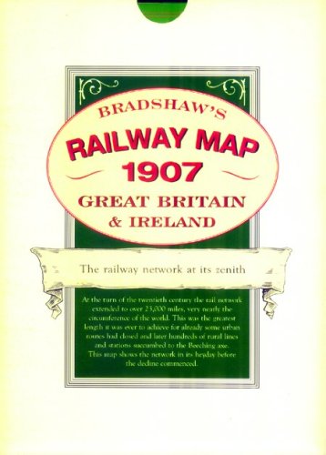
Map: 1 Pages (2006-12-15)
list price: US$20.00 -- used & new: US$8.65
(price subject to change: see help)
Asin: 1873590334
Average Customer Review: 5.0 out of 5 stars
Canada | United Kingdom | Germany | France | Japan
Editorial Review

Product Description
A detailed map of the railway network at its zenith.At the turn of the twentieth century the rail network in Britain and Ireland extended to over 23,000 miles, very nearly the circumference of the world. This was the greatest length it was ever to achieve for already some urban routes had lost the fight with electric trams and, later, culminating in the Beeching axe, hundreds of rural lines and stations were closed. This map shows the network in its heyday before the decline commenced.This map shows lines in England, Scotland, Wales and Ireland with detailed enlargements of the major conurbations. The great main lines with major stations and termini are marked as well as many small village halts on the humble country branch lines. The map bears witness to the culmination of the gargantuan engineering feat which produced 23,000 route miles in the 82 years since the first 25 miles of railway was completed between Stockton and Darlington in 1825.Compare that to the less than 11,000 miles we have a century later and use the map to explore the hundreds of routes, with their stations, which ran through so many parts of the country but survived for no more than a few generations before succumbing to the march of progress which favoured alternative means of transport. ... Read more

Customer Reviews (1)

5-0 out of 5 stars Reproduction of a fold-out map
Apparently, 1907 was the year in which the British railway network neared its peak, but it didn't sustain that peak for very long. Contraction of the network began even before the first world war, picked up pace between the wars and accelerated after the second world war culminating in the Beeching-inspired cuts. Since then, there has been a mini-revival with some old lines being re-opened, while some completely new lines have opened including the London to Paris line via the Channel Tunnel. Yet even if there is a further expansion of the network in the twenty-first century, I cannot imagine there ever again being a network comparable to that which existed in 1907.

The map itself is about the size of the average fold-out street map. About half of the space is taken up by the main island of Great Britain, together with the Isle of Man and Isle of Wight. Ireland is also featured, it being given space in the top right corner. The network is very dense in some places but larger scale insets are provided for Glasgow, Dublin, Manchester, Birmingham, London, Edinburgh, Leeds and Liverpool. Some shipping routes are also marked, but I don't think they all are.

Where space permits, a few places are marked on the map despite never having been connected to the railway network. I was surprised to find that Marshfield in Gloucestershire, where I lived for a couple of years in my childhood, was among them. Hatherleigh in Cornwall, another place that wasn't on a railway line in 1907 but is marked on the map, eventually got a station on the Halwill Junctionto Torrington line, which opened in 1925. It may well have been the last rural branch line to be constructed in Britain; if not, it was certainly among the last. Passenger services only operated for 40 years, though the china clay traffic for which the line was primarily built lasted until 1982.

In Scotland, Ullapool and Braemar are among the places marked on the map. It is noticeable that they were always some distance from the nearest railway, even in 1907. I don't know if there was ever a proposal to build a railway to Ullapool, but a plan was proposed to build one from Aberdeen to Braemar. Queen Victoria didn't want a railway going anywhere near Balmoral so that didn't happen. A railway was built from Aberdeen along the proposed route as far as Ballater, perhaps with the hope that the royal family would relent, but the extension was never built. Elsewhere, there seem to be big areas in southern Scotland that never got a railway, but the people of England and Wales (even those living in Marshfield) were never far from a railway in 1907. It is all so different now.

I can imagine that it was quite a difficult map for any traveller to read in 1907, but it was at least a handy size for carrying around. Regular travellers would surely have wanted to invest in an atlas of some kind, to study the detail at home even if it was too bulky to carry around. In much the same way, I find it to be a handy quick reference, but I still usually have to go to the library to look up a specialist atlas.

A 12-page booklet comes with the map, with some useful explanatory notes. Among other things, it points out that the direct GWR route to Birmingham had not been completed in 1907, but eventually opened in 1910. This leaves me wondering why 1907 was chosen rather than 1910, as I don't know of any closures that took place in that period.

This map is interesting curiosity and useful for research up to a point, but anybody wanting to do serious research needs either a period road atlas with the railway lines marked or, better still, a specialist railway atlas such as Jowett`s (the one I look up in the library). ... Read more


  Back | 21-40 of 100 | Next 20
A  B  C  D  E  F  G  H  I  J  K  L  M  N  O  P  Q  R  S  T  U  V  W  X  Y  Z  

Prices listed on this site are subject to change without notice.
Questions on ordering or shipping? click here for help.

site stats