e99 Online Shopping Mall

Geometry.Net - the online learning center Help  
Home  - Basic I - Indiana Maps (Books)

  Back | 21-40 of 101 | Next 20
A  B  C  D  E  F  G  H  I  J  K  L  M  N  O  P  Q  R  S  T  U  V  W  X  Y  Z  

click price to see details     click image to enlarge     click link to go to the store

 
21. Indiana's County Maps
 
22. Indiana, "Hoosier State"
 
23. Soil survey of Grant County, Indiana
$9.48
24. American Map Indianapolis, Indiana
$5.99
25. Indiana Central Street Map
$77.35
26. Rand Mcnally Muncie/marion, Kokomo/richmond,
$29.95
27. Family Maps of Ripley County,
$10.99
28. Indiana Bicycle Trails Reference
$19.95
29. Southern Indiana Fishing Map Guide
$3.33
30. Rand McNally Champion Map Indiana,
$29.95
31. Family Maps of Elkhart County,
 
$5.95
32. Central Indiana Pm: Formerly Indianapolis
$71.00
33. Rand McNally Indiana Easyfinder
 
34. Indiana State Map
$29.95
35. Family Maps of Harrison County,
$29.95
36. Family Maps of Shelby County,
$26.95
37. Family Maps of Orange County,
 
38. 1857 Atlas Henry County, Indiana.
 
39. MAP: Road Map: Indiana
$4.95
40. Indiana / Kittanning / Armstrong

21. Indiana's County Maps
by C. J. Puetz
 Paperback: Pages (1996)
list price: US$14.85
Isbn: 0916514099
Canada | United Kingdom | Germany | France | Japan

22. Indiana, "Hoosier State"
by Olin Dee Morrison
 Unknown Binding: Pages (1962)

Asin: B0007EKOZU
Canada | United Kingdom | Germany | France | Japan

23. Soil survey of Grant County, Indiana (SuDoc A 57.38:G 76/13)
by Earnest L. Jensen
 Unknown Binding: Pages (1988)

Asin: B000102DDQ
Canada | United Kingdom | Germany | France | Japan

24. American Map Indianapolis, Indiana Street Atlas
Spiral-bound: 156 Pages (2006-10-15)
list price: US$18.95 -- used & new: US$9.48
(price subject to change: see help)
Asin: 0841626707
Canada | United Kingdom | Germany | France | Japan
Editorial Review

Product Description
The Indianapolis, IN Street Atlas covers Beech Grove, Brownsburg, Carmel, Fishers, Greenwood, Lawrence, Mooresville, Noblesville, Plainfield, Southport, Speedway, Zionsville and adjoining communities. This atlas indicates parks, beaches, campsites, picnic areas, schools, libraries, post offices, zip codes, points of interest, and more. ... Read more


25. Indiana Central Street Map
by American Map
Map: Pages (2009-08-12)
list price: US$5.99 -- used & new: US$5.99
(price subject to change: see help)
Asin: 0841671273
Canada | United Kingdom | Germany | France | Japan

26. Rand Mcnally Muncie/marion, Kokomo/richmond, Indiana: Local Street Detail (Rand McNally Folded Map: Cities)
Map: Pages (2006-06-19)
list price: US$4.95 -- used & new: US$77.35
(price subject to change: see help)
Asin: 0528863479
Average Customer Review: 3.0 out of 5 stars
Canada | United Kingdom | Germany | France | Japan

Customer Reviews (1)

3-0 out of 5 stars I have a problem with rating this map...
Rand Mcnally treated Muncie badly, with this all-in-one 2006 edition. Up till know Muncie had a dedicated map all to itself, at least between 1990 and 2001. In 2006 Rand McNally made a strange decision as many cities smaller than Muncie have Rand McNally maps all to themselves (say Roswell, NM or Capser, WY). Why does this matter though? Well it does, as now the scale is much smaller and many people have problems reading it. For that idea I would give the map 1 star. However, there is only one more map out there - Universal Map's Muncie. Sure, it's dedicated, but also much worse. So comparing just the quality of the maps, I would give Rand Mcnally 5 stars. Together it ended up at 3... It's a great map... but remember to take extra strong glasses if you don't have perfect sight! ... Read more


27. Family Maps of Ripley County, Indiana, Deluxe Edition
by Gregory A. Boyd
Paperback: 224 Pages (2010-07-16)
-- used & new: US$29.95
(price subject to change: see help)
Asin: 1420311980
Canada | United Kingdom | Germany | France | Japan
Editorial Review

Product Description
Locating original landowners in maps has never been an easy task--until now. This volume in the Family Maps series contains newly created maps of original landowners (patent maps) in what is now Ripley County, Indiana, gleaned from the indexes of the U.S. Bureau of Land Management. But it offers much more than that. For each township in the county, there are two additional maps accompanying the patent map: a road map and a map showing waterways, railroads, and both modern and many historical city-centers and cemeteries.

Included are indexes to help you locate what you are looking for, whether you know a person's name, a last name, a place-name, or a cemetery. The combination of maps and indexes are designed to aid researchers of American history or genealogy to explore frontier neighborhoods, examine family migrations, locate hard-to-find cemeteries and towns, as well as locate land based on legal descriptions found in old documents or deeds.

The patent-maps are essentially plat maps but instead of depicting owners for a particular year, these maps show original landowners, no matter when the transfer from the federal government was completed. Dates of patents typically begin near the time of statehood and run into the early 1900s.

This high-quality paperback book from the critically acclaimed Family Maps series measures 8-3/8" wide x 10-5/8" high. ... Read more


28. Indiana Bicycle Trails Reference Guide and Map
by Ray Hoven
Map: Pages (2005)
-- used & new: US$10.99
(price subject to change: see help)
Asin: 1574301179
Canada | United Kingdom | Germany | France | Japan
Editorial Review

Product Description
The map is 26' x 34", in color and comes with a 25 1/2" x 20" Guide. The map set features trail lengths; surfaces; settings; alternate uses; coordinates; and directions on "How to Get There". ... Read more


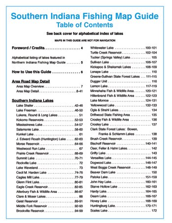
29. Southern Indiana Fishing Map Guide
by Sportsman's Connection
Spiral-bound: Pages (2006)
list price: US$24.95 -- used & new: US$19.95
(price subject to change: see help)
Asin: B0013JE47W
Canada | United Kingdom | Germany | France | Japan
Editorial Review

Product Description
Includes Ohio River, inland lakes and streams of Southern Indiana. Contour Fishing Maps, Best Fishing Spots, Local Inside Information, Fishing Techniques, Fish Stocking and Census, Access Locations and Conditions, Accommodations, Area Road Maps, & GPS Grids ... Read more


30. Rand McNally Champion Map Indiana, Pennsylvania
by Rand McNally
Paperback: Pages (2008-02-15)
list price: US$3.95 -- used & new: US$3.33
(price subject to change: see help)
Asin: 0528870793
Canada | United Kingdom | Germany | France | Japan

31. Family Maps of Elkhart County, Indiana, Deluxe Edition
by Gregory A. Boyd
Paperback: 218 Pages (2010-07-16)
-- used & new: US$29.95
(price subject to change: see help)
Asin: 1420311476
Canada | United Kingdom | Germany | France | Japan
Editorial Review

Product Description
Locating original landowners in maps has never been an easy task--until now. This volume in the Family Maps series contains newly created maps of original landowners (patent maps) in what is now Elkhart County, Indiana, gleaned from the indexes of the U.S. Bureau of Land Management. But it offers much more than that. For each township in the county, there are two additional maps accompanying the patent map: a road map and a map showing waterways, railroads, and both modern and many historical city-centers and cemeteries.

Included are indexes to help you locate what you are looking for, whether you know a person's name, a last name, a place-name, or a cemetery. The combination of maps and indexes are designed to aid researchers of American history or genealogy to explore frontier neighborhoods, examine family migrations, locate hard-to-find cemeteries and towns, as well as locate land based on legal descriptions found in old documents or deeds.

The patent-maps are essentially plat maps but instead of depicting owners for a particular year, these maps show original landowners, no matter when the transfer from the federal government was completed. Dates of patents typically begin near the time of statehood and run into the early 1900s.

This high-quality paperback book from the critically acclaimed Family Maps series measures 8-3/8" wide x 10-5/8" high. ... Read more


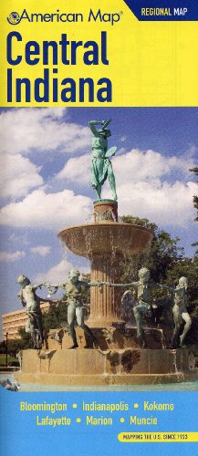
32. Central Indiana Pm: Formerly Indianapolis 50 Mile Map
by Creative Sales Corp.
 Map: Pages (2005-11-30)
list price: US$5.95 -- used & new: US$5.95
(price subject to change: see help)
Asin: 0841626588
Canada | United Kingdom | Germany | France | Japan
Editorial Review

Product Description
Folded Pocket Map with Regional Level Detail covers Indianapolis, Indiana. ... Read more


33. Rand McNally Indiana Easyfinder Map (Rand McNally Easyfinder)
by Rand McNally and Company
Paperback: Pages (1999-06)
list price: US$6.95 -- used & new: US$71.00
(price subject to change: see help)
Asin: 0528982966
Canada | United Kingdom | Germany | France | Japan

34. Indiana State Map
 Map: Pages (2005-01-01)

Isbn: 0762534001
Canada | United Kingdom | Germany | France | Japan

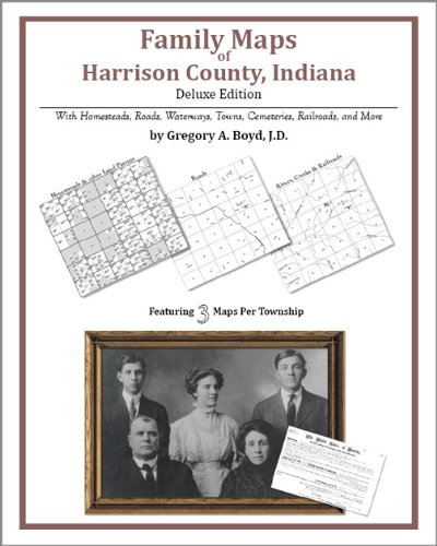
35. Family Maps of Harrison County, Indiana, Deluxe Edition
by Gregory A. Boyd
Paperback: 222 Pages (2010-07-16)
-- used & new: US$29.95
(price subject to change: see help)
Asin: 1420314920
Canada | United Kingdom | Germany | France | Japan
Editorial Review

Product Description
Locating original landowners in maps has never been an easy task--until now. This volume in the Family Maps series contains newly created maps of original landowners (patent maps) in what is now Harrison County, Indiana, gleaned from the indexes of the U.S. Bureau of Land Management. But it offers much more than that. For each township in the county, there are two additional maps accompanying the patent map: a road map and a map showing waterways, railroads, and both modern and many historical city-centers and cemeteries.

Included are indexes to help you locate what you are looking for, whether you know a person's name, a last name, a place-name, or a cemetery. The combination of maps and indexes are designed to aid researchers of American history or genealogy to explore frontier neighborhoods, examine family migrations, locate hard-to-find cemeteries and towns, as well as locate land based on legal descriptions found in old documents or deeds.

The patent-maps are essentially plat maps but instead of depicting owners for a particular year, these maps show original landowners, no matter when the transfer from the federal government was completed. Dates of patents typically begin near the time of statehood and run into the early 1900s.

This high-quality paperback book from the critically acclaimed Family Maps series measures 8-3/8" wide x 10-5/8" high. ... Read more


36. Family Maps of Shelby County, Indiana, Deluxe Edition
by Gregory A. Boyd
Paperback: 204 Pages (2010-07-16)
-- used & new: US$29.95
(price subject to change: see help)
Asin: 1420311468
Canada | United Kingdom | Germany | France | Japan
Editorial Review

Product Description
Locating original landowners in maps has never been an easy task--until now. This volume in the Family Maps series contains newly created maps of original landowners (patent maps) in what is now Shelby County, Indiana, gleaned from the indexes of the U.S. Bureau of Land Management. But it offers much more than that. For each township in the county, there are two additional maps accompanying the patent map: a road map and a map showing waterways, railroads, and both modern and many historical city-centers and cemeteries.

Included are indexes to help you locate what you are looking for, whether you know a person's name, a last name, a place-name, or a cemetery. The combination of maps and indexes are designed to aid researchers of American history or genealogy to explore frontier neighborhoods, examine family migrations, locate hard-to-find cemeteries and towns, as well as locate land based on legal descriptions found in old documents or deeds.

The patent-maps are essentially plat maps but instead of depicting owners for a particular year, these maps show original landowners, no matter when the transfer from the federal government was completed. Dates of patents typically begin near the time of statehood and run into the early 1900s.

This high-quality paperback book from the critically acclaimed Family Maps series measures 8-3/8" wide x 10-5/8" high. ... Read more


37. Family Maps of Orange County, Indiana, Deluxe Edition
by Gregory A. Boyd
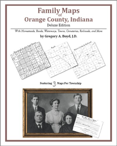
Paperback: 182 Pages (2010-07-16)
-- used & new: US$26.95
(price subject to change: see help)
Asin: 1420311522
Canada | United Kingdom | Germany | France | Japan
Editorial Review

Product Description
Locating original landowners in maps has never been an easy task--until now. This volume in the Family Maps series contains newly created maps of original landowners (patent maps) in what is now Orange County, Indiana, gleaned from the indexes of the U.S. Bureau of Land Management. But it offers much more than that. For each township in the county, there are two additional maps accompanying the patent map: a road map and a map showing waterways, railroads, and both modern and many historical city-centers and cemeteries.

Included are indexes to help you locate what you are looking for, whether you know a person's name, a last name, a place-name, or a cemetery. The combination of maps and indexes are designed to aid researchers of American history or genealogy to explore frontier neighborhoods, examine family migrations, locate hard-to-find cemeteries and towns, as well as locate land based on legal descriptions found in old documents or deeds.

The patent-maps are essentially plat maps but instead of depicting owners for a particular year, these maps show original landowners, no matter when the transfer from the federal government was completed. Dates of patents typically begin near the time of statehood and run into the early 1900s.

This high-quality paperback book from the critically acclaimed Family Maps series measures 8-3/8" wide x 10-5/8" high. ... Read more


38. 1857 Atlas Henry County, Indiana. Reprinted From a Map of Henry County, Indiana
by Harwood and Watson
 Paperback: Pages (1994)

Asin: B003QB3DAE
Canada | United Kingdom | Germany | France | Japan

39. MAP: Road Map: Indiana
by Phillips Petroleum Company
 Unbound: Pages (1959-01-01)

Asin: B000NSMWJQ
Canada | United Kingdom | Germany | France | Japan

40. Indiana / Kittanning / Armstrong & Indiana Counties PA Street Map
by GM Johnson & Associates Ltd
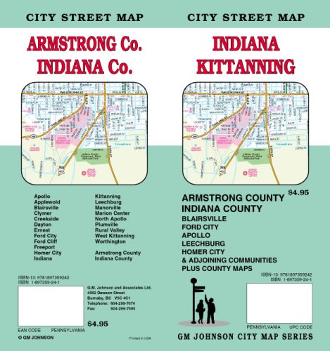
Map: 1 Pages (2007-04-15)
list price: US$4.95 -- used & new: US$4.95
(price subject to change: see help)
Asin: 1897359241
Canada | United Kingdom | Germany | France | Japan

  Back | 21-40 of 101 | Next 20
A  B  C  D  E  F  G  H  I  J  K  L  M  N  O  P  Q  R  S  T  U  V  W  X  Y  Z  

Prices listed on this site are subject to change without notice.
Questions on ordering or shipping? click here for help.

site stats