e99 Online Shopping Mall

Geometry.Net - the online learning center Help  
Home  - Basic I - Indiana Maps (Books)

  Back | 41-60 of 101 | Next 20
A  B  C  D  E  F  G  H  I  J  K  L  M  N  O  P  Q  R  S  T  U  V  W  X  Y  Z  

click price to see details     click image to enlarge     click link to go to the store

$4.99
41. Indianapolis Indiana Street Map
$29.95
42. Family Maps of Putnam County,
 
43. County & Township Map of the
$78.50
44. Rand Mcnally Lafayette & West
45. 6 Different Shell Oil State Road
 
$9.95
46. MAP: Indiana: 1864 [reproduction
 
$4.49
47. Indiana State Map (State Maps-USA)
$26.95
48. Family Maps of Steuben County,
 
49. OHIO AND INDIANA [map].
 
50. Shell Map of Indiana.
 
51. Combination Atlas Map of Howard
$31.95
52. Family Maps of Allen County, Indiana,
$29.95
53. Family Maps of Daviess County,
$26.95
54. Family Maps of Adams County, Indiana,
 
55. Indiana Flip Map In422 (State
 
$7.95
56. Indiana Flip Map
 
57. A Map of Indiana Showing its History,
$4.95
58. Evansville, Indiana/Owensboro/Henderson,
$29.95
59. Family Maps of Jennings County,
$36.99
60. Raven Wall Map for the State of

41. Indianapolis Indiana Street Map (American Map)
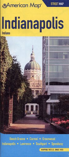
Map: Pages (2009-02)
list price: US$4.99 -- used & new: US$4.99
(price subject to change: see help)
Asin: 0841614946
Canada | United Kingdom | Germany | France | Japan

42. Family Maps of Putnam County, Indiana, Deluxe Edition
by Gregory A. Boyd
Paperback: 240 Pages (2010-07-16)
-- used & new: US$29.95
(price subject to change: see help)
Asin: 1420311182
Canada | United Kingdom | Germany | France | Japan
Editorial Review

Product Description
Locating original landowners in maps has never been an easy task--until now. This volume in the Family Maps series contains newly created maps of original landowners (patent maps) in what is now Putnam County, Indiana, gleaned from the indexes of the U.S. Bureau of Land Management. But it offers much more than that. For each township in the county, there are two additional maps accompanying the patent map: a road map and a map showing waterways, railroads, and both modern and many historical city-centers and cemeteries.

Included are indexes to help you locate what you are looking for, whether you know a person's name, a last name, a place-name, or a cemetery. The combination of maps and indexes are designed to aid researchers of American history or genealogy to explore frontier neighborhoods, examine family migrations, locate hard-to-find cemeteries and towns, as well as locate land based on legal descriptions found in old documents or deeds.

The patent-maps are essentially plat maps but instead of depicting owners for a particular year, these maps show original landowners, no matter when the transfer from the federal government was completed. Dates of patents typically begin near the time of statehood and run into the early 1900s.

This high-quality paperback book from the critically acclaimed Family Maps series measures 8-3/8" wide x 10-5/8" high. ... Read more


43. County & Township Map of the States of Ohio and Indiana.
by (OHIO / INDIANA).
 Unknown Binding: Pages (1880)

Asin: B00455ZA0Q
Canada | United Kingdom | Germany | France | Japan

44. Rand Mcnally Lafayette & West Lafayette, Indiana: City Map, Including Purdue University, Tippecanoe County
by Rand McNally, Rand McNally
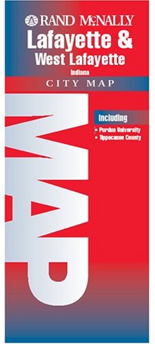
Map: Pages (2004-10-06)
list price: US$4.95 -- used & new: US$78.50
(price subject to change: see help)
Asin: 0528856170
Canada | United Kingdom | Germany | France | Japan

45. 6 Different Shell Oil State Road Maps from 1935-6: Arizona, Colorado, Illinois, Indiana, Nebraska, and Nevada-Utah
by Shell Oil Company
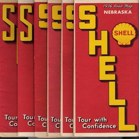
Map: Pages (1935)

Asin: B001QPZEWC
Canada | United Kingdom | Germany | France | Japan
Editorial Review

Product Description
6 different Shell Oil road maps, published in 1935-36. ... Read more


46. MAP: Indiana: 1864 [reproduction of original]
by A.J. Johnson
 Map: Pages (2008-01-01)
-- used & new: US$9.95
(price subject to change: see help)
Asin: B003DD2A6I
Canada | United Kingdom | Germany | France | Japan
Editorial Review

Product Description
Our reproduction of this 1864 A.J. Johnson map shows both county and township boundaries, rivers and creeks, and towns and settlements. Roads and rail lines are also indicated. Black and white map, printed on 18 x 24 paper, folded. ... Read more


47. Indiana State Map (State Maps-USA)
 Paperback: 1 Pages (1993-08)
list price: US$2.50 -- used & new: US$4.49
(price subject to change: see help)
Asin: 0528960687
Canada | United Kingdom | Germany | France | Japan

48. Family Maps of Steuben County, Indiana, Deluxe Edition
by Gregory A. Boyd
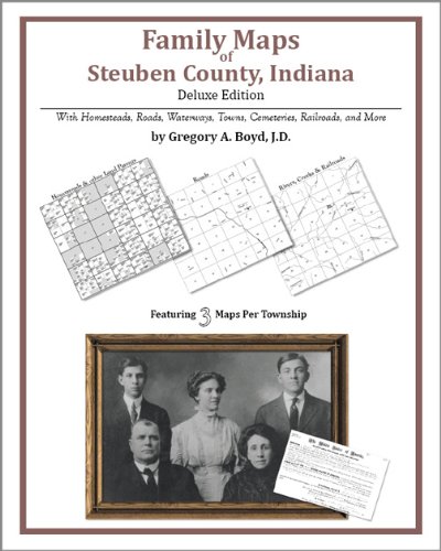
Paperback: 156 Pages (2010-07-16)
-- used & new: US$26.95
(price subject to change: see help)
Asin: 1420312456
Canada | United Kingdom | Germany | France | Japan
Editorial Review

Product Description
Locating original landowners in maps has never been an easy task--until now. This volume in the Family Maps series contains newly created maps of original landowners (patent maps) in what is now Steuben County, Indiana, gleaned from the indexes of the U.S. Bureau of Land Management. But it offers much more than that. For each township in the county, there are two additional maps accompanying the patent map: a road map and a map showing waterways, railroads, and both modern and many historical city-centers and cemeteries.

Included are indexes to help you locate what you are looking for, whether you know a person's name, a last name, a place-name, or a cemetery. The combination of maps and indexes are designed to aid researchers of American history or genealogy to explore frontier neighborhoods, examine family migrations, locate hard-to-find cemeteries and towns, as well as locate land based on legal descriptions found in old documents or deeds.

The patent-maps are essentially plat maps but instead of depicting owners for a particular year, these maps show original landowners, no matter when the transfer from the federal government was completed. Dates of patents typically begin near the time of statehood and run into the early 1900s.

This high-quality paperback book from the critically acclaimed Family Maps series measures 8-3/8" wide x 10-5/8" high. ... Read more


49. OHIO AND INDIANA [map].
by N. & S.S. Jocelyn
 Unbound: Pages (1820-01-01)

Asin: B0010YBWXY
Canada | United Kingdom | Germany | France | Japan

50. Shell Map of Indiana.
by (INDIANA)
 Unknown Binding: Pages (1949)

Asin: B00455S7N8
Canada | United Kingdom | Germany | France | Japan

51. Combination Atlas Map of Howard County, Indiana Compiled, Drawn and Published From Personal Examination and Surveys, 1877.
by Kingman Brothers
 Unknown Binding: Pages (1976)

Asin: B003QBBA2M
Canada | United Kingdom | Germany | France | Japan

52. Family Maps of Allen County, Indiana, Deluxe Edition
by Gregory A. Boyd
Paperback: 252 Pages (2010-07-16)
-- used & new: US$31.95
(price subject to change: see help)
Asin: 1420314068
Canada | United Kingdom | Germany | France | Japan
Editorial Review

Product Description
Locating original landowners in maps has never been an easy task--until now. This volume in the Family Maps series contains newly created maps of original landowners (patent maps) in what is now Allen County, Indiana, gleaned from the indexes of the U.S. Bureau of Land Management. But it offers much more than that. For each township in the county, there are two additional maps accompanying the patent map: a road map and a map showing waterways, railroads, and both modern and many historical city-centers and cemeteries.

Included are indexes to help you locate what you are looking for, whether you know a person's name, a last name, a place-name, or a cemetery. The combination of maps and indexes are designed to aid researchers of American history or genealogy to explore frontier neighborhoods, examine family migrations, locate hard-to-find cemeteries and towns, as well as locate land based on legal descriptions found in old documents or deeds.

The patent-maps are essentially plat maps but instead of depicting owners for a particular year, these maps show original landowners, no matter when the transfer from the federal government was completed. Dates of patents typically begin near the time of statehood and run into the early 1900s.

This high-quality paperback book from the critically acclaimed Family Maps series measures 8-3/8" wide x 10-5/8" high. ... Read more


53. Family Maps of Daviess County, Indiana, Deluxe Edition
by Gregory A. Boyd
Paperback: 218 Pages (2010-07-16)
-- used & new: US$29.95
(price subject to change: see help)
Asin: 1420312154
Canada | United Kingdom | Germany | France | Japan
Editorial Review

Product Description
Locating original landowners in maps has never been an easy task--until now. This volume in the Family Maps series contains newly created maps of original landowners (patent maps) in what is now Daviess County, Indiana, gleaned from the indexes of the U.S. Bureau of Land Management. But it offers much more than that. For each township in the county, there are two additional maps accompanying the patent map: a road map and a map showing waterways, railroads, and both modern and many historical city-centers and cemeteries.

Included are indexes to help you locate what you are looking for, whether you know a person's name, a last name, a place-name, or a cemetery. The combination of maps and indexes are designed to aid researchers of American history or genealogy to explore frontier neighborhoods, examine family migrations, locate hard-to-find cemeteries and towns, as well as locate land based on legal descriptions found in old documents or deeds.

The patent-maps are essentially plat maps but instead of depicting owners for a particular year, these maps show original landowners, no matter when the transfer from the federal government was completed. Dates of patents typically begin near the time of statehood and run into the early 1900s.

This high-quality paperback book from the critically acclaimed Family Maps series measures 8-3/8" wide x 10-5/8" high. ... Read more


54. Family Maps of Adams County, Indiana, Deluxe Edition
by Gregory A. Boyd
Paperback: 170 Pages (2010-07-16)
-- used & new: US$26.95
(price subject to change: see help)
Asin: 142031212X
Canada | United Kingdom | Germany | France | Japan
Editorial Review

Product Description
Locating original landowners in maps has never been an easy task--until now. This volume in the Family Maps series contains newly created maps of original landowners (patent maps) in what is now Adams County, Indiana, gleaned from the indexes of the U.S. Bureau of Land Management. But it offers much more than that. For each township in the county, there are two additional maps accompanying the patent map: a road map and a map showing waterways, railroads, and both modern and many historical city-centers and cemeteries.

Included are indexes to help you locate what you are looking for, whether you know a person's name, a last name, a place-name, or a cemetery. The combination of maps and indexes are designed to aid researchers of American history or genealogy to explore frontier neighborhoods, examine family migrations, locate hard-to-find cemeteries and towns, as well as locate land based on legal descriptions found in old documents or deeds.

The patent-maps are essentially plat maps but instead of depicting owners for a particular year, these maps show original landowners, no matter when the transfer from the federal government was completed. Dates of patents typically begin near the time of statehood and run into the early 1900s.

This high-quality paperback book from the critically acclaimed Family Maps series measures 8-3/8" wide x 10-5/8" high. ... Read more


55. Indiana Flip Map In422 (State Flip Map)
by Universal Map
 Map: 1 Pages (2004-01)
list price: US$6.95
Isbn: 0762535709
Canada | United Kingdom | Germany | France | Japan

56. Indiana Flip Map
 Map: Pages (2004-01)
list price: US$7.95 -- used & new: US$7.95
(price subject to change: see help)
Asin: 076255617X
Canada | United Kingdom | Germany | France | Japan

57. A Map of Indiana Showing its History, Points of Interest, and the holdings of the Dept. of Conservation.
by Lee (mapmaker). INDIANA) Carter
 Unknown Binding: Pages (1954)

Asin: B00455SESG
Canada | United Kingdom | Germany | France | Japan

58. Evansville, Indiana/Owensboro/Henderson, Kentucky Pocket Map (American Map)
Map: Pages (2008-06)
list price: US$4.95 -- used & new: US$4.95
(price subject to change: see help)
Asin: 0841628564
Canada | United Kingdom | Germany | France | Japan
Editorial Review

Product Description
American Map puts you in control by supplying the "big picture" as well as the details.Meticulously researched and continually updated, each map features the latest road changes, easy-to-use reference keys, color-coding and a comprehensive index. ... Read more


59. Family Maps of Jennings County, Indiana, Deluxe Edition
by Gregory A. Boyd
Paperback: 224 Pages (2010-07-16)
-- used & new: US$29.95
(price subject to change: see help)
Asin: 1420312820
Canada | United Kingdom | Germany | France | Japan
Editorial Review

Product Description
Locating original landowners in maps has never been an easy task--until now. This volume in the Family Maps series contains newly created maps of original landowners (patent maps) in what is now Jennings County, Indiana, gleaned from the indexes of the U.S. Bureau of Land Management. But it offers much more than that. For each township in the county, there are two additional maps accompanying the patent map: a road map and a map showing waterways, railroads, and both modern and many historical city-centers and cemeteries.

Included are indexes to help you locate what you are looking for, whether you know a person's name, a last name, a place-name, or a cemetery. The combination of maps and indexes are designed to aid researchers of American history or genealogy to explore frontier neighborhoods, examine family migrations, locate hard-to-find cemeteries and towns, as well as locate land based on legal descriptions found in old documents or deeds.

The patent-maps are essentially plat maps but instead of depicting owners for a particular year, these maps show original landowners, no matter when the transfer from the federal government was completed. Dates of patents typically begin near the time of statehood and run into the early 1900s.

This high-quality paperback book from the critically acclaimed Family Maps series measures 8-3/8" wide x 10-5/8" high. ... Read more


60. Raven Wall Map for the State of Indiana - Paper
by Raven Maps
Unknown Binding: Pages (2008)
-- used & new: US$36.99
(price subject to change: see help)
Asin: B003MX9594
Canada | United Kingdom | Germany | France | Japan
Editorial Review

Product Description
Raven Wall Map For The State Of Indiana (Paper). All Raven state wall maps display an incredible amount of detail, from cities, highways, and mountain ranges, to valleys, rivers, and small towns. The Indiana map elevations are represented by color, and this, in combination with Raven's relief shading technique, gives the map a lush, 3-dimensional look.Size = 29 x 44 Inches ... Read more


  Back | 41-60 of 101 | Next 20
A  B  C  D  E  F  G  H  I  J  K  L  M  N  O  P  Q  R  S  T  U  V  W  X  Y  Z  

Prices listed on this site are subject to change without notice.
Questions on ordering or shipping? click here for help.

site stats