|
|
Help |
| Home - Basic L - Louisiana Maps (Books) | |
e99 Online Shopping Mall
|
|
Help |
| Home - Basic L - Louisiana Maps (Books) | |
| Back | 61-80 of 108 | Next 20 |
click price to see details click image to enlarge click link to go to the store
| 61. Family Maps of De Soto Parish, Louisiana, Deluxe Edition by Gregory A. Boyd | |
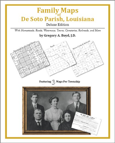 | Paperback: 338
Pages
(2010-07-16)
-- used & new: US$32.95 (price subject to change: see help) Asin: 142031260X Canada | United Kingdom | Germany | France | Japan |
|
Editorial Review Product Description | |
| 62. Family Maps of Jackson Parish, Louisiana, Deluxe Edition by Gregory A. Boyd | |
 | Paperback: 224
Pages
(2010-07-16)
-- used & new: US$29.95 (price subject to change: see help) Asin: 1420312170 Canada | United Kingdom | Germany | France | Japan |
|
Editorial Review Product Description | |
| 63. Arkansas/Louisiana (State Fold Map) | |
| Paperback:
Pages
(2001-01)
list price: US$4.95 -- used & new: US$4.95 (price subject to change: see help) Asin: 0762547995 Canada | United Kingdom | Germany | France | Japan | |
| 64. MAP: 'Louisiana' ...map from Encyclopaedia Britannica, Ninth Editon by Encyclopaedia Britannica | |
| Unbound:
Pages
(1911-01-01)
Asin: B002DD1KJW Canada | United Kingdom | Germany | France | Japan | |
| 65. Louisiana. [map] by George F. Cram | |
| Unknown Binding:
Pages
(1886-01-01)
Asin: B0032OPJO8 Canada | United Kingdom | Germany | France | Japan | |
| 66. MAP: 'Louisiana'...from Hammond's Atlas of the World, 1903 by Hammond & Co | |
| Unbound:
Pages
(1904-01-01)
Asin: B002DD4Y8Q Canada | United Kingdom | Germany | France | Japan | |
| 67. County Map of the States of Arkansas Mississippi and Louisiana. by W.H. (drawn and engraved by). (ARKANSAS / MISSISSIPPI / LOUISIANA) Gamble | |
| Hardcover:
Pages
(1867)
Asin: B00455S5YE Canada | United Kingdom | Germany | France | Japan | |
| 68. Family Maps of Ouachita Parish, Louisiana, Deluxe Edition by Gregory A. Boyd | |
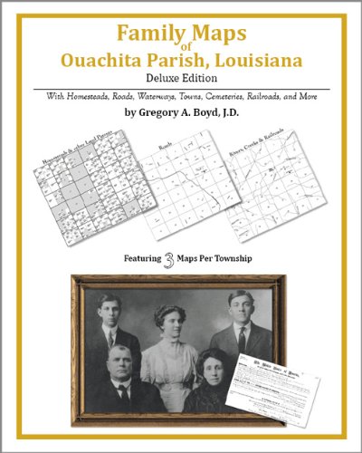 | Paperback: 248
Pages
(2010-07-16)
-- used & new: US$29.95 (price subject to change: see help) Asin: 1420313983 Canada | United Kingdom | Germany | France | Japan |
|
Editorial Review Product Description | |
| 69. Family Maps of Lincoln Parish, Louisiana, Deluxe Edition by Gregory A. Boyd | |
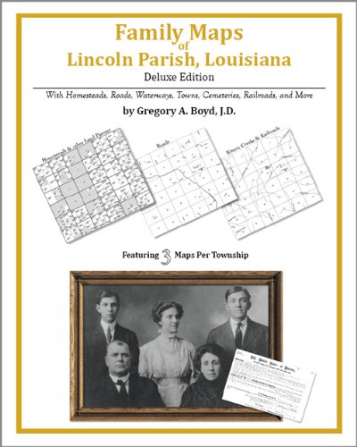 | Paperback: 206
Pages
(2010-07-16)
-- used & new: US$29.95 (price subject to change: see help) Asin: 1420313096 Canada | United Kingdom | Germany | France | Japan |
|
Editorial Review Product Description | |
| 70. Rand McNally Louisiana: Highways & Interstates (Rand McNally Folded Map: States) by Rand McNally | |
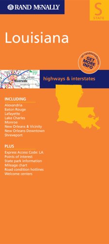 | Map:
Pages
(2003-10-30)
list price: US$4.95 -- used & new: US$4.95 (price subject to change: see help) Asin: 0528994646 Average Customer Review: Canada | United Kingdom | Germany | France | Japan |
|
Editorial Review Product Description Customer Reviews (1)
| |
| 71. Charting Louisiana: Five Hundred Years of Maps.(Book Review): An article from: The Geographical Review by Craig E. Colten | |
| Digital: 3
Pages
(2003-07-01)
list price: US$5.95 -- used & new: US$5.95 (price subject to change: see help) Asin: B0009GTYRU Canada | United Kingdom | Germany | France | Japan | |
|
Editorial Review Product Description | |
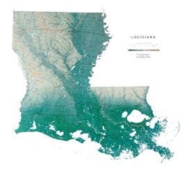
| 72. Louisiana Map Laminated | |
 | Map: 1
Pages
(1999)
-- used & new: US$50.00 (price subject to change: see help) Asin: B0038LMHTA Canada | United Kingdom | Germany | France | Japan |
|
Editorial Review Product Description The gentle rolling landscape shown on the Louisiana map is a result of years of clays and silt being deposited by the Mississippi River. Remarkable Lake Pontchartrain is the largest estuary in southern Louisiana. All of Raven's state wall maps display an incredible amount of detail, from cities, highways, and mountain ranges, to valleys, rivers, and small towns. Louisiana map elevations are represented by color, and this, in combination with their relief shading technique, gives the map a lush, 3-dimensional look. Louisiana Map Dimensions: 45" x 41" A laminated map can also be mounted and framed without using glass. This method of display helps keep the weight and cost of framing down, and is less reflective and easier to clean than glass. Laminated maps are durable enough to pin onto the wall, yet flexible enough to be rolled and shipped in our sturdy cardboard tubes. The lamination is a lightweight (1.7 mil) clear vinyl that can even be written on with dry erase markers (available at any office supply store or elsewhere on Amazon.com) and wiped clean with a soft cloth. | |
| 73. | |
Canada | United Kingdom | Germany | France | Japan | |
| 74. | |
Canada | United Kingdom | Germany | France | Japan | |
| 75. | |
Canada | United Kingdom | Germany | France | Japan | |
| 76. | |
Canada | United Kingdom | Germany | France | Japan | |
| 77. | |
Canada | United Kingdom | Germany | France | Japan | |
| 78. | |
Canada | United Kingdom | Germany | France | Japan | |
| 79. The fisherman's "Ofishall" map and guide: New Orleans area, Southeast Louisiana and Gulf coast by William E Boesch | |
| Unknown Binding: 24
Pages
(1947)
Asin: B0007FMVU0 Canada | United Kingdom | Germany | France | Japan | |
| 80. Family Maps of Vernon Parish, Louisiana, Deluxe Edition by Gregory A. Boyd | |
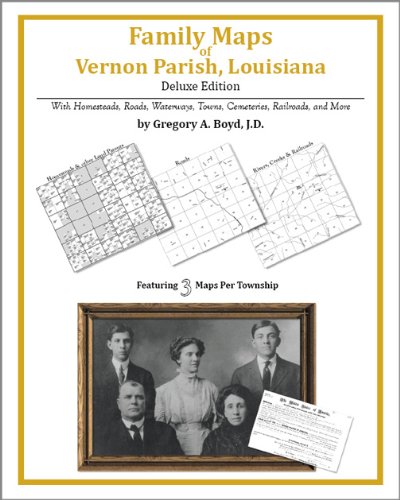 | Paperback: 452
Pages
(2010-07-16)
-- used & new: US$38.95 (price subject to change: see help) Asin: 1420314092 Canada | United Kingdom | Germany | France | Japan |
|
Editorial Review Product Description | |
| Back | 61-80 of 108 | Next 20 |