e99 Online Shopping Mall

Geometry.Net - the online learning center Help  
Home  - Basic M - Maps & Geography General (Books)

  Back | 21-40 of 101 | Next 20
A  B  C  D  E  F  G  H  I  J  K  L  M  N  O  P  Q  R  S  T  U  V  W  X  Y  Z  

click price to see details     click image to enlarge     click link to go to the store

$99.99
21. Karakoram Highway Map-3 / This
 
$111.93
22. The Nature of Maps: Essays Toward
$976.98
23. Rand McNally Schoolhouse Beginner
 
$176.94
24. Maps and Symbols (Geography Starts
$29.95
25. A Malleable Map: Geographies of
$13.45
26. The Bible Betrayed: Have scholars
$300.00
27. Charting Louisiana: Five Hundred
$5.75
28. Blank Spots on the Map: The Dark
$34.75
29. Project Geography: Map Based Quizzes
 
$72.59
30. Guide to U.S. Map Resources
 
31.
$14.99
32. Report on Governmental Maps for
$2.25
33. Rand McNally Schoolhouse Intermediate
$6.92
34. Mapping the Civil War: Featuring
$26.53
35. Novels, Maps, Modernity: The Spatial
 
36. Basic Geography: Map Skills
 
37. Super Lccs: Class G : Geography;
 
$37.50
38. Library of Congress Classification
$5.54
39. Geography Connexions
 
40. Student Map Manual: Historical

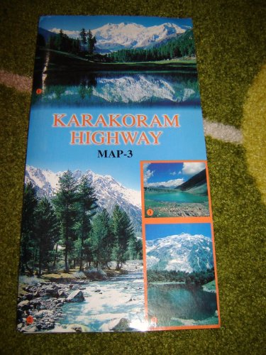
21. Karakoram Highway Map-3 / This is a well researched MAP with information on: Geography, History, Culture and Trekking Routes / Gilgit, Ghizer, Diamar, Skardu, Ghangche, Karimabad, Fairy Medow, Nanga Parbat Region
by Professor Manzoom Ali
Map: Pages (2009)
-- used & new: US$99.99
(price subject to change: see help)
Asin: B0040J7IP2
Canada | United Kingdom | Germany | France | Japan
Editorial Review

Product Description
Title: Karakoram Highway Map-3 / This is a well researched MAP with information on: Geography, History, Culture and Trekking Routes / Gilgit, Ghizer, Diamar, Skardu, Ghangche, Karimabad, Fairy Medow, Nanga Parbat RegionPublication date: 2009 ... Read more


22. The Nature of Maps: Essays Toward Understanding Maps and Mapping
by Arthur Howard Robinson
 Hardcover: 138 Pages (1976-09)
list price: US$12.50 -- used & new: US$111.93
(price subject to change: see help)
Asin: 0226722813
Average Customer Review: 5.0 out of 5 stars
Canada | United Kingdom | Germany | France | Japan

Customer Reviews (1)

5-0 out of 5 stars The classic by Robinson and Petchenick
I don't understand why Barbara Bartz Petchenik isn't listed as co-author. It's actually kind of confusing: "Did Robinson write a different 'Nature of Maps' by himself?"

This book is the classic effort that helped establish Cartography as an academic discipline rather than simply a trade. Robinson developed a very positivist sense of maps and map making while heading the US Office of Strategic Services Map Division during World War II. The OSS was a group of primarily social scientists tasked with producing actionable military information from any available sources. The OSS maintained a culture strongly favoring objectivity and standardization. This culture was extended by Robinson toward Cartography and embedded in this text. The title mirrors the OSS Chair of the Projects Committee Robert Hartshorne's "The Nature of Geography".

The book is a ground-breaking work in the application of cognitive science to cartography by situating maps within a system of communication. This system begins with the "real world", which is encoded by the map maker using cartographic language into a map which is then decoded by the map user resulting in an understanding of the real world.

This might seem trivial, but prior to Robinson, maps were assumed to just be "understood". By establishing the existence of the "cartographic language", Robinson opens the map making and reading process to semiotic analysis. ... Read more


23. Rand McNally Schoolhouse Beginner Geography & Map Activities
by Rand McNally
Paperback: 128 Pages (2005-06-24)
list price: US$7.95 -- used & new: US$976.98
(price subject to change: see help)
Asin: 0528934694
Average Customer Review: 5.0 out of 5 stars
Canada | United Kingdom | Germany | France | Japan
Editorial Review

Product Description
Big, bright illustrations make finding information fun and easy for young geographers. Schoolhouse's Beginner Geography & Map Activities workbook is the perfect tool for introducing kids to geography and basic map and globe skills through hands-on activities.

Features include:

  • Fun, yet education-oriented activities for kids ages 6-9
  • Colorful map illustrations, games, and geography facts
  • World, continent, and country exercises
  • Big, easy-to-read words
  • Companion to the Beginner's World Atlas or great on its own
  • Paperback
  • 128 pages
... Read more

Customer Reviews (3)

5-0 out of 5 stars Love it!!!
I homeschool my 5 & 6 year old boys.I'm using this book along with the Rand McNally Beginner Atlas.I absolutely love this activity book.It is a complete geography curriculum for young kids.The activities and map work are presented in a simple, easy to understand way.And, the kids learn so much from it.I love this book and highly recommend it!

5-0 out of 5 stars A wonderful introduction to geography at a great price!
I came across this book one day and decided on a whim to add it to our homeschool...I'm so glad I did! My son enjoys the activities and is learning a ton. The book is made up of 3 sections: Making Sense of Maps, in which kids learn about different types of maps and how to use them;Introducing World Geography, in which they learn about globes, world maps, continents, oceans, boundaries, hemispheres, the equator and prime meridian, latitude and longitude, and time zones; and Discovering the Continents, in which kids learn a bit about the geography, customs, culture, animals, and landmarks of each continent.

5-0 out of 5 stars Love it!
I am a homeschooling mom with 5 kiddos.I got these workbooks for my 9 and 7 year olds.There are great!they introduce basic map and geography skills.The lessons are short and not overwhelming. My 9year old worked totally independantlyand my 7yo did most on her own too. the pages are colorful and fun! Great fro the price! I am actually on here to order the intermediate books :) ... Read more


24. Maps and Symbols (Geography Starts Here)
by Angela Royston
 Library Binding: 32 Pages (1999-02)
list price: US$25.64 -- used & new: US$176.94
(price subject to change: see help)
Asin: 0817251138
Canada | United Kingdom | Germany | France | Japan
Editorial Review

Product Description
An introduction to maps, what they represent, how they are constructed, and how to read them. ... Read more


25. A Malleable Map: Geographies of Restoration in Central Japan, 1600-1912 (Asia: Local Studies / Global Themes)
by Kären Wigen
Hardcover: 340 Pages (2010-05-27)
list price: US$39.95 -- used & new: US$29.95
(price subject to change: see help)
Asin: 0520259181
Canada | United Kingdom | Germany | France | Japan
Editorial Review

Product Description
Kären Wigen probes regional cartography, choerography, and statecraft to redefine restoration (ishin) in modern Japanese history. As developed here, that term designates not the quick coup d'état of 1868 but a three-centuries-long project of rehabilitating an ancient map for modern purposes. Drawing on a wide range of geographical documents from Shinano (present-day Nagano Prefecture), Wigen argues that both the founder of the Tokugawa Shogunate (1600-1868) and the reformers of the Meiji era (1868-1912) recruited the classical map to serve the cause of administrative reform. Nor were they alone; provincial men of letters played an equally critical role in bringing imperial geography back to life in the countryside. To substantiate these claims, Wigen traces the continuing career of the classical court's most important unit of governance--the province--in central Honshu. ... Read more


26. The Bible Betrayed: Have scholars misplaced ancient Egypt on the map and thus obscured the Holy Land?
by James Rappai
Paperback: 268 Pages (2009-03-01)
list price: US$14.95 -- used & new: US$13.45
(price subject to change: see help)
Asin: 8190641824
Average Customer Review: 3.5 out of 5 stars
Canada | United Kingdom | Germany | France | Japan
Editorial Review

Product Description
'THE BIBLE BETRAYED'By James Rappai'The Bible Betrayed' presents an astonishing new hypothesis-discovery that conclusively proves the following: 1.The Bible stories are true.2.Ancient Egypt was in the Turkey-Syria region. 3.Ancient Israel was in Syria. 4.It pinpoints the ruins of the real Jerusalem in the mountains of Syria. 5.Finally, it suggests that scholars may be involved in an elaborate cover-up exercise. The Bible Betrayed proves that the Bible stories are true. The book goes on to reveal a mind-numbing archaeological reconstruction error in the volatile Middle Eastern arena. Modern-day scholars have misidentified and misplaced ancient Egypt on the reconstructed map of the Levant (core biblical arena). Since Egypt was the sheet anchor for this reconstruction, this fundamental flaw spawned multiple errors in the map, including the Bible anomaly of missing archaeological evidence. The Bible anomaly is probably being used as a smokescreen to cover up this grave error.The author, James Rappai's fascinating conclusions are based on his newly reconstructed map of the core biblical arena that emerged from a 10-year long study. It all began with the author's suspicion that 'Ethiopia of the secular Greek scholars' and 'Canaan of the Bible' were one and not two different kingdoms as modern-day scholars currently assume. This proved true. A search for the root cause of this inadvertent duplication led to the Egypt error.The new map is based on geographical pointers that are rigorously corroborated by both the Bible as well as secular ancient world historians such as Strabo and Herodotus. It firmly places Egypt as well as Canaan (of which ancient Israel was a part) in the Middle Eastern arena. When 'test run' to find Jerusalem, the new map delivers an astonishing find! It triangulates a fort-temple ruin situated on a high mountain ridge, hidden deep in the mountains of modern-day Syria. From the description given of Jerusalem by the Jewish historian Josephus, this fort-temple ruin is a hand-in-glove fit and instantly recognizable as the Fort Antonia cum Temple complex of the Jerusalem acropolis upon the Moriah Ridge that was rebuilt by King Herod. It is surprisingly intact... almost exactly as Titus left it in 70 AD! 'The Bible Betrayed' is soon to be followed by three new books that will highlight various other mysteries that are revealed and resolved by this hypothesis-discovery. ... Read more

Customer Reviews (3)

1-0 out of 5 stars LOL!
LOL! What a silly book! Wow, ....wow. This book is so un historical it isn't even funny. I want my money back!

5-0 out of 5 stars AMAZING ABSOLUTELY ABSOLUTELY AMAZING!!
I GIVE THIS GUY THE 4As!! The scope of this book is immense. The author, James Rappai has managed to do what a hundred nay a thousand scholars before him tried and failed to accomplish!

Okay, histrionics aside, what Mr. Rappai has done is single-handedly resolve the Bible anomaly of missing archaeological evidence. In the process, he blithely dismantles the 'sacred' Egypt reconstruction and ships it lock-stock and barrel to the Near Eastern arena.

Is one allowed to do this? Do I find it believable? Frankly, I am a little bewildered, but if you ask me, does it make sense, I have to say... sure. Why the hell not.

The Egypt reconstruction is not all robust as it seems. True, there are the ruins, but the story that goes with it, is not all 'kosher.' The fit is a sham. There is a lot that has been quietly swept under the carpet. It is entirely possible that we have clothed one set of ruins with the garment of another, as Rappai suggests.

The inexplicable presence of Egypt in Syria has always vexed Egyptologists. Indeed, to accommodate this powerful magnetic pull, this region has been considered an annexe of Egypt.

A must read for every student of Egyptology and biblical studies. A must read for all the armchair explorers out there who want to sink their teeth into areal live-wire history mystery, one that take on a hundred thousands scholars head-on.

5-0 out of 5 stars Facinating hypothesis
The Bible Betrayed attempts to resolve the enigma of missing archaeological evidence for the Bible. It suggestions that the reconstructed map of the Levant (including the Holy Land), suffers from an error and is indeed the root cause for the Bible's archaeological no-show. While this is indeed the standard position of the biblical maximalists, the author suggests that the map suffers from a fundamental or fatal error reconstruction error.

What is this fatal error?

Ancient Egypt was misidentified and misplaced. Ancient Egyptians were poor builders, and textual sources reveal them to have been a sophisticate populace much along the lines of ancient Greece. What we have now is exactly the opposite and clearly a case of mistaken identity.

The Egypt error skews the whole map. It caused Ethiopia of the Greek scholars and Canaan of the Bible to be separately reconstructed when in reality they are merely two different perspectives of the same city-state. This fact is elaborately established by tallying similarities between the two. History, topographical and political similarities are painstakingly tallied. The author cleverly uses corroborating ancient world textual sources such as Strabo, Josephus and Herodotus, to establish it in an irrefutable and transparent manner.

Incidentally, tracing the root cause of the Ethiopia-Canaan duplication is what that leads to Egypt error. Once again, using the corroborative approach, the author establishes that ancient Egypt too is erroneous.
Real Egypt was located in the Middle East where Syria is situated. With incredible easy the author eases Egypt into an altogether different landscape. The Nile and its delta are identified, and indeed, the whole reconstruction is expertly put into place in the most believable manner. The fit too is hand-in glove and everything makes much more sense. Frankly, the entire presentation is very unnerving.

As if this weren't enough, the new map is tested; it is used to locate Jerusalem. Here, a key extract from Strabo comes in handy. Jerusalem which was located in the mountains, was visible from the coast, it states. Using this clue, a fort-temple ruin set on a mountain ridge is triangulated. Closer examination reveals it to be a perfect match. The acropolis is exactly as described by Josephus and Strabo. One look at the photograph (use `customer image' link beneath the title image to reach) is enough to trigger cardiac arrhythmia amongst seasoned bible archaeologist. The resemblance is so uncanny!

The book is well written and written for the lay audience. All the arguments are structured well and the complex unraveling of this Gordian knot is indeed expertly done.

The whole ideology is new from end to end. Thus, petty scholars, especially short-order Wikipedia scholars empowered with stars and bottle-cap medallions to save the world, will undoubtedly bay for blood, and try their utmost to berate this discovery-hypothesis, make a mockery of the presentation. Senior scholars are however well advised to take a close look. ... Read more


27. Charting Louisiana: Five Hundred Years of Maps
Hardcover: 408 Pages (2003-04-01)
list price: US$95.00 -- used & new: US$300.00
(price subject to change: see help)
Asin: 0917860470
Average Customer Review: 5.0 out of 5 stars
Canada | United Kingdom | Germany | France | Japan
Editorial Review

Product Description

To celebrate the bicentennial of the Louisiana Purchase, The Historic New Orleans Collection (THNOC) has pursued the ambitious goal of publishing an atlas that depicts Louisiana's history through maps. The result of those efforts is Charting Louisiana. This book, THNOC's bicentennial gift to the public, offers a rich selection of historic and contemporary maps from various sources that collectively illustrate the region's diverse history, from its multinational colonial experiences to the modern American state.

Charting Louisiana presents 104 maps from THNOC's holdings, representing the full range of the institution's cartographic treasures. The atlas also features sixty-seven important works from the Geography and Map Division of the Library of Congress—custodian of the largest cartographic collection in the world—and contributions from other United States repositories, including the Louisiana State Museum and Chicago's Newberry Library. Archives in France, Spain, Great Britain, and Mexico generously provided the balance, as befits Louisiana's international history.

The product of this cooperative effort is an unprecedented compilation of 193 high-quality reproductions of important maps illustrating the development of Louisiana from the early sixteenth century to the present, along with historical essays providing a broader context for understanding the maps. Complete with a detailed cartobibliography and list of selected readings, Charting Louisiana is a lush, captivating, and valuable source of information for history buffs, scholars, and map lovers, providing ample opportunities for new interpretations of the state's history as well as that of the nation.
... Read more

Customer Reviews (3)

5-0 out of 5 stars The "Uncharted" is "Charted"
I purchased this volume at the Louisiana Book Festival the year it came out.I even got the authors/editors to sign it.During a presentation and discussion of the book, it fell to the floor with a loud thud.The speaker quipped that it was "heavy reading". While it is a large book, I would hardly rate it a "coffee table book". This is an excellent well done book with a lot of color and information throughout.Maps from all the countries that had an interest (and some that didn't) in the Louisiana territory from the age of exploration until the last of the twentieth century.Excellent price too!I would've waited but I really wanted the signatures.I can't ever see selling this book.It is a great aid to re-enactors and living history personnel.No museum in the Louisiana Purchase should be without this book either.Kudos!

5-0 out of 5 stars A wonderful history of Louisiana in maps
This coffee table volume was produced to celebrate the bicentennial of the Louisiana Purchase. It contains 193 high-quality reproductions of important maps illustrating the development of Louisiana from the early sixteenth century to the present. Each map is accompanied by an historical essay placing the map in its cultural context. There is a detailed cartobibliography and list of selected readings.

The maps themselves are wonderfully reproduced. Here are a couple of examples of the essays:

"21. A Map of Louisiana And Of The River Mississippi by John Senex. London, [1718 or 1719]. The Historic New Orleans Collection

"A restless band of Carolina tranders--who crossed the Appalachian Mountains seeking closer economic relations with Native American nations to the west--galvanized English interest in Louisiana and the Mississippi River valley. In light of this development, English mapmaker John Senex responded to market demands with this map, copying liberally from Guillaume de L'Isle's ca.1718 Carte de la Louisiane et du Cours du Mississipi. This plagiarism did not, of course, include L'Isle's notation about French claims to Carolina. Interestingly, Senex dedicated his map to William Law, the father of financier John Law, whose scheme to develop French Louisiana eventually caused the ruin of many European investors."

***

"74. Louisiana from Mathew Carey's General Atlas Improved and Enlarged: Being A Collection of Maps of the World and Quarters...[Philadelphia, 1814]. The Historic New Orleans Collection

Mathew Carey became a pioneer American map publisher following his immigration to Philadelphia from Dublin in 1784. Carey set up a publishing firm financed by the marquis de Lafayette, with whom he had earlier become friends in Paris. His success in publishing Guthrie's Geography Improved led him to similar projects. Carey's American Atlas of 1795 was the earliest atlas of the United States. His American Pocket Atlas, in which the map of Louisiana appeared, was published in editions of 1796, 1801, 1809, 1813, and 1814. He had issued the earliest printed map of Louisiana as a state in 1813, which appears here in an enlarged version from his 1814 General Atlas. This map was probably compiled by Samuel Lewis, Carey's principal mapmaker."

This book makes for fascinating reading and study.

Robert C. Ross 2008

5-0 out of 5 stars More than a Coffee Table Book
This beautifully produced volume deserves a prominant place on anyone's coffee table. Abstractors and professional landmen, especially if they live in Louisiana and its surrounding states, will fall in love with it. ... Read more


28. Blank Spots on the Map: The Dark Geography of the Pentagon's Secret World
by Trevor Paglen
Paperback: 352 Pages (2010-03-02)
list price: US$16.00 -- used & new: US$5.75
(price subject to change: see help)
Asin: B0046HAJVS
Average Customer Review: 3.0 out of 5 stars
Canada | United Kingdom | Germany | France | Japan
Editorial Review

Product Description
This is the adventurous, insightful, and often chilling story of a road trip through a shadow nation of state secrets, clandestine military bases, black sites, hidden laboratories, and top-secret agencies that make up what insiders call the "black world."

Here, geographer and provocateur Trevor Paglen knocks on the doors of CIA prisons, stakes out a covert air base in Nevada from a mountaintop 30 miles away, dissects the Defence Department's multibillion dollar "black" budget, and interviews those who live on the edges of these blank spots.

Whether Paglen reports from a hotel room in Vegas, a secret prison in Kabul, or a trailer in Shoshone Indian territory, he is impassioned, rigorous, relentless-and delivers eye-opening details. ... Read more

Customer Reviews (18)

5-0 out of 5 stars Excellent, courageous
If it is not a matter of interest to readers that many billions of your tax dollars,
up to 30% or more of all govt. spending, goes to vast secret operations that pollute, lie,
cheat, torture, orchestrate politics, and focus on suffering while the country goes to hell along with the
rest of the world (illiteracy, poverty, unemployment, pollution, degeneration- and that
is one's average town)- and if it is not news on any level to you how, where, and perhaps
why this is done, then this book may not be "for" you.I think most people are clueless
that we have such an extensive secret "government" (a better word is dictatorship) , so
far reaching and taking so much of our resources.I would think that the political issues
of today , with many factions wanting "their country" back may be traced back to just
these fungal developments in the past several decades.

I felt the book was well written, riveting, well researched, a page turner, and obviously
from an intelligent author.The country needs more awareness such as this.

2-0 out of 5 stars Not what was billed
Thought the book was rather shallow with not much info on the location, versus a lot of historical perspective.

5-0 out of 5 stars An Important Book That Every American Should Read
No one can argue that the U.S. Government doesn't need to keep secrets. Details of ongoing military operations, data that could harm the economy, and sensitive personal or medical records, for example, should not be in the public domain. But some Government agencies' passion for secrecy goes far beyond what is needed. They hide from the eyes of the public information that could do no conceivable harm if revealed. Worse, some agencies cynically use the "national security" umbrella to conceal illegal activities not only from the public, but also from the very elected representatives who are charged with overseeing them. Classified or "black" expenses, not subject to justification or disclosure, make up a major part of the Department of Defense budget, and a significant majority of Government employees work on classified activities. This situation is clearly incompatible with a society in which informed public debate is supposedly (but not always actually) a cornerstone of the democratic process.

In "Blank Spots on the Map: The Dark Geography of the Pentagon's Secret World," Dr. Trevor Paglen takes an interesting approach to examining America's black landscape. He seeks to identify the actual physical areas that must exist in order for these classified activities to take place. He looks for the "blank spots on the map," the places where buildings, industrial facilities, airfields, prisons and other brick-and-mortar structures have been expunged from the public record. An example is the Area 51 flight test facility at Groom Lake, Nevada, an enormous air base that the U.S. Air Force arrogantly denied existed until the late 1990s. Today, anyone can bring up Google Earth and inspect Area 51 in all of its sprawling splendor. It has been there for more than 50 years (Air Force denials to the contrary). Dr. Paglen's quest to find such facilities takes him across the U.S. and to Central America and the Middle East.

By looking at the borders where these blank areas contact the "white" world, Dr. Paglen is able to sketch out a picture of the scope and magnitude of some of the things that are going on today that "they" don't want "us" to know about. It's a fragmentary and incomplete picture, to be sure, but even so it is eye-opening and intensely disturbing. He sums up his findings perfectly in the Epilogue: "The black world has sculpted the United States in numerous ways. Creating secret geographies has meant erasing parts of the Constitution, creating blank spots in the law, institutionalizing dishonesty in the halls of government, handing sovereign powers...to the executive branch, making the nation's economy dependent upon military spending, and turning our own history into a state secret."

Having first-hand experience with just a small part of the black world that Dr. Paglen describes, I was very impressed that he got that part right. When an author makes errors in describing something that I have personal knowledge of, I must then question the accuracy of the rest of the book. Similarly, when an author gets right something that I know about--as Dr. Paglen does--it makes me tend to believe the rest of his work. I think the story put forth in "Blank Spots on the Map" is very close to the appalling truth. If you care about how far America has drifted from the intentions and values of the Founders, and if you care about the extent to which lying and deception underpin the Government at all levels (and you should), then you need to read this book. I recommend it most highly.

2-0 out of 5 stars Overstated, biased, a bit sloppy, but interesting
This book espouses the viewpoint that the large amount of money expended on "black" programs and activities, because it is not detailed in the budget, undermines the foundations of American democracy. That viewpoint is worth considering, whether one agrees with it or not, and Mr. Paglen offers much information to support his case. However, he overstates his case in various ways, distorts the interpretation of certain facts, and pastes together a collection of unrelated information and anecdotes. This leaves the book less convincing to a knowledgeable reader than it should be. None the less, it's worth reading.

As an example of the problems of the book I'll touch on the work at Groom Lake (Area 51), on the Nevada Test Range, operated as part of Nellis Air Force Base. Mr. Paglen asserts that the work at Groom Lake is so secret that not even the name "Groom Lake" can be used in publio. That may have been true many years ago, but isn't now. Indeed, a large amount of information about what goes on at the Area 51 test site is available on the Web, some of it thoughtfully provided by the United States Air Force. I spent a couple of hours browsing this material, and finally I got bored, having learned as much as I cared to know from text, photos, maps, etc. And I note one minor misrepresentation of fact in Mr. Paglen's material on Groom Lake. In two places he asserts that the Soviet aircraft used in Red Flag exercises were "stolen" from the Russians, but that's not how they were acquired. The US gov't got those from countries which had acquired them from the Soviet Union and then decided to use US equipment instead, and happily let us have their unwanted Soviet-built fighter aircraft.

Indeed, there is one truly "black" area at the Nevada Test Range: "Area 19". What goes on there (if anything) is not clear, although there is a lot of mythology about Area 19 on the Web. My personal guess is that Area 19 was intended and prepared for use in projects that never took place, and that the reason nothing can be seen there now is that there's nothing to see. But, of course, I may be wrong about that.

Now, having criticized Mr. Paglen's book, I'll soften my discussion by pointing out that in choosing his examples of "black" programs he faced a nearly insuperable obstacle. There are indeed some programs and activities of the US government that are truly "black", but you won't find references to those in the public domain, and no writer will get the time of day from the government in seeking to find out about them. Those might furnish better material for Mr. Paglen's thesis, but he can't learn about them. I've been on the fringes of a number of those during 50+ years of working off and on in and with the defense community, and took part in a few. The thing all the ones I'm aware of had in common is that they weren't secret to keep Congress or other appropriate people in the US from knowing about them; they were secret to conceal them from foreign military adversaries. None of them and none of their budgets, posed the slightest threat to American democracy. Indeed, all except one of the ones I worked with were so small they wouldn't have rated a line in the budget even if they had been unclassified; if something is big and sprawling, it's exceedingly difficult to keep its existence and reason for being from becoming known. In one case, we successfully concealed the existence of a good-sized overseas military installation for several years, to keep the Soviet Union from learning enough about it to attack it successfully, but even in that case the word got out after a while, and we were visited by a Congressional delegation; by now it's ancient history, long since abandoned and demolished, and one can learn a bit about it on the Web (although not much). There may be analogous "black" programs that could pose a threat to US democracy; I have never heard even a rumor of any such, but then I wouldn't have.

5-0 out of 5 stars Excellent, answers a lot of questions
Along with his other book answers a lot of questions.This gives the history of how we got in this mess, and makes the "Bourne" movies very believable.The UFO's are obviously out of Area 51 & its environs, probably a mixture of Tesla and the NAZI "Foo" fighters.

Highly recommend. ... Read more


29. Project Geography: Map Based Quizzes and Puzzles (Young Puffin)
by Philip Boys
Paperback: 32 Pages (1995-04-06)
-- used & new: US$34.75
(price subject to change: see help)
Asin: 0140364080
Canada | United Kingdom | Germany | France | Japan
Editorial Review

Product Description
Puzzles and quizzes about places and countries which aim to help develop geographical skills. Readers are offered puzzles such as matching the monument to the country, birds-eye views, buried treasure, world wordsearch, name games and the great county alphabet game. ... Read more


30. Guide to U.S. Map Resources
by Map and Geography Round Table (MAGERT) of the American Library Association
 Paperback: 520 Pages (2005-11-28)
list price: US$90.20 -- used & new: US$72.59
(price subject to change: see help)
Asin: 0810852683
Canada | United Kingdom | Germany | France | Japan
Editorial Review

Product Description
More than fourteen years have passed since the second edition of the Map and Geography Round Table's Guide to U.S. Map Resources appeared in 1990. The third edition offers users a detailed snapshot of and guide to hundreds of map collections and cartographic resources in libraries and repositories throughout the nation. Geographic information systems (GIS), the World Wide Web, email, Portable Document Format, data sets, the Internet and digitization have all played revolutionary roles in transforming libraries--and map collections in particular--over the past fifteen years. Today's librarian who works with maps is no longer limited by the contents of his or her own collection. In many cases the librarian can turn to the Internet and locate a map or data set physically located in a library hundreds of miles away. ... Read more


31.
 

Canada | United Kingdom | Germany | France | Japan

32. Report on Governmental Maps for Use in Schools
by Chicago, 1892, . Conference on geography
Paperback: 78 Pages (2009-10-21)
list price: US$14.99 -- used & new: US$14.99
(price subject to change: see help)
Asin: 1112528636
Canada | United Kingdom | Germany | France | Japan
Editorial Review

Product Description
Originally published in 1894.This volume from the Cornell University Library's print collections was scanned on an APT BookScan and converted to JPG 2000 format by Kirtas Technologies.All titles scanned cover to cover and pages may include marks notations and other marginalia present in the original volume. ... Read more


33. Rand McNally Schoolhouse Intermediate Geography And Map Activities
by Rand McNally and Company
Paperback: 128 Pages (2005-09-12)
list price: US$7.95 -- used & new: US$2.25
(price subject to change: see help)
Asin: 0528934708
Average Customer Review: 5.0 out of 5 stars
Canada | United Kingdom | Germany | France | Japan
Editorial Review

Product Description
Action and adventure accompany geographers on their journey around the world with this fantastic activity book. Schoolhouse's Intermediate Geography & Map Activities workbook uses a fun format with action heroes to help kids expand their knowledge of world geography through informative reading passages, map activities, and interesting geography.

Features include:

  • Fun, education-oriented activities for students ages 9-14
  • Colorful map illustrations, games, and geography facts
  • World, continent, and country exercises
  • Companion to the Intermediate World Atlas or great on its own
  • Paperback
  • 128 pages
... Read more

Customer Reviews (3)

5-0 out of 5 stars wish they made an advanced version!
This is a great little activity book. The left side pages explain a concept, such as how to read a map key or longitude and latitude, and the right side page then has a few practical questions based on an actual map. The activities are colorful. The pages break each concept down into pieces so it's easily understood, and the child progresses through the book like up stairs a step at a time, not realizing how much progress they've made so quickly. My son can race through these pages. He loves geography presented this way. Bring on the Advance Geography Activities!

5-0 out of 5 stars great books!
these workbooks are great!We are a homeschooling family and my 2nd and 4th grader are doing them.Well done, good price!

5-0 out of 5 stars Best geography workbook
The only negative thing is that they don't have more volumes published! We are a very geography-oriented homeschool family and I have spent hours online looking for good geography workbooks for kids-- this is tops. High quality paper, colors, exercises encompassing maps, countries' data, "did you know" facts... my 6th grader is wishing they publish the advanced level soon! ... Read more


34. Mapping the Civil War: Featuring Rare Maps from the Library of Congress (Library of Congress Classics)
by Christopher Nelson, Brian Pohanka
Hardcover: 176 Pages (1992-10)
list price: US$39.95 -- used & new: US$6.92
(price subject to change: see help)
Asin: 1563730014
Average Customer Review: 3.5 out of 5 stars
Canada | United Kingdom | Germany | France | Japan

Customer Reviews (3)

3-0 out of 5 stars All Show, Not a Lot of Go...
"Mapping the Civil War", by Christopher Nelson with Brian Pohanka, is beautifully formatted and nicely illustrated, but it isn't the history of map-making in the Civil War implied by the title.The book's foreward introduces the topic of how important handmade maps were in a country without standard geodesy products.However, Christopher Nelson's history of the Civil War that follows is unremarkable in content and coverage.There is no sustained attempt to document in detail the importance of maps to the conflict.The volume does contain a nice but surprisingly limited selection of maps, sketches, and photographs from the extensive holdings of the Library of Congress, which are beautifully presented.

"Mapping the Civil War" may be worth a look for the casual reader interested in the Civil War.More serous students of the Civil War can find more detailed content elsewhere.

2-0 out of 5 stars A beautiful printing job but just coffee table material.
The Forward was the best reading, with interesting historical insights about map makers during the war, but with Chapter One, the book turned into a "one over the world" scale recap of selected battles of thewar.The book displayed maps associated with a particular battle, butbeyond "pretty" they were useless. I bought the book in the hopethat the map reprints could be studied and perhaps compared to the WestPoint Atlas.But unfortunately, map details are mostly illegible asprinted.They present the reader only with a sense of what a CW period maplooked like.Fold out maps reproduced with some greater clarity and thususeful detail would have been preferred to the useless reprints of oldcivil war photographs which added nothing to a book on map making andprobably made the book more expensive to produce.Disappointing.

5-0 out of 5 stars A must read for all Civil War buffs!
A well documented volume.Mr. Pohanka and Mr. Nelson have a winner with this volume. Nicely detailed in all aspects.If any one individual has full and accurate knowledge of the Civil War it is Mr. Pohanka.His books come highly recommended! ... Read more


35. Novels, Maps, Modernity: The Spatial Imagination, 18502000 (Literary Criticism and Cultural Theory)
by Eric Bulson
Paperback: 192 Pages (2009-09-30)
list price: US$40.00 -- used & new: US$26.53
(price subject to change: see help)
Asin: 0415800536
Canada | United Kingdom | Germany | France | Japan
Editorial Review

Product Description

"Novels, Maps, Modernity is a remarkable book that promises to transform our knowledge of the representation of space in modern fiction." - Brian Richardson, University of Maryland

"Bulson’s informative book maps out the territory and points the way to further research and discovery." - Ian Pindar, Times Literary Supplement

Novels, Maps, Modernity argues that cartographic devices—including maps, sea charts, and aerial photographs—have radically shaped how novelistic space has been imagined and represented from the midnineteenth century to the end of the twentieth. More than an antidote to disorientation, Eric Bulson demonstrates that they conceal a more complex story about capitalism, urbanization, empire, and world war.

Guiding readers through the "cartographic encounters" of Melville, Joyce, Pynchon and the long tradition of literary mapping, Bulson provides an original and thoughtful argument about space and the modern novel.

In this volume, Bulson examines:

• the development of novelistic space from realism to postmodernism

• the "reality effect" of mapping and signposting within novels

• the juxtaposition of map and text

• the rise of literary maps and guidebooks.

... Read more

36. Basic Geography: Map Skills
by P.R.Cooper- Maggs, etc.
 Hardcover: 48 Pages (1996-02-08)

Isbn: 0750100966
Canada | United Kingdom | Germany | France | Japan
Editorial Review

Product Description
The "Basic Geography" series of books of photocopiable worksheet masters cover reference skills embodied in the National Curriculum. They are suitable for use in upper primary and middle schools and would also be appropriate for children with special educational needs in lower secondary schools. The worksheets contain simple maps, tables, bar charts, grids and a variety of exercises, including sentence completion, multiple-choice, colouring and matching. The books also include games and puzzles to reinforce skills. This title deals with graph and number skills, covering extracting data from, and constructing, graphs and charts; interpreting rainfall and temperature charts; understanding population density and areas; and using timetables. ... Read more


37. Super Lccs: Class G : Geography; Maps; Anthropology; Recreation
 Paperback: Pages (2002-11)
list price: US$200.00
Isbn: 0787635987
Canada | United Kingdom | Germany | France | Japan

38. Library of Congress Classification 2005: G: Geography, Maps, Anthropology, Recreation
by Library of Congress
 Paperback: 893 Pages (2005-08-12)
list price: US$62.50 -- used & new: US$37.50
(price subject to change: see help)
Asin: 0844410918
Canada | United Kingdom | Germany | France | Japan

39. Geography Connexions
by Clive Carpenter
Map: 10 Pages (2001-09-01)
-- used & new: US$5.54
(price subject to change: see help)
Asin: 184236023X
Canada | United Kingdom | Germany | France | Japan

40. Student Map Manual: Historical Geography of the Bible Lands
by J. (General Consultant) Monson
 Paperback: Pages (1983)

Asin: B000ILEMVO
Canada | United Kingdom | Germany | France | Japan

  Back | 21-40 of 101 | Next 20
A  B  C  D  E  F  G  H  I  J  K  L  M  N  O  P  Q  R  S  T  U  V  W  X  Y  Z  

Prices listed on this site are subject to change without notice.
Questions on ordering or shipping? click here for help.

site stats