e99 Online Shopping Mall

Geometry.Net - the online learning center Help  
Home  - Basic M - Maps Geography (Books)

  Back | 41-60 of 100 | Next 20
A  B  C  D  E  F  G  H  I  J  K  L  M  N  O  P  Q  R  S  T  U  V  W  X  Y  Z  

click price to see details     click image to enlarge     click link to go to the store

$10.87
41. Europe Wall Map (OS Wall Map)
$3.95
42. Mega-Fun Map Skills (Grades 2-3)
 
$111.93
43. The Nature of Maps: Essays Toward
 
$3.95
44. Maps (First Step Nonfiction Geography)
 
$96.58
45. Railroad Maps of the United States:
$8.00
46. Geography Map Exercises Answer
$20.00
47. City of London Map 1520: 500 years
$14.99
48. Africa Executive Wall Map (tubed)
 
$404.18
49. An Atlas of Ancient Geography,
$12.63
50. United Kingdom Administrative
$8.05
51. The Little Man In the Map Teaches
$5.22
52. Roman Britain (Historical Map)
$21.45
53. Civil War Newspaper Maps: A Historical
$94.50
54. Antique Maps
 
$45.18
55. The Book And The Map: New insights
$22.36
56. Designed Maps: A Sourcebook for
$15.99
57. Student Atlas of World Geography
$5.42
58. Ancient Britain (Historical Map)
$39.99
59. Atlas of Rare City Maps: Comparative
$66.86
60. Hereford World Map: Medieval World

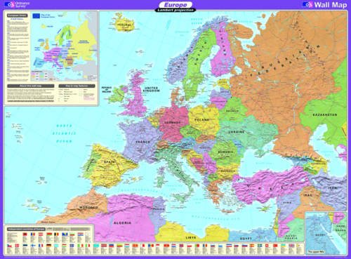
41. Europe Wall Map (OS Wall Map)
by Ordnance Survey
Map: Pages (2008-02-11)
list price: US$15.90 -- used & new: US$10.87
(price subject to change: see help)
Asin: 0319148300
Canada | United Kingdom | Germany | France | Japan

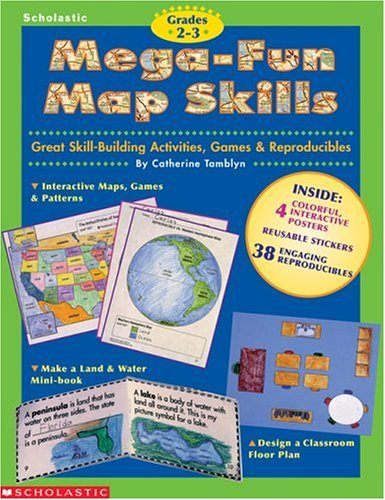
42. Mega-Fun Map Skills (Grades 2-3)
by Catherine Tamblyn
Paperback: 80 Pages (1999-01-01)
list price: US$14.95 -- used & new: US$3.95
(price subject to change: see help)
Asin: 0590187996
Canada | United Kingdom | Germany | France | Japan
Editorial Review

Product Description
Great Skill-Building Activities, Games & Reproducibles
This one-of-a-kind, one-stop resource includes dozens of activities, games, and reproducibles that make learning about maps fun to teach and fun to learn. Topics covered include location, direction, models, maps and globes. Activities are hands-on and packed with kid-appeal. Plus two 2-sided maps and 4 sticker sheets with reusable stickers! ... Read more


43. The Nature of Maps: Essays Toward Understanding Maps and Mapping
by Arthur Howard Robinson
 Hardcover: 138 Pages (1976-09)
list price: US$12.50 -- used & new: US$111.93
(price subject to change: see help)
Asin: 0226722813
Average Customer Review: 5.0 out of 5 stars
Canada | United Kingdom | Germany | France | Japan

Customer Reviews (1)

5-0 out of 5 stars The classic by Robinson and Petchenick
I don't understand why Barbara Bartz Petchenik isn't listed as co-author. It's actually kind of confusing: "Did Robinson write a different 'Nature of Maps' by himself?"

This book is the classic effort that helped establish Cartography as an academic discipline rather than simply a trade. Robinson developed a very positivist sense of maps and map making while heading the US Office of Strategic Services Map Division during World War II. The OSS was a group of primarily social scientists tasked with producing actionable military information from any available sources. The OSS maintained a culture strongly favoring objectivity and standardization. This culture was extended by Robinson toward Cartography and embedded in this text. The title mirrors the OSS Chair of the Projects Committee Robert Hartshorne's "The Nature of Geography".

The book is a ground-breaking work in the application of cognitive science to cartography by situating maps within a system of communication. This system begins with the "real world", which is encoded by the map maker using cartographic language into a map which is then decoded by the map user resulting in an understanding of the real world.

This might seem trivial, but prior to Robinson, maps were assumed to just be "understood". By establishing the existence of the "cartographic language", Robinson opens the map making and reading process to semiotic analysis. ... Read more


44. Maps (First Step Nonfiction Geography)
by Robin Nelson
 Paperback: 8 Pages (2005-01)
list price: US$3.95 -- used & new: US$3.95
(price subject to change: see help)
Asin: 0822553937
Canada | United Kingdom | Germany | France | Japan

45. Railroad Maps of the United States: Selected Annotated Bibliography of Original 19th Century Maps in the Geography and Map Division of the Library of
by Andrew M. Modelski
 Paperback: 112 Pages (1982-06)
list price: US$5.50 -- used & new: US$96.58
(price subject to change: see help)
Asin: 0844401552
Canada | United Kingdom | Germany | France | Japan

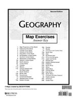
46. Geography Map Exercises Answer Key
Paperback: Pages (2000)
-- used & new: US$8.00
(price subject to change: see help)
Asin: 1579244084
Canada | United Kingdom | Germany | France | Japan
Editorial Review

Product Description
The Answer Key for Map Exercises. ... Read more


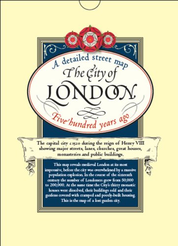
47. City of London Map 1520: 500 years ago, Henry the 8th's City... Showing Major Streets, Lanes, Churches, Great Houses, Public Buildings, Folded in Wallet,
by The Historic Towns Trust
Map: 1 Pages (2009-02-15)
list price: US$20.00 -- used & new: US$20.00
(price subject to change: see help)
Asin: 1873590776
Canada | United Kingdom | Germany | France | Japan
Editorial Review

Product Description
The capital city in 1520 during the reign of Henry VIII showing major streets, lanes, churches, great houses, monasteries and public buildings.This map reveals medieval London at its most impressive, before the city was overwhelmed by a massive population explosion. In the course of the sixteenth century the number of Londoners grew from 50,000 to 200,000. At the same time the City's thirty monastic houses were dissolved, their buildings sold and their gardens covered with cramped and poorly-built housing. This is the map of the lost garden city. ... Read more


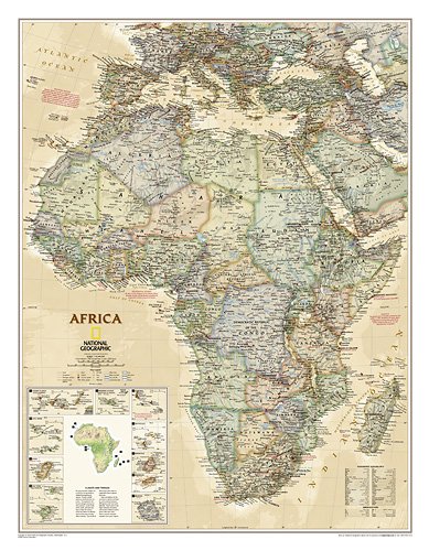
48. Africa Executive Wall Map (tubed)
by National Geographic Maps
Map: Pages (2009-01-01)
list price: US$14.99 -- used & new: US$14.99
(price subject to change: see help)
Asin: 1597752584
Canada | United Kingdom | Germany | France | Japan
Editorial Review

Product Description
NEW! Our executive style political map of Africa features country boundaries, place names, bodies of water, airports, major highways and roads, and much more.

(Tubed) 24'' x 31''
Scale size: 1:14,244,000 ... Read more


49. An Atlas of Ancient Geography, Biblical and Classical: Maps of the Ancient World
by William Smith
 Hardcover: 240 Pages (2011-05-24)
list price: US$475.00 -- used & new: US$404.18
(price subject to change: see help)
Asin: 1848853521
Canada | United Kingdom | Germany | France | Japan
Editorial Review

Product Description
Richard Talbert is William Rand Kenan Jr. Professor of History and Classics at the University of North Carolina at Chapel Hill, USA. He is an international authority on the cartography of the ancient world and is the editor of "The Barrington Atlas of the Greek and Roman World". Published to complement his Greek and Roman dictionaries, "An Atlas of Ancient Geography, Biblical and Classical" by Sir William Smith is the rarest and most visually compelling of the volumes. Produced to the highest standard by the leading mapmaker of the day, the maps - large-scale, small-scale, historical, topographical, multiple city plans and other insets - are clear, detailed, intricately colored works of art. "The Atlas" provides the first complete set of maps of the ancient world, both classical and biblical. A full index of names and places, both ancient and modern, accompanies each of the larger maps. For each map there is also an accompanying text, giving sources and authorities for them. This handsome edition is introduced by Richard Talbert, William Rand Kenan Jr.Professor of History and Classics at the University of North Carolina at Chapel Hill, and one of the world's foremost scholars of the cartography of the ancient world. Academics, collectors and libraries will welcome the opportunity to acquire a copy of this extremely rare landmark work. ... Read more


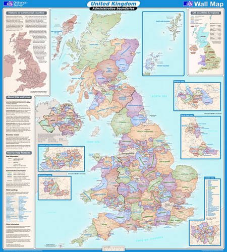
50. United Kingdom Administrative (OS Wall Map)
by Ordnance Survey
Map: Pages (2009-11-30)
-- used & new: US$12.63
(price subject to change: see help)
Asin: 0319148335
Canada | United Kingdom | Germany | France | Japan

51. The Little Man In the Map Teaches the State Capitals!
by E. Andrew Martonyi
Paperback: 112 Pages (2010-10-25)
list price: US$11.95 -- used & new: US$8.05
(price subject to change: see help)
Asin: 0978510070
Average Customer Review: 5.0 out of 5 stars
Canada | United Kingdom | Germany | France | Japan
Editorial Review

Product Description
From the author of the award-winning The Little Man In the Map: With Clues To Remember All 50 States comes its eagerly awaited companion book, The Little Man In the Map Teaches the State Capitals!Following the proven method of its predecessor, this clever paper-bound volume uses memory aids, well-laced with humor, to help anyone learn the U.S. capitals.A How To Use section explaining the simple and effective method is followed by an alphabetical listing where a two-page spread is devoted to each state/capital unit. The left-hand page establishes word clues based on word associations derived from the sounds of the names of the state and its capital; the facing page brings the word clues together in two to four rhymed lines placed under a humorous cartoon that reinforces the "story."The book will appeal to a wide range of ages, from elementary to high school students. They will surely be joined by some of their parents who will find themselves finally remembering even the more elusive state capitals. ... Read more

Customer Reviews (5)

5-0 out of 5 stars Invite The Little Man in the Map Over for Dinner...
My wife and I have children ages 15, 11, 5, and 1.We are used to a pretty lively dinner table with a wide range of conversation.Recently I pulled out E. Andrew Martonyi's State Capitals book and had the Little Man in the Map join our discussion.I read the memory clues for each of the capitals to everyone which were silly, imaginative, and clever and found that not only did we have lots of fun discussing them but as we made a game of it we discovered that our 15, 11, and 5 year olds all were able to recall the states and their capitals accurately (my 1 year old ate peas...but she seemed engaged).The book is ideal for some good family fun and for sneaking in some learning at the same time without them even realizing it!By the way, Mr. Martonyi's original book for remembering each of the 50 states "The Little Man in the Map" is equally effective as a creative learning tool that makes for a fun learning opportunity (it's also beautifully illustrated).Together these books compliment each other well and each present a great opportunity for a parent or teacher to lead an enjoyable, memorable, learning experience.

5-0 out of 5 stars A Must Have
We have seven year old twins who learned all of the states from E. Martonyi's Little Man in the Map book.Of course when the State Capital book came available, we wanted to be one of the first to try it out.This book is visually attractive to kids of all ages.The tips are useful, the flow is smooth and believe it or not, learning capitals can be fun.Along with my kids, I learned the capitals forgotten over the years.Highly recommended.

5-0 out of 5 stars Another Fun Geography Book from The Little Man in the Map!
A month ago I received E. Andrew Martonyi's newest book, The Little Man in the Map Teaches the State Capitals. My children and I loved Martonyi's initial book, The Little Man in the Map, which very creatively taught children the 50 states, their shapes and locations. I anticipated that we would enjoy his newest book, too.

Predictably, my school-aged children (in 9th grade, 6th grade, 3rd grade and kindergarten) have enjoyed learning two state capitals each day as part of that day's regular school lessons. In Martonyi's newest book, however, the learning approach is a bit different than simply reading a colorful picture book set in rhyming verse--and certainly learning the capitals is a bit more challenging than simply learning the 50 states. I would definitely recommend that any potential purchaser has his children begin by learning the states first, and then learn their capitals with this book.

So, what is unique about Martonyi's newest book?

* memory aids are included to stimulate children (and adults) to learn the capitals
* each state and its capital is covered in a two page spread, which includes word clues, a full clue, an illustration of the state and location of its capital, the cartoon itself, plus a longer clue of rhyming verse which explains the cartoon
* it is designed to be read in less than an hour with the intention of teaching all state capitals in that time
* simple cartoons and line drawings are used instead of full-color illustrations

While I do think it would be challenging for most elementary or middle school children to simply read through the book one time and recall all the capitals, I do think this is a great book. It retains my children's interest, and they have learned almost all the state capitals in just a few minutes per day over the course of a month's time.

And after I have read the book to them this month, I have gone from knowing 40-something state capitals to knowing all 50. And we all had fun while using it. I am impressed.

This book retails for $11.95 and may be purchased from the author's website here. His original hardcover title is available for $19.95.

Disclosure: I received a complimentary copy of this book for review from the author. No other compensation was received and opinions expressed are my own.

5-0 out of 5 stars Fun and Engaging To Learn the State Captials!
Elementary and up through middle and high school will love learning the state capitals! We did!

Very visual and easy to read each state has a black line cartoons which are a fun way to remember the capital city in each of the United States.

Perfect for homeschooling OR traditional school where each can be assigned or used as pleasure reading~the format is very versatile.We really loved it, and you will too! BIG THUMBS UP!

[...]FREE Little Man in the Map resources
The Little Man In the Map: With Clues To Remember All 50 States!

5-0 out of 5 stars The Little Man Returns for More Scholastic Fun!
Geographically creative and poetically sophisticated author, E. Andrew Martonyi returns with the companion book to his best-selling Little Man in the Map with The Little Man in the Map Teaches the State Capitals!

This outstanding paperback book is just as memorable, fun and effective as its predecessor. Through the use of cute cartoon drawings and simple mnemonics, children of all ages (and their parents) can easily learn all 50 State capitals without tears, frustration or boring repetition in the course of one hour. (Seriously. I'm not exaggerating!)

Like most adults, I could barely remember the various state capitals from my elementary school days. (Not that I had any interest in doing so, but I digress.) But after spendingjust one hour with this book, I found myself rattling off ALL 50 capitals with ease. Wow! Jeopardy, here I come!

{For example, here are the clues for Washington state: Washington = Washing a ton. Olympia = ole limpy Pa. "Washing a ton for ole limpy Pa was not as task enjoyed by Ma." Pretty cute, huh?}

When I handed it to my children (who are huge fans of MIM--aka "Man in the Map"), they couldn't wait to dig in. They quickly left the room and I didn't see them again for a good hour and a half. Once they emerged, I asked them how they liked it.

My son said it was, "Funny and silly" and Abby agreed. "Yes, I know" I said, "but did you learn anything from it?" They replied, "No". (Umm...SHOCK!!!)

"So you're telling me that you didn't learn any state capitals?" I asked incredulously. They shook their heads again. This of course, was totally unbelievable since I'd just gleaned quite a bit from it's pages. So I decided to quiz them.

"Nothing, huh? Okay. What's the capital of Alaska?"

Abby: "Juneau."

"Arkansas?"

Ethan: "Little Rock."

"Maine?"

Abby: "Augusta!" I fired-off more states, each yielding the correct answer from both.

"Ha! You see? You did learn something!" I said, throwing my hands in the air.

Abby was surprised and dumbfounded. "You mean, it wasn't just as silly story? Those are real places and names?"

Isn't she cute, folks? {Ahem}

So whether your children realize it or not, they will learn the capital cities of all nifty-fifty United States in record time!

Many thanks once again to Mr. Martonyi and his supreme geographic geniusness! I wholeheartedly recommend this little gem for every student--homeschooler or otherwise--and proudly award it two thumbs up! :o)

*Disclosure: I received a copy of the above book directly from the author in exchange for an honest review. No additional compensation was provided and the thoughts expressed are my own.*

... Read more


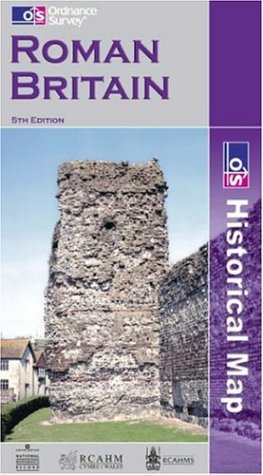
52. Roman Britain (Historical Map)
by Ordnance Survey
Map: Pages (2001-03-08)
list price: US$12.95 -- used & new: US$5.22
(price subject to change: see help)
Asin: 0319290298
Canada | United Kingdom | Germany | France | Japan
Editorial Review

Product Description
Historical Maps.Only two maps in this series, comprising Ancient Britain and Roman Britain.Produced in conjunction with the Royal Commissions on Historical Monuments for England, Scotland and Wales. ... Read more


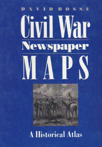
53. Civil War Newspaper Maps: A Historical Atlas
by Professor David Bosse
Hardcover: 176 Pages (1993-10-01)
list price: US$38.00 -- used & new: US$21.45
(price subject to change: see help)
Asin: 080184553X
Canada | United Kingdom | Germany | France | Japan
Editorial Review

Product Description

In Civil War Newspaper Maps, David Bosse shows how nineteenth-century advances in printing and engraving technology, coupled with an unprecedented public demand for information, led to the development of a means of mass communication still in use today--the quickly produced, up-to-the-minute newspaper battlefield map. Bosse's introduction offers a concise overview of the subject, including how correspondents got maps to their papers from the field, press-military relations during the war, and the economic problems of map printing. Following the text is an atlas of forty-five newspaper maps printed by the Northern daily press, each accompanied by a summary of the military operation it illustrates and a commentary on the map itself.

... Read more

54. Antique Maps
by Carl Moreland, David Bannister
Paperback: 326 Pages (1994-01-01)
list price: US$27.95 -- used & new: US$94.50
(price subject to change: see help)
Asin: 0714829544
Average Customer Review: 3.5 out of 5 stars
Canada | United Kingdom | Germany | France | Japan
Editorial Review

Product Description
This is a standard reference work, incorporating a general historical background, methods of map making, practical advice on collecting old maps and a list of the major map makers. Organized country by country, it refers to over 600 cartographers active between 1450 and 1850. ... Read more

Customer Reviews (6)

5-0 out of 5 stars A ValuAsable Reference for Collectors
As a collector of antique maps, I find this book a particularly worthwhile reference guide to old maps. It is of great use in identifying and providing information on historic maps and charts. No serious collector or student of cartography should be without it.

1-0 out of 5 stars The only color map is the cover
This book may be informative but if you are looking for color antique maps, this book will certainly disappoint you.

4-0 out of 5 stars A worthwhile, good book
A nice book! Well-writen and there is a lot of substance here. This is a very useful reference book, and although a bit weak in the maps of the 19th century (especially maps of America interest), it is overall worthwhile and a good source of old map information.

5-0 out of 5 stars Antigue Maps
If you must own one book on Antique Maps, this is the one. Bannister & Moreland bring an insightful appreciation of the subject; both in general terms and for the specicivity of a collector. Filled with important detailsof the major cartographers ;it executes this with a brevity other resourceauthors should emulate. The information is crisp,readable, and informativewithout weighting down in anecdotal ephemera so common to works of thissort. Other resource and academic authorities should note the format whenattempting a guide to their subject[s]. Highly reccomeneded. As anex-retail map dealer it was my bible in aiding authentification and fairmarket value. An invaluable tool to the serious collector and professional;and a highly organized book on cartography for the general reading public.

5-0 out of 5 stars A must read classic introduction to antique maps
This is a first class introduction to the subject of antique maps. I have over 700 books on the topic in my personal library and I often return to this book to brush up on a cartographer, region, or a particular map.Bannister is an internationally respected dealer and expert on the subject.Do not get distracted by cowardly comments and reviews by someone afraid toleave their name. I regularly recommend this book to those who want to readONE book on antique maps. ... Read more


55. The Book And The Map: New insights into Book of Mormon Geography
by Venice Priddis
 Hardcover: 169 Pages (1975)
-- used & new: US$45.18
(price subject to change: see help)
Asin: 0884942775
Average Customer Review: 3.0 out of 5 stars
Canada | United Kingdom | Germany | France | Japan

Customer Reviews (2)

1-0 out of 5 stars Wako-Wacko Geography
This is probably the most amusing book ever written in defense of the Book of Mormon. Priddis believes that the whole Amazon basin was flooded by the ocean some 1500 years ago, not millions of years ago in the days of the dinosaurs. This would create a "narrow neck of land" between the Pacific and Atlantic oceans (the Andes Mountains forming the pass).

Because there is no evidence of any great battles at Hill Cumorah near Joseph Smith's hometown in upstate New York, most modern Mormon scholars claim that the Book of Mormon Hill Cumorah was somewhere else.This in spite of the fact that Joseph Smith claimed to have found the gold plates of the Nephites at the New York Hill Cumorah, and in spite of the fact that early Mormons claimed that the hill was full of lost Nephite treasures.

The other reason for moving Hill Cumorah out of New York is to put it near the regions of high civilization in the New World--pagan civilizations, one should add.

The Cumorah problem has led to identifications of Hill Cumorah all over both North and South America.Priddis believes that Hill Cumorah might be Imbabura at 15,033 feet in the Andes (p. 57)."It is a very interesting hill indeed." A hill? at 15,033 feet!Most people would call that a "mountain."Tens of thousands of warriors battling it out at 15,000 feet!

But that is not all. The Nephites were supposed to cross the narrow neck of land from sea to sea in a day. That would be quite a climb in height and distance to cross the Andes Mountains.

But let no septic go unanswered. Priddis says, "To many, cerro Imbabura, Cayambe, and Hermoso would be mountains, but one man's mountain can be another man's hill."Indeed.

The possibility of rational discussion vanishes when a writer cannot concede that a mound of earth fifteen-thousand-feet tall is probably not a "hill."

Priddis' proposal, however, goes beyond anything ever written on the subject. She presents a map showing the "Probable Geophysical Configuration of South America Before the Time of Christ."

But this Mormon South America is one that has not been seen in millions of years--the Book of Mormon "west sea," "east sea" and the "narrow neck of land" wind up in Ecuador. All that is left of poor old South America is the land surrounding the Andes Mountains---or perhaps, we should say the Andes "hills." Priddis writes:

"We cannot know how a lone man (Mormon), of himself, could have made the long trek from South America to North America to bury the plates in a hill in New York State."

And carrying all those heavy gold plates, one should add.

Indeed, why make the journey at all? The Angel Moroni took the plates from Joseph Smith and disappeared, so why not just fly them up to the false Hill Cumorah, where the yearly Mormon pageant is held--a pageant depicting the last days of the Nephites at the Hill Cumorah in New York.

The theatrical setting and story of the Book of Mormon simply does not translate well into the real world.

First came the end of two million sword-carrying Jaredites at "Hill Cumorah." There "had been slain two millions of mighty men, and also their wives and children" (Ether 15:2).

Hundreds of years later, the Nephites were also wiped out at the same Hill Cumorah.

"And we marched forth and came to the land of Joshua....the Lamanites had a king, and his name was Aaron; and he came against us with an army of forty and four thousand. And behold, I withstood him with forty and two thousand....And it came to pass that we did contend with an army of thirty thousand against an army of fifty thousand" ("Mormon" 3:6-25). This was in 346 AD.

With all these stupendous sword-carrying armies, what happened to all the swords? Why are they not found all over the Americas?How could such civilizations have disappeared without a trace? The answer can only be a sigh.

See my one-star reviews of books by other Mormon writers and my listmania list.
Since Cumorah: The Book of Mormon in the modern world

Your comments--positive or negative--are appreciated. Thanks.

5-0 out of 5 stars Only Book Making Sense of Book of Mormon Geography
The best book on Book of Mormon Geography I have ever read.

This book just makes sense. The Book of Mormon talks about a Sea East and a Sea West. The Central America theories just never made sense. In the Book of Mormon it says that Hagoth launched ships into the Sea West near the narrow neck of land and sailed northward (not West or Northwest). Venice's South America theory works.

The Book was Published in 1974. I liked how Venice gave credit to Verla Birrell's 1946 book, proposing the location of the narrow neck of land (The Gulf of Guayaquil in so. Equador), even though she stated that she did not know anyone had thought of it before.

The Book proposes specific locations of the City of Nephi (Cuzco, Peru), Zarahemla (Pachacamac), the River Sidon (Montaro), etc. It is interesting to note that another Author, Aurthur Kocherhans, has taken camera crews to South America over the last 10+ years. He has made 7 videos ("Lehi's Isle of Promise") showing these proposed locations on film, bringing this theory alive. ... Read more


56. Designed Maps: A Sourcebook for GIS Users
by Cynthia A Brewer
Paperback: 170 Pages (2008-03-01)
list price: US$39.95 -- used & new: US$22.36
(price subject to change: see help)
Asin: 1589481607
Average Customer Review: 4.5 out of 5 stars
Canada | United Kingdom | Germany | France | Japan
Editorial Review

Product Description

This sequel to the highly successful Designing Maps, offers a graphics-intensive presentation of published maps, providing cartographic examples that GIS users can then adapt for their own needs. Each chapter characterizes a common design decision and includes a demonstration map, which is annotated with specific information needed to reproduce the design, such as text fonts, sizes and styles; line weights, colors, and patterns; marker symbol fonts, sizes, and colors; and fill colors and patterns. Visual hierarchies and the purpose of each map are considered with the audience in mind, drawing a clear connection between intent and design. The book also includes a valuable task index that explains what ArcGIS 9 tools to use for desired cartographic effects. From experienced cartographers to those who make GIS maps only occasionally, all GIS users will find this book to be an indispensable resource.
... Read more

Customer Reviews (5)

5-0 out of 5 stars Useful
I'm not very good at making maps and its because I don't know all the little tricks to making nice maps.This book helps show how to make nice readable maps.I have the other one as well but this one seems a bit more useful.

5-0 out of 5 stars A must have reference book for GIS users
I accidently purchased "Designed Maps" thinking I was getting Cynthia Brewers other book "Designing Better Maps", but I stumbled across something great.Brewer does a superb job of illustrating sound and well thought out map design to any level of GIS user.I originally purchased the book when I was taking a cartography course and it was a lifesaver.Anytime I was puzzled as to how I could best present the information at hand, I was able to flip to a similar map in "Designed Maps" in order to get a solid feel for how I could approach the problem.

Brewer allows even the most casual GIS user the ability to understand the concepts presented in her examples, breaking down how each of the individual segments can be modified to highlight different cartographic aspects. "Designed Maps" also does a wonderful job of explaining how the map is intended to be used and what the user is supposed to see.I particularly enjoyed the compare and contrast segments which depicted the ways that the same information could be displayed in different manners to highlight individual components.
"Designed Maps" is a must have a for a GIS library.Although the book is published by ESRI Press (it features several tips specific to ArcMap), I found it useful for understanding the specifics of cartographic representation on pretty much any platform.

5-0 out of 5 stars A powerful sourcebook any GIS collection needs.
College-level libraries strong in either cartography or GIS mapping design will appreciated DESIGNED MAPS: SOURCEBOOK FOR GIS USERS, which offers easy basic guidelines for creating the cartographic effects using ESRI ArcGis Desktop software. These designs show how a dataset may be portrayed by a map, offering demonstration maps with details needed to achieve effective designs. The result is a powerful sourcebook any GIS collection needs.

4-0 out of 5 stars Great source of ideas
As an experienced GIS user with no formal education in geography/cartography, I found this book to be right down my alley. It's highly visual, but this is no coffee table book - the text actually explains the choices presented to mapmakers, and you get a sense for what works in which situations.

Each of the six sections addresses a particular broad category of map (reference, thematic, special-purpose, etc.), and each has one map that the author has reproduced in four different styles to emphasize different features or optimize for printing. Several other example maps then follow, each with a paragraph to explain some of the techniques used in its production. The book ends with a section that shows how to recreate the effects in the book using ArcMap, which exposed me to features I didn't know existed and lots of new ideas on how to use the familiar dialogs.

I would recommend this book to anyone who has a basic feel for how to use GIS software to make maps but doesn't necessarily feel the need to delve into cartographic theory.

4-0 out of 5 stars Designing maps
Enjoyable collection of maps created to inform.I found the text very useful for my purposes, and an interesting way to compare various map presentation styles.This fits well with her previous book on color use on maps. ... Read more


57. Student Atlas of World Geography
by John Allen
Paperback: 336 Pages (2009-03-13)
-- used & new: US$15.99
(price subject to change: see help)
Asin: 0073527602
Average Customer Review: 4.5 out of 5 stars
Canada | United Kingdom | Germany | France | Japan
Editorial Review

Product Description
The Student Atlas series combines full-color maps and data sets to introduce students to the importance of the connections between geography and other areas of study such as world politics, environmental issues, and economic development. These thematic atlases will give students a clear picture of the recent agricultural, industrial, demographic, environmental, economic, and political changes in every world region. ... Read more

Customer Reviews (3)

5-0 out of 5 stars Amazing!
Im very pleased!!!!! Got the book in 3 days!!! Fast Delivery! and Condition of book, BRAND NEW!.

4-0 out of 5 stars Atlas
This is a very good Atlas with many different views of the world.However my copy arrived with a bad bend in the lower right hand cornor that goes all the way to page 67.I would advise Amazon.com to change the way this book is shipped so that this does not happen to anyone else.

5-0 out of 5 stars Great Atlas
Not only does this book have great thematic maps, but it also has really good captions beneath the maps to help you understand the data that the map is illustrating. ... Read more


58. Ancient Britain (Historical Map)
by Ordnance Survey
Map: Pages (2005-05-16)
list price: US$9.87 -- used & new: US$5.42
(price subject to change: see help)
Asin: 0319290352
Canada | United Kingdom | Germany | France | Japan
Editorial Review

Product Description
Historical Maps.Only two maps in this series, comprising Ancient Britain and Roman Britain.Produced in conjunction with the Royal Commissions on Historical Monuments for England, Scotland and Wales. ... Read more


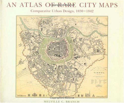
59. Atlas of Rare City Maps: Comparative Urban Design, 1830-1842
by Melville C Branch
Hardcover: 112 Pages (1997-09-01)
list price: US$70.00 -- used & new: US$39.99
(price subject to change: see help)
Asin: 1568980736
Average Customer Review: 5.0 out of 5 stars
Canada | United Kingdom | Germany | France | Japan
Editorial Review

Product Description
The map-plans in this collection of forty cities in Europe,Russia, the United States, and Asia were first published in the mid-nineteenth century by England's Society for the Diffusion of UsefulKnowledge. These maps were all commissioned and drawn within a periodof thirteen years, presenting a unique opportunity to compare urbandevelopment among 40 cities in 19 countries at one moment in time. Anexquisite feast for the eye, the hand-colored, hand-lettered steelengravings are artistic masterpieces in themselves, representative ofan era of exceptional artisanal skill. They are reproduced here infine detail in an oversized format.

The Atlas of Rare City Maps includes bothwell-known European and American citiessuch as Amsterdam, London, Madrid,Moscow, New York, and Venice, as well assmaller cities like Calcutta, Edinburgh,Hamburg, Lisbon, Marseille, Parma, andStockholm. An introductory essay byMelville C. Branch discusses the historicalevolution of urban design, and provides abackground on engraving techniques. Branchalso evaluates each map-plan, remarking onthe details of each engraving and theevolution of the forms of the cities, theirhistories, and demographic characteristics. This rare collection first appeared in itsmodern form twenty years ago in a limitededition (Arno Press); long out of print, thisbook has been much sought after byarchitects, urban planners, and mapenthusiasts everywhere. PrincetonArchitectural Press is proud to makeavailable once again this valuable resource.The first in the world to receive a doctoratein planning (Harvard, 1949), Melville C.Branch has been a pioneer in his field forhalf a century. He is Distinguished ProfessorEmeritus at the School of Urban Planningand Development, University of SouthernCalifornia, where he has served since 1966.He is the author of over twenty books onurban and regional planning, includingPlanning Urban Environment andComprehensive Planning: General Theoriesand Principles.Amazon.com Review
For the visual historians among us, An Atlas of Rare City Maps isa cartographic feast. It presents 40 map plans of cities in Europe, Russia,the United States, and Asia--all published in the 19th century by England'sSociety for the Diffusion of Useful Knowledge, and all commissioned anddrawn within a period of 13 years. See Munich, Calcutta, Dublin, andWarsaw, Madrid, Moscow, and New York as they once were, and relish thehand-colored, hand-lettered steel engravings. The maps are artistic gems, representativeof an era of skill, and reproduced in fine detail. ... Read more

Customer Reviews (2)

5-0 out of 5 stars Gave it to City Administrator
Discovered Atlas of Rare City Maps at Micawber books in Princeton, NJ. The college student/clerk said it was her favorite book in the store. I read it. Loved it. Gave it to the City Administrator in our town. He's so delighted by it that, after skimming it, he decided to read it one city at a time; like a morning devotional reading!

5-0 out of 5 stars Comparative design
This book contains some of the loveliest reproductions of old maps I have ever scene.Aside from the beautiful pictures, the author includes interesting and valuable commentary to help the reader understand thesecity plans in the context of history and geography.All those interestedin urban design should read the eloquent forward of this book.It would behighly beneficial if more of our political leaders, and just people ingeneral, understood this era in urban design- the end of the traditionaland the beginning of the modern.With the help of this book, perhaps wecan bring about a new commitment to intelligent and beautiful urbanplanning for the future. ... Read more


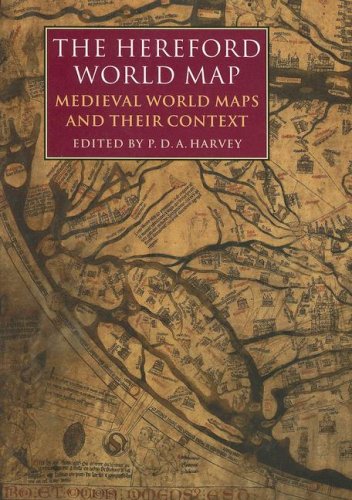
60. Hereford World Map: Medieval World Maps and their Context (British Library - British Library Studies in the History of the Book)
Hardcover: 392 Pages (2006-08-09)
list price: US$90.00 -- used & new: US$66.86
(price subject to change: see help)
Asin: 0712347607
Canada | United Kingdom | Germany | France | Japan
Editorial Review

Product Description

The famous Hereford world map, the ‘Mappa Mundi,’ dates from around 1300, and was painted on one skin of calf-parchment, less than 1 mm thick and measuring about 130 cm square. When we read of its frequent ordeals we may marvel that it is still in good condition and can be examined. Yet it is by no means the oldest surviving mappamundi, nor was it the largest: the Ebstorf map (destroyed by bombing in 1943) was of similar age and almost three times bigger.

Mappaemundi may be square or round, large or small, extremely simple or amazingly complex. Their geography is unfamiliar and many of their fauna are grotesque. Their importance is enormous: for their encyclopaedic ambition, for their place in devotional and romanesque iconography and for their attempts to document contemporary world views.

In setting the Hereford world map in context, P.D.A. Harvey and his twenty-four collaborators introduce us to medieval ideas of the world and man’s place in it, in ways that will excite historians, geographers, students of art history, theologians, and anyone interested in the medieval world view.

... Read more

  Back | 41-60 of 100 | Next 20
A  B  C  D  E  F  G  H  I  J  K  L  M  N  O  P  Q  R  S  T  U  V  W  X  Y  Z  

Prices listed on this site are subject to change without notice.
Questions on ordering or shipping? click here for help.

site stats