e99 Online Shopping Mall

Geometry.Net - the online learning center Help  
Home  - Basic M - Maps Reference (Books)

  Back | 21-40 of 100 | Next 20
A  B  C  D  E  F  G  H  I  J  K  L  M  N  O  P  Q  R  S  T  U  V  W  X  Y  Z  

click price to see details     click image to enlarge     click link to go to the store

$7.62
21. Turkey Travel Map (Globetrotter
$14.95
22. United States Executive Wall Map
$13.26
23. Canada Wall Map (tubed)
$3.35
24. Streetwise Greenwich Village Map
$10.36
25. New Zealand, North Island
$5.48
26. Laminated Cuba Map by Borch (English
$7.15
27. Laminated Munich Map by Borch
$3.80
28. Rand McNally West Palm Beach,
$25.90
29. Washington State Wall Map (laminated)
$8.31
30. Laminated Ecuador Map by Borch
$18.25
31. Afghanistan, Pakistan, and the
$37.22
32. The Whole World in Your Hands:
$7.89
33. Rail Map Europe, 17th (Thomas
$7.34
34. Laminated London Map by Borch
$39.99
35. National Geographic Maps: Mount
$71.27
36. Map Projections: A Reference Manual
$4.62
37. Basic Essentials Map & Compass,
$37.79
38. World Classic, Pacific Centered
$14.99
39. United States Explorer Wall Map
$9.15
40. Kings Canyon high country Trail

21. Turkey Travel Map (Globetrotter Travel Map)
by New Holland Publishers (UK) Ltd.
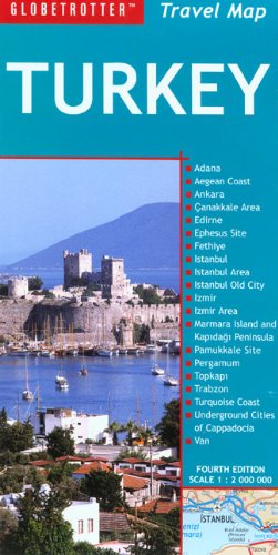
Map: Pages (2007-04-01)
list price: US$8.95 -- used & new: US$7.62
(price subject to change: see help)
Asin: 1845377494
Average Customer Review: 2.5 out of 5 stars
Canada | United Kingdom | Germany | France | Japan
Editorial Review

Product Description

Globetrotter Travel Maps cater specifically to the needs of tourists and visitors, packed with all the essential information to introduce travelers to each dynamic destination. Key buildings and places of interest are pinpointed, as well as where to stay. Distance and climate charts enable travelers to plan their visits, while stunning photographs conjure up each destination’s special atmosphere.
- Sharp, full color cartography that is easy to follow
- Nature reserves, parks and places of interest
- Scenic routes highlighted
- Town plans of major tourist centers including hotels
- Climate and distance charts
- Double sided, illustrated and full of useful information
- The ideal journey planner


... Read more

Customer Reviews (2)

1-0 out of 5 stars dcb
ever since i have purchesed from you i have had spam emails pertaining to be from AMAZON i will no longer buy from you !

David Browne

4-0 out of 5 stars Great Tourist Map
This map is very clear, concise and easy to read. Contains major roadways, highlights historic and touristic sights. Insets show enlarged and more detailed maps of popular tourist areas, major cities and historic sights. Also some nice photos and descriptions of some tourist "must-sees". ... Read more


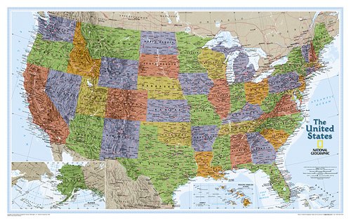
22. United States Executive Wall Map - Laminated
by National Geographic Maps
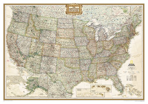
Map: Pages (2006-01-01)
list price: US$24.99 -- used & new: US$14.95
(price subject to change: see help)
Asin: 0792233786
Canada | United Kingdom | Germany | France | Japan
Editorial Review

Product Description
Make a statement with this "2008 Premier Print Awards Winner." The rich tones of this Political Executive map combine the popular antique look with up-to-date information so that you have a map that is elegant enough for the board room, study, or office, and contemporary enough to make it an ideal reference.

Laminated (43 x 40 )
Scale size: 1:4,560,000 ... Read more


23. Canada Wall Map (tubed)
by National Geographic Maps
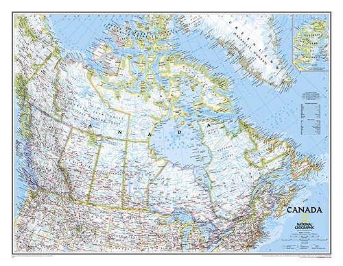
Map: Pages (2006-01-01)
list price: US$14.99 -- used & new: US$13.26
(price subject to change: see help)
Asin: 0792249577
Average Customer Review: 4.0 out of 5 stars
Canada | United Kingdom | Germany | France | Japan
Editorial Review

Product Description
This beautiful wall-map depicts Canada and the areas surrounding the Great Lakes. Includes Canadian province and US State boundaries, cities and towns, lakes and waterways, major geographic features, roadways, and other geographic details.

Scale: 1:7,966,000. 30 x 24 inches (approx). ... Read more

Customer Reviews (1)

4-0 out of 5 stars A [Small] Canada Map
The map itself is awesome. However, I bought it for a classroom wall, and it is a bit smaller than I thought. I think you should highlight the fact that it is a SMALL wall map. ... Read more


24. Streetwise Greenwich Village Map - Laminated City Street Map of Greenwich Village, NY - Folding pocket size travel map
by Streetwise Maps
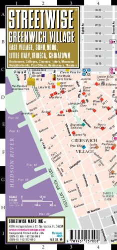
Map: 1 Pages (2009-05-01)
list price: US$6.95 -- used & new: US$3.35
(price subject to change: see help)
Asin: 1931257000
Average Customer Review: 4.5 out of 5 stars
Canada | United Kingdom | Germany | France | Japan
Editorial Review

Product Description
Streetwise Greenwich Village Map - Laminated Street Map of Greenwich Village, NY - Folding pocket size travel map with subway stations

This map covers the following areas:
Main Greenwich Village Map 1:17,000
East Village Map 1:17,000
NoHo Map 1:17,000
SoHo Map 1:17,000
Little Italy Map 1:17,000
Tribeca Map 1:17,000
Chinatown Map 1:17,000

The STREETWISE® Greenwich Village Map doesn’t just cover Greenwich Village, but everything south of 14th street and north of Chambers street, from the east River to the Hudson. Within these boundaries are some of the most colorful neighborhoods in Manhattan. While times have changed and the area may not be as bohemian as it once was, the influx of professionals has certainly not eradicated the independent spirit of each neighborhood. The area is also such a prime gastronomic destination that this is one of the few STREETWISE® Maps to feature restaurants not only highlighted on the map, but also included in the index.

While a few ultra modern condo buildings have shot up recently, Greenwich Village is still a collection of brownstones and townhouses on small tree lined streets. There’s an academic atmosphere fueled by students of New York University, the New School, Parsons School of Design and Cardozo Law School. A longtime center for gays and lesbians, the Village isn’t as shocking as it used to be. The annual Halloween parade is still a great sight to see, but the neighborhood is more of a restaurant destination than the flame throwing extravaganza that it once was.

The East Village has gentrified as well. St Marks Place was Punk Rock Central in the 70’s and 80’s, and while there will always be a few multicolored Mohawks hanging around Trash& Vaudeville (the original American punk rock hangout), the cleaned up Tompkins Square park has attracted uptowners looking for a deal. There are plenty of great restaurants in the area catering to all tastes.

In between the east Village and the West Village lies NoHo (NOrth of HOuston) and NoLita (NOrth of Little ITAly). Renovated lofts and tenements share the neighborhood with unrenovated buildings, making it a bit scruffier that SoHo or Tribeca. The Lower East Side originally was a neighborhood of immigrants jam-packed into tenements, pushcarts and small ethnic shops. It’s still a neighborhood of shops where you’ll find bargains a plenty and it’s the home of some of the more innovative restaurants in the city.

Chinatown's frenetic atmosphere is punctuated by stores selling various decipherable and undecipherable goods. Shop for treasures to take home or find a good Dim Sum restaurant and let the dumpling parade begin.

SoHo is an upscale shopping bonanza with labels such as Chanel, Prada and even Bloomingdale’s. Tribeca is a close-knit neighborhood of lofts, taverns, galleries and restaurants. The Tribeca FilmFestival, held each spring, brings visitors from all over New York and the world to see the diverse selection of offerings, some shown in an open air drive-in set up along the Hudson.

Each of these neighborhoods is delineated by color and fully indexed with listing of streets, parks, bookstores, cinemas, clubs, colleges, hotels, museums, points of interest, post offices, restaurants, shopping and theaters. Subway stops are also clearly marked.

Our pocket size map of Greenwich Village is laminated for durability and accordion folding for effortless use. The STREETWISE® Greenwich Village map is one of many detailed and easy-to-read city street maps designed and published by STREETWISE®. Buy your STREETWISE® Greenwich Village map today and you too can navigate the village like a native. For a larger selection of our detailed travel maps simply type STREETWISE MAPS into the Amazon search bar. ... Read more

Customer Reviews (2)

4-0 out of 5 stars Greenwich Village map
We needed a map like this to cover the odd layout of Greenwich Village streets.Could have had larger print for us "over-forties" but worth carrying.

5-0 out of 5 stars LOVE this handy map of the Village
This sturdy, compact tri-fold laminated map of Greenwich Village, NYC is a must have for both tourists and anyone new to the area. I've lived in New York all my life but actually found it really handy when I got this inside a "Welcome" packet when I attended school on West 4st. Always helped to know where the tiny little streets were, which subways stopped where, and how certain streets are here but then disappear once you get further uptown (like Fourth Avenue)!
Best is that it holds up well to raindrops, fits in a purse, folder, backpack, etc. without taking up room, and is full color and easy to read.A must-have for anyone interested in navigating this part of Manhattan more efficiently. ... Read more


25. New Zealand, North Island
by Hema
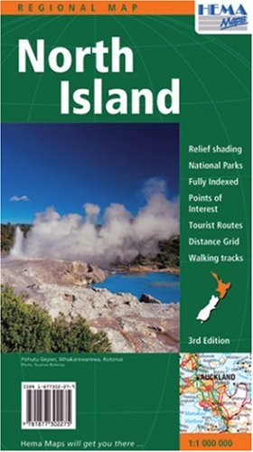
Map: 1 Pages (2004-01-01)
list price: US$10.95 -- used & new: US$10.36
(price subject to change: see help)
Asin: 1877302279
Canada | United Kingdom | Germany | France | Japan

26. Laminated Cuba Map by Borch (English Edition)
by Borch
Map: 2 Pages (2008-12-12)
list price: US$10.95 -- used & new: US$5.48
(price subject to change: see help)
Asin: 3866093594
Canada | United Kingdom | Germany | France | Japan
Editorial Review

Product Description
Folded color road and travel map. Scale 1:1,000,000. Distinguishes roads ranging from expressways to country lanes. Legend includes international airports, airfields, sights, museums, monuments, castles, churches, synagogues, mosques, caves, beaches, yachting, windsurfing, scuba diving sites, shipwrecks, police, hospitals, golf courses, bus stations, national parks, nature reserves, viewpoints, waterfalls, reefs, mangroves, swamps, hotels, markets, prohibited areas. Includes inset map of Havana Downtown (1:16,000), Playas Del Este (1:22,000), Santiago de Cuba (1:19,000), Varadero (West), Varadero (East). Climate charts show the average daily temperatures, humidity, hours of sunshine and precipitation for each month. Extensive index. ... Read more


27. Laminated Munich Map by Borch (English Edition)
by Borch
Map: 2 Pages (2010-03-31)
list price: US$8.95 -- used & new: US$7.15
(price subject to change: see help)
Asin: 3866093098
Average Customer Review: 5.0 out of 5 stars
Canada | United Kingdom | Germany | France | Japan
Editorial Review

Product Description
Folded color street and travel map. Scale 1:11,000/1:22,000. Legend includes sights, museums, theatres, monuments, churches, synagogues, monasteries, castles, mosques, international airport, police, hospitals, golf courses, parking, park+rides, subways, commuter trains, hotels, restaurants, gas stations, motels and restaurant, snack bars, truck stops. Includes inset map of Allianz-Arena (1:22,000), Munich Expo (1:22,000), Munich Downtown (1:11,000), Munich Region (1:130,000), Voralpen-Land 1(850,000) and Munich Public Transport System. Climate charts show the average daily temperatures, humidity, hours of sunshine and precipitation for each month. Top 30 sights list. Extensive index. ... Read more

Customer Reviews (1)

5-0 out of 5 stars Munich Laminated Map (B&B) also the same map but for Salsburg, Venice and Vienna
A very good map to take along on your travels. All of the Berndtson & Berndtson laminated maps are wonderful! They include a lot of information, even show where buildings are located, and they are practically indistructible. From now on, when I buy any maps for travel, they will be the B&B laminated maps, I won't waste my money on the others. ... Read more


28. Rand McNally West Palm Beach, Florida: Local Street Detail (Easyfinder Maps)
by Rand McNally and Company
Map: Pages (2004-10-22)
list price: US$7.95 -- used & new: US$3.80
(price subject to change: see help)
Asin: 0528854739
Canada | United Kingdom | Germany | France | Japan
Editorial Review

Product Description
The durable and convenient EasyFinderTM of West Palm Beach, Florida will take all the wear and tear your journey can dish out. The laminated design allows you to mark your route, make notes, then wipe the surface clean for further use.

This map features enhanced cartography with: Clearly indicated highways,County Boundaries, Streets,Points of Interest and National Parks. ... Read more


29. Washington State Wall Map (laminated)
by National Geographic Maps
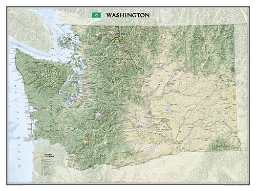
Map: Pages (2009-01-01)
list price: US$29.99 -- used & new: US$25.90
(price subject to change: see help)
Asin: 1597752509
Average Customer Review: 4.0 out of 5 stars
Canada | United Kingdom | Germany | France | Japan
Editorial Review

Product Description
National Geographic proudly presents our new Washington State Wall Map, part of our growing series of State Wall Maps. Ideal for home or business, Washington is printed on a premium print quality stock ideal for framing or is also available in a durable laminated edition. Washington's diverse terrain and vegetation is rendered accurately through the map's color palate, shaded relief, and ocean bathymetry. Inherent to National Geographic reference cartography, the state wall maps contain thousands of place names and precise locations of: cities, major roadways and railways, airports, federal and state protected lands, mountain ranges and prominent peaks, marine sanctuaries, military installations, major lakes, rivers and reservoirs, and other geographic features. All state wall maps are printed in Ft. Collins, Colorado by a certified green printer using 10% recycled paper stock, low V.O.C. inks, and shipped less than 30 miles to our warehouse.Scale: 1:652,174
Size: 30'' x 41'' ... Read more

Customer Reviews (1)

4-0 out of 5 stars Great Map, Difficult Size
This map, at 30" by 41" is absolutely wonderful, as lovely as you would expect from National Geographic.My map was damaged slightly when I received it, some superficial crunching on one edge.My main problem, and the reason this is a four, rather than a five star review is it's size.I have found poster frames that are 30" by 40" and 27" by 41", but no 30" by 41".I tried converting to metric and searching for that, with no luck.I'm stuck with the choice of trimming off the edge or spending a bunch of money on a custom frame.The poster has a nice wide black and white border, so it's not a very big deal, but it would be nice if poster makers took this into consideration more often.As for the other option, the cheapest custom frame I could find was $50, and this was the lowest end; they get pricey fast. ... Read more


30. Laminated Ecuador Map by Borch (English Edition)
by Borch
Map: 2 Pages (2009-06-19)
list price: US$10.95 -- used & new: US$8.31
(price subject to change: see help)
Asin: 3866093241
Average Customer Review: 4.5 out of 5 stars
Canada | United Kingdom | Germany | France | Japan
Editorial Review

Product Description
Folded road and travel map in color. Scale 1:1,000,000. Distinguishes roads ranging from expressways to country lanes. Legend includes paths, sights, museums, monuments, churches, chapels, antique/ancient sites, caves, beaches, shipwrecks, snorkeling/scuba diving sites, mines, golf courses, bus stations, gas stations, checkpoints, international airports, airfields, mountain passes, lodges, national parks, nature reserves, hotels, markets. Includes inset map of Galapagos Islands (1:1,300,000), Greater Quito (1:100,000), Quito (1:20,000), Guayaquil (1:18,000), Cuenca (1:17,000), Ingapirca (1:8,000). Climate charts show the average daily temperatures, humidity, hours of sunshine and precipitation for each month. ... Read more

Customer Reviews (8)

5-0 out of 5 stars map of Ecuador
Map is new, but cannot find year of printing although it has all major and secondary roads... I am quite pleased

5-0 out of 5 stars Better than ITMB, except for showing elevation.
I just spent a couple of weeks biking around Ecuador, with this map and the Ecuador Map by ITMB.This was the better of the two maps for two reasons:(1) it's laminated; (2) it has severalmap insets of cities, including two of Quito and central Quito that I found particularly useful.

The ITMB's upside is that it had more color shading for elevation that better demonstrates topography; the Borch map only has monochrome elevation shading and pinpoint heights for peaks, etc.That made the ITMB helpful for planning biking routes, where elevation change was important.

The ITMB is also at a larger scale (1:700,000 for ITMB as opposed to 1:1,000,000 for Borch) but that did not seem to make much difference in the detail (towns, roads) on the maps.The scale difference is more pronounced the far Oriente, which is on the backside of the Borch map at 1:2,000,000 -- the main (1:700,000) map cuts off about 25km east of the Tena-Puyo-Baeza road.This seems like a fair compromise to allow the extra real estate devoted to city inserts, because number of people going that far east is pretty low.

So, although I'm glad I had both maps, if I had to choose one, it'd be the Borch.

5-0 out of 5 stars Good maps are hard to find
As a person who has dealt with maps for forty years, I recognize both the look and feel of a good map, and how depictions on paper need to be clear and useful.This map fulfilled every expectation.

4-0 out of 5 stars Helpful Planning Guide
Moon's division of accomodations into price categories was very helpful in planning our trip to Ecuador.I also liked the detailed maps of the 4 regions; it gave more detail about roads than the countrywide map we ordered from another source.I also appreciated their candor about less than positive safety and appeal in some areas.Will order from Moon when traveling elsewhere.

1-0 out of 5 stars WTF??
Am I missing something? $151.00 for a MAP??? I would really like to find a good map of Ecuador and I realize they're hard to find but come on! Not at this price. ... Read more


31. Afghanistan, Pakistan, and the Middle East Wall Map Laminated
by National Geographic Maps
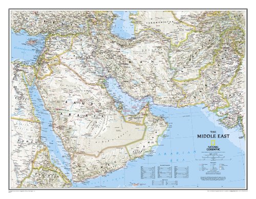
Map: 1 Pages (2009-01-01)
list price: US$19.99 -- used & new: US$18.25
(price subject to change: see help)
Asin: 0792250222
Canada | United Kingdom | Germany | France | Japan
Editorial Review

Product Description
This finely detailed political map shows up-to-date country boundaries and place names, as well as beautiful shaded relief.

The map covers a broad geographic area ranging from northern Africa through the Middle East to the western edge of China and India. Includes complete coverage of Afghanistan, Pakistan, Tajikistan, Iran, Iraq, Kuwait, Syria, Israel, Jordan, Lebanon, Saudi Arabia, Qatar, Bahrain, United Arab Emirates, Yemen, Oman, Cyprus, and Eritrea.

Also includes parts of India, China, Kyrgyzstan, Uzbekistan, Turkmenistan, Azerbaijan, Armenia, Turkey, Egypt, Sudan, Ethiopia, and Djibouti.

Laminated (30'' x 23'')
Scale size: 1:6,087,000 ... Read more


32. The Whole World in Your Hands: Looking at Maps (Discovery Readers)
by Melvin Berger
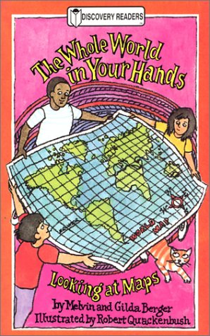
Paperback: 48 Pages (2001-09-01)
list price: US$3.95 -- used & new: US$37.22
(price subject to change: see help)
Asin: 0824953150
Canada | United Kingdom | Germany | France | Japan
Editorial Review

Product Description
Explains what maps are and how to use them, discusses map symbols and their meanings, and includes maps of a house, community, city, state, country, and the world. ... Read more


33. Rail Map Europe, 17th (Thomas Cook Rail Map Europe)
by Thomas Cook Timetables Team
Map: 2 Pages (2009-03-03)
list price: US$16.95 -- used & new: US$7.89
(price subject to change: see help)
Asin: 1848480490
Average Customer Review: 4.0 out of 5 stars
Canada | United Kingdom | Germany | France | Japan
Editorial Review

Product Description

These color-coded maps feature over 6,000 cities and towns, high speed lines, scenic routes and principal passenger and rail ferries.  Features include:
· Passengers railways of Europe from the Atlantic to Moscow
· Over 6000 cities and towns
· High-speed lines colour coded
· Scenic routes highlighted
· Channel Tunnel and other major tunnels
· Principal passenger and rail ferries
· Main mountain ranges and rivers, tourist areas, holiday beaches, international
airports
· Europe 1 : 4 million scale
· Scandinavia at 1 : 6 million
· Central Europe enlarged to 1 : 1.5 million
· Compiled and updated by the staff of the famous Thomas Cook European
Timetable

... Read more

Customer Reviews (4)

3-0 out of 5 stars Not necessary for travel planning.
This map is great to visualize your trip and lay it out on the desk to map out where you want to go. However, you get a FREE one with your purchase of a rail pass. So, it's not entirely necessary if you are intending on purchasing a rail pass.

5-0 out of 5 stars Must Have Book
This book is invaluable when visiting Europe and riding the trains.
Up-to-date!!
Will get another one - when I travel to Europe again.

4-0 out of 5 stars pretty good map, but ...
This is a nice map. It's made with heavy, shiny paper and covers all of Europe. I was hoping however to get a map that showed distances and travel times between stations. It doesn't. I expected the map to show the timetable numbers. It doesn't. I thought the map would show every city that has a train station. It doesn't. I wish I had known before I bought the map that none of this information is shown on the map.

5-0 out of 5 stars Excellent map of the Continent.
Folds out to be about 3 feet wide and 2.5 feet tall, with maps printed on both sides.The large orange box in the middle of the greater-Europe side (which shows the area printed on the opposite side of the map) is a bit annoying, but that seems to be the worst of it.The map's heavier-duty cover is built to not mutilate the paper map inside when folding and unfolding, and the legends are clear and helpful.The largest map goes from the northernmost part of Great Britain to the top of North Africa, and from the outskirts of Moscow, Russia, to the outskirts of Ankara, Turkey.Aside from the orange box, there is nothing obscuring the continent.Scandinavia is chopped off the top of the map and moved into a greater-detailed box out in the Atlantic; I fully agree with this choice and prefer it over other maps I have owned where showing Scandinavia in its correct spot means either a lesser-detailed map, or moving Italy to another side of the map.The detailed side of the map showing central Europe only runs from Dover, UK, to Paris to Avignon, France, and Warsaw, Poland, to Belgrade, Serbia.It shows the rail relationships between these European cities and most stops in-between: Dover, UK; Paris; Turin; Milan; Munich; Brussels; Cologne; Berlin; Vienna; Budapest; Warsaw; and Prague.The detailed map covers the heartland of where most American travelers go in Europe, and shows definitively how to travel to other popular destinations, such as Madrid, Rome, Athens, London, Moscow, and Copenhagen.Either side of the map is great for posting on a wall, and the well-marked scenic rail routes make it easy to plan a train ride.Also simply excellent as a general-purpose map of Europe, and superior in this respect to road maps of the Continent. ... Read more


34. Laminated London Map by Borch (English Edition)
by Borch
Map: 2 Pages (2009-01-01)
list price: US$8.95 -- used & new: US$7.34
(price subject to change: see help)
Asin: 3866093071
Average Customer Review: 3.5 out of 5 stars
Canada | United Kingdom | Germany | France | Japan
Editorial Review

Product Description
Folded street and travel map in color. Scale 1:11,000/1:15,000. Legend includes museums, theatres, monuments, churches, synagogues, mosques, sights, castles/palaces, ruins, monasteries, airfields, Underground, British Rail, golf courses, bus stations, parking, nature reserves, hotels, markets. Includes inset map of Kew Gardens & Richmond (1:35,000), Central Sights (1:11,000), Greater London (1:375,000) and London Underground System. Climate charts show the average daily temperatures, humidity, hours of sunshine and precipitation for each month. ... Read more

Customer Reviews (3)

5-0 out of 5 stars map review
All the maps in this series are just what I needed. I ordered several for different cities in Europe.

2-0 out of 5 stars London Map by Borch
We bought a couple of different maps when preparing for a European trip last year.We found this map to be cumbersome and unhelpful.The maps in the travel guides met our needs as tourists who saw London by foot and Tube.

4-0 out of 5 stars Durable, but could be smaller.
The map was very informative and durable (with the lamination), but could have been a bit smaller for easier carrying around town. ... Read more


35. National Geographic Maps: Mount Everest 23 1/2 X 38 (NG World Thematic Maps)
by National Geographic Society
Paperback: Pages (1988-04)
list price: US$17.99 -- used & new: US$39.99
(price subject to change: see help)
Asin: 1572623861
Average Customer Review: 5.0 out of 5 stars
Canada | United Kingdom | Germany | France | Japan
Editorial Review

Product Description
This elegant, richly colored antique-style world map features the incredible cartographic detail that is the trademark quality of National Geographic. The map features a Tripel Projection, which reduces distortion of land masses as they near the poles. Corner inset maps feature vegetation and land use, and population density. Winner of the 2001 Premier Print Award from Printing Industries of America for unique ability to create visual masterpieces. Winner of the 2002 Best Reference Map from the American Congress on Surveying & Mapping.

This wall map is an impressive 73 x 49 inches (approx) in size with a scale of 1:22,445,000. ... Read more

Customer Reviews (5)

4-0 out of 5 stars Great Map
The map is very large and provides a lot of detail. I framed it in with a cherry stained wood and it looks great.

5-0 out of 5 stars B E A U T I F U L <3
It's huge and beautiful. Kind of hard to hang up but it's totally worth it. Great price too!

5-0 out of 5 stars beautiful on the wall
This poster is beautiful and the size is very dramatic.A great focal point for the room.Love it.

5-0 out of 5 stars Good price, excellent quality
Awesome map, HUGE and fancy looking.And my goodness can you find this thing for cheap!Highly satisfied with this map.Nail it in with some small gold colored nails and it looks absolutely stunning up on the wall.

5-0 out of 5 stars Beautiful!
This book is gorgeous. It is loaded with wonderful photos of Mt. Everest, the mountaineers, the local people, and the Nepali Himalyan region. The photos really convey the feeling that you are there. The text interestingly details the expedition and is well written. More than just a coffee table book. ... Read more


36. Map Projections: A Reference Manual (Volume 0)
by L M Bugayevskiy, John Snyder
Paperback: 352 Pages (1995-06-28)
list price: US$87.95 -- used & new: US$71.27
(price subject to change: see help)
Asin: 0748403043
Canada | United Kingdom | Germany | France | Japan
Editorial Review

Product Description
Map projection concerns the science of mathematical cartography, the techniques by which the Earth's dimensions, shape and features are translated in map form. The central focus of this book is the theory of map projections. ... Read more


37. Basic Essentials Map & Compass, 3rd (Basic Essentials Series)
by Cliff Jacobson
Paperback: 96 Pages (2007-01-01)
list price: US$8.95 -- used & new: US$4.62
(price subject to change: see help)
Asin: 0762740167
Canada | United Kingdom | Germany | France | Japan
Editorial Review

Product Description

An information-packed tool for the novice or handy reference for the veteran. Distills years of knowledge into an affordable and portable book.
... Read more

38. World Classic, Pacific Centered Wall Map (enlarged & laminated)
by National Geographic Maps
Map: Pages (2007-02-01)
list price: US$59.99 -- used & new: US$37.79
(price subject to change: see help)
Asin: 1597751340
Canada | United Kingdom | Germany | France | Japan
Editorial Review

Product Description
This unique view employs a new map projection to accentuate the Pacific Rim, and shows Oceania and Asia in close proportion to their actual size on the Earth. It brings Oceania and Asia into the center of the picture, while dramatically showing the entire breadth of the Pacific Ocean. The Pacific-centered world map features classic National Geographic cartography, with political boundaries, thousands of place names, time zones, and special insets showing world vegetation and land use, and population density.
Scale: 1:22,445,000. Enlarged & laminated (73'' x 48'') ... Read more


39. United States Explorer Wall Map - Laminated
by National Geographic Maps
Map: Pages (2007-01-01)
list price: US$14.99 -- used & new: US$14.99
(price subject to change: see help)
Asin: 1597750093
Canada | United Kingdom | Germany | France | Japan
Editorial Review

Product Description
This colorful USA political map clearly shows state boundaries, capitals, major highways, rivers, lakes, and many major cities. Insets show detail of Alaska and Hawaii.

Laminated (20'' x 32'')
Scale size: 1:6,107,000 ... Read more


40. Kings Canyon high country Trail Map
by Tom Harrison
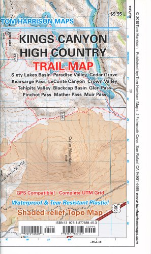
Map: 1 Pages (2010-01-01)
list price: US$9.95 -- used & new: US$9.15
(price subject to change: see help)
Asin: 1877689459
Average Customer Review: 5.0 out of 5 stars
Canada | United Kingdom | Germany | France | Japan
Editorial Review

Product Description
All maps have color-coded symbols and trails, mileages between trail junctions, latitude/longitude, UTM grids, contour lines, vegetation, and elevations at trail junctions.Tom Harrison Maps is famous for the beauty and accuracy of its maps. All maps printed on waterproof and tear resistent material ... Read more

Customer Reviews (1)

5-0 out of 5 stars Necessary Kings Canyon Map, waterproof, color topo (1:63k)
You can't have too many maps when in the backcountry, but if you had to have just one, this might be it. A color topo waterproof map at a scale useful for backpacking, but versatile enough for a myriad of trips. This covers most of the north part of Kings Canyon national park, from the Rae Lakes to Evolution Valley. ... Read more


  Back | 21-40 of 100 | Next 20
A  B  C  D  E  F  G  H  I  J  K  L  M  N  O  P  Q  R  S  T  U  V  W  X  Y  Z  

Prices listed on this site are subject to change without notice.
Questions on ordering or shipping? click here for help.

site stats