e99 Online Shopping Mall

Geometry.Net - the online learning center Help  
Home  - Basic M - Maps Reference (Books)

  Back | 81-100 of 100
A  B  C  D  E  F  G  H  I  J  K  L  M  N  O  P  Q  R  S  T  U  V  W  X  Y  Z  

click price to see details     click image to enlarge     click link to go to the store

$7.17
81. Laminated Copenhagen Map by Borch
$1.79
82. Map of the World/Map of United
$8.35
83. Laminated Portugal Map by Borch
$12.95
84. United States Classic Wall Map
$7.34
85. Laminated Rio de Janeiro Map by
$41.25
86. San Francisco in Maps & Views
$8.22
87. Central America Nelles Map (English,
$3.00
88. Streetwise San Francisco Map -
$4.48
89. Laminated New York City Streets
$7.42
90. Michelin Map USA Political14761(p,
$5.79
91. Tunisia Travel Map (Globetrotter
$6.24
92. South East Asia Map by Nelles
$12.50
93. World Decorator Wall Map (tubed)
$14.89
94. National Geographic Europe Classic
$31.44
95. Central America Map (Travel Reference
$4.74
96. Geneva popoutmap (Popout Map Geneva)
$4.95
97. Rand McNally Oakland/Berkeley
$21.99
98. Europe Political Wall Map (enlarged
$8.72
99. Northern England Road Map (A-Z
100. Northern Scotland, Orkney and

81. Laminated Copenhagen Map by Borch (English Edition)
by Borch
Map: 2 Pages (2007-03-01)
list price: US$8.95 -- used & new: US$7.17
(price subject to change: see help)
Asin: 3866093535
Average Customer Review: 4.5 out of 5 stars
Canada | United Kingdom | Germany | France | Japan
Editorial Review

Product Description
Folded street and travel map in color. Scale 1:11,000. Legend includes sights, museums, monuments, churches, synagogues, monasteries, castles, windmills, beaches, golf courses, parking, youth hostels, car ferries, airfields, subway, commuter train, camping sites, viewpoints, hotels. Includes inset map of Copenhagen Region (1:115,000), Sjaelland (1:700,000) and Copenhagen Public Transport. Climate charts show the average daily temperatures, humidity, hours of sunshine and precipitation for each month. ... Read more

Customer Reviews (3)

5-0 out of 5 stars Laminated Copenhagen Map by Borch (English Edition)
This map is excellent.It shows all points of interest and they are easily identified.It also folds nicely for travel.

5-0 out of 5 stars Great Map!
This map is outstanding! I almost could have gone without my guidebook with this map. It has all the Copenhagen highlights clearly marked (including Stroget, which most maps don't include), all the hotels (VERY helpful) clearly marked, all the train stations - inlcluding lines, etc. It's very easy to follow - it was a lifesaver for me! It was also nice that it was laminated, yet it wasn't plastic, so I could bend it to fit in my bag. I never thought I would be so impressed with a map!

4-0 out of 5 stars Be Aware
This is a nice laminated map of Copenhagen with all of the major attractions, streets, neighborhoods, hotels, etc notated.However, be forewarned, none of the map is in English. Of most note is that the attraction names are a little confusing because most guidebooks refer to their 'English' name versions.You can figure it out pretty easily with the use of a guidebook but don't expect anything on the map to be in English. ... Read more


82. Map of the World/Map of United States: 2-Sided Strip Map
Map: Pages (2000-09)
list price: US$2.95 -- used & new: US$1.79
(price subject to change: see help)
Asin: 0841694656
Canada | United Kingdom | Germany | France | Japan
Editorial Review

Product Description
Handy reference for any student. Our 8 1/2" x 11" full color maps are really two maps in one.3-hole punched to fit in a binder and laminated for durability, these beautiful maps feature the United States on one side, the World on the other. ... Read more


83. Laminated Portugal Map by Borch (English Edition)
by Borch
Map: 2 Pages (2007-03-01)
list price: US$10.95 -- used & new: US$8.35
(price subject to change: see help)
Asin: 3866097441
Canada | United Kingdom | Germany | France | Japan
Editorial Review

Product Description
Folded road and travel map in color. Scale 1:650,000. Distinguishes roads ranging from motorways to secondary roads (paved/unpaved). Legend includes road numbers, gas stations, restaurants, motels and restaurants, international airports, regional airports, passes, ferry lines, railways, national parks/nature preserves, sights, churches, beaches, castles, ruins, monasteries, viewpoints, museums, monuments, chapels, caves, antique/ancient sites, windmills, hospitals, golf courses, nature reserves, camping sites, waterfalls. Includes inset map of Lisbon and Region (1:110,000), Madeira & Porto Santo (1: 500,000), Azores (1: 2,000,000) and Algarve (1:300,000). Climate charts show the average daily temperatures, humidity, hours of sunshine and precipitation for each month. ... Read more


84. United States Classic Wall Map (tubed)
by National Geographic Maps
Map: Pages (2008-01-01)
list price: US$16.99 -- used & new: US$12.95
(price subject to change: see help)
Asin: 0792293185
Average Customer Review: 5.0 out of 5 stars
Canada | United Kingdom | Germany | France | Japan
Editorial Review

Product Description
Our most popular United States wall map. Features all 50 States with insets for Alaska and Hawaii. All major cities, transportation routes, State boundaries, National Parks, inland waterways, and mountain ranges are clearly displayed and labeled.
Scale size: 1:4,560,000
Tubed 30'' x 43'' ... Read more

Customer Reviews (2)

5-0 out of 5 stars Great Map of the U.S.
If your looking for a great looking, detailed, interesting U.S. map at just the right size then this map would be perfect for you. It's not too large yet includes many cities/towns in all states either well-known or not. It works out well for me becuase I find it fun to put small push pins in all the different cities I visited all around the country. The map also makes room for parts of Canada and Mexico. The key is very helpful and creative and the map also shows some of the more mountainous regions of the U.S. I have it hanging up right above my bed and I love just exploring the map and the states every night before I go to bed.

5-0 out of 5 stars US map, just what I wanted
I have a world map that I place markers of the places I have been and where I want to go next.I have traveled widely in the US and will frame this map and do the same.I love to travel and this will help me plan future trips and remember wonderful past trips. ... Read more


85. Laminated Rio de Janeiro Map by Borch
by Borch
Map: 2 Pages (2009-05-01)
list price: US$8.95 -- used & new: US$7.34
(price subject to change: see help)
Asin: 3866093144
Average Customer Review: 5.0 out of 5 stars
Canada | United Kingdom | Germany | France | Japan
Editorial Review

Product Description
Folded laminated street and travel map. Scale 1:13,000. Legend includes sights, museums, theatres, monuments, churches, chapels, monasteries, caves, beaches, cable railways, police stations, hospitals, golf courses, parking, bus stations, youth hostels, airports/airfields, national parks, nature reserves, viewpoints, subway, hotels, markets, shopping centers. Includes inset map of Rio de Janeiro public transport system, Corcovado, Quinta da Boa Vista, Ipanema/Leblon, Rio de Janeiro region, Rio de Janeiro and Sao Paulo region. Indexed. ... Read more

Customer Reviews (1)

5-0 out of 5 stars Rio Map
This is a great map. It is easy to fold and it is laminated so it is durable. It is easy to read. ... Read more


86. San Francisco in Maps & Views
by Sally B. Woodbridge
Hardcover: 176 Pages (2006-12-05)
list price: US$50.00 -- used & new: US$41.25
(price subject to change: see help)
Asin: 0847828719
Canada | United Kingdom | Germany | France | Japan
Editorial Review

Product Description
San Francisco in Maps documents the evolution of this fascinating and beautiful city through 72 breathtaking antiquarian maps, spanning four centuries.The gorgeous maps, many of them hand colored and rarely seen, bring alivethe history of this vibrant city. These maps range from the early days when they served to aid ship navigation of this unfamiliar and frequently foggy harbor; to the gold rush era in the mid-1800s, when the city's population grew exponentially and it saw the beginnings of neighborhoods like Chinatown, many of which persist to today; to the period before and after the great earthquake of 1906, which destroyed 80 percent of the city, and from out of which modern San Francisco emerged. ... Read more


87. Central America Nelles Map (English, French, Italian and German Edition)
by Nelles Verlag
Map: 2 Pages (2009-11-27)
list price: US$11.95 -- used & new: US$8.22
(price subject to change: see help)
Asin: 3865742106
Average Customer Review: 3.5 out of 5 stars
Canada | United Kingdom | Germany | France | Japan
Editorial Review

Product Description
Folded road & tourist map for the countries in Central America at 1:1,750,000 scale (Guatemala, Honduras, Nicaragua, El Salvador, Costa Rica, Panama). National parks, points of interest, and beaches are highlighted. Shaded-relief coloring clearly depicts topography. Insets include enlarged map of Costa Rica, central Antiqua, and Cancun. Yucatan Peninsula in Mexico also shown. Legend in 4 languages. ... Read more

Customer Reviews (3)

4-0 out of 5 stars Central America Road Map
Good driving map; lots of detail with major city insets.Coupled with more detailed city maps, it will be a valuable asset.

5-0 out of 5 stars map of central america
THIS MAP HAS NAMES OF TOWNS,MOUNTAIN RANGES,PEAKS,TELLS WHAT COUNTRY IS WHICH.THIS IS A EXCELLENT MAP

2-0 out of 5 stars Nelle's Maps, Central America
We are disappointed in this map.It is in several sections, front and back and not easily "put together".It seems to be very detailed and that is good.We also thought for the price of the map we would find a few notes of information about the area of which there is none.Also there is no index of the cities so that we could locate particular places. ... Read more


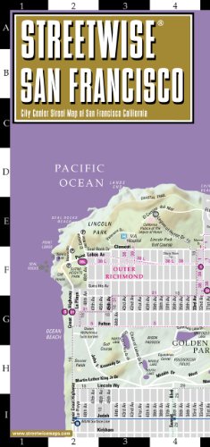
88. Streetwise San Francisco Map - Laminated City Center Street Map of San Francisco, California - Folding pocket size travel map with BART map, MUNI lines, bus routes
by Streetwise Maps
Map: 1 Pages (2009-03-01)
list price: US$6.95 -- used & new: US$3.00
(price subject to change: see help)
Asin: 0935039201
Average Customer Review: 4.5 out of 5 stars
Canada | United Kingdom | Germany | France | Japan
Editorial Review

Product Description
Folded, laminated, indexed, street map of San Francisco, showing all streets, parks, and public transportation at a scale of 1:30,000.Legend includes cultural sites, hotels, places of interest, and more.Also provides insets for Chinatown/Union Square and the regional Bay Area.Legend is in English. ... Read more

Customer Reviews (26)

5-0 out of 5 stars Excellent Map
Map holds up well due to lamination.Easy to read.Has all bus and transit lines.Have used it for over 4 months since I moved to San Francisco and it is still like new.

Highly recommend this map.

5-0 out of 5 stars Great Map for San Fran Newbie!
I walked everywhere (Fisherman's Wharf, Union Square, Chinatown, Embarcadero...) and this was the only map I needed. It's also the perfect size for a jean pocket or inside my coat.

5-0 out of 5 stars This is a fantastic map but beware..................
As always, the Streetwise map is fantastic and most useful throughout our recent visit to San Fran.We used the public transportation (MUNI) extensively and map's markings of all the bus/subway/trolley/cablecar lines were very helpful.Just beware that there are extensive MUNI changes coming on December 5th, 2009 (due to severe budget shortfall and subsequent cuts), so some of the descriptions will no longer be valid.I am sure that Streetwise will have new version out soon enough but this current version will be outdated very soon.Too bad, but it's not Streetwise's fault.

1-0 out of 5 stars Free maps that the SF hotels give out are just as good
And while the laminate would be nice in the rain, I guess, it makes it bulky to carry around.

4-0 out of 5 stars Works well except print too small
Used map while visiting San Francisco and it worked well.The print was too small for me to read even with my glasses.A family member read it.

The laminated map held up well. ... Read more


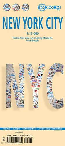
89. Laminated New York City Streets Map by Borch (English Edition)
by Borch
Map: 2 Pages (2010-04-07)
list price: US$8.95 -- used & new: US$4.48
(price subject to change: see help)
Asin: 3866093039
Average Customer Review: 4.5 out of 5 stars
Canada | United Kingdom | Germany | France | Japan
Editorial Review

Product Description
Folded street and travel map in color. Scale 1:15,000. Legend includes sights, museums, theatres, churches, synagogues, mosques, monuments, beaches, international/regional airports, bus stations, golf courses, Subway, nature reserve, hotels, shopping malls, markets. Includes inset map of Flushing Meadows (1:15,000), Five Boroughs (1:100,000) and Public Transport System. Map also includes list of top 30 sights and Midtown theatres. Climate charts show the average daily temperatures, humidity, hours of sunshine and precipitation for each month. ... Read more

Customer Reviews (2)

4-0 out of 5 stars Excellent, and worth it
Berndtson maps are jam packed full of information, yet easy to read and legible thanks to its clean modern layout and judicious use of colors and icons.On the main map, Manhattan is shown from downtown all the way up to 86th Street in 1:15000 scale with Subway stations pinpointed along with major landmarks, churches, and museums. The back is printed with 1:9000 scale focus maps of the financial district, and another one of midtown. There is also a 1:240000 map of the tri-state area.Easy to fold, and to store away, the maps are also thickly laminated allowing you to mark it up with a china pen, then wipe off the marks when you are done. rkchin. more map reviews at http://www.nychinatown.org/bookstore/index6.html

5-0 out of 5 stars The Best Map of NYC
I have been stranded too many times in foreign cities by inadequate maps. This series of maps simply does it right - no improvements needed.

The B & B Map is laminated and can easily be folded many different ways. It shows every street, no matter how small. It lists bus lines, subway lines, and even buildings, such as the Met Life building and the Mid-Manhattan Library. Another cool feature of the map is that major areas of Manhattan receive their own little section. There are zoomed-in maps of Midtown and the Financial District with amazing detail. Best of all, it is inexpensive. ... Read more


90. Michelin Map USA Political14761(p, Rolled) (Michelin Wall Maps)
by Michelin
Map: Pages (2007-01-01)
list price: US$10.95 -- used & new: US$7.42
(price subject to change: see help)
Asin: 2061011306
Average Customer Review: 5.0 out of 5 stars
Canada | United Kingdom | Germany | France | Japan
Editorial Review

Product Description
An annually updated political map of the USA. Beautifully colored. Rolled and tubed, with statistical information including population, surface area, state capital, (40 x 50). Highlights the flags of each state. Scale: 1/3,850,000 - 1cm = 38.5km - 1in = 55 miles. Legend/Key in three languages (English, French, Spanish) ... Read more

Customer Reviews (1)

5-0 out of 5 stars excellent
I ordered from overseas and the map arrived very quickly. It is a good value for the money and exactly what I wanted. ... Read more


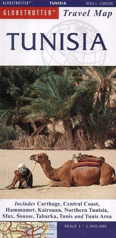
91. Tunisia Travel Map (Globetrotter Travel Map)
by Globetrotter
Map: 1 Pages (2001-09-28)
list price: US$8.95 -- used & new: US$5.79
(price subject to change: see help)
Asin: 1859747817
Canada | United Kingdom | Germany | France | Japan
Editorial Review

Product Description
This map is completely user-friendly.Designed forvisitors, this map contains practical and informative informationabout the area.More than just a map, it includes detailed streetplans of the major cities and large scale projections of populartourist destinations.There is also information provided on hotelsand national parks. ... Read more


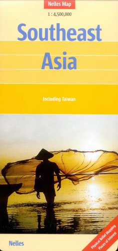
92. South East Asia Map by Nelles (Nelles Map) (English, French and German Edition)
by Nelles Verlag
Map: 2 Pages (2006-04-30)
list price: US$9.42 -- used & new: US$6.24
(price subject to change: see help)
Asin: 3865740650
Canada | United Kingdom | Germany | France | Japan
Editorial Review

Product Description
Folded road & tourist map of Southeast Asia at 1:4,500,000 scale. Overview map covers Thailand, Malaysia, Vietnam, Cambodia, Laos, most of Myanmar, Philippines, Indonesia, Hong Kong, Singapore and Taiwan. Places of interest are highlighted. Shaded-relief coloring clearly depicts topography. ... Read more


93. World Decorator Wall Map (tubed)
by National Geographic Maps
Map: Pages (2009-01-01)
list price: US$16.99 -- used & new: US$12.50
(price subject to change: see help)
Asin: 0792280865
Canada | United Kingdom | Germany | France | Japan
Editorial Review

Product Description
Bright colors and unparalleled detail bring the world alive! Enjoy the accuracy and beauty of this world map from the cartographers at National Geographic. Created with the Winkel Tripel projection, this map reduces the distortion of land masses as they near the poles. Insets show world vegetation cover and landforms. Scale: 1:36,384,000. 46 x 30 inches (approx). ... Read more


94. National Geographic Europe Classic Wall Map (tubed)
by National Geographic Maps
Map: Pages (2007-01-01)
list price: US$14.99 -- used & new: US$14.89
(price subject to change: see help)
Asin: 079228111X
Canada | United Kingdom | Germany | France | Japan
Editorial Review

Product Description
Our classic political map of Europe features country boundaries, place names, bodies of water, airports, major highways and roads, and much more. Scale size: 1:8,425,000. Tubed (24'' x 30''). ... Read more


95. Central America Map (Travel Reference Map)
by ITMB
Map: 2 Pages (2005-01)
list price: US$10.95 -- used & new: US$31.44
(price subject to change: see help)
Asin: 1553410521
Average Customer Review: 4.0 out of 5 stars
Canada | United Kingdom | Germany | France | Japan
Editorial Review

Product Description
Travel map of Central America in color. Color changes show elevations. Shows roads from paved Inter-American Highways to secondary and seasonal tracks, with distances in kilometers; railways; airports and landing grounds; ferry routes; active volcanoes; mountains with altitude in meters; national parks and protected areas; points of interest; mines, mining and prospecting areas; beaches; gas stations; more. With maps of Panama Canal area; environs of San Jose; San Andres Island. Includes index of places; facts in brief about each country; descriptions of geography and highlights. Main map scale 1:1,100,000. Distances in kilometers and miles. Printed on both sides. ... Read more

Customer Reviews (4)

3-0 out of 5 stars map of central america
Watch Video Here: http://www.amazon.com/review/R2KWB73HL6KIPQ this video shows you the difference between Nelles version and this product

5-0 out of 5 stars Does what it is meant to do
This map is a very good reference if you plan to travel all over Central America by land.It gives you the information you can expect a map to give.

3-0 out of 5 stars Nothing special
The map is just not detailed enough. But do give you a reasonably idea of the biggest roads in Central America. And there is no distance calculator between major city's.

5-0 out of 5 stars Best Map of Central America
When we took off in our RV to explore Central America we had this map, the AAA Map for Central America and several country maps from ITMB and others.Particularly in Honduras, we found the non-ITMB maps dangerously inaccurate.I wouldn't venture south without this map. ... Read more


96. Geneva popoutmap (Popout Map Geneva)
by COMPASS MAPSLTD.
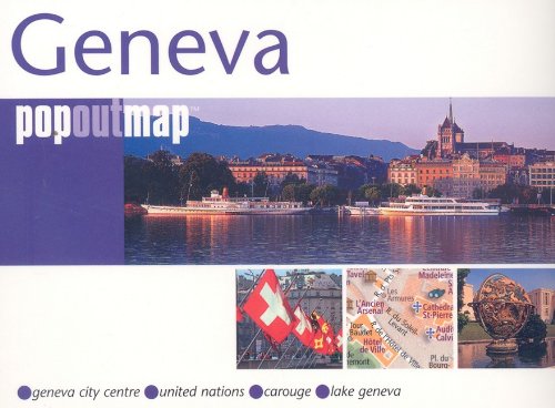
Map: 2 Pages (2008-10-01)
list price: US$6.95 -- used & new: US$4.74
(price subject to change: see help)
Asin: 1845876474
Canada | United Kingdom | Germany | France | Japan

97. Rand McNally Oakland/Berkeley Richmond: Local: California (Rand McNally Folded Map: Cities)
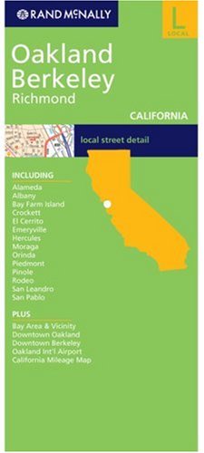
Map: 1 Pages (2003-09)
list price: US$4.95 -- used & new: US$4.95
(price subject to change: see help)
Asin: 0528996169
Average Customer Review: 4.0 out of 5 stars
Canada | United Kingdom | Germany | France | Japan
Editorial Review

Product Description
This detailed map of Oakland and Berkeley, California, including western Contra Costa County, has complete coverage for the cities and surrounding area, with an inset map for downtown, plus most major tourist and business districts. When you flip the map over, you will find a complete street index and a "city and vicinity" map of the entire metro area. ... Read more

Customer Reviews (1)

4-0 out of 5 stars Excellent basic city map
An excellent basic city map for Oakland & Berkeley, which I used when I was apartment hunting before starting grad school at Cal. It was pretty easy to read, and the lamination was nice. It was handy that most of Berkeley's rectangle fit on one of the panels.

This was a VERY smart purchase, much better than trying to computer-map everything ... or ask directions. I could use it on the fly.

If there were to be any improvements:
- I'd make the BART stations and tracks a little more prominent. That's how I got around, so every address to me was "8 blocks east of the BART," etc. I eventually circled them in ink for quick reference.
- It would be handy to have a couple other folds that included the rest of North Berkeley and Albany, but that's OK.

Overall, it was great. Most of the maps and guides are completely SF-centric, seemingly geared for tourism, so it was great to have something practical for the East Bay (tho, if you need the farther-out suburbs, this won't be your map ... it really is mostly just Oakland and Berkeley). It was worth it to me to order online, because finding a good city map when you really need one at, say, a gas station or drug store can be a gamble. ... Read more


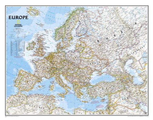
98. Europe Political Wall Map (enlarged & tubed)
by National Geographic Maps
Map: Pages (2007-01-01)
list price: US$24.99 -- used & new: US$21.99
(price subject to change: see help)
Asin: 0792281136
Canada | United Kingdom | Germany | France | Japan
Editorial Review

Product Description
Our classic political map of Europe features country boundaries, place names, bodies of water, airports, major highways and roads, and much more. Scale size: 1:5,471,000. Enlarged and tubed (46'' x 36''). ... Read more


99. Northern England Road Map (A-Z Road Map)
by Geographers' A-Z Map Company
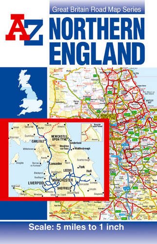
Map: Pages (2010-04-14)
-- used & new: US$8.72
(price subject to change: see help)
Asin: 1843487195
Canada | United Kingdom | Germany | France | Japan

100. Northern Scotland, Orkney and Shetland (OS Travel Map - Road Map)
by Ordnance Survey
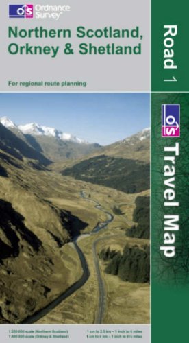
Map: Pages (2007-03-12)
list price: US$12.95
Isbn: 0319230872
Average Customer Review: 5.0 out of 5 stars
Canada | United Kingdom | Germany | France | Japan
Editorial Review

Product Description
The eight regional Road Maps of the OS Travel Map series show the road network of Great Britain plus tourist information and places of interest as well as a place names index. All motorways, A roads and B roads are marked, making route planning simple. ... Read more

Customer Reviews (1)

5-0 out of 5 stars The North of Scotland...
Ordnance Survey publishes maps of the United Kingdom in a variety of scales.The Road Traveler Series provides regional coverage at a 1:250,000 scale.There are a total of eight sheets for the whole of Britain.Road Travel Map #1 is "Northern Scotland, Orkney & Shetland."

The coverage of Map#1 begins a line across central Scotland marked by Montrose on the North Sea, Pitlochry on the A9 north of Perth, and Balanchulish near Glen Coe in western Scotland.Map#1 covers all of Northern Scotland except Skye and the Outer Hebrides.It includes the Orkney Islanda and the Shetland Islands in separate map insets. The scale and multicolored presentation permit road travel planning and navigation between the principal population centers, and an appreciation of the terrain.The map includes a handy place names index to locate any of the numerous small towns and villages to be found in northern Scotland.Map symbology is sufficiently detailed to highlight points of tourist interest such as castles, vistas, train stations and camping grounds.The map does not provide sufficient detail for cross-country or over water navigation.There are other Ordnance Survey products for those needs.

"Ordnance Survey Road Travel Map #1: Northern Scotland, Orkney and Shetland" is very highly recommended to travelers and others needing a large scale map for planning and navigation purposes. ... Read more


  Back | 81-100 of 100
A  B  C  D  E  F  G  H  I  J  K  L  M  N  O  P  Q  R  S  T  U  V  W  X  Y  Z  

Prices listed on this site are subject to change without notice.
Questions on ordering or shipping? click here for help.

site stats