e99 Online Shopping Mall

Geometry.Net - the online learning center Help  
Home  - Basic M - Michigan Maps (Books)

  Back | 81-100 of 100
A  B  C  D  E  F  G  H  I  J  K  L  M  N  O  P  Q  R  S  T  U  V  W  X  Y  Z  

click price to see details     click image to enlarge     click link to go to the store

 
81. Notes and comments on the composition
$29.95
82. Family Maps of Ionia County, Michigan,
$31.95
83. Family Maps of Livingston County,
$32.95
84. Family Maps of Newaygo County,
$3.95
85. Michigan: Road Map (Travelvision
$32.95
86. Family Maps of Lenawee County,
$32.95
87. Family Maps of Jackson County,
88. Rand McNally Michigan EasyFinder
$31.95
89. Family Maps of Luce County, Michigan,
 
$67.94
90. Michigan Bibliography. a Partial
$4.95
91. Rand McNally Michigan: Oakland
$29.95
92. Family Maps of Gratiot County,
$31.95
93. Family Maps of Berrien County,
$32.95
94. Family Maps of Washtenaw County,
$29.95
95. Family Maps of Shiawassee County,
 
96. Rand McNally Easyfinder Michigan
 
$15.77
97. Michigan (State Fold Map)
 
$9.95
98. MAP: Michigan: 1873/74 [reproduction
99. Aeromagnetic Map of Parts of Marquette,
$38.95
100. Family Maps of Ontonagon County,

81. Notes and comments on the composition of terrestrial and celestial maps (1772) (Michigan geographical publication)
by Johann Heinrich Lambert
 Unknown Binding: 125 Pages (1972)

Asin: B0006CASR2
Canada | United Kingdom | Germany | France | Japan

82. Family Maps of Ionia County, Michigan, Deluxe Edition
by Gregory A. Boyd
Paperback: 218 Pages (2010-07-16)
-- used & new: US$29.95
(price subject to change: see help)
Asin: 1420313045
Canada | United Kingdom | Germany | France | Japan
Editorial Review

Product Description
Locating original landowners in maps has never been an easy task--until now. This volume in the Family Maps series contains newly created maps of original landowners (patent maps) in what is now Ionia County, Michigan, gleaned from the indexes of the U.S. Bureau of Land Management. But it offers much more than that. For each township in the county, there are two additional maps accompanying the patent map: a road map and a map showing waterways, railroads, and both modern and many historical city-centers and cemeteries.

Included are indexes to help you locate what you are looking for, whether you know a person's name, a last name, a place-name, or a cemetery. The combination of maps and indexes are designed to aid researchers of American history or genealogy to explore frontier neighborhoods, examine family migrations, locate hard-to-find cemeteries and towns, as well as locate land based on legal descriptions found in old documents or deeds.

The patent-maps are essentially plat maps but instead of depicting owners for a particular year, these maps show original landowners, no matter when the transfer from the federal government was completed. Dates of patents typically begin near the time of statehood and run into the early 1900s.

This high-quality paperback book from the critically acclaimed Family Maps series measures 8-3/8" wide x 10-5/8" high. ... Read more


83. Family Maps of Livingston County, Michigan, Deluxe Edition
by Gregory A. Boyd
Paperback: 262 Pages (2010-07-16)
-- used & new: US$31.95
(price subject to change: see help)
Asin: 1420313932
Canada | United Kingdom | Germany | France | Japan
Editorial Review

Product Description
Locating original landowners in maps has never been an easy task--until now. This volume in the Family Maps series contains newly created maps of original landowners (patent maps) in what is now Livingston County, Michigan, gleaned from the indexes of the U.S. Bureau of Land Management. But it offers much more than that. For each township in the county, there are two additional maps accompanying the patent map: a road map and a map showing waterways, railroads, and both modern and many historical city-centers and cemeteries.

Included are indexes to help you locate what you are looking for, whether you know a person's name, a last name, a place-name, or a cemetery. The combination of maps and indexes are designed to aid researchers of American history or genealogy to explore frontier neighborhoods, examine family migrations, locate hard-to-find cemeteries and towns, as well as locate land based on legal descriptions found in old documents or deeds.

The patent-maps are essentially plat maps but instead of depicting owners for a particular year, these maps show original landowners, no matter when the transfer from the federal government was completed. Dates of patents typically begin near the time of statehood and run into the early 1900s.

This high-quality paperback book from the critically acclaimed Family Maps series measures 8-3/8" wide x 10-5/8" high. ... Read more


84. Family Maps of Newaygo County, Michigan, Deluxe Edition
by Gregory A. Boyd
Paperback: 326 Pages (2010-07-16)
-- used & new: US$32.95
(price subject to change: see help)
Asin: 1420314963
Canada | United Kingdom | Germany | France | Japan
Editorial Review

Product Description
Locating original landowners in maps has never been an easy task--until now. This volume in the Family Maps series contains newly created maps of original landowners (patent maps) in what is now Newaygo County, Michigan, gleaned from the indexes of the U.S. Bureau of Land Management. But it offers much more than that. For each township in the county, there are two additional maps accompanying the patent map: a road map and a map showing waterways, railroads, and both modern and many historical city-centers and cemeteries.

Included are indexes to help you locate what you are looking for, whether you know a person's name, a last name, a place-name, or a cemetery. The combination of maps and indexes are designed to aid researchers of American history or genealogy to explore frontier neighborhoods, examine family migrations, locate hard-to-find cemeteries and towns, as well as locate land based on legal descriptions found in old documents or deeds.

The patent-maps are essentially plat maps but instead of depicting owners for a particular year, these maps show original landowners, no matter when the transfer from the federal government was completed. Dates of patents typically begin near the time of statehood and run into the early 1900s.

This high-quality paperback book from the critically acclaimed Family Maps series measures 8-3/8" wide x 10-5/8" high. ... Read more


85. Michigan: Road Map (Travelvision State Maps)
Map: Pages (1997-06)
list price: US$3.95 -- used & new: US$3.95
(price subject to change: see help)
Asin: 0841650659
Canada | United Kingdom | Germany | France | Japan
Editorial Review

Product Description
This Michigan map features points of interest, airports, camping facilities, parks, selected local attractions and more. State maps feature insets of major cities. Our city map offers additional detail, with depiction of streets on one side and a large scale metro area road map on the other. ... Read more


86. Family Maps of Lenawee County, Michigan, Deluxe Edition
by Gregory A. Boyd
Paperback: 332 Pages (2010-07-16)
-- used & new: US$32.95
(price subject to change: see help)
Asin: 1420312707
Canada | United Kingdom | Germany | France | Japan
Editorial Review

Product Description
Locating original landowners in maps has never been an easy task--until now. This volume in the Family Maps series contains newly created maps of original landowners (patent maps) in what is now Lenawee County, Michigan, gleaned from the indexes of the U.S. Bureau of Land Management. But it offers much more than that. For each township in the county, there are two additional maps accompanying the patent map: a road map and a map showing waterways, railroads, and both modern and many historical city-centers and cemeteries.

Included are indexes to help you locate what you are looking for, whether you know a person's name, a last name, a place-name, or a cemetery. The combination of maps and indexes are designed to aid researchers of American history or genealogy to explore frontier neighborhoods, examine family migrations, locate hard-to-find cemeteries and towns, as well as locate land based on legal descriptions found in old documents or deeds.

The patent-maps are essentially plat maps but instead of depicting owners for a particular year, these maps show original landowners, no matter when the transfer from the federal government was completed. Dates of patents typically begin near the time of statehood and run into the early 1900s.

This high-quality paperback book from the critically acclaimed Family Maps series measures 8-3/8" wide x 10-5/8" high. ... Read more


87. Family Maps of Jackson County, Michigan, Deluxe Edition
by Gregory A. Boyd
Paperback: 326 Pages (2010-07-16)
-- used & new: US$32.95
(price subject to change: see help)
Asin: 1420315536
Canada | United Kingdom | Germany | France | Japan
Editorial Review

Product Description
Locating original landowners in maps has never been an easy task--until now. This volume in the Family Maps series contains newly created maps of original landowners (patent maps) in what is now Jackson County, Michigan, gleaned from the indexes of the U.S. Bureau of Land Management. But it offers much more than that. For each township in the county, there are two additional maps accompanying the patent map: a road map and a map showing waterways, railroads, and both modern and many historical city-centers and cemeteries.

Included are indexes to help you locate what you are looking for, whether you know a person's name, a last name, a place-name, or a cemetery. The combination of maps and indexes are designed to aid researchers of American history or genealogy to explore frontier neighborhoods, examine family migrations, locate hard-to-find cemeteries and towns, as well as locate land based on legal descriptions found in old documents or deeds.

The patent-maps are essentially plat maps but instead of depicting owners for a particular year, these maps show original landowners, no matter when the transfer from the federal government was completed. Dates of patents typically begin near the time of statehood and run into the early 1900s.

This high-quality paperback book from the critically acclaimed Family Maps series measures 8-3/8" wide x 10-5/8" high. ... Read more


88. Rand McNally Michigan EasyFinder Map
by Rand McNally and Company
Paperback: Pages (1999-06)
list price: US$6.95
Isbn: 0528983008
Canada | United Kingdom | Germany | France | Japan

89. Family Maps of Luce County, Michigan, Deluxe Edition
by Gregory A. Boyd
Paperback: 282 Pages (2010-07-16)
-- used & new: US$31.95
(price subject to change: see help)
Asin: 1420312847
Canada | United Kingdom | Germany | France | Japan
Editorial Review

Product Description
Locating original landowners in maps has never been an easy task--until now. This volume in the Family Maps series contains newly created maps of original landowners (patent maps) in what is now Luce County, Michigan, gleaned from the indexes of the U.S. Bureau of Land Management. But it offers much more than that. For each township in the county, there are two additional maps accompanying the patent map: a road map and a map showing waterways, railroads, and both modern and many historical city-centers and cemeteries.

Included are indexes to help you locate what you are looking for, whether you know a person's name, a last name, a place-name, or a cemetery. The combination of maps and indexes are designed to aid researchers of American history or genealogy to explore frontier neighborhoods, examine family migrations, locate hard-to-find cemeteries and towns, as well as locate land based on legal descriptions found in old documents or deeds.

The patent-maps are essentially plat maps but instead of depicting owners for a particular year, these maps show original landowners, no matter when the transfer from the federal government was completed. Dates of patents typically begin near the time of statehood and run into the early 1900s.

This high-quality paperback book from the critically acclaimed Family Maps series measures 8-3/8" wide x 10-5/8" high. ... Read more


90. Michigan Bibliography. a Partial Catalogue of Books, Maps, Manuscripts and Miscellaneous Materials Relating to the Resources, Development and
by Michigan Historical Commission
 Paperback: 626 Pages (2010-01-06)
list price: US$67.94 -- used & new: US$67.94
(price subject to change: see help)
Asin: 1152418505
Canada | United Kingdom | Germany | France | Japan
Editorial Review

Product Description
Title: Michigan Bibliography. a Partial Catalogue of Books, Maps, Manuscripts and Miscellaneous Materials Relating to the Resources, Development and History of Michigan From Earliest Times to July 1, 1917; Together With Citation of Libraries in Which the Materials May Be Consulted, and a Complete Analytical Index by Subject and AuthorVolume: 1Publisher: Lansing : Michigan Historical CommissionPublication date: 1921Subjects: Michigan -- BibliographyNotes: This is an OCR reprint. There may be numerous typos or missing text. There are no illustrations or indexes.When you buy the General Books edition of this book you get free trial access to Million-Books.com where you can select from more than a million books for free. You can also preview the book there. ... Read more


91. Rand McNally Michigan: Oakland County North : Local (Rand McNally City Maps)
by Rand McNally and Company
Map: 1 Pages (2002-03)
list price: US$4.95 -- used & new: US$4.95
(price subject to change: see help)
Asin: 0528992937
Canada | United Kingdom | Germany | France | Japan
Editorial Review

Product Description
This detailed map of northern Oakland County, Michigan has complete coverage for the area, with inset maps for towns, plus most major tourist and business districts. When you flip the map over, you will find a complete street index and a "city and vicinity" map of the entire metro area. ... Read more


92. Family Maps of Gratiot County, Michigan, Deluxe Edition
by Gregory A. Boyd
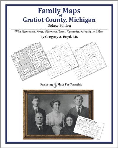
Paperback: 220 Pages (2010-07-16)
-- used & new: US$29.95
(price subject to change: see help)
Asin: 1420312499
Canada | United Kingdom | Germany | France | Japan
Editorial Review

Product Description
Locating original landowners in maps has never been an easy task--until now. This volume in the Family Maps series contains newly created maps of original landowners (patent maps) in what is now Gratiot County, Michigan, gleaned from the indexes of the U.S. Bureau of Land Management. But it offers much more than that. For each township in the county, there are two additional maps accompanying the patent map: a road map and a map showing waterways, railroads, and both modern and many historical city-centers and cemeteries.

Included are indexes to help you locate what you are looking for, whether you know a person's name, a last name, a place-name, or a cemetery. The combination of maps and indexes are designed to aid researchers of American history or genealogy to explore frontier neighborhoods, examine family migrations, locate hard-to-find cemeteries and towns, as well as locate land based on legal descriptions found in old documents or deeds.

The patent-maps are essentially plat maps but instead of depicting owners for a particular year, these maps show original landowners, no matter when the transfer from the federal government was completed. Dates of patents typically begin near the time of statehood and run into the early 1900s.

This high-quality paperback book from the critically acclaimed Family Maps series measures 8-3/8" wide x 10-5/8" high. ... Read more


93. Family Maps of Berrien County, Michigan, Deluxe Edition
by Gregory A. Boyd
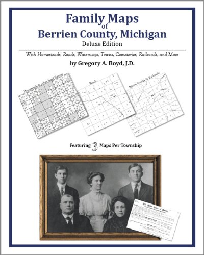
Paperback: 266 Pages (2010-07-16)
-- used & new: US$31.95
(price subject to change: see help)
Asin: 1420313479
Canada | United Kingdom | Germany | France | Japan
Editorial Review

Product Description
Locating original landowners in maps has never been an easy task--until now. This volume in the Family Maps series contains newly created maps of original landowners (patent maps) in what is now Berrien County, Michigan, gleaned from the indexes of the U.S. Bureau of Land Management. But it offers much more than that. For each township in the county, there are two additional maps accompanying the patent map: a road map and a map showing waterways, railroads, and both modern and many historical city-centers and cemeteries.

Included are indexes to help you locate what you are looking for, whether you know a person's name, a last name, a place-name, or a cemetery. The combination of maps and indexes are designed to aid researchers of American history or genealogy to explore frontier neighborhoods, examine family migrations, locate hard-to-find cemeteries and towns, as well as locate land based on legal descriptions found in old documents or deeds.

The patent-maps are essentially plat maps but instead of depicting owners for a particular year, these maps show original landowners, no matter when the transfer from the federal government was completed. Dates of patents typically begin near the time of statehood and run into the early 1900s.

This high-quality paperback book from the critically acclaimed Family Maps series measures 8-3/8" wide x 10-5/8" high. ... Read more


94. Family Maps of Washtenaw County, Michigan, Deluxe Edition
by Gregory A. Boyd
Paperback: 322 Pages (2010-07-16)
-- used & new: US$32.95
(price subject to change: see help)
Asin: 1420312111
Canada | United Kingdom | Germany | France | Japan
Editorial Review

Product Description
Locating original landowners in maps has never been an easy task--until now. This volume in the Family Maps series contains newly created maps of original landowners (patent maps) in what is now Washtenaw County, Michigan, gleaned from the indexes of the U.S. Bureau of Land Management. But it offers much more than that. For each township in the county, there are two additional maps accompanying the patent map: a road map and a map showing waterways, railroads, and both modern and many historical city-centers and cemeteries.

Included are indexes to help you locate what you are looking for, whether you know a person's name, a last name, a place-name, or a cemetery. The combination of maps and indexes are designed to aid researchers of American history or genealogy to explore frontier neighborhoods, examine family migrations, locate hard-to-find cemeteries and towns, as well as locate land based on legal descriptions found in old documents or deeds.

The patent-maps are essentially plat maps but instead of depicting owners for a particular year, these maps show original landowners, no matter when the transfer from the federal government was completed. Dates of patents typically begin near the time of statehood and run into the early 1900s.

This high-quality paperback book from the critically acclaimed Family Maps series measures 8-3/8" wide x 10-5/8" high. ... Read more


95. Family Maps of Shiawassee County, Michigan, Deluxe Edition
by Gregory A. Boyd
Paperback: 214 Pages (2010-07-16)
-- used & new: US$29.95
(price subject to change: see help)
Asin: 1420314106
Canada | United Kingdom | Germany | France | Japan
Editorial Review

Product Description
Locating original landowners in maps has never been an easy task--until now. This volume in the Family Maps series contains newly created maps of original landowners (patent maps) in what is now Shiawassee County, Michigan, gleaned from the indexes of the U.S. Bureau of Land Management. But it offers much more than that. For each township in the county, there are two additional maps accompanying the patent map: a road map and a map showing waterways, railroads, and both modern and many historical city-centers and cemeteries.

Included are indexes to help you locate what you are looking for, whether you know a person's name, a last name, a place-name, or a cemetery. The combination of maps and indexes are designed to aid researchers of American history or genealogy to explore frontier neighborhoods, examine family migrations, locate hard-to-find cemeteries and towns, as well as locate land based on legal descriptions found in old documents or deeds.

The patent-maps are essentially plat maps but instead of depicting owners for a particular year, these maps show original landowners, no matter when the transfer from the federal government was completed. Dates of patents typically begin near the time of statehood and run into the early 1900s.

This high-quality paperback book from the critically acclaimed Family Maps series measures 8-3/8" wide x 10-5/8" high. ... Read more


96. Rand McNally Easyfinder Michigan Map
by Rand McNally and Company
 Paperback: Pages (1995-08)
list price: US$4.95
Isbn: 0528970585
Canada | United Kingdom | Germany | France | Japan

97. Michigan (State Fold Map)
 Paperback: Pages (2001-01)
list price: US$4.95 -- used & new: US$15.77
(price subject to change: see help)
Asin: 0762551259
Canada | United Kingdom | Germany | France | Japan

98. MAP: Michigan: 1873/74 [reproduction of original]
by Asher and Adams
 Map: Pages (2008-01-01)
-- used & new: US$9.95
(price subject to change: see help)
Asin: B003DD29LY
Canada | United Kingdom | Germany | France | Japan

99. Aeromagnetic Map of Parts of Marquette, Dickinson, Baraga, Alger, and Schoolcraft Counties, Michigan, and its Geologic Interpretation: 3 maps, plus 10-Page Booklet
by J.E. Case and J.E. Gair
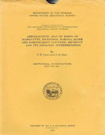
Map: Pages (1965)

Asin: B002QM78IW
Canada | United Kingdom | Germany | France | Japan

100. Family Maps of Ontonagon County, Michigan, Deluxe Edition
by Gregory A. Boyd
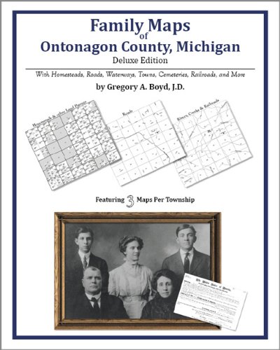
Paperback: 474 Pages (2010-07-16)
-- used & new: US$38.95
(price subject to change: see help)
Asin: 1420315188
Canada | United Kingdom | Germany | France | Japan
Editorial Review

Product Description
Locating original landowners in maps has never been an easy task--until now. This volume in the Family Maps series contains newly created maps of original landowners (patent maps) in what is now Ontonagon County, Michigan, gleaned from the indexes of the U.S. Bureau of Land Management. But it offers much more than that. For each township in the county, there are two additional maps accompanying the patent map: a road map and a map showing waterways, railroads, and both modern and many historical city-centers and cemeteries.

Included are indexes to help you locate what you are looking for, whether you know a person's name, a last name, a place-name, or a cemetery. The combination of maps and indexes are designed to aid researchers of American history or genealogy to explore frontier neighborhoods, examine family migrations, locate hard-to-find cemeteries and towns, as well as locate land based on legal descriptions found in old documents or deeds.

The patent-maps are essentially plat maps but instead of depicting owners for a particular year, these maps show original landowners, no matter when the transfer from the federal government was completed. Dates of patents typically begin near the time of statehood and run into the early 1900s.

This high-quality paperback book from the critically acclaimed Family Maps series measures 8-3/8" wide x 10-5/8" high. ... Read more


  Back | 81-100 of 100
A  B  C  D  E  F  G  H  I  J  K  L  M  N  O  P  Q  R  S  T  U  V  W  X  Y  Z  

Prices listed on this site are subject to change without notice.
Questions on ordering or shipping? click here for help.

site stats