e99 Online Shopping Mall

Geometry.Net - the online learning center Help  
Home  - Basic O - Ohio Maps (Books)

  Back | 41-60 of 100 | Next 20
A  B  C  D  E  F  G  H  I  J  K  L  M  N  O  P  Q  R  S  T  U  V  W  X  Y  Z  

click price to see details     click image to enlarge     click link to go to the store

$5.95
41. Rand McNally FabMap: Ohio State
 
42. Combination Atlas Map of Trumbull
 
43. Combination Atlas Map of Summit
 
44. Combination Atlas Map of Seneca
$5.47
45. Rand McNally Streets of Columbus,
 
46. Combination atlas map of Warren
47. Ohio: Atlas of Historical County
$26.95
48. Family Maps of Allen County, Ohio,
$29.95
49. Family Maps of Seneca County,
$3.72
50. Rand McNally Streets of Dayton,
$2.73
51. 50 Hikes in Ohio: Day Hikes and
$5.38
52. Rand Mcnally Easyfinder Map: Cleveland
 
53. Soil survey of Trumbull County,
 
$32.24
54. Northern Ohio Fishing Map Guide
$3.95
55. Rand McNally Butler County, Ohio
 
56. County Map of Ohio, and Indiana.
$3.95
57. Champion Maps Mentor / Eastlake
$31.99
58. County reports and maps. Ohio,
$29.95
59. Family Maps of Guernsey County,
 
60. MAP: 'Map of Highland, Ross &

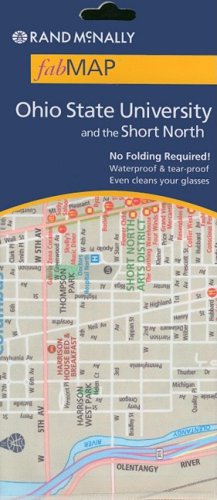
41. Rand McNally FabMap: Ohio State University and the Short North
Map: 1 Pages (2008-05-31)
list price: US$5.95 -- used & new: US$5.95
(price subject to change: see help)
Asin: 0528871757
Canada | United Kingdom | Germany | France | Japan

42. Combination Atlas Map of Trumbull County Ohio
by L. H. Everts
 Hardcover: 121 Pages (1874)

Asin: B0044EO5RM
Canada | United Kingdom | Germany | France | Japan
Editorial Review

Product Description
contains hand-colored maps and plats of cities, also many lithographic views of homes, farmsteads and businesses ... Read more


43. Combination Atlas Map of Summit County, Ohio
by Mead & Moffett Tackabury
 Hardcover: 133 Pages (1874)

Asin: B0044M6TEQ
Canada | United Kingdom | Germany | France | Japan
Editorial Review

Product Description
Folio size atlas with many maps of the towns, cities and townships,all hand colored. Also numerous views of homes, farms, and residents of this county. ... Read more


44. Combination Atlas Map of Seneca County, Ohio
by D. J. Stewart
 Hardcover: 69 Pages (1874)

Asin: B0044F5L6A
Canada | United Kingdom | Germany | France | Japan
Editorial Review

Product Description
Hand colored maps of the towns and townships, lithographic views of public buildings, farms, and homesteads. ... Read more


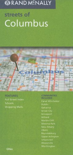
45. Rand McNally Streets of Columbus, Ohio (Rand McNally Streets Of...)
Map: Pages (2010-02)
list price: US$5.99 -- used & new: US$5.47
(price subject to change: see help)
Asin: 0528879723
Canada | United Kingdom | Germany | France | Japan

46. Combination atlas map of Warren County, Ohio: Compiled, drawn and published from personal examinations
by L. H Everts
 Unknown Binding: 200 Pages (1974)

Asin: B0006WJRC4
Canada | United Kingdom | Germany | France | Japan

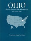
47. Ohio: Atlas of Historical County Boundaries
Hardcover: 311 Pages (1998-01)
list price: US$130.00
Isbn: 0133663949
Average Customer Review: 4.0 out of 5 stars
Canada | United Kingdom | Germany | France | Japan

Customer Reviews (1)

4-0 out of 5 stars Alabama : Atlas of Historical County Boundaries
If you're interested in this sort of thing as I am this book could be of great value however the price is unreal. I have a CD that does much the same for the entire country at a third the price of one state however this book is MUCH more accurate and shows county boundaries that only occured for as little as three days. The CD is also easier to use. That said I'll likely ask for the book as one of those Christmas presents I wouldn't buy for myself. ... Read more


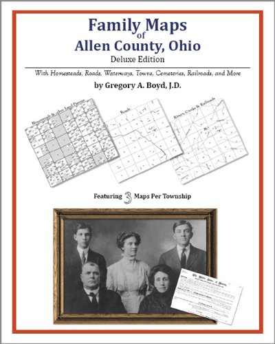
48. Family Maps of Allen County, Ohio, Deluxe Edition
by Gregory A. Boyd
Paperback: 166 Pages (2010-07-16)
-- used & new: US$26.95
(price subject to change: see help)
Asin: 1420315153
Canada | United Kingdom | Germany | France | Japan
Editorial Review

Product Description
Locating original landowners in maps has never been an easy task--until now. This volume in the Family Maps series contains newly created maps of original landowners (patent maps) in what is now Allen County, Ohio, gleaned from the indexes of the U.S. Bureau of Land Management. But it offers much more than that. For each township in the county, there are two additional maps accompanying the patent map: a road map and a map showing waterways, railroads, and both modern and many historical city-centers and cemeteries.

Included are indexes to help you locate what you are looking for, whether you know a person's name, a last name, a place-name, or a cemetery. The combination of maps and indexes are designed to aid researchers of American history or genealogy to explore frontier neighborhoods, examine family migrations, locate hard-to-find cemeteries and towns, as well as locate land based on legal descriptions found in old documents or deeds.

The patent-maps are essentially plat maps but instead of depicting owners for a particular year, these maps show original landowners, no matter when the transfer from the federal government was completed. Dates of patents typically begin near the time of statehood and run into the early 1900s.

This high-quality paperback book from the critically acclaimed Family Maps series measures 8-3/8" wide x 10-5/8" high. ... Read more


49. Family Maps of Seneca County, Ohio, Deluxe Edition
by Gregory A. Boyd
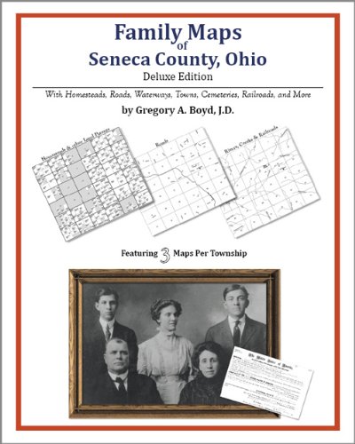
Paperback: 240 Pages (2010-07-16)
-- used & new: US$29.95
(price subject to change: see help)
Asin: 1420312375
Canada | United Kingdom | Germany | France | Japan
Editorial Review

Product Description
Locating original landowners in maps has never been an easy task--until now. This volume in the Family Maps series contains newly created maps of original landowners (patent maps) in what is now Seneca County, Ohio, gleaned from the indexes of the U.S. Bureau of Land Management. But it offers much more than that. For each township in the county, there are two additional maps accompanying the patent map: a road map and a map showing waterways, railroads, and both modern and many historical city-centers and cemeteries.

Included are indexes to help you locate what you are looking for, whether you know a person's name, a last name, a place-name, or a cemetery. The combination of maps and indexes are designed to aid researchers of American history or genealogy to explore frontier neighborhoods, examine family migrations, locate hard-to-find cemeteries and towns, as well as locate land based on legal descriptions found in old documents or deeds.

The patent-maps are essentially plat maps but instead of depicting owners for a particular year, these maps show original landowners, no matter when the transfer from the federal government was completed. Dates of patents typically begin near the time of statehood and run into the early 1900s.

This high-quality paperback book from the critically acclaimed Family Maps series measures 8-3/8" wide x 10-5/8" high. ... Read more


50. Rand McNally Streets of Dayton, Ohio (Rand McNally Streets Of...)
Map: Pages (2010-02)
list price: US$5.99 -- used & new: US$3.72
(price subject to change: see help)
Asin: 0528879774
Canada | United Kingdom | Germany | France | Japan

51. 50 Hikes in Ohio: Day Hikes and Backpacks Throughout the Buckeye State (Fifty Hikes Series)
by Ralph Ramey
Paperback: 271 Pages (1997-10)
list price: US$16.95 -- used & new: US$2.73
(price subject to change: see help)
Asin: 0881504017
Average Customer Review: 4.0 out of 5 stars
Canada | United Kingdom | Germany | France | Japan
Editorial Review

Product Description
A lot of hiking can be found in a state as diverse and as committed to preserving its natural heritage as Ohio. In an extensive system of state parks, wildlife areas, natural preserves, and historic sites - not to mention the state-long Buckeye Trail - you will find trails that follow old wagon roads, primitive game paths, and abandoned railroad beds. The 50 hikes in this guide are grouped geographically and range over the entire state, from the rugged Appalachian plateau of Shawnee Forest in the south to the Ottawa Wildlife Refuge on the shores of Lake Erie. Even if you live in one of Ohio's major metropolitan areas, there's a hike just a short drive away. There are outings for every ability, from easy walks to rigorous overnight backpacks. Each hike write-up includes: trail access and parking information; route distance and hiking time; a contour map; and mile-by-mile directions. In addition, the author's commentary on plants and animals, geology and local history makes each hike a way to learn something new about a diverse and compelling region. ... Read more

Customer Reviews (5)

3-0 out of 5 stars Needs Updating
This book gives a great overview of the hikes available in Ohio. However, I found this book to be very disappointing. The directions to the trailheads are often unclear and some of the features of the hikes have changed since the book was written (i.e. big trees have gone down). In addition, important information is lacking. For example, the fact that dogs are not allowed on many of the Ohio metro-park trails is not mentioned in the book. I think this book was probably excellent when first published, but times have changed and this book needs to be updated.

2-0 out of 5 stars Confusing and Poorly Written
I give this hiking guide two stars because it has given me a lot of places to go hiking I would never have known about otherwise.

However, as far as actually using the guide to hike the trails, its virtually impossible.Ramey leaves out major forks and landmarks and does not tell you near enough about the trail's conditions or difficulty level.For example, today I tried to follow his route through the Glen Helen Nature Preserve.First, he tells you to start outside the museum at the stone terrace.There are two forks-one a major route down the stone steps that probably 99% of the park visitors take.The route he actually wants you to take is a small, side path that's almost overgrown and not as well maintained as the main trail.He never mentioned that it wasn't the main trail, so I went 1/2 a mile down that one before realizing I was wrong and had to climb the extremely steep stone steps all the way back up to the museum and ask for help.Then, this trail that he was talking about is pretty difficult and dangerous-portions go along a very narrow and rocky ridge where it would be easy to fall, and like I said before this is a rarely used trail.If you did run into trouble, it would probably be a long time before you were found.In my opinion, its not a trail that should be hiked alone even by an experienced woodsman, and Ramey never mentions these conditions at all.I also usually take my dog with me when I hike.Thankfully, I didn't on this occasion because the trail would be twice as dangerous with a pet to supervise, another thing Ramey neglected to mention.

In short, this book will give you ideas for good day trip hikes that you will enjoy, but do NOT rely on it for directions or safety.Research Ramey's route and get complete directions from park personnel before attempting any of these hikes.

4-0 out of 5 stars Excellent Guide
Ramey knows all the obscure places to hike in Ohio and this book 's organization by region lets you see what is availible in your corner of Ohio. The milage is usefull, though the estimated hiking times are a little long in many cases. I may just walk too fast. I think this is book is essential to help find new places to hike, that would otherwise go unexplored.One problem that takes away a star is confusing directions to the trailhead and sometimes on the trail. I try to research places before I go so I have back up directions. However, I'm thrilled that he has written a second book with 50 more hikes.

5-0 out of 5 stars Wonderful gift for the hikers in your families!
This book was a gift for my husband who is an avid hiker. Since our home is in Pennsylvania, he is very familiar with local forests, like Allegheny National Forest and Cook Forest. However, Ohio is less then a half hour away, and he needed more information about where to hike and where to take the Boy Scouts for both hikes and camping trips. We never realized Ohio had such wonderful and great sites until we saw this book. The maps and descriptions and information about difficulty of hiking for the various trails are great (except at least one map we used need updating for changes in the path). What is really enjoyed is the historical information given. Sometimes the Scouts need to be given some historical information to make the hiking more interesting, and history always aids in making memories. For an example in the section on Beaver Creek State Park there are a bunch of old locks and damns. One of the locks on the canal was named after the daughter of a worker on the canal who died. Her casket was buried in the lock, and when the worker was finished in Ohio he dug up the casket to take it back to his country. The ship sunk on the ocean and both the worker and the casket were never retrieved. This type of story makes the history of the time period more accessible to both the Scouts and to anyone who is hiking in the area. It certainly is a good reminder of how easy our lives are compared to the 1800's...Great reference book. Karen Sadler University of Pittsburgh

5-0 out of 5 stars The best hiking in the Buckeye State
This book features some of the best hiking Ohio has to offer.The hikes range in distance from 1.6 miles to over 20 miles, thus accomodating hikers of every ability.Each hike contains a detailed description of the trail,a trail map, usually taken for the USGS maps, and directions to thetrailhead. Ramey has a very warm, friendly writing style.In addition,his considerable experience in hiking and wildlife management makes Rameythe perfect guide for the trail.This book is an essential part of thelibrary of any Ohio hiker. ... Read more


52. Rand Mcnally Easyfinder Map: Cleveland
by Rand McNally and Company
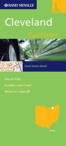
Map: 1 Pages (2003-10-31)
list price: US$7.95 -- used & new: US$5.38
(price subject to change: see help)
Asin: 0528993607
Average Customer Review: 2.0 out of 5 stars
Canada | United Kingdom | Germany | France | Japan
Editorial Review

Product Description
The durable and convenient EasyFinderTM of Cleveland, Ohio, will take all the wear and tear your journey can dish out. The laminated design allows you to mark your route, make notes, then wipe the surface clean for further use.

This map features enhanced cartography with: Clearly indicated highways,County Boundaries, Streets,Points of Interest and National Parks. ... Read more

Customer Reviews (1)

2-0 out of 5 stars Try Street Atlas of Cuyahoga County
Universal Maps has a better product called Cuyahoga County Street Atlas.This map didn't work for me. ... Read more


53. Soil survey of Trumbull County, Ohio (SuDoc A 57.38:T 77)
by Norris L. Williams
 Unknown Binding: Pages (1992)

Asin: B00010CU7K
Canada | United Kingdom | Germany | France | Japan

54. Northern Ohio Fishing Map Guide (Fishing Maps from Sportsman's Connection)
 Spiral-bound: Pages (2006-05)
list price: US$22.25 -- used & new: US$32.24
(price subject to change: see help)
Asin: 188501046X
Canada | United Kingdom | Germany | France | Japan
Editorial Review

Product Description
BRAND NEW!!! Updated in 2006!! Lake maps and fishing information for Lake Erie and over 130 inland lakes and reservoirs in the northern half of Ohio - from Grand Lake St. Mary's down to many of the small but well-stocked city reservoirs and MetroPark lakes. Includes detailed close-up maps for the western basin of Lake Erie, including the Camp Perry reef complex, Catawba/Marblehead, the Bass Islands and Kelleys Island, Toledo area and Sandusky Bay.With GPS grids larger lakes. "Want to know which of the popular Fostoria Reservoirs are which, and where?It's right on pages 116 and 117, with details." - Steve Pollick, The Toledo Blade Newspaper ... Read more


55. Rand McNally Butler County, Ohio City Map: Including: College Corner, Fairfield, Hamilton, Middletown, Millville, Monroe, New Miami, Oxford, Seven Mil (Rand McNally City Maps)
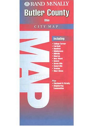
Map: Pages (2001-02)
list price: US$3.95 -- used & new: US$3.95
(price subject to change: see help)
Asin: 0528990292
Canada | United Kingdom | Germany | France | Japan
Editorial Review

Product Description
This is a detailed map of Butler County, Ohio. Complete coverage for the cities and surrounding areas, with an inset map for downtown. Plus most major tourist and business districts. When you flip the maps over, you will find a complete street index and a "city and vicinity" map of the entire metro area ... Read more


56. County Map of Ohio, and Indiana.
by (OHIO / INDIANA)
 Unknown Binding: Pages (1860)

Asin: B00455W6W6
Canada | United Kingdom | Germany | France | Japan

57. Champion Maps Mentor / Eastlake / Painesville, Ohio
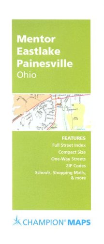
Map: Pages (2007-09-07)
list price: US$3.95 -- used & new: US$3.95
(price subject to change: see help)
Asin: 0528869884
Canada | United Kingdom | Germany | France | Japan

58. County reports and maps. Ohio, Brooke and Hancock counties.
by West Virginia Geological and Economic Survey
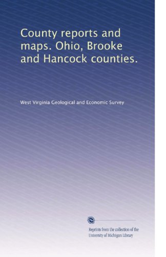
Paperback: 472 Pages (1907-01-01)
list price: US$31.99 -- used & new: US$31.99
(price subject to change: see help)
Asin: B0030ZS8V0
Canada | United Kingdom | Germany | France | Japan
Editorial Review

Product Description
This volume is produced from digital images created through the University of Michigan University Library's large-scale digitization efforts. The Library seeks to preserve the intellectual content of items in a manner that facilitates and promotes a variety of uses. The digital reformatting process results in an electronic version of the original text that can be both accessed online and used to create new print copies. The Library also understands and values the usefulness of print and makes reprints available to the public whenever possible. This book and hundreds of thousands of others can be found in the HathiTrust, an archive of the digitized collections of many great research libraries. For access to the University of Michigan Library's digital collections, please see http://www.lib.umich.edu and for information about the HathiTrust, please visit http://www.hathitrust.org ... Read more


59. Family Maps of Guernsey County, Ohio, Deluxe Edition
by Gregory A. Boyd
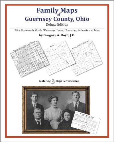
Paperback: 236 Pages (2010-07-16)
-- used & new: US$29.95
(price subject to change: see help)
Asin: 1420315323
Canada | United Kingdom | Germany | France | Japan
Editorial Review

Product Description
Locating original landowners in maps has never been an easy task--until now. This volume in the Family Maps series contains newly created maps of original landowners (patent maps) in what is now Guernsey County, Ohio, gleaned from the indexes of the U.S. Bureau of Land Management. But it offers much more than that. For each township in the county, there are two additional maps accompanying the patent map: a road map and a map showing waterways, railroads, and both modern and many historical city-centers and cemeteries.

Included are indexes to help you locate what you are looking for, whether you know a person's name, a last name, a place-name, or a cemetery. The combination of maps and indexes are designed to aid researchers of American history or genealogy to explore frontier neighborhoods, examine family migrations, locate hard-to-find cemeteries and towns, as well as locate land based on legal descriptions found in old documents or deeds.

The patent-maps are essentially plat maps but instead of depicting owners for a particular year, these maps show original landowners, no matter when the transfer from the federal government was completed. Dates of patents typically begin near the time of statehood and run into the early 1900s.

This high-quality paperback book from the critically acclaimed Family Maps series measures 8-3/8" wide x 10-5/8" high. ... Read more


60. MAP: 'Map of Highland, Ross & Pike Counties'from Geological Survey of Ohio, 1874
by State of Ohio
 Unbound: Pages (1874-01-01)

Asin: B000NKN2VG
Canada | United Kingdom | Germany | France | Japan

  Back | 41-60 of 100 | Next 20
A  B  C  D  E  F  G  H  I  J  K  L  M  N  O  P  Q  R  S  T  U  V  W  X  Y  Z  

Prices listed on this site are subject to change without notice.
Questions on ordering or shipping? click here for help.

site stats