e99 Online Shopping Mall

Geometry.Net - the online learning center Help  
Home  - Basic O - Ontario Geography (Books)

  Back | 61-80 of 100 | Next 20
A  B  C  D  E  F  G  H  I  J  K  L  M  N  O  P  Q  R  S  T  U  V  W  X  Y  Z  

click price to see details     click image to enlarge     click link to go to the store

 
61. The Orange Order in nineteenth-century
 
62. From rural village to industrial
 
63. Urban water supply alternatives;:
 
64. ONTARIO STUDIES CANADIAN GEOGRAPHY
65. Ontario (Canadian Maps)
 
66. An analyses of Ontario, California
 
$39.99
67. Soil microscopy: Proceedings of
 
68. Ontario: Geographical perspectives
$28.37
69. Between a Rock and a Hard Place:
 
70. Geographic thinking skills (Informal
 
71. Physical Geography, Geomorphology
 
72. Economic and environmental impacts
$20.87
73. Geography of Thunder Bay District,
$19.99
74. Geography of Lennox and Addington
$14.13
75. Geography of Parry Sound District,
$14.13
76. Geography of Rainy River District,
 
77. Ontario High School Physical Geography
$14.13
78. Geography of Sault Ste. Marie,
$37.19
79. Cities in Modernity: Representations
 
$43.00
80. Agriculture and Environmental

61. The Orange Order in nineteenth-century Ontario: A study in institutional cultural transfer (Discussion paper - Department of Geography, University of Toronto)
by C Houston
 Unknown Binding: 55 Pages (1977)

Asin: B0007AL3WW
Canada | United Kingdom | Germany | France | Japan

62. From rural village to industrial suburb: A guide to a field trip examining the impact of metropolitan Toronto on Maple, Ontario (Discussion paper / Dept. of Geography, York University)
by G. B Norcliffe
 Unknown Binding: 46 Pages (1984)

Asin: B0007B22Q2
Canada | United Kingdom | Germany | France | Japan

63. Urban water supply alternatives;: Perception and choice in the Grand Basin, Ontario (The University of Chicago. Dept. of Geography. Research paper no. 126)
by Ian MacIver
 Unknown Binding: 178 Pages (1970)

Asin: B0006C0DRM
Canada | United Kingdom | Germany | France | Japan

64. ONTARIO STUDIES CANADIAN GEOGRAPHY
by LOUIS ED. GENTILCORE
 Hardcover: Pages (1972-01-01)

Asin: B003KD4LBS
Canada | United Kingdom | Germany | France | Japan

65. Ontario (Canadian Maps)
Map: Pages (1999-01)
list price: US$3.95
Isbn: 1551982773
Canada | United Kingdom | Germany | France | Japan
Editorial Review

Product Description
Ontario Cities & Towns - 3-Book Value Pack ... Read more


66. An analyses of Ontario, California in regard to human geography
by Denise Y Hansen
 Unknown Binding: Pages (1987)

Asin: B0007C379M
Canada | United Kingdom | Germany | France | Japan

67. Soil microscopy: Proceedings of the fourth International Working-Meeting on Soil Micromorphology, Department of Geography, Queen's University, Kingston, Ontario, Canada, 27th-31st August, 1973
 Hardcover: 857 Pages (1974)
-- used & new: US$39.99
(price subject to change: see help)
Asin: 0919642608
Canada | United Kingdom | Germany | France | Japan

68. Ontario: Geographical perspectives on economy and environment (Department of Geography publication series)
 Paperback: 311 Pages (1991)

Isbn: 0921083378
Canada | United Kingdom | Germany | France | Japan

69. Between a Rock and a Hard Place: A Historical Geography of the Finns in the Sudbury Area
by Oiva W. Saarinen
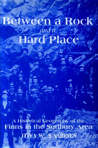
Paperback: 344 Pages (1999-11-22)
list price: US$38.95 -- used & new: US$28.37
(price subject to change: see help)
Asin: 0889203539
Canada | United Kingdom | Germany | France | Japan
Editorial Review

Product Description
Where else can that well-known phrase be better applied than to astudy of the Finns in Sudbury?"Rock" defines the physical reality of the Sudbury setting:rugged hills,mines,farms and forests set in the Precambrian Shield."Hard" defines the human setting:Finnish immigrants having to contend with the problems andstresses of relocating to a new culture, with livelihoods thatrequired great endurance as well as a tolerance for hazardousconditions.

Since 1883 Finnish immigrants in Sudbury,men and women alike,have striven to improve their lot through the options availableto them.Despite great obstacles,the Finns never flagged in their unwavering fight for workers'rights and the union movement.And as agricultural settlers,labour reformers, builders of churches,halls,saunas and athletic fields,Finns left an indelible imprint on the physical and humanlandscape.In the process they have played an integral part in thetransformation of Sudbury from a small struggling rail town toits present role as regional capital of northwestern Ontario. ... Read more


70. Geographic thinking skills (Informal series / Ontario Institute for Studies in Education)
by John A Ross
 Paperback: 198 Pages (1981)

Isbn: 0774450371
Canada | United Kingdom | Germany | France | Japan

71. Physical Geography, Geomorphology and Late Quaternary History of the Mahidasht Project Area, Qara Su Basin, Central Iran (Rom Mahidasht Project, V. 1) (Vol 1)
by Ian A. Brookes
 Paperback: 48 Pages (1989-09)
list price: US$23.95
Isbn: 0888543468
Canada | United Kingdom | Germany | France | Japan

72. Economic and environmental impacts of land drainage in Ontario (Geographical monographs)
by William C Found
 Paperback: 175 Pages (1975)

Isbn: 091960420X
Canada | United Kingdom | Germany | France | Japan

73. Geography of Thunder Bay District, Ontario: Lake Superior
Paperback: 190 Pages (2010-09-15)
list price: US$27.46 -- used & new: US$20.87
(price subject to change: see help)
Asin: 1156482259
Canada | United Kingdom | Germany | France | Japan
Editorial Review

Product Description
Chapters: Lake Superior. Source: Wikipedia. Pages: 188. Not illustrated. Free updates online. Purchase includes a free trial membership in the publisher's book club where you can select from more than a million books without charge. Excerpt: Lake Superior -The Ojibwe call the lake Gichigami, meaning "big water." Henry Wadsworth Longfellow wrote the name as "Gitche Gumee" in The Song of Hiawatha. "The first French explorers approaching the great inland sea by way of the Ottawa River and Lake Huron during the 17th Century referred to their discovery as le lac superieur. Properly translated, the expression means "Upper Lake," that is, the lake above Lake Huron. The lake was also called Lac Tracy by 17th Century Jesuit missionaries." The English, upon taking control of the region from the French in the 1760's, following the French and Indian War, anglicized the lake's name to Superior, "on account of its being superior in magnitude to any of the lakes on that vast continent." Lake Superior is the largest freshwater lake in the world by surface area, and empties into Lake Huron via the St. Marys River and the Soo Locks. Lake Baikal in Russia is larger by volume, as is Lake Tanganyika. The Caspian Sea, while larger than Lake Superior in both surface area and volume, is brackish; though presently isolated, historically the Caspian has been repeatedly connected to and isolated from the Mediterranean via the Black Sea. Lake Superior has a surface area of 31,820 square miles (82,413 km), which is approximately the size of South Carolina. It has a maximum length of 350 miles (563 km) and maximum breadth of 160 miles (257 km). Its average depth is 482 feet (147 m) with a maximum depth of 1,332 feet (406 m). Lake Superior contains 2,900 cubic miles (12,100 km³) of water. There is enough water in Lake Superior to cover the entire land mass of North and South America with 1 foot (30 cm) of water. The shoreline of the lake stretches 2,726 ...More: http://booksllc.net/?id=17951 ... Read more


74. Geography of Lennox and Addington County, Ontario: Skootamatta River, Partridge Creek, Merrill Creek, Clare River, Flinton Creek
Paperback: 56 Pages (2010-05-03)
list price: US$19.99 -- used & new: US$19.99
(price subject to change: see help)
Asin: 115535625X
Canada | United Kingdom | Germany | France | Japan
Editorial Review

Product Description
Purchase includes free access to book updates online and a free trial membership in the publisher's book club where you can select from more than a million books without charge. Chapters: Skootamatta River, Partridge Creek, Merrill Creek, Clare River, Flinton Creek, Rainy Creek (Lennox and Addington County, Ontario), Killer Creek, Deerock Lake, Merrill Lake, Skootamatta Lake, Whitefish Lake, Little Merrill Lake, Rainy Lake, Little Mink Lake (Lennox and Addington County, Ontario), Grimsthorpe Lake, Todd Lakes (Lennox and Addington County, Ontario), Pearson Lake (Lennox and Addington County, Ontario), Norway Lake, Canoe Lake (Lennox and Addington County, Ontario), Partridge Lake (Lennox and Addington County, Ontario), Joeperry Lake, Rainy Lake. Excerpt:Canoe Lake Canoe Lake is a small endorheic lake near the community of Weslemkoon in Addington Highlands in the north and on the western edge of Lennox and Addington County , Ontario , Canada . It is just south-east of the West Bay of Weslemkoon Lake . References (URLs online) A hyperlinked version of this chapter is at Coordinates : 44°28 58 N 77°16 31 W / 44.48278°N 77.27528°W / 44.48278; -77.27528 Clare River The Clare River is a river that is part of the Moira River system in the Lake Ontario drainage basin in Hastings and Lennox and Addington Counties, Ontario , Canada . Course The Clare River begins at the junction of several unnamed creeks in the township of Stone Mills , Lennox and Addington County at an elevation of 189 metres (620 ft). It flows southwest into Calpin Lake at an elevation of 171 metres (561 ft) at the community of McGuire Settlement , then continues southwest under Highway 41 . It then turns west and passes into the municipality of Tweed , Hastings County. It takes in the left tributary Goose Creek and right tributary Otter Creek , flows past the settlement of Bogart , and empties into the east side of Stoco Lake on the Moira River at an elevation of 138 metres (453 ft). The Moira River flow... ... Read more


75. Geography of Parry Sound District, Ontario: Magnetawan River, Wahwashkesh Lake, Lake Rosseau, Lake Cecebe, Doe Lake (Parry Sound District
Paperback: 36 Pages (2010-09-15)
list price: US$14.14 -- used & new: US$14.13
(price subject to change: see help)
Asin: 1156884411
Canada | United Kingdom | Germany | France | Japan
Editorial Review

Product Description
Chapters: Magnetawan River, Wahwashkesh Lake, Lake Rosseau, Lake Cecebe, Doe Lake (Parry Sound District, Ontario), Ahmic Lake, Lake Bernard, Shawanaga Lake, Snowshoe Lake (Cripple Creek, Ontario), Snowshoe Lake (Kimikong River, Ontario), Snowshoe Lake (Magnetawan River, Ontario), Canoe Lake (Parry Sound District, Ontario), Lake Joseph. Source: Wikipedia. Pages: 34. Not illustrated. Free updates online. Purchase includes a free trial membership in the publisher's book club where you can select from more than a million books without charge. Excerpt: The Magnetawan River is a river in Parry Sound District, Ontario, Canada which flows 175 km from Magnetawan Lake inside Algonquin Park to empty into Georgian Bay at the town of Britt, Ontario on Byng Inlet. At the end of the 19th century, the river was used to float white pine logs to sawmills downstream. The river gained recent renown when it was featured in Bill Mason's film Waterwalker. The River has numerous rapids, such as, "The Thirty Dollar Rapids", "The Fourteen", "The Ten", the "Potato Rapids", "Poverty Bay Chutes", and "Cody Rapids". The town of Magnetawan, Ontario is located on the river between Lake Cecebe and Ahmic Lake. Locks were built here on the river to allow steamboats to travel further down the river from the railway station at Burk's Falls. The locks officially opened on July 8, 1886 and are still in use today. The name of the river means "swiftly flowing waters" in the Ojibwa language. There is also a Reserve with the name Magnetawan First Nation, the same name as the river. The Reserve is situated on the river in between Britt and Byng Inlet. Canoers on Upper Magnetawan RiverThe Magnetawan River also provides great canoe routes for novice and more experienced canoe tripping. Canadian Canoe Routes lists three Magnetawan River Canoe Routes: ...More: http://booksllc.net/?id=1157415 ... Read more


76. Geography of Rainy River District, Ontario: Height of Land Portage
Paperback: 38 Pages (2010-05-31)
list price: US$14.14 -- used & new: US$14.13
(price subject to change: see help)
Asin: 1156180236
Canada | United Kingdom | Germany | France | Japan
Editorial Review

Product Description
Purchase includes free access to book updates online and a free trial membership in the publisher's book club where you can select from more than a million books without charge. Excerpt: Height of Land Portage is a portage along the historic Boundary Waters route between Canada and the United States. Located at the border of the Canadian province of Ontario and the U.S. State of Minnesota, the path is a relatively easy crossing of the Laurentian Divide separating the watersheds of the Atlantic and Arctic oceans. It was used for centuries for canoe travel by the First Nations, and the historic route of which it was a part became a preindustrial thoroughfare giving the voyageurs access to the fur trading posts in western Canada. For many years the portage was part of an important route from Lower Canada to the interior of the North American continent. It became part of the boundary between British North America and the United States following the American Revolution and treaties delineating the border. In recognition of this history, the portage is on the U.S. National Register of Historic Places, and is a Minnesota State Historic Site. Located in La Verendrye Provincial Park and the Boundary Waters Canoe Area Wilderness in the unspoiled country along the international boundary, the portage retains its traditional use, but for recreational canoe trips rather than commerce. The portage, 80 rods (about 400 m) long, crosses a low saddle between North Lake and South Lake in the Rove Formation. It adjoins the boundary vista, a cleared strip which marks the Canada United States border between those lakes. South Lake is the source of the Arrow River, tributary to the Pigeon River, which flows east to Lake Superior, other Great Lakes, and the St. Lawrence River to the Atlantic Ocean. North Lake is in the watershed of the Rainy River, which drains by way of the Winnipeg and Nelson Rivers to Hudson Bay. According to the Canada/US Intern... More: http://booksllc.net/?id=9721593 ... Read more


77. Ontario High School Physical Geography
by George A Cornish & David Whyte
 Hardcover: Pages (1934)

Asin: B0031I7H40
Canada | United Kingdom | Germany | France | Japan

78. Geography of Sault Ste. Marie, Ontario: St. Marys River (Michigan-ontario), Soo Locks, Sault Ste. Marie International Bridge
Paperback: 26 Pages (2010-09-16)
list price: US$14.14 -- used & new: US$14.13
(price subject to change: see help)
Asin: 1158692315
Canada | United Kingdom | Germany | France | Japan
Editorial Review

Product Description
Chapters: St. Marys River (Michigan-ontario), Soo Locks, Sault Ste. Marie International Bridge, Sault Ste. Marie Canal, Gros Cap Reefs Light, Whitefish Island. Source: Wikipedia. Pages: 24. Not illustrated. Free updates online. Purchase includes a free trial membership in the publisher's book club where you can select from more than a million books without charge. Excerpt: The Soo Locks allow ships to travel between Lake Superior and the lower Great Lakes. The locks pass an average of 10,000 ships per year. This is achieved in spite of the locks being closed during the winter from January through March, when ice shuts down shipping on the Great Lakes. The winter closure period is used to inspect and maintain the locks. The locks bypass the rapids of the St. Marys River where the water falls 7 meters (21 feet) from Lake Superior. Sault Ste. Marie gives its name to both the Canadian and U.S. cities at the site, in Ontario and Michigan, respectively. The Sault Ste. Marie International Bridge between the United States and Canada permits vehicular traffic to pass over the locks. The U.S. locks form part of a 1.6 mile (2.6 km) canal formally named the St. Marys Falls Canal. The entire canal, including the locks, is owned and maintained by the United States Army Corps of Engineers, which provides free passage. The first iteration of the U.S. Soo Locks was completed in May 1855, and operated by the State of Michigan until transferred to the U.S. Army in 1881. The current configuration consists of four parallel lock chambers, each running east to west; starting at the Sault Sainte Marie, Michigan, shoreline and moving north, these are: The Davis and Sabin locks have been slated for replacement since 1986 with a new 'Super-Lock', which would provide a second lock capable of accommodating the lakers. Groundbreaking for the new lock project was held on June 30, 2009, although the bulk of the funding necessary to complete the project has...More: http://booksllc.net/?id=367986 ... Read more


79. Cities in Modernity: Representations and Productions of Metropolitan Space, 1840-1930 (Cambridge Studies in Historical Geography)
by Richard Dennis
Paperback: 452 Pages (2008-04-28)
list price: US$43.99 -- used & new: US$37.19
(price subject to change: see help)
Asin: 0521468418
Canada | United Kingdom | Germany | France | Japan
Editorial Review

Product Description
What made cities 'modern' in the nineteenth and early twentieth centuries? Cities in Modernity explores connections between culture, economy and built environment in cities of this period, drawing its evidence principally from London, New York and Toronto. The book discusses both the cultural experience of modernity and the material modernization of cities, placing special emphasis on their historical geographies, on the production, representation and use of urban space. The opening chapters present new ways of seeing cities in political and religious discourse, social survey, mapping, art and literature. The book then concentrates on new kinds of public and private spaces, such as apartment buildings, office blocks and department stores, and the networks of communication between them. An important theme throughout is the gendered experience of the new types of environment. The book will appeal to scholars and students of historical geography, urban history and cultural studies. ... Read more


80. Agriculture and Environmental Security in Southern Ontario's Watersheds
by Glen Filson, Bamidele Adekunle, Katia Marzall
 Hardcover: Pages (2010-09-30)
list price: US$43.00 -- used & new: US$43.00
(price subject to change: see help)
Asin: 161668156X
Canada | United Kingdom | Germany | France | Japan
Editorial Review

Product Description
This book attempts to undertake critical, social scientific scrutiny of contradictions between the evolving forms of agricultural production and ecosystem health within Ontario's southern agricultural watersheds in the light of prevailing environmental management systems and policies. It's purpose takes a critical look at the environmental and social implications of Ontario's increasingly intensive and industrialised agriculture. ... Read more


  Back | 61-80 of 100 | Next 20
A  B  C  D  E  F  G  H  I  J  K  L  M  N  O  P  Q  R  S  T  U  V  W  X  Y  Z  

Prices listed on this site are subject to change without notice.
Questions on ordering or shipping? click here for help.

site stats