e99 Online Shopping Mall

Geometry.Net - the online learning center Help  
Home  - Basic S - Surveying & Mapping Geography (Books)

  Back | 41-60 of 100 | Next 20
A  B  C  D  E  F  G  H  I  J  K  L  M  N  O  P  Q  R  S  T  U  V  W  X  Y  Z  

click price to see details     click image to enlarge     click link to go to the store

$71.87
41. Assessing the Accuracy of Remotely
42. Wetland Landscape Characterization
 
43. Inventory of World Topographic
44. Geographical Information Systems
$78.95
45. Geographical Data Acquisition
 
$5.95
46. Political Ecology: an Integrative
 
$5.95
47. Recent literature.(bibliography
 
$5.95
48. Groundwater Modeling Using Geographical
$41.18
49. Civil, Commercial, and International
$90.00
50. GIS for Coastal Zone Management
 
$186.00
51. Geodetic Theory Today: Third Hotine-Marussi
 
$5.95
52. Equal Area Map Projection for
$25.30
53. Mapper of Mountains: M.P. Bridgland
$160.08
54. Proximal Soil Sensing (Progress
 
$5.95
55. Towards developing Kentucky's
 
$5.95
56. An inverse solution to the Winkel
 
$5.95
57. Complexity and Intractability:
 
$5.95
58. Epilogue.(advances in mapmaking):
 
$5.95
59. A Computer Science Perspective
 
$5.95
60. On the Origins of Analytical Cartography.:

41. Assessing the Accuracy of Remotely Sensed Data: Principles and Practices (Mapping Science)
by Russell G. Congalton, Kass Green
Hardcover: 160 Pages (1998-09-17)
list price: US$104.95 -- used & new: US$71.87
(price subject to change: see help)
Asin: 0873719867
Average Customer Review: 5.0 out of 5 stars
Canada | United Kingdom | Germany | France | Japan
Editorial Review

Product Description
Because the accuracy of remotely sensed data is critical to any successful mapping project, accuracy assessment is an important tool for anyone who uses remote sensing. This is a complete guide to assessing the accuracy of maps generated from remotely sensed data, and the only book available that is devoted solely to this complex topic. ... Read more

Customer Reviews (1)

5-0 out of 5 stars Great Book
Congalton does a great job presenting remote sensing accuracy assessment concepts.In addition to the theory, he provides practical examples to help in applying the theory to real world situations.

The book seems way over-priced for its size. ... Read more


42. Wetland Landscape Characterization
by John G.Lyon
Kindle Edition: 160 Pages (2007-04-16)
list price: US$119.95
Asin: B000PUB75M
Average Customer Review: 2.0 out of 5 stars
Canada | United Kingdom | Germany | France | Japan
Editorial Review

Product Description
This book was written to assist scientists, engineers, technicians and other resource managers in the evaluation of wetland boundaries and characteristics. Powerful tools - GIS, mapping, remote sensing - are described and demonstrated using practical applications and combined to yield landscape ecological data, and ecological risk assessments. Using numerous technical methods, Wetland Landscape Characterization shows you how to evaluate the presence of wetlands, and the stressors, exposures and ecological systems - streams, lakes, terrestial - that influence their condition. A vital component of the book is the variety of quality assurance/quality control and accuracy assessment techniques presented throughout the text. A thorough understanding of these methods is critical to the success of your project. ... Read more

Customer Reviews (2)

1-0 out of 5 stars Superficial and Badly Out-of-Date
I agree with the first reviewer. The book Wetland Landscape Characterization lacks detail sufficient to make it useful.

It is very similar to another book by the author about Watershed characterization and uses much the same material. They are practically the same book in many ways.

Many important wetlands are completely ignored and the ones that are featured are not significant.

Lastely, the information is badly dated in this rapidly changing technology. There are critical new sensors, satellites, statistical approaches and methods not mentioned in the book because they are new.

3-0 out of 5 stars Ankle deep, but has some useful information
Though the book does not go into great detail, it does have useful information hidden in the text.I would have liked to see a better treating of GIS, like pratical examples and real case studies.

A lot of the general information can be found on the web.What would make this book better would be some geostatistical examples, color photos as opposed to low res black and white ones, and a bigger section on GIS and remote sensing. ... Read more


43. Inventory of World Topographic Mapping, 3-Volume Set
by Rolf Bohme, Bö
 Hardcover: 1186 Pages (1993-11-01)
list price: US$785.00
Isbn: 0080424147
Canada | United Kingdom | Germany | France | Japan
Editorial Review

Product Description
Topographic maps are essential tools for use in development projects, resource exploitation, the planning of construction, infrastructure and recreation. They also give detailed illustration of the relative degrees of development of areas within a landscape and are thus useful in demonstrating the cultural status of a country. This three-volume set provides a source for information on topographic mapping. The information supplied for each country consists of a text (including a brief history of the development of topographic mapping), geodetic data, map scales and series, as well as extracts of maps and index sheets illustrating the present status of map coverage within that country. Volume 1 provides an introduction to world topographic mapping, giving details and examples of topographic maps from Western Europe, North America and Australasia. Volume 2 gives details and examples of topographic maps from Central and South America and Africa. Volume 3 contains specific details relating to the current coverage of states located in Eastern Europe, Asia, Oceania and Antarctica.The geographical positions of countries described are illustrated by means of a series of accompanying reference maps. These volumes should be of interest to cartographers, geographers, geologists and those involved in planning. ... Read more


44. Geographical Information Systems and Computer Cartography
by C. Jones
Textbook Binding: 336 Pages (1997-08-05)
list price: US$52.00
Isbn: 0582044391
Average Customer Review: 5.0 out of 5 stars
Canada | United Kingdom | Germany | France | Japan
Editorial Review

Product Description
Presents the fundamental concepts in Geographical Information Systems (GIS), emphasizing the techniques in management, analysis, and graphic display of spatial information. Paper. ... Read more

Customer Reviews (1)

5-0 out of 5 stars One of the best text books on GIS and Computer Cartography
Despite the fact that the book is rather old (1997) it covers efficiently a considerable number of issues on GIS and Computer Cartography. I found it very useful and I recommend it to all those who want to get into the field.
It is evident that a new edition is required to cover the recent developments i.e. Open systems, Internet GIS and Location Based Services. ... Read more


45. Geographical Data Acquisition
Paperback: 265 Pages (2001-01-05)
list price: US$129.00 -- used & new: US$78.95
(price subject to change: see help)
Asin: 3211834729
Canada | United Kingdom | Germany | France | Japan
Editorial Review

Product Description
This book is dedicated to the theory and methodology of geographical data acquisition, providing comprehensive coverage ranging from the definition of geo-referencing systems, transformation between these systems to the acquisition of geographical data using different methods. Emphasis is placed on conceptual aspects, and the book is written in a semi-technical style to enhance its readability. After reading this book, readers should have a rather good understanding of the nature of spatial data, the accuracy of spatial data, and the theory behind various data acquisition methodologies. This volume is a text book for GIS students in disciplines such as geography, environmental science, urban and town planning, natural resource management, computing and geomatics (surveying and mapping). Furthermore it is an essential reading for both GIS scientists and practitioners who need some background information on the technical aspects of geographical data acquisition. ... Read more


46. Political Ecology: an Integrative Approach to Geography and Environment-Development Studies (2003).(book review )(Book Review): An article from: Cartography and Geographic Information Science
by Salvatore Engel-Di Mauro
 Digital: 5 Pages (2004-04-01)
list price: US$5.95 -- used & new: US$5.95
(price subject to change: see help)
Asin: B000841CKK
Canada | United Kingdom | Germany | France | Japan
Editorial Review

Product Description
This digital document is an article from Cartography and Geographic Information Science, published by American Congress on Surveying & Mapping on April 1, 2004. The length of the article is 1378 words. The page length shown above is based on a typical 300-word page. The article is delivered in HTML format and is available in your Amazon.com Digital Locker immediately after purchase. You can view it with any web browser.

Citation Details
Title: Political Ecology: an Integrative Approach to Geography and Environment-Development Studies (2003).(book review )(Book Review)
Author: Salvatore Engel-Di Mauro
Publication: Cartography and Geographic Information Science (Refereed)
Date: April 1, 2004
Publisher: American Congress on Surveying & Mapping
Volume: 31Issue: 2Page: 123(3)

Article Type: Book Review

Distributed by Thomson Gale ... Read more


47. Recent literature.(bibliography of cartographic related literature)(Bibliography): An article from: Cartography and Geographic Information Science
by Jovanka R. Ristic
 Digital: 9 Pages (2003-10-01)
list price: US$5.95 -- used & new: US$5.95
(price subject to change: see help)
Asin: B0008GEBTW
Canada | United Kingdom | Germany | France | Japan
Editorial Review

Product Description
This digital document is an article from Cartography and Geographic Information Science, published by American Congress on Surveying & Mapping on October 1, 2003. The length of the article is 2538 words. The page length shown above is based on a typical 300-word page. The article is delivered in HTML format and is available in your Amazon.com Digital Locker immediately after purchase. You can view it with any web browser.

Citation Details
Title: Recent literature.(bibliography of cartographic related literature)(Bibliography)
Author: Jovanka R. Ristic
Publication: Cartography and Geographic Information Science (Refereed)
Date: October 1, 2003
Publisher: American Congress on Surveying & Mapping
Volume: 30Issue: 4Page: 355(4)

Article Type: Bibliography

Distributed by Thomson Gale ... Read more


48. Groundwater Modeling Using Geographical Information Systems.(Book Review): An article from: Cartography and Geographic Information Science
by David L. Ozsvath
 Digital: 4 Pages (2004-07-01)
list price: US$5.95 -- used & new: US$5.95
(price subject to change: see help)
Asin: B00084M0GK
Canada | United Kingdom | Germany | France | Japan
Editorial Review

Product Description
This digital document is an article from Cartography and Geographic Information Science, published by American Congress on Surveying & Mapping on July 1, 2004. The length of the article is 1119 words. The page length shown above is based on a typical 300-word page. The article is delivered in HTML format and is available in your Amazon.com Digital Locker immediately after purchase. You can view it with any web browser.

Citation Details
Title: Groundwater Modeling Using Geographical Information Systems.(Book Review)
Author: David L. Ozsvath
Publication: Cartography and Geographic Information Science (Refereed)
Date: July 1, 2004
Publisher: American Congress on Surveying & Mapping
Volume: 31Issue: 3Page: 189(2)

Article Type: Book Review

Distributed by Thomson Gale ... Read more


49. Civil, Commercial, and International Remote Sensing Systems and Geoprocessing
by D. Glackin, G. Peltzer
Paperback: 89 Pages (1999-01-01)
list price: US$34.95 -- used & new: US$41.18
(price subject to change: see help)
Asin: 1884989071
Canada | United Kingdom | Germany | France | Japan
Editorial Review

Product Description
Remote sensing and geospatial data processing arerapidly evolving and increasingly important fields with widespread applications. In this monograph Glackin and Peltzer trace the evolution of remote sensing satellites and their instruments and geospatial data processing, document the state of the art, and present key trends emerging for the next decade. The authors emphasize the increasing commercialization and international expansion of the field particularly in the field of imaging satellites and the use of geographic information systems to make remote sensing data more accessible. ... Read more


50. GIS for Coastal Zone Management (Research Monographs in GIS)
Hardcover: 344 Pages (2004-05-26)
list price: US$119.95 -- used & new: US$90.00
(price subject to change: see help)
Asin: 0415319722
Canada | United Kingdom | Germany | France | Japan
Editorial Review

Product Description
Geographical Information Systems are increasingly being used to analyze and manage marine and coastal zones. They provide a powerful set of tools for use in coastal zone supervision. This book discusses recent developments and specific applications that can be used to help marine scientists and conservationists enhance their skills. The techniques presented in this book teach GIS applications in a coastal setting, including shoreline mapping, ship borne data collection techniques, coastal decision making with GIS and more.Including new information presented at the CoastGIS 2001 Symposium, this book will inspire and stimulate continued research in this important new application domain of GIS. ... Read more


51. Geodetic Theory Today: Third Hotine-Marussi Symposium on Mathematical Geodesy. L'Aquila, Italy, May 30-June 3,1994 (International Association of Geodesy Symposia)
 Paperback: 446 Pages (1995-09-28)
list price: US$186.00 -- used & new: US$186.00
(price subject to change: see help)
Asin: 3540594213
Canada | United Kingdom | Germany | France | Japan
Editorial Review

Product Description
In 1954, Antonio Marussi started a series of symposia in Venice. The first three of these covered the entire theoretical definition of 3-D geodesy as delineated in discussions with renowned contemporary scientists, particularly Martin Hotine. After Marussi's death, the symposia were finally named the Hotine-Marussi Symposia and were continued in Italy. The Third Hotine-Marussi Symposium was held in L'Aquila from May 30 to June 3, 1994. It provided geodesists interested in theory and methodology with the opportunity to discuss their theoretical achievements, as well as new topics in the geodetic sciences. This book thus provides an updated overview of the main geodetic theories in various fields of application. ... Read more


52. Equal Area Map Projection for Irregularly Shaped Objects.: An article from: Cartography and Geographic Information Science
by Yang Cheng, Jean J. Lorre
 Digital: 16 Pages (2000-04-01)
list price: US$5.95 -- used & new: US$5.95
(price subject to change: see help)
Asin: B0008HB6US
Canada | United Kingdom | Germany | France | Japan
Editorial Review

Product Description
This digital document is an article from Cartography and Geographic Information Science, published by American Congress on Surveying & Mapping on April 1, 2000. The length of the article is 4695 words. The page length shown above is based on a typical 300-word page. The article is delivered in HTML format and is available in your Amazon.com Digital Locker immediately after purchase. You can view it with any web browser.

Citation Details
Title: Equal Area Map Projection for Irregularly Shaped Objects.
Author: Yang Cheng
Publication: Cartography and Geographic Information Science (Refereed)
Date: April 1, 2000
Publisher: American Congress on Surveying & Mapping
Volume: 27Issue: 2Page: 91

Distributed by Thomson Gale ... Read more


53. Mapper of Mountains: M.P. Bridgland in the Canadian Rockies, 1902-1930 (Mountain Cairns: A series on the history and culture of the Canadian Rockies)
by I. S. MacLaren
Paperback: 312 Pages (2005-12-15)
-- used & new: US$25.30
(price subject to change: see help)
Asin: 0888644566
Average Customer Review: 5.0 out of 5 stars
Canada | United Kingdom | Germany | France | Japan
Editorial Review

Product Description
Mapper of Mountains follows the career of Dominion Land Surveyor Morrison Parsons Bridgland, who provided the first detailed maps of many regions of the Canadian Rockies. Between 1902 and 1930, this unheralded alpinist perfected phototopographical techniques to compile a series of mountaintop photographs during summers of field work, and spent his winters collating them to provide the Canadian government, tourists, and mountain climbers with accurate topographical maps. Bridgland was a great climber and co-founder of the Alpine Club of Canada. Mapper of Mountains also tells the story of the Rocky Mountain Repeat Photography Project, which studies the changes sustained in the Rockies, repeating the field work accomplished by Bridgland almost a century ago. ... Read more

Customer Reviews (9)

5-0 out of 5 stars The true story of dominion land surveyor Morrison Parsons Bridgland
Mapper Of Mountains: M.P. Bridgland In The Canadian Rockies 1902-1930 is the true story of dominion land surveyor Morrison Parsons Bridgland, who climbed many of Canada's Rocky Mountains for the first time and perfected photographic techniques to compile a series of mountaintop photographs and create accurate topographical maps. In 1915 he applied his top-rate skills to Jasper Park, creating a legacy of research and exacting quality for future generations to build upon. Mapper Of Mountains is the true testimony of one man's lifetime dedication to, and passion for, precisely recording the lay of high and sometimes deadly peaks. Illustrated with black-and-white maps and photographs throughout, Mapper Of Mountains is as much a tribute to geographic history as it is to Bridgland's acute vision and drive.
... Read more


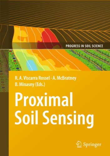
54. Proximal Soil Sensing (Progress in Soil Science)
Hardcover: 468 Pages (2010-08-03)
list price: US$179.00 -- used & new: US$160.08
(price subject to change: see help)
Asin: 904818858X
Canada | United Kingdom | Germany | France | Japan
Editorial Review

Product Description

This book reports on developments in Proximal Soil Sensing (PSS) and high resolution digital soil mapping. PSS has become a multidisciplinary area of study that aims to develop field-based techniques for collecting information on the soil from close by, or within, the soil. Amongst others, PSS involves the use of optical, geophysical, electrochemical, mathematical and statistical methods. This volume, suitable for undergraduate course material and postgraduate research, brings together ideas and examples from those developing and using proximal sensors and high resolution digital soil maps for applications such as precision agriculture, soil contamination, archaeology, peri-urban design and high land-value applications, where there is a particular need for high spatial resolution information. The book in particular covers soil sensor sampling, proximal soil sensor development and use, sensor calibrations, prediction methods for large data sets, applications of proximal soil sensing, and high-resolution digital soil mapping.

Key themes: soil sensor sampling – soil sensor calibrations – spatial prediction methods – reflectance spectroscopy – electromagnetic induction and electrical resistivity – radar and gamma radiometrics – multi-sensor platforms – high resolution digital soil mapping - applications

Raphael A. Viscarra Rossel is a scientist at the Commonwealth Scientific and IndustrialResearch Organisation (CSIRO) of Australia.

Alex McBratney is Pro-Dean and Professor of Soil Science in the Faculty of Agriculture Food& Natural Resources at the University of Sydney in Australia.

Budiman Minasny is a Senior Research Fellow in the Faculty of Agriculture Food & Natural Resources at the University of Sydney in Australia.

... Read more

55. Towards developing Kentucky's landscape change maps.: An article from: Cartography and Geographic Information Science
by Demetrio P. Zourarakis, Susan Carson Lambert, Mike Palmer
 Digital: 4 Pages (2003-04-01)
list price: US$5.95 -- used & new: US$5.95
(price subject to change: see help)
Asin: B0008DUEUU
Canada | United Kingdom | Germany | France | Japan
Editorial Review

Product Description
This digital document is an article from Cartography and Geographic Information Science, published by American Congress on Surveying & Mapping on April 1, 2003. The length of the article is 1009 words. The page length shown above is based on a typical 300-word page. The article is delivered in HTML format and is available in your Amazon.com Digital Locker immediately after purchase. You can view it with any web browser.

Citation Details
Title: Towards developing Kentucky's landscape change maps.
Author: Demetrio P. Zourarakis
Publication: Cartography and Geographic Information Science (Refereed)
Date: April 1, 2003
Publisher: American Congress on Surveying & Mapping
Volume: 30Issue: 2Page: 175(4)

Distributed by Thomson Gale ... Read more


56. An inverse solution to the Winkel Tripel projection using partial derivatives.: An article from: Cartography and Geographic Information Science
by Cengizhan Ipbuker
 Digital: 12 Pages (2002-01-01)
list price: US$5.95 -- used & new: US$5.95
(price subject to change: see help)
Asin: B0008F50Z2
Canada | United Kingdom | Germany | France | Japan
Editorial Review

Product Description
This digital document is an article from Cartography and Geographic Information Science, published by American Congress on Surveying & Mapping on January 1, 2002. The length of the article is 3489 words. The page length shown above is based on a typical 300-word page. The article is delivered in HTML format and is available in your Amazon.com Digital Locker immediately after purchase. You can view it with any web browser.

Citation Details
Title: An inverse solution to the Winkel Tripel projection using partial derivatives.
Author: Cengizhan Ipbuker
Publication: Cartography and Geographic Information Science (Refereed)
Date: January 1, 2002
Publisher: American Congress on Surveying & Mapping
Volume: 29Issue: 1Page: 37(6)

Distributed by Thomson Gale ... Read more


57. Complexity and Intractability: Limitations to Implementation in Analytical Cartography.: An article from: Cartography and Geographic Information Science
by Alan Saalfeld
 Digital: 26 Pages (2000-07-01)
list price: US$5.95 -- used & new: US$5.95
(price subject to change: see help)
Asin: B0008HF1ZO
Canada | United Kingdom | Germany | France | Japan
Editorial Review

Product Description
This digital document is an article from Cartography and Geographic Information Science, published by American Congress on Surveying & Mapping on July 1, 2000. The length of the article is 7717 words. The page length shown above is based on a typical 300-word page. The article is delivered in HTML format and is available in your Amazon.com Digital Locker immediately after purchase. You can view it with any web browser.

Citation Details
Title: Complexity and Intractability: Limitations to Implementation in Analytical Cartography.
Author: Alan Saalfeld
Publication: Cartography and Geographic Information Science (Refereed)
Date: July 1, 2000
Publisher: American Congress on Surveying & Mapping
Volume: 27Issue: 3Page: 239

Distributed by Thomson Gale ... Read more


58. Epilogue.(advances in mapmaking): An article from: Cartography and Geographic Information Science
by Mark Monmonier
 Digital: 5 Pages (1999-07-01)
list price: US$5.95 -- used & new: US$5.95
(price subject to change: see help)
Asin: B00099OSPK
Canada | United Kingdom | Germany | France | Japan
Editorial Review

Product Description
This digital document is an article from Cartography and Geographic Information Science, published by American Congress on Surveying & Mapping on July 1, 1999. The length of the article is 1325 words. The page length shown above is based on a typical 300-word page. The article is delivered in HTML format and is available in your Amazon.com Digital Locker immediately after purchase. You can view it with any web browser.

Citation Details
Title: Epilogue.(advances in mapmaking)
Author: Mark Monmonier
Publication: Cartography and Geographic Information Science (Refereed)
Date: July 1, 1999
Publisher: American Congress on Surveying & Mapping
Volume: 26Issue: 3Page: 235

Distributed by Thomson Gale ... Read more


59. A Computer Science Perspective on the Bendsimplification Algorithm.: An article from: Cartography and Geographic Information Science
by Mahes Visvalingam, Simon Herbert
 Digital: 21 Pages (1999-10-01)
list price: US$5.95 -- used & new: US$5.95
(price subject to change: see help)
Asin: B00099OSQE
Canada | United Kingdom | Germany | France | Japan
Editorial Review

Product Description
This digital document is an article from Cartography and Geographic Information Science, published by American Congress on Surveying & Mapping on October 1, 1999. The length of the article is 6079 words. The page length shown above is based on a typical 300-word page. The article is delivered in HTML format and is available in your Amazon.com Digital Locker immediately after purchase. You can view it with any web browser.

Citation Details
Title: A Computer Science Perspective on the Bendsimplification Algorithm.
Author: Mahes Visvalingam
Publication: Cartography and Geographic Information Science (Refereed)
Date: October 1, 1999
Publisher: American Congress on Surveying & Mapping
Volume: 26Issue: 4Page: 253

Distributed by Thomson Gale ... Read more


60. On the Origins of Analytical Cartography.: An article from: Cartography and Geographic Information Science
by Keith C. Clarke, John G. Cloud
 Digital: 26 Pages (2000-07-01)
list price: US$5.95 -- used & new: US$5.95
(price subject to change: see help)
Asin: B0008HF1YU
Canada | United Kingdom | Germany | France | Japan
Editorial Review

Product Description
This digital document is an article from Cartography and Geographic Information Science, published by American Congress on Surveying & Mapping on July 1, 2000. The length of the article is 7676 words. The page length shown above is based on a typical 300-word page. The article is delivered in HTML format and is available in your Amazon.com Digital Locker immediately after purchase. You can view it with any web browser.

Citation Details
Title: On the Origins of Analytical Cartography.
Author: Keith C. Clarke
Publication: Cartography and Geographic Information Science (Refereed)
Date: July 1, 2000
Publisher: American Congress on Surveying & Mapping
Volume: 27Issue: 3Page: 195

Distributed by Thomson Gale ... Read more


  Back | 41-60 of 100 | Next 20
A  B  C  D  E  F  G  H  I  J  K  L  M  N  O  P  Q  R  S  T  U  V  W  X  Y  Z  

Prices listed on this site are subject to change without notice.
Questions on ordering or shipping? click here for help.

site stats