e99 Online Shopping Mall

Geometry.Net - the online learning center Help  
Home  - Basic T - Texas Maps (Books)

  Back | 61-80 of 119 | Next 20
A  B  C  D  E  F  G  H  I  J  K  L  M  N  O  P  Q  R  S  T  U  V  W  X  Y  Z  

click price to see details     click image to enlarge     click link to go to the store

 
$25.00
61. Whiich Way USA 14 States (West
 
62. Principal Game Birds and Mammals
$34.75
63. Texas Atlas and Gazetteer: Detailed
$7.55
64. Rand Mcnally Easyfinder Houston,
 
$1.99
65. Rand McNally Garland, Texas
$4.86
66. Rand McNally Streets of San Antonio,
$5.99
67. Rand McNally Streets Of El Paso,
$27.55
68. Going to Texas: Five Centuries
$20.23
69. National Geographic Guide Map
$5.65
70. Rand Mcnally Houston/pasadenda/baytown,
 
71. Roads of Texas Atlas
$6.10
72. Rand McNally Austin Texas: Georgetown
$0.59
73. Texas - The Making of America
 
$3.75
74. The Making of America - TEXAS
$4.95
75. Rand Mcnally Waco, Texas Street
$30.00
76. The Great Texas Cattle Trails
$6.00
77. Big Bend National Park, TX - Trails
$2.41
78. Rand McNally Galveston/Texas City
$4.79
79. Rand McNally Houston: Texas City
$30.00
80. Reproduction Pre-Civil War 1860

61. Whiich Way USA 14 States (West Virginia; Minnesota; New York; California; Massachusetts; Colorado; Connecticut; Arizona; Alaska; Utah; Delaware; Alabama; Florida; Texas) with Maps
by Highlights for children
 Paperback: Pages (2009)
-- used & new: US$25.00
(price subject to change: see help)
Asin: B003Z54WHE
Canada | United Kingdom | Germany | France | Japan

62. Principal Game Birds and Mammals of texas: Their Distribution and Management (First Edition | Folding Maps)
by Texas Game Fish and Oyster Commission
 Hardcover: Pages (1945)

Asin: B000GKUKY0
Canada | United Kingdom | Germany | France | Japan

63. Texas Atlas and Gazetteer: Detailed Maps of the Entire State (State Atlas & Gazetteer)
Paperback: 156 Pages (1995-05)
list price: US$24.95 -- used & new: US$34.75
(price subject to change: see help)
Asin: 0899332412
Average Customer Review: 3.0 out of 5 stars
Canada | United Kingdom | Germany | France | Japan

Customer Reviews (1)

3-0 out of 5 stars These maps could be better
If you are considering purchasing this atlas, I would suggest The Roads ofTexas instead.I have two copies of The Roads of Texas and use themextensively.My copy of the Delorme book has not seen much use. ... Read more


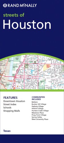
64. Rand Mcnally Easyfinder Houston, Texas: Local Street Detail
by Rand McNally and Company
Map: Pages (2005-08-15)
list price: US$7.95 -- used & new: US$7.55
(price subject to change: see help)
Asin: 0528856790
Canada | United Kingdom | Germany | France | Japan
Editorial Review

Product Description
The durable and convenient EasyFinderTM of the Houston, Texas will take all the wear and tear your journey can dish out. The laminated design allows you to mark your route, make notes, then wipe the surface clean for further use.

This map features enhanced cartography with: Clearly indicated highways,County Boundaries, Streets,Points of Interest and National Parks. ... Read more


65. Rand McNally Garland, Texas
by Rand McNally and Company
 Paperback: Pages (2002-09)
list price: US$3.95 -- used & new: US$1.99
(price subject to change: see help)
Asin: 0528975099
Canada | United Kingdom | Germany | France | Japan

66. Rand McNally Streets of San Antonio, Texas (Rand McNally Streets Of...)
Map: Pages (2010-01-05)
list price: US$5.99 -- used & new: US$4.86
(price subject to change: see help)
Asin: 0528880470
Canada | United Kingdom | Germany | France | Japan

67. Rand McNally Streets Of El Paso, Texas (Rand McNally Streets Of...)
Map: Pages (2010-01-30)
list price: US$5.99 -- used & new: US$5.99
(price subject to change: see help)
Asin: 0528879812
Canada | United Kingdom | Germany | France | Japan

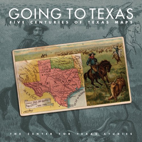
68. Going to Texas: Five Centuries of Texas Maps
by Center for Texas Studies at TCU
Hardcover: 120 Pages (2007-10-18)
list price: US$39.95 -- used & new: US$27.55
(price subject to change: see help)
Asin: 0875653448
Average Customer Review: 3.0 out of 5 stars
Canada | United Kingdom | Germany | France | Japan
Editorial Review

Product Description
This volume illustrates the history of the Lone Star State through color plates of sixty-four historic Texas maps from the Marty and Yana Davis Map Collection, Sul Ross State University, Alpine, and includes ten original essays written by noted historians. Going to Texas is a catalog that will accompany the exhibition of the Davis Map Collection to ten museums throughout the Southwest over a period of two years. It will begin in Dallas at the Hall of State with the Dallas Historical Society and conclude at the National Cowgirl Museum and Hall of Fame in Fort Worth.

The maps range from the earliest sixteenth-century maps of New Spain through early settlement, the Republic and statehood, and into the twenty-first century. These objects are not only historical documents but also served to promote settlement or another aspect of Texas, to chart transport lines, and to guide the military. The earliest maps demonstrate cartography as an art that only centuries later evolved into a science.

The accompanying essays cover the Spanish exploration, the Louisiana Purchase and the Texas borderlands, empresario settlement, the Republic of Texas, the Trans-Pecos, statehood and the Confederacy, the end of the nineteenth century, the Mexican wars, and Texas in the twentieth century. They provide the historical context in which the maps should be viewed.

The maps are presented not only as historical artifacts but also as representations of culture, art, politics, and the great trends of industrialization and westward expansion. They reflect much of the American movement toward Manifest Destiny and the creation of the myths of "The West." The collection serves not only to illustrate Texas history but also American and European cultures over the centuries. Both the map collector and the amateur will benefit from reading this catalog. ... Read more

Customer Reviews (3)

1-0 out of 5 stars Not good for maps
Good book for brief history surrounding the maps, but the maps are worthless for use, as they are far too small to be readable. Huge disappointment, and misleading title.

3-0 out of 5 stars Light on maps
The book is beautiful and informative. I wish the maps had been larger and appeared independently, instead of being dropped into the pages as illustrations.

5-0 out of 5 stars Great book for Texas history buffs and map collectors!
I was impressed at the amount of history contained in this volume.The maps and information are very interesting and provide a great historical identity of Texas and its mapping over the years.Being a die-hard Texan and a map afficionado, it is a great addition to my collection.Only disappointment is the book isn't big enough!Would love to have seen it enlarged to a coffee table sized book. ... Read more


69. National Geographic Guide Map Texas (Guidemaps)
by National Geographic Society, Laminating Services
Map: 1 Pages (2001-06)
list price: US$6.99 -- used & new: US$20.23
(price subject to change: see help)
Asin: 1572624108
Average Customer Review: 5.0 out of 5 stars
Canada | United Kingdom | Germany | France | Japan

Customer Reviews (1)

5-0 out of 5 stars Truly Useful
Following a series of recommended drives throughout the Middle South from west to east, this compact little book provides an excellent listing of sights (including brief descriptions) that a reasonably intelligent reader might enjoy. I read it with highlighter in hand, marking the sights that appealed to me, an approach I recommend to others.

Mr. White appears to be an active bird-watcher (he apparently has written other books on that subject). Readers who share that interest will find this book particularly interesting, since he highlights the best bird-watching spots along the Gulf Coast. ... Read more


70. Rand Mcnally Houston/pasadenda/baytown, Texas (Rand McNally Streets Of...)
by Rand McNally and Company
Map: Pages (2010-03-17)
list price: US$5.99 -- used & new: US$5.65
(price subject to change: see help)
Asin: 0528879898
Canada | United Kingdom | Germany | France | Japan

71. Roads of Texas Atlas
by Texas A & M University, Cartographics Laboratory
 Paperback: 170 Pages (1993-05)
list price: US$12.95
Isbn: 0940672456
Average Customer Review: 4.0 out of 5 stars
Canada | United Kingdom | Germany | France | Japan

Customer Reviews (28)

5-0 out of 5 stars excellent resource for driving Texas roads
This book is a necessity for anyone who likes driving the backroads of Texas.Every little road is covered (which you won't find on normal maps), with all sorts of interesting historical tidbits.Also, things like cattle guards across roads are noted (important if you drive a sports car and probably motorcycle too).It would be nice if it were spiral-bound, but anyway it's a great book.

2-0 out of 5 stars OUT OF DATE
THIS BOOK WENT OUT OF DATE 10 DAYS AFTER I RECEIVED IT. A NEWER VERSION WAS ABOUT TO BE RELEASED HOWEVER I WAS UNAWARE OF THIS. HAD I KNOWN I WOULD NOT HAVE PURCHASED THIS VERSION. BUYER BEWARE.

5-0 out of 5 stars If you are going to Texas, take this with you
This is a large format map book with a lot of details. Good info on Texas place names, parks, notable Texans, and of course streets and roads. My only complaint is there is no topo feature, like the excellent DeLorme mapbooks that this resembles. I suppose in someway these maps are becoming obsolete, as many people, myself included, have mapping software, gps, and even aircards on their laptops, and increasingly built into their cars and trucks.
Still, it is nice to sit and browse a paper product from the living room or even a diner, looking at tomorrow's travels.

5-0 out of 5 stars Great for the back roads
Use this map for discovering the back roads for motorcycle trips.Excellent resource.

4-0 out of 5 stars Great Atlas
Has almost every major road/backroad. The only thing it doesn't have are the detailed neighborhood roads. I really recommend this book for motorcycle enthusiasts who want to explore Texas. ... Read more


72. Rand McNally Austin Texas: Georgetown / Round Rock (Rand McNally Folded Map: Cities)
by Rand McNally and Company
Map: Pages (2005-12-05)
list price: US$4.95 -- used & new: US$6.10
(price subject to change: see help)
Asin: 0528856995
Canada | United Kingdom | Germany | France | Japan

73. Texas - The Making of America Maps (11 in series of 17)
by NATIONAL GEOGRAPHIC
Map: Pages (1986)
-- used & new: US$0.59
(price subject to change: see help)
Asin: B002PFSAZK
Canada | United Kingdom | Germany | France | Japan
Editorial Review

Product Description
NATIONAL GEOGRAPHICTHE MAKING OF AMERICA - TEXASFOLDED MAPMARCH 1986 ... Read more


74. The Making of America - TEXAS (National Geographic Map 11th in series of 17) (Making of America, 11)
by Jr. John B. Garver
 Map: Pages (1986)
-- used & new: US$3.75
(price subject to change: see help)
Asin: B000M1A0Q6
Canada | United Kingdom | Germany | France | Japan
Editorial Review

Product Description
27" x 20" map of Texas with brief historical facts and artwork on flip side. ... Read more


75. Rand Mcnally Waco, Texas Street Map (Rand McNally Streets Of...)
Map: Pages (2007-08-06)
list price: US$4.95 -- used & new: US$4.95
(price subject to change: see help)
Asin: 0528869205
Canada | United Kingdom | Germany | France | Japan
Editorial Review

Product Description
This detailed map of Waco, Texas has complete coverage for the city and surrounding area, with an inset map for downtown, plus most major tourist and business districts. When you flip the map over, you will find a complete street index and a "city and vicinity" map of the entire metro area. ... Read more


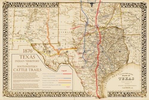
76. The Great Texas Cattle Trails Map ~ Original Design 18" x 24"
by Pete Charlton
Map: Pages (2005)
-- used & new: US$30.00
(price subject to change: see help)
Asin: B002YUGO0Y
Canada | United Kingdom | Germany | France | Japan
Editorial Review

Product Description
The Great Trails map is printed on a 18" x 24" sheet. A larger 24" x 36" size is available This Great Texas Trails map is a parchment toned reproduction of the superb 1876 S. A. Mitchell County Map of Texas from an original in the Electric Books collection. It is thought to be one of the best Texas and Southwestern maps ever published for the period after the Civil War through the end of the 19th century. Upon it we laid, in color, the documented routes of the major Texas and Southwestern northbound cattle trails including the Chisholm/Eastern Trail, the Western Trail, the Goodnight-Loving Trail and the Shawnee Trail, as well as the later route of the Butterfield Overland Stage Lines. In addition, we detailed the locations of the major Frontier and Indian Territory military forts including some very early private forts. This highly detailed post Civil War map also shows some historic locations like Jesse Chisholm's Ranch, the Chisholm Store in Indian Territory, the famous Red River Crossing on the Chisholm Trail in Montague County, Doan's Crossing of the Red River in Wilbarger County on the Western Trail and Horsehead Crossing on the Goodnight-Loving Trail and Butterfield Stage route.. In Texas and the Southwest, the period after the Civil War from about 1865 to the middle 1890's was turbulent with reconstruction, the final Indian Wars, the development of long distance transportation including the telegraph, stage lines and railroads. The cattle drives rebuilt a staggering Texas economy and opened up a new food source to all of the United States. ... Read more


77. Big Bend National Park, TX - Trails Illustrated Map #225 (National Geographic Maps: Trails Illustrated)
by National Geographic Maps
Map: 1 Pages (2009-01-01)
list price: US$11.95 -- used & new: US$6.00
(price subject to change: see help)
Asin: 1566952891
Canada | United Kingdom | Germany | France | Japan
Editorial Review

Product Description
The map includes Big Bend National Park, Big Bend Ranch State Park, Black Gap Wildlife Management ARea, the Chisos Mountains, Sierra del Carmen, Sierra del Caballo Muerto, designated backcountry camping sites, park information, and more. Includes UTM tick marks for use with your GPS unit.

Scale = 1:133,333 & 1:27,500 Size: 26'' x 38'' ... Read more


78. Rand McNally Galveston/Texas City Map: Including Alvin/Dickinson/Hitchcock/La Marque/League City/Sante Fe/The Village of Tiki Island Plus Houston & Vicinity/mileage & Driving Times Map/Neig
by Rand McNally and Company
Map: Pages (2008-01-03)
list price: US$4.95 -- used & new: US$2.41
(price subject to change: see help)
Asin: 0528996436
Canada | United Kingdom | Germany | France | Japan
Editorial Review

Product Description
This detailed map of Galveston and Texas City, Texas has complete coverage for the city and surrounding area, with an inset map for downtown, plus most major tourist and business districts. When you flip the map over, you will find a complete street index and a "city and vicinity" map of the entire metro area. ... Read more


79. Rand McNally Houston: Texas City Map (Rand McNally Folded Map: Cities)
by Rand McNally and Company
Map: Pages (2003-07)
list price: US$4.95 -- used & new: US$4.79
(price subject to change: see help)
Asin: 0528996428
Average Customer Review: 5.0 out of 5 stars
Canada | United Kingdom | Germany | France | Japan

Customer Reviews (1)

5-0 out of 5 stars It's Got Everything on the Map
A complete map of the Houston area, it shows everything.Good job, Rand McNally. ... Read more


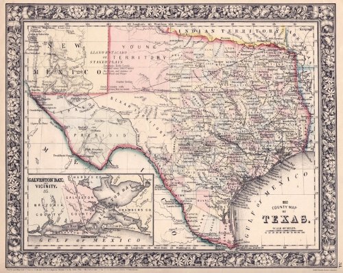
80. Reproduction Pre-Civil War 1860 Texas County map by S.A. Mitchell ~ 18" x 24"
by Pete Charlton
Map: Pages (2004)
-- used & new: US$30.00
(price subject to change: see help)
Asin: B002Z9S1M8
Canada | United Kingdom | Germany | France | Japan
Editorial Review

Product Description
This Texas map is a reproduction of the superb 1860 S. A. Mitchell County Map of Texas from an original in the Electric Books collection. It is thought to be one of the best Texas and Southwestern maps ever published for the period just prior to the Civil War . In this period Texas was in rapid development, trying to get railroad lines to the major cities and shipping points. The slavery issue and secession was in the background but getting new settlers into the states and creating an economy were on the minds of most. The large cattle drives to the north had not started at this point. Here is more detail from the superb Handbook of Texas Online:This map features an intricate and beautiful border that was typical of Mitchell County Maps to this point. The hand applied colors on the original in our collection, from which this reproduction was made, are subtle but effective and avoid the checkerboard look of so many other Texas maps of this period. Note that this map will have large margins at right & left on the 18" x 24" sheet. The sheet size is just right for easy readability of the great amount of detail included. It is extremely decorative when placed on a wall. The map is printed on excellent heavy acid free linen finish stock that will resist handling smudges. ... Read more


  Back | 61-80 of 119 | Next 20
A  B  C  D  E  F  G  H  I  J  K  L  M  N  O  P  Q  R  S  T  U  V  W  X  Y  Z  

Prices listed on this site are subject to change without notice.
Questions on ordering or shipping? click here for help.

site stats