e99 Online Shopping Mall

Geometry.Net - the online learning center Help  
Home  - Basic W - West Virginia Maps (Books)

  Back | 61-80 of 105 | Next 20
A  B  C  D  E  F  G  H  I  J  K  L  M  N  O  P  Q  R  S  T  U  V  W  X  Y  Z  

click price to see details     click image to enlarge     click link to go to the store

 
61. Eastern United States Areamap:
$12.83
62. West Virginia Atlas & Gazetteer
 
63. Calendar and Index to Recorded
$3.95
64. Rand McNally Streets of Huntington/Ashland,
$25.22
65. ... [County Reports and Maps]:
$39.99
66. County Reports and Maps: Braxton
$21.85
67. County Reports and Maps Jackson,
$28.59
68. County Reports and Maps ... Jefferson,
$49.99
69. Raven Wall Map for the State of
 
70. Nationa Geographic Map - Maryland
 
71.
72. National Geographic Close-up USA
 
73. Delaware, Maryland, Virginia,
 
74. Map of Delaware, Maryland, Virginia,
 
75. Map of Delaware, Maryland, Virginia
 
76. West Virginia Geological Survey-Map
 
77. Geology of Oil & Gas Fields
 
78. Delaware - Maryland - Virgina
 
79. Papers of the Bibliographical
 
$54.48
80. Virginia/West Virginia (State

61. Eastern United States Areamap: Including Alabama, Arkansas, Connecticut, Delaware, Florida, Georgia ... West Virginia, Plus Mini-Maps of Interstate H (Gousha Travel Publication)
by H.M. Gousha Co.
 Hardcover: 1 Pages (1993-01)
list price: US$2.25
Isbn: 0137705123
Canada | United Kingdom | Germany | France | Japan

62. West Virginia Atlas & Gazetteer
by Delorme
Map: 64 Pages (2001-02-01)
list price: US$19.95 -- used & new: US$12.83
(price subject to change: see help)
Asin: 0899333273
Average Customer Review: 4.5 out of 5 stars
Canada | United Kingdom | Germany | France | Japan
Editorial Review

Product Description
The first choice of outdoors enthusiasts. Beautiful, detailed, large-format maps of every state. Perfect for home and office reference, and a must for all your vehicles. Gazetteer information may include: campgrounds, attractions, historic sites & museums, recreation areas, trails, freshwater fishing site & boat launches, canoe trips or scenic drives. Categories vary by state ... Read more

Customer Reviews (9)

5-0 out of 5 stars Indespensible
I LOVE these map books!My first one was a NH book - since then I have bought a Maine, then Maryland/Delaware, now WV - helpful when trying to plot our way thru the back roads...

4-0 out of 5 stars The usual, for a Delorme atlas
Like other Delorme atlases, this is nicely detailed - though like other atlas, it can be annoying to use when you have to move from one page to another to follow a route.We also purchased (on Amazon) a Martinsburg - Charles Town - Eastern West Virginia road map that would be a better choice if you are looking for something to use while driving around Eastern West Virginia.

5-0 out of 5 stars Hitting the road and then the hills
Once again this series of maps has been outstanding. The ease in reading and applying the info to the road is way above par. And for railroad enthusiasts, this is the only map published with railroad details that are current and precise.

5-0 out of 5 stars Essential tool for any West Virginia outdoorsman
This book provides complete and thurough topographical maps for the entire state of West Virginia. If you enjoy hiking, fishing, camping, exploring in this great state, you need this atlas. At first I was surprised at the details provided in this book. I was able to find even the smallest of streams and geographical features. Now, after using it so many times, I would be surprised if a stream is not on this map.

The bottom line is that you need this atlas if you enjoy the West Virginia outdoors.

5-0 out of 5 stars Very helpful tool
This atlas fills a void because it gives a very clear picture of the terrain as well as roads.I like having these atlases along to give the context for hiking excursions, as well as showing the back road ways to get there.The section on special sights to see in WV is very helpful as well.There is no substitute for more detailed topographical maps for actual hiking trails, but this atlas is a necessart intermediate step between topos and road maps. ... Read more


63. Calendar and Index to Recorded Survey Plats in Jefferson County, West Virginia (Virginia), Courthouse, 1801-1901
by Michael D. Thompson
 Hardcover: Pages (1984)

Asin: B003N3DGKM
Canada | United Kingdom | Germany | France | Japan

64. Rand McNally Streets of Huntington/Ashland, West Virginia/ Kentucky (Champion Maps)
Map: Pages (2007-11-04)
list price: US$3.95 -- used & new: US$3.95
(price subject to change: see help)
Asin: 0528869906
Canada | United Kingdom | Germany | France | Japan

65. ... [County Reports and Maps]: Wirt, Roane and Calhoun Counties, Volume 1
by Ray Vernon Hennen
Paperback: 630 Pages (2010-02-24)
list price: US$45.75 -- used & new: US$25.22
(price subject to change: see help)
Asin: 1145706495
Canada | United Kingdom | Germany | France | Japan
Editorial Review

Product Description
This is an EXACT reproduction of a book published before 1923. This IS NOT an OCR'd book with strange characters, introduced typographical errors, and jumbled words.This book may have occasional imperfections such as missing or blurred pages, poor pictures, errant marks, etc. that were either part of the original artifact, or were introduced by the scanning process. We believe this work is culturally important, and despite the imperfections, have elected to bring it back into print as part of our continuing commitment to the preservation of printed works worldwide. We appreciate your understanding of the imperfections in the preservation process, and hope you enjoy this valuable book. ... Read more


66. County Reports and Maps: Braxton and Clay Counties
by Ray Vernon Hennen, Robert Murray Gawthrop
Paperback: 958 Pages (2010-06-08)
list price: US$62.75 -- used & new: US$39.99
(price subject to change: see help)
Asin: 1174014474
Canada | United Kingdom | Germany | France | Japan
Editorial Review

Product Description
This is an EXACT reproduction of a book published before 1923. This IS NOT an OCR'd book with strange characters, introduced typographical errors, and jumbled words.This book may have occasional imperfections such as missing or blurred pages, poor pictures, errant marks, etc. that were either part of the original artifact, or were introduced by the scanning process. We believe this work is culturally important, and despite the imperfections, have elected to bring it back into print as part of our continuing commitment to the preservation of printed works worldwide. We appreciate your understanding of the imperfections in the preservation process, and hope you enjoy this valuable book. ... Read more


67. County Reports and Maps Jackson, Mason and Putnam Counties
by W J. Latimer
Paperback: 490 Pages (2010-03-10)
list price: US$38.75 -- used & new: US$21.85
(price subject to change: see help)
Asin: 1147225850
Canada | United Kingdom | Germany | France | Japan
Editorial Review

Product Description
This is an EXACT reproduction of a book published before 1923. This IS NOT an OCR'd book with strange characters, introduced typographical errors, and jumbled words.This book may have occasional imperfections such as missing or blurred pages, poor pictures, errant marks, etc. that were either part of the original artifact, or were introduced by the scanning process. We believe this work is culturally important, and despite the imperfections, have elected to bring it back into print as part of our continuing commitment to the preservation of printed works worldwide. We appreciate your understanding of the imperfections in the preservation process, and hope you enjoy this valuable book. ... Read more


68. County Reports and Maps ... Jefferson, Berkeley, and Morgan Counties, Volume 2
by George Perry Grimsley
Paperback: 752 Pages (2010-02-16)
list price: US$52.75 -- used & new: US$28.59
(price subject to change: see help)
Asin: 1144673909
Canada | United Kingdom | Germany | France | Japan
Editorial Review

Product Description
This is an EXACT reproduction of a book published before 1923. This IS NOT an OCR'd book with strange characters, introduced typographical errors, and jumbled words.This book may have occasional imperfections such as missing or blurred pages, poor pictures, errant marks, etc. that were either part of the original artifact, or were introduced by the scanning process. We believe this work is culturally important, and despite the imperfections, have elected to bring it back into print as part of our continuing commitment to the preservation of printed works worldwide. We appreciate your understanding of the imperfections in the preservation process, and hope you enjoy this valuable book. ... Read more


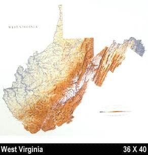
69. Raven Wall Map for the State of West Virginia - Laminated
by Raven Maps
Unknown Binding: Pages (1993)
-- used & new: US$49.99
(price subject to change: see help)
Asin: B003N3KHP4
Canada | United Kingdom | Germany | France | Japan
Editorial Review

Product Description
Raven Wall Map For The State Of West Virginia (Laminated). All Raven state wall maps display an incredible amount of detail, from cities, highways, and mountain ranges, to valleys, rivers, and small towns. The West Virginia map elevations are represented by color, and this, in combination with Raven's relief shading technique, gives the map a lush, 3-dimensional look.Size = 36 x 40 Inches ... Read more


70. Nationa Geographic Map - Maryland Virginia Delaware West Virginia
by National Geographic Society
 Unknown Binding: Pages (1976-01-01)

Asin: B002B901KM
Canada | United Kingdom | Germany | France | Japan

71.
 

Canada | United Kingdom | Germany | France | Japan

72. National Geographic Close-up USA Map: Maryland, Virginia, Delaware, West Virginia (Mid-Atlantic States)
Unknown Binding: Pages (1976)

Asin: B001TJ0DS0
Canada | United Kingdom | Germany | France | Japan

73. Delaware, Maryland, Virginia, West Virginia (Highway/Road Map)
by American Oil Company
 Unknown Binding: Pages (1965)

Asin: B0045VP5WI
Canada | United Kingdom | Germany | France | Japan

74. Map of Delaware, Maryland, Virginia, West Virginia, North Carolina, Kentucky, Tennessee, Ohio and Indiana.
by MARYLAND, VIRGINIA, WEST VIRGINIA, NORTH CAROLINA, KENTUCKY, TENNESSEE, OHIO, INDIANA) . DELAWARE
 Unknown Binding: Pages (1873)

Asin: B00455W8UG
Canada | United Kingdom | Germany | France | Japan

75. Map of Delaware, Maryland, Virginia and West Virginia.
by (DELAWARE / MARYLAND / VIRGINIA / WEST VIRGINIA)
 Unknown Binding: Pages (1900)

Asin: B00455UI3K
Canada | United Kingdom | Germany | France | Japan

76. West Virginia Geological Survey-Map 1931.Randolph County.
by West Virginia Geological Survey.
 Map: Pages (1931)

Asin: B001DRI56A
Canada | United Kingdom | Germany | France | Japan

77. Geology of Oil & Gas Fields in Steubenville, Burgettstown and Claysville Quadrangles (Ohio, West Virginia and Pennsylvania) WITH MAPS
by W.T. Griswald and M.J. Munn
 Paperback: Pages (1907)

Asin: B000OMIHWC
Canada | United Kingdom | Germany | France | Japan

78. Delaware - Maryland - Virgina - West Virginia. Sunoco Road Map and Historical Scenic Guide. Map title: Sunoco Historic Pictorial Map of Delaware - Maryland - Virgina - West Virginia.
by DELAWARE / MARYLAND / VIRGINIA / WEST VIRGINIA)
 Unknown Binding: Pages (1940)

Asin: B00455W66M
Canada | United Kingdom | Germany | France | Japan

79. Papers of the Bibliographical Society of america V Forty Five 3d Q 1951Frontier Presidios of New Spain; Ruysch Map of World; Early West Virginia Imprints
by Lawence C; Bradford F Swan; Boyd B Stutler Wroth
 Paperback: Pages (1951)

Asin: B000LM2W7G
Canada | United Kingdom | Germany | France | Japan

80. Virginia/West Virginia (State Fold Map)
 Paperback: Pages (2001-01)
list price: US$4.95 -- used & new: US$54.48
(price subject to change: see help)
Asin: 0762547987
Canada | United Kingdom | Germany | France | Japan

  Back | 61-80 of 105 | Next 20
A  B  C  D  E  F  G  H  I  J  K  L  M  N  O  P  Q  R  S  T  U  V  W  X  Y  Z  

Prices listed on this site are subject to change without notice.
Questions on ordering or shipping? click here for help.

site stats