|
|
Help |
| Home - Basic W - Wisconsin Maps (Books) | |
e99 Online Shopping Mall
|
|
Help |
| Home - Basic W - Wisconsin Maps (Books) | |
| Back | 21-40 of 102 | Next 20 |
click price to see details click image to enlarge click link to go to the store
| 21. Soils of Wisconsin (Bulletin - Geological and Natural History Survey) by Francis D. Hole, Marvin T. Beatty, Gerhard Bjarne Lee | |
| Hardcover: 264
Pages
(1976-06)
list price: US$40.00 -- used & new: US$35.00 (price subject to change: see help) Asin: 0299068307 Canada | United Kingdom | Germany | France | Japan | |
| 22. County Map of Michigan and Wisconsin. by Samuel Augustus Jr. MITCHELL | |
| Unbound:
Pages
(1866)
Asin: B001GX85TS Canada | United Kingdom | Germany | France | Japan | |
| 23. Green Bay/Appleton/Oshkosh/Fond Du Lac, Wisconsin Street Map | |
 | Map:
Pages
(2009-02)
list price: US$4.99 -- used & new: US$4.99 (price subject to change: see help) Asin: 084161458X Canada | United Kingdom | Germany | France | Japan |
| 24. National Geographic, Trails Illustrated, Apostle Islands National Lakeshore: Wisconsin, USA(Trails Illustrated - Topo Maps USA) (Map) by Trails Illustrated | |
 | Map: 1
Pages
(1997-01)
list price: US$9.95 -- used & new: US$9.64 (price subject to change: see help) Asin: 1566950082 Canada | United Kingdom | Germany | France | Japan |
| 25. Champion Maps Wausau / Rothschild / Weston, Wisconsin | |
 | Map:
Pages
(2007-10-05)
list price: US$3.95 -- used & new: US$3.25 (price subject to change: see help) Asin: 0528871293 Canada | United Kingdom | Germany | France | Japan |
| 26. Southwestern Wisconsin Road Map (USA City Maps - Wisconsin) by Milwaukee Map Service | |
| Hardcover: 1
Pages
(2007-01)
list price: US$5.95 Isbn: 1885825072 Canada | United Kingdom | Germany | France | Japan | |
| 27. Northwest Wisconsin Fishing Map Guide, Southern Region (Fishing Maps from Sportsman's Connection) by Sportsmans Connection | |
 | Spiral-bound:
Pages
(2000-02)
list price: US$22.25 -- used & new: US$30.30 (price subject to change: see help) Asin: 1885010222 Canada | United Kingdom | Germany | France | Japan |
|
Editorial Review Product Description | |
| 28. Milwaukee and SE Wisconsin Bike Map 2nd Edition by Bruce Thompson | |
 | Map: 1
Pages
(2009-04-27)
list price: US$11.95 -- used & new: US$10.99 (price subject to change: see help) Asin: 1935372009 Canada | United Kingdom | Germany | France | Japan |
|
Editorial Review Product Description Coverage: Detailed maps of Milwaukee, Racine, Kenosha, Waukesha, Mukwonago and parts of Brookfield. Larger scale overview map of SE Wisconsin from the Illinois border to Port Washington and west to Lake Geneva. Highlights: Complete network of bicycle friendly roads and bike trails. All routes have been field tested by an experienced local rider and checked by other riders. Features: Full color map 22 X 34 inches, two sided. Milwaukee's signature Oak Leaf Trail is clearly marked. Selected locations for parking, drinking water, restrooms and points of interest. Clear and easy-to-understand graphics. 100% to scale. About the paper: Printed on tear and water resistant Polyart paper. Will hold up to sweaty jersey pockets, sudden storms, chaotic handlebar packs and overstuffed panniers. | |
| 29. Northwest Wisconsin Fishing Map Guide, Northern Region: Lake Maps and Fishing Information for Bayfield, Douglas, Sawyer & Washburn Counties (Sportsman's Connection) by Sportsmans Connection | |
 | Spiral-bound:
Pages
(2000-02)
list price: US$22.25 -- used & new: US$10.00 (price subject to change: see help) Asin: 1885010214 Canada | United Kingdom | Germany | France | Japan |
|
Editorial Review Product Description | |
| 30. Milwaukee Bike Map: And Southeast Wisconsin by Bruce Thompson | |
 | Map: 1
Pages
(2006-04-30)
list price: US$9.95 -- used & new: US$9.95 (price subject to change: see help) Asin: 0974662542 Average Customer Review: Canada | United Kingdom | Germany | France | Japan |
|
Editorial Review Product Description You wil find unique local roads and and little known bike trails for great recreational bike riding plus direct, bike friendly routes to get you to work and back or through your daily errands. Map Details: 34" X 22" Side 1: Detail view of Milwaukee including all local streets, bike routes and trails. Smaller roads grayed out to improve readability. All bike roads and trails interconnect to create a complete network of bike routes. Includes inset details of Racine, Kenosha and Waukesha Side 2: Overview of SE Wisconsin from Illinois border to Port Washington and west to Lake Geneva. Includes bike friendly roads and bike trails. All routes and trails interconnect to create a continuous network of routes. Transition from urban to rural areas is seamless so you can continue your route into or out from the urban/suburban core. Small roads grayed out to improve readability. Customer Reviews (1)
| |
| 31. Family Maps of Sheboygan County, Wisconsin, Deluxe Edition by Gregory A. Boyd | |
 | Paperback: 210
Pages
(2010-07-16)
-- used & new: US$29.95 (price subject to change: see help) Asin: 1420313657 Canada | United Kingdom | Germany | France | Japan |
|
Editorial Review Product Description | |
| 32. Minnesota & Wisconsin State Folding Map (State Fold Map) by UniversalMAP | |
 | Map:
Pages
(2008-01-01)
list price: US$4.95 -- used & new: US$4.15 (price subject to change: see help) Asin: 0762551089 Canada | United Kingdom | Germany | France | Japan |
| 33. Family Maps of Lincoln County, Wisconsin, Deluxe Edition by Gregory A. Boyd | |
 | Paperback: 380
Pages
(2010-07-16)
-- used & new: US$35.95 (price subject to change: see help) Asin: 1420315242 Canada | United Kingdom | Germany | France | Japan |
|
Editorial Review Product Description | |
| 34. Family Maps of Monroe County, Wisconsin, Deluxe Edition by Gregory A. Boyd | |
 | Paperback: 352
Pages
(2010-07-16)
-- used & new: US$35.95 (price subject to change: see help) Asin: 1420313959 Canada | United Kingdom | Germany | France | Japan |
|
Editorial Review Product Description | |
| 35. Folded Map-Wisconsin Dells (Rand McNally City Maps) | |
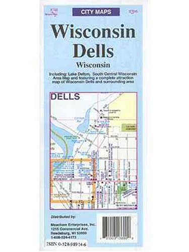 | Map:
Pages
(2000-04)
list price: US$3.95 Isbn: 0528989146 Canada | United Kingdom | Germany | France | Japan |
| 36. Rand McNally Milwaukee Wisconsin City Map (Rand McNally City Maps) | |
| Map:
Pages
(2002-05)
list price: US$3.95 -- used & new: US$110.05 (price subject to change: see help) Asin: 0528993305 Average Customer Review: Canada | United Kingdom | Germany | France | Japan | |
Customer Reviews (1)
| |
| 37. MAP: 'Wisconsin'...from Atlas of the World by Rand McNally & Co | |
| Unbound:
Pages
(1895-01-01)
Asin: B002FJRZ0W Canada | United Kingdom | Germany | France | Japan | |
| 38. County maps of Northwestern Wisconsin by Homer H Borum | |
| Unknown Binding: 21
Pages
(1978)
-- used & new: US$7.99 (price subject to change: see help) Asin: B0006WWPHS Canada | United Kingdom | Germany | France | Japan | |
| 39. La Crosse, Wisconsin: City Map (Rand McNally) by Rand McNally | |
| Map:
Pages
(1999-08)
list price: US$3.95 Isbn: 0528981935 Canada | United Kingdom | Germany | France | Japan | |
| 40. Rand McNally Easyfinder Wisconsin Map by Rand McNally and Company | |
| Paperback: 1
Pages
(1995-07)
list price: US$4.95 Isbn: 052897064X Canada | United Kingdom | Germany | France | Japan | |
| Back | 21-40 of 102 | Next 20 |