e99 Online Shopping Mall

Geometry.Net - the online learning center Help  
Home  - Earth Sciences - Geographic Information Systems (Books)

  1-20 of 100 | Next 20

click price to see details     click image to enlarge     click link to go to the store

$29.56
1. Geographic Information Systems
$49.49
2. Geographic Information Systems
 
$122.95
3. Geographic Information Systems
$65.00
4. Geographic Information Systems:
$85.01
5. Geographic Information Systems
$94.64
6. Introduction to Geographic Information
$49.99
7. Managing Geographic Information
$43.44
8. Geographic Information Systems
$116.91
9. Anthropology, Space, and Geographic
$4.00
10. Fundamentals of Geographic Information
$72.80
11. Concepts and Techniques of Geographic
$61.48
12. Introduction to Geographic Information
$40.95
13. Multidimensional Geographic Information
$42.50
14. Introducing Geographic Information
$60.00
15. Managing Geographic Information
$34.97
16. Algorithmic Foundations of Geographic
$77.91
17. Geographic Information Systems
$236.14
18. Geographic Information Systems:
$63.97
19. Geographic Information Systems:
$60.47
20. Geographic Information Systems

1. Geographic Information Systems and Science
by Paul A. Longley, Michael F. Goodchild, David J. Maguire, David W. Rhind
Paperback: 536 Pages (2005-03-22)
-- used & new: US$29.56
(price subject to change: see help)
Asin: 047087001X
Average Customer Review: 4.5 out of 5 stars
Canada | United Kingdom | Germany | France | Japan
Editorial Review

Product Description
The first edition of Geographic Information Systems and Science has taken the GIS textbook market by storm, selling over 22,000 copies since publication. It is the most current, authoritative and comprehensive treatment of the field, that goes from fundamental principles to the big picture.

GISS 2e builds on the success of the first edition:

  • Completely revised with a new five part structure: Foundations; Principles; Techniques; Analysis; Management and Policy
  • All new personality boxes of current GIS practitioners
  • New chapters on Distributed GIS, Map Production, Geovisualization, Modeling, and Managing GIS
  • Specific coverage of current hot topics:
    • GIS and the New World Order
    • Security, health and well-Being
    • Digital differentiation in GIS consumption
    • The core organizing role of GIS in geography
    • The greening of GIS
    • Grand challenges of GIS science
    • Science and explanation

A new suite of instructor resources including a companion website with an on-line lab resource and personal student sullabus and a cehensive Instructor’s Manual that maps the textbook to various disciplines and levels of courses. ... Read more

Customer Reviews (9)

5-0 out of 5 stars Geographic Information Systems and Science
If you want to know how GIS works, this book will give you a complete picture of it.

5-0 out of 5 stars Excellent Reference
This is a great reference book.Initially purchased for a class, I have returned to it several times to review key points.

5-0 out of 5 stars Easy to understand
It has examples and explains things clearly. It is a book about GIS theory and design, and understanding GIS systems in general although they use Arc software primarily for examples. Overall a useful book that is not too expensive.

5-0 out of 5 stars As described
I needed this text book.It was exactly as described and arrived very quickly and in good condition. For me, it provided a good overview of GIS and the management of that technology.

4-0 out of 5 stars Helpful and good price
This book was helpful for those new to GIS.I am taking a grad course and found this text useful in giving background information. ... Read more


2. Geographic Information Systems and Science
by Paul A. Longley, Mike Goodchild, David J. Maguire, David W. Rhind
Paperback: 560 Pages (2010-08-09)
-- used & new: US$49.49
(price subject to change: see help)
Asin: 0470721448
Average Customer Review: 2.0 out of 5 stars
Canada | United Kingdom | Germany | France | Japan
Editorial Review

Product Description
The Third Edition of this bestselling textbook has been fully revised and updated to include the latest developments in the field and still retains its accessible format to appeal to a broad range of students.

Now divided into five clear sections the book investigates the unique, complex and difficult problems that are posed by geographic information and together they build into a holistic understanding of the key principles of GIS.

This is the most current, authoritative and comprehensive treatment of the field, that goes from fundamental principles to the big picture of:

  • GIS and the New World Order
  • security, health and well-being
  • digital differentiation in GIS consumption
  • the core organizing role of GIS in Geography
  • the greening of GIS
  • grand challenges of GIScience
  • science and explanation

Key features:

  • Four-colour throughout
  • Associated website with free online resources
  • Teacher’s manual available for lecturers
  • A complete learning resource, with accompanying instructor links, free online lab resources and personal syllabi
  • Includes learning objectives and review boxes throughout each chapter

New in this edition:

  • Completely revised with a new five part structure: Foundations; Principles; Techniques; Analysis; Management and Policy
  • All new personality boxes of current GIS practitioners
  • New chapters on Distributed GIS, Map Production, Geovisualization, Modeling, and Managing GIS
... Read more

Customer Reviews (1)

2-0 out of 5 stars New book?
If you are going to sell on amazon under the new book category you have to make sure the book is in new condition when it reaches the user.I don't know if the book was damaged in transit or prior to shipping, but it sure isn't new now. ... Read more


3. Geographic Information Systems and Cartographic Modeling
by C. Dana Tomlin
 Hardcover: 572 Pages (1990-03)
list price: US$79.00 -- used & new: US$122.95
(price subject to change: see help)
Asin: 0133509273
Average Customer Review: 4.0 out of 5 stars
Canada | United Kingdom | Germany | France | Japan

Customer Reviews (1)

4-0 out of 5 stars This is where raster GIS started...
...well not really, but this book sparked the scientific interest in it. The concepts surrounding surface analysisdate back to late 1970s and were championed by Dana Tomlin with his PhD dissertation in 1983, which was later published as this book. Here, Tomlin introduces map algebra operators based on how a computer algorithm obtains data values for processing raster surfaces. He identifies three fundamental classes: local, focal and zonal functions.
Tomlin is a must to any academic student of GIS, since much or nearly all work on raster GIS springs off from Tomlin's work. The illustrations clearly show that this is an old book, but the knowlegde still remains as brilliant today as it was then.
This is a book you want to own, simply because it is very sought after and constantly unavailable from your university library. ... Read more


4. Geographic Information Systems: An Introduction
by Tor Bernhardsen
Hardcover: 448 Pages (2002-05-23)
list price: US$110.00 -- used & new: US$65.00
(price subject to change: see help)
Asin: 0471419680
Average Customer Review: 4.5 out of 5 stars
Canada | United Kingdom | Germany | France | Japan
Editorial Review

Product Description
"If we are to solve many of the problems facing us-in the cities, in the wild areas of the earth, in the atmosphere, and the oceans-we shall need the help of skilled users of GIS technology. If readers can master what is in this volume, they will be well started on this enterprise."
-From the Foreword by Jack Dangermond
President of ESRI
Praise for previous editions:
"One of only a small number of texts devoted to the technology of GIS that are truly introductory in nature. . . . Very readable and of moderate length. Those who are real novices to GIS will find this one attractive."
-Computers and Geosciences
"Well-rendered and very clear line drawings . . . well written, with a well-balanced blend of technical/theoretical concepts and more applied facts of GIS."
-Professional Geographer
Geographic Information Systems provides a practical, theory-driven overview of GIS that is supported with clear coverage of basic techniques. This treatment enables readers to understand the broad aspects of GIS without focusing on a specific software or discipline, such as engineering or geography. New features of this Third Edition include: up-to-date information on standardization efforts aimed at facilitating the exchange of ideas and data; technical content that is up to date with current hardware, software, database design, and analytical techniques; and comprehensive cost/benefit guidelines for choosing and evaluating a GIS, including coverage of organizational and technical issues.
Complete with extensive references and links to online resources, Geographic Information Systems, Third Edition, is an exceptional resource for students of GIS, planning, land use, natural resources, civil and environmental engineering, real estate, and wildlife biology. ... Read more

Customer Reviews (2)

5-0 out of 5 stars An ideal introduction and valuable reference
This review refers to the 1996 Norwegian edition. Having studied GIS for 2years, first at a Norwegian college, and then doing an MSc in GIS at a UKuniversity, I have found this book a very valuable reference. The examplesand case descriptions are depicting real-life problems, the illustrationsare explanatory and to the point. The book covers GIS and related topics ina way I haven't found in any other books. I can recommend this book toanyone, student or professional. Now I am about to start a PhD at aUniversity in the US, where I have noticed that this book in fact is therequired textbook for GIS. To me this proves the overall quality of thisbook.

4-0 out of 5 stars Comprehensive GIS Book
A comprehensive GIS book specially for the introductory and intermediate readers and students. The book has dealt with the current organizational and technical issues of GIS. The components of GIS are described withillustrations. Object Oriented model in database could have been added.Since this is an introductory book, some of the chapters for advancedreaders are concise. The content is clear even for the nontechnicalreaders. ... Read more


5. Geographic Information Systems in Water Resources Engineering
by Lynn E. Johnson
Hardcover: 328 Pages (2008-12-17)
list price: US$125.95 -- used & new: US$85.01
(price subject to change: see help)
Asin: 1420069136
Canada | United Kingdom | Germany | France | Japan
Editorial Review

Product Description

State-of-the-art GIS spatial data management and analysis tools are revolutionizing the field of water resource engineering. Familiarity with these technologies is now a prerequisite for success in engineers’ and planners’ efforts to create a reliable infrastructure.

GIS in Water Resource Engineering presents a review of the concepts and applications of GIS in the various sub-fields of water resource engineering. After a summary review of analyses and database functions, the book addresses concepts and applications in the following areas:

  • Surface Water Hydrology
  • Groundwater Hydrology
  • Water Supply and Irrigation systems
  • Wastewater and Stormwater Systems
  • Floodplain Management
  • Water Quality
  • Water Resource Monitoring and Forecasting
  • River Basin Planning and Management

The book develops a general understanding of the nature of GIS and how it is used to create and analyze geographic data. The author first introduces primary field data collection methods and describes procedures for interpretation and analysis. The second portion of the book focuses on the linkage of GIS data with water resource analysis and management models. Applications are presented with descriptions of GIS database development, analysis background theory, and model integration with GIS.

The profound impact of GIS systems on water resources engineering continues to grow. GIS in Water Resource Engineering arms engineers and planners with an arsenal of tools to assist in the creation of a reliable, environmentally sensitive, infrastructure.

... Read more

6. Introduction to Geographic Information Systems with Data Files CD-ROM
by Kang-tsung Chang
Hardcover: 448 Pages (2009-01-16)
-- used & new: US$94.64
(price subject to change: see help)
Asin: 007729436X
Average Customer Review: 4.0 out of 5 stars
Canada | United Kingdom | Germany | France | Japan
Editorial Review

Product Description
Introduction to Geographic Information Systems, 5e is designed to provide students in a first or second GIS course with a solid foundation in both GIS concepts and the use of GIS. Introduction to GIS strikes a careful balance between GIS concepts and hands-on applications. The main portion of the chapter presents GIS terms and concepts and helps students learn how each one fits into a complete GIS system. At the end of each chapter, an application section with 2-7 tasks presents students with actual GIS exercises and the necessary data to solve the problem. ... Read more

Customer Reviews (7)

2-0 out of 5 stars Buy Bolstad's Book Instead
This book is not very well-written.I agree with the previous reader that it reads more like an encyclopedia than a textbook.It discussed practical topics, but in a very theoretical way.The exercises do walk you through ArcGIS examples step by step, but they do have some mistakes in there.All of the examples use the same data from Idaho.If you are looking foor a book that is a good read with interesting exercises, this is not the book for you.Instead, try Bolstad's Intro to GIS.

3-0 out of 5 stars textbook
It's a textbook...it serves its purpose.Got here in good time & good condition

3-0 out of 5 stars reads more like an encyclopedia than a textbook
This textbook covers a LOT of information.Unfortunately, it reads like an encyclopedia on GIS-- definitely NOT like a textbook for beginners.It is a good reference book, but is very user-unfriendly for the novice.Endless terminology is presented with little or no conceptual explanations. Each chapter has a corresponding ArcGIS exercise in which you are asked to answer questions which were not really addressed in preceeding material. Honestly, my Intro to GIS prof. isn't really using the text at all.

5-0 out of 5 stars great book
shipping took a bit longer than expected, but it was just in time for my first assignment

5-0 out of 5 stars Great Price
The price for this GIS book beat my university's price hands down and i also didn't have to wait long to receive it. Two thumbs up! I love getting all my books from amazon.com ... Read more


7. Managing Geographic Information Systems, Second Edition
by Nancy J. Obermeyer Phd, PhD Jeffrey K. Pinto PhD
Hardcover: 360 Pages (2007-12-03)
list price: US$65.00 -- used & new: US$49.99
(price subject to change: see help)
Asin: 1593856350
Canada | United Kingdom | Germany | France | Japan
Editorial Review

Product Description

Now in a fully revised and expanded second edition, this widely adopted text and practical reference addresses all aspects of developing and using geographic information systems (GIS) within an organization. Coverage includes the role of the GIS professional, how geographic information fits into broader management information systems, the use of GIS in strategic planning, and ways to navigate the organizational processes that support or inhibit the success of GIS implementation. All chapters retained from the prior edition have been thoroughly updated to reflect significant technological, empirical, and conceptual advances, as well as the changing contexts of GIS use. New chapters discuss organizational politics, metadata, legal issues, and GIS ethics.

... Read more

8. Geographic Information Systems for the Social Sciences: Investigating Space and Place
by Steven J. Steinberg, Sheila L. Steinberg
Paperback: 272 Pages (2005-08-04)
list price: US$63.95 -- used & new: US$43.44
(price subject to change: see help)
Asin: 0761928731
Average Customer Review: 4.0 out of 5 stars
Canada | United Kingdom | Germany | France | Japan
Editorial Review

Product Description
Geographic Information Systems for the Social Sciences: Investigating Space and Place is the first book to take a cutting-edge approach to integrating spatial concepts into the social sciences. In this text, authors Steven J. Steinberg and Sheila L. Steinberg simplify GIS (Geographic Information Systems) for practitioners and students in the social sciences through the use of examples and actual program exercises so that they can become comfortable incorporating this research tool into their repertoire and scope of interest. The authors provide learning objectives for each chapter, chapter summaries, links to relevant Web sites, as well as suggestions for student research projects.  ... Read more

Customer Reviews (1)

4-0 out of 5 stars excellent guidebook for good research practices
I bought this book several months ago, but only just recently finished reading it. I got it on the recommendation of a colleague who recommended it, and I was not disappointed.
While the book is geared more towards social scientists and graduate students pursuing a career in social scientists, it does an excellent job of showing researchers common fallacies in using GIS for research. The book does not use many case studies, as other books do, which I think is more helpful because it allows the reader to think out how they would like to pursue their own direction in researching a topic, as opposed to a reader thinking, "well now, that doesn't really work for me," and tossing out the advice that comes from examples altogether.
The book is generic enough when talking about GIS systems that you don't get the feeling that you're reading a 200-page advertisement on the glories and wonders of ArcGIS. I also appreciate the layout of each chapter, opening with an outline of topics, an introduction, the main chapter, and then a summary. It gives you several opportunities to check to make sure you understand exactly what the authors are talking about. ... Read more


9. Anthropology, Space, and Geographic Information Systems (Spatial Information Systems)
Hardcover: 304 Pages (1996-07-18)
list price: US$125.00 -- used & new: US$116.91
(price subject to change: see help)
Asin: 0195085752
Canada | United Kingdom | Germany | France | Japan
Editorial Review

Product Description
Major advances in the use of geographic information systems have been made in both anthropology and archaeology. Yet there are few published discussions of these new applications and their use in solving complex problems. This book explores these techniques, showing how they have been successfully deployed to pursue research previously considered too difficult--or impossible--to undertake. Among the projects described here are studies of land degradation in the Peruvian Amazon, settlement patterns in the Pacific northwest, ethnic distribution within the Los Angeles garment industry, and prehistoric sociopolitical development among the Anasazi.The book is divided into a general section on the theory of geographic information systems, followed by sections demonstrating actual applications in cultural anthropology, archaeology, paleoanthropology, and physical anthropology.The work will be of much interest within all these communities. ... Read more


10. Fundamentals of Geographic Information Systems, 2nd Edition Update with Integrated Lab Exercises
by Michael N. DeMers
Hardcover: 656 Pages (2002-12-20)
list price: US$113.60 -- used & new: US$4.00
(price subject to change: see help)
Asin: 0471426091
Average Customer Review: 3.5 out of 5 stars
Canada | United Kingdom | Germany | France | Japan
Editorial Review

Product Description
This informative book on the principles of geographic information systems (GIS) interweaves the idea of geographic inquiry and spatial discovery throughout. It provides a comprehensive and accessible look at GIS without burdening the reader with an imposing array of equations, algorithms, computer code and command structures. ... Read more

Customer Reviews (7)

2-0 out of 5 stars Lame, at best
I totally agree with the two negative review above.This book is unnecessarily obtuse.You should look elsewhere if you are a total beginner.The information does not need to be presented in such a dry, academic manner.

5-0 out of 5 stars A review from an undergraduate user
I was privileged to take a class from Dr. Demers, himself, using this textbook.I found it to be a great textbook, and I particularly enjoyed his sense of humor in the book, a welcome addition to what I found to be a somewhat difficult and challenging topic.He has a good understanding of the topic, and a sensitivity to the needs of students that is unparalleled. I recommend it to anyone willing to put the effort into learning a new way of looking at geography and the world.

1-0 out of 5 stars Most topics are covered, but this book is barely readable
This book needs help, it is verbose. The book could be cut by a third, and would not lose any meaning. Most of the important topics are covered, but the discussions are often difficult to wade through, it takes forever to get to the main point.

There are better introductory texts out there. The ones by C.P. Lo and A.K Yeung, or by P. Bolstad are both more concise, to the point, easier to read, and just as complete in their coverage of topics.

2-0 out of 5 stars Useful, but needs editorial work
I am a GIS novice, and am about 1/3 of the way through the book.There is definitely a lot of useful and current information in this book, so I find it worth reading.However, I feel editorial work on it is needed in several ways.There are numerous examples of sloppy use of English (both in choice of words and in paragraph structure), discussions that are overly abstract, and explanations that are lengthy yet unclear.This was not universal, but occurred annoyingly often.On subjects I knew something about already, I was able to see how the book's accounts were accurate, but only after puzzling over the author's choice of phraseology.I will definitely have to look elsewhere for an understanding of map projections, database structures, raster models, and other topics.

Too much time is spent early in the book belaboring an abstract conceptual framework, where some concrete examples would serve much better.It was also disconcerting that certain terms are used without being defined (or only defined very abstractly), forcing the reader to guess meaning from the context.Yet other relatively simple terms are defined at length.The discussion questions at the end of each chapter are sometimes too open-ended, not focussed on the chapter material.

It is difficult to write for neophytes about a subject one knows intimately -- as I'm sure the author does.Important terms and assumptions are embedded in the one's thinking, so one does not realize that some crucial points are unfamiliar to the student, and one tends to skip certain steps.This book has good coverage of GIS issues, but it would benefit from a more severe editor and from more feedback from the undergraduate audience on which areas need clarification.

5-0 out of 5 stars A comprehensive and very understandable text.
This is unquestionably one of the finest GIS textbooks available today. Itcovers not only the basic input, data management, and reporting concepts,but includes sufficient depth of spatial analysis issues that anyone notable to take additional geographic analysis courses will come away withenough practical knowledge to truly unleash the power of geographicinformation systems. ... Read more


11. Concepts and Techniques of Geographic Information Systems (2nd Edition)
by Chor Pang Lo, Albert K.W. Yeung
Hardcover: 544 Pages (2006-08-20)
list price: US$115.00 -- used & new: US$72.80
(price subject to change: see help)
Asin: 013149502X
Average Customer Review: 4.5 out of 5 stars
Canada | United Kingdom | Germany | France | Japan
Editorial Review

Product Description

Fully updated to reflect advances in GIS concepts and techniques, this guide approaches the subject from the broader context of information technology. Gives complete, up-to-date coverage to the concepts and techniques pertaining to every stage of the systems development life cycle of GIS, as well as its applications to various areas of spatial problem solving and decision making.

For GIS specialists, GIS technologists, GIS sales directors, urban planners, natural resource managers, land surveyors, geomatics engineers, and foresters who want a complete understanding of GIS and how GIS applies to their fields of interest. ... Read more

Customer Reviews (3)

5-0 out of 5 stars Excellent and thorough
I purchased this book for a Fundamentals of GIS course I am taking online, it is very thorough.I can't imagine what a better book would look like.This one has it all.Lots of detail, highly recommended.

5-0 out of 5 stars Concepts and Techniques of Geographic Information Systems
Book was in good condition as described on Amazon. Very informative and perfect for my class.

4-0 out of 5 stars Broad yet thorough treatment of GIS techniques and issues
The focus of this book is on the concepts and techniques needed by GIS professionals. Thus, this book stands out for its intentional focus on professional education. The reader should be proficient in geometry, algebra and trigonometry and also have some background in computer science and geography. While this book deals with the range of topics normally included in introductory GIS courses, coverage of many subjects is deep enough for the advanced reader. The authors definitely had a problem trying to place the many interconnected topics of GIS into a linear sequence of chapters. Thus, there are many times where a topic is briefly introduced in one chapter only to have it reappear in greater depth in some subsequent chapter.

Sometimes, the connection between the original introduction and the later details is not clear. For example, in Chapter 2, surveying gets a much more thorough treatment than photogrammetry. However, in chapter 8, six chapters later, photogrammetry reappears as a topic and is covered in tremendous detail. The references at the end of each chapter are very good and are usually in sources that should be accessible to most readers. Once past the simple scale and map theme topics, students face their first mathematical challenge in meaty sections on planar coordinate transformations, projections, geodetic datums, UTM, state plane systems and even a brief introduction to land surveying and GPS . Thisdemonstrates that the authors decided not to shy away from the difficult details of GIS. This would make a good textbook in an upper undergraduate class as well as a good professional reference. Since the table of contents is not shown, I do that next:

1. INTRODUCTION - This chapter explains the context for studying GIS in both the academic and professional settings.

2. MAPS AND GEOSPATIAL DATA - This chapter explains the relationship between maps and GIS.

3. DIGITAL REPRESENTATION AND ORGANIZATION OF GEOSPATIAL DATA - Explains the concepts and techniques of representing geographic data in digital form using different data models. Includes a quick reference to important geographical foundations such as Berry's geographic matrix, then introduces the concepts of objects and fields and rasters and vectors. This chapter also includes a useful section on representing temporal relationships and a good level of detail on object-oriented data models and database systems.

4. GEOSPATIAL DATA QUALITY AND STANDARDS - Defines the basic concepts and terminology commonly used for the description and evaluation of data quality with special reference to GIS. Includes an introduction to spatial autocorrelation and error propagation covered in much greater detail later in the book. Interoperability and OGC get one page here and one more page later in Chapter 12. Finally the chapter includes an extensive section on data standards both in the US and elsewhere.

5. RASTER GEOPROCESSING - Includes rasterfile formats and various topics related to acquiring raster data such as rectification, registration and mosaicing. Brief reference is made to various ways in which raster operations might be categorized. Then the local, neighborhood, extended neighborhood and regional classification system is used to explore the range of operations. Logical overlay operations are thoroughly covered. The determination of slope is also covered here under extended neighborhood operations. Map algebra and cartographic modeling are discussed later in the chapter along with some worked examples.

6. VECTOR GEOPROCESSING - Covers a variety of vector topics including digitizing, scanning, editing, topology building, attribute data conversion, address geocoding, a selection of basic vector operations such as buffering and topological overlay, and a good introduction to network analysis, picked up in much greater detail in Chapter 10.

7. GEOVISUALIZATION AND GEOSPATIAL INFORMATION PRODUCTS - An eclectic mix that covers GIS as information communication channel, human-computer interaction and user interfaces, scientific visualization, 3D, animation, web cams, hypermaps, digital spatial libraries, and how CRTs work.

8. REMOTE SENSING AND GIS INTEGRATION - Deep coverage on such topics as orthophotography production, thermal infrared energy equations, radar imaging theory, photogrammetric considerations of satellite imaging systems, and image classifiers.

9. DIGITAL TERRAIN MODELING - Deep coverage of a range of topics including sampling terrain data, geometric characteristics of DEMs, construction of TINs (including their topological datastructure), more on GPS, stereoplotter operation, sources and quality of existing DEMdata, extraction of topographic features, viewshed analysis, terrain visualization (including tables summarizing various software packages for terrain modeling). It also includes brief coverage of interpolation, surface fitting and trend surface analysis.

10. SPATIAL ANALYSIS, MODELING, AND MINING - Examines spatial analysis at a higher level than the simple map data manipulation of chapters 5 and 6. Good coverage of advanced topics include spatial autocorrelation indices, quadrat counts, nearest-neighbor analysis, gravity models and network analysis. A few detailed examples of integrating GIS with mathematical models concludes the chapter.

11. GIS IMPLEMENTATION AND PROJECT MANAGEMENT - Thorough coverage of important topics such as the value of a software engineering approach, stages of GIS project planning, system analysis, database design methodology (including several pages on E-R modeling, logical schema and normalization), application software design, system implementation and maintenance.

12. GIS ISSUES AND PROSPECTS - Overview of the key issues facing GIS users today. It also examines the emerging concepts and techniques that are rapidly changing the nature of using geographic information. ... Read more


12. Introduction to Geographic Information Systems
by Kang-Tsung Chang
Paperback: Pages (2009-04-01)
-- used & new: US$61.48
(price subject to change: see help)
Asin: 0071267581
Average Customer Review: 2.0 out of 5 stars
Canada | United Kingdom | Germany | France | Japan
Editorial Review

Product Description
"Introduction to Geographic Information Systems, 5/e" is designed to provide students in a first or second GIS course with a solid foundation in both GIS concepts and the use of GIS. "Introduction to GIS" strikes a careful balance between GIS concepts and hands-on applications. The main portion of the chapter presents GIS terms and concepts and helps students learn how each one fits into a complete GIS system. At the end of each chapter, an application section with 2-7 tasks presents students with actual GIS exercises and the necessary data to solve the problem. ... Read more

Customer Reviews (1)

2-0 out of 5 stars confusion about this product
This product causesmore confusion than is normal. But I will home in only on a mistake made by Amazon.com. They show a picture of the fifth edition paperback with an arrow that says look inside. When that is clicked you are taken to the second edition. Amazon.com are you selling the fifth edition paperback or the second edition?

I had to buy the book for a class. So now I will tell you what I think aboout the 4th edition. I gave a poor review for the first edition because of the mistakes in explaining the way the CD data was to be used. The back of the fourth edition says "Learn GIS the Easy Way" I assume that is put there because the CD is supposed to walk the student through the subject. The problem is that the exercises are sometimes wrong and sometimes assume you understand what is meant, without a proper explanation. Instructions are abreviated in some cases and assume the student understands how to accomplish the task. It appears in order to learn GIS from this book, using the included data, one has to know GIS.

There is no discussion of the included CD in the book. After awhile I concluded that you are supposed to simply copy the entire disk to your hard drive. when that is done things work better, but it does not get rid of the typos and mistakes and cryptic wording in some of the tasks. The text itself is OK but it could explain some subjects better.

... Read more


13. Multidimensional Geographic Information Science (Geographic Information Systems Workshop)
by Jonathan Raper
Paperback: 332 Pages (2000-11-23)
list price: US$59.95 -- used & new: US$40.95
(price subject to change: see help)
Asin: 0748405070
Average Customer Review: 4.0 out of 5 stars
Canada | United Kingdom | Germany | France | Japan
Editorial Review

Product Description
This text focuses on the ways in which GIS could be made multi-dimensional, based on modelling limitations of current two-dimensional GIS. It suggests extending GIS to incorporate the third dimension, 3D GIS, and spatio-temporal GIS. ... Read more

Customer Reviews (1)

4-0 out of 5 stars Vast New Applications
With the incipient rise of the mobile web, this book describes potentially vast new applications for Geographic Information Systems. New cellphones now often have GIS locator capability builtin. Plus, we can easily imagine other mobile devices like laptops, PDAs and vehicles having GIS by default. Combine this with an ever-increasing pervasive web, as suggested by WiFi and next generationWiFi, and you can see the need for ever more GIS databases. Where these would have street information, for example.

One future direction is in developing innovative ways to query the GIS data, and to hook it up to other databases, like weather maps.

Thus far, GIS has existed for what will one day be seen as small, specialised applications, like oceanside and mining activities. In reality, the much larger markets exist in urban areas, where most people are. By checking out this book, you can get a feel for how these new applications might be developed. ... Read more


14. Introducing Geographic Information Systems with ArcGIS: A Workbook Approach to Learning GIS
by Michael Kennedy
Paperback: 624 Pages (2009-04-13)
list price: US$80.00 -- used & new: US$42.50
(price subject to change: see help)
Asin: 0470398175
Average Customer Review: 5.0 out of 5 stars
Canada | United Kingdom | Germany | France | Japan
Editorial Review

Product Description
A unique approach to learning and teaching GIS, updated for ArcGIS 9.3

Introducing Geographic Information Systems with ArcGIS, Second Edition serves as both an easy-to-understand introduction to GIS and a hands-on manual for the ArcGIS 9.3 software. This combination theory-workbook approach is designed to quickly bring the reader from GIS neophyte to well-informed GIS user from both a general knowledge and practical viewpoint.

Replacing the traditional separate texts on theory and application, the book integrates a broad introduction to GIS with a software-specific workbook for ESRIs ArcGIS in a single comprehensive volume.¿Easy to read, interesting, and at times quite amusing, the new edition is even more accessible to a wide variety of readers.

Each chapter presents two mutually supporting sections:

Overview- a discussion of theory and ideas relating to GIS, laying the groundwork for spatial analysis

Step-by-step instructions on how to use ArcGIS software. There are sixty exercises and nine review exercises throughout the book, covering most of the topics students need to gain GIS jobs or continue work in GIS or GIScience

Complete with a CD-ROM containing data for working out all of the exercises, this Second Edition provides an updated examination of file geodatabases including vector, raster, and 3D GIS with terrains. On completion of this text, students will have acquired in-depth understanding of GIS theory and how to operate the ArcGIS software. They will have been exposed, through additional hands-on demonstrations, to virtually everything about GIS that supports spatial analysis.

Written by an author with over thirty years of experience writing software manuals, Introducing Geographic Information Systems with ArcGIS, Second Edition puts readers on the quick road to mastery of GIS. ... Read more

Customer Reviews (6)

5-0 out of 5 stars rest in peace, evan
to the author, Mr Kennedy: a chance encounter brought me to this book and a chance encounter connected me to your son, evan, years ago here in sf. i didn't know him terribly well, but well enough to appreciate him. it was nice to see your dedication to him and to his memory

5-0 out of 5 stars Great book
Great Book, has everything for an introduction, the only low point is that some topics are treated very short (one page), but well, for an introductory book is enough. ;-)

4-0 out of 5 stars Good intro book
I purchased this book to help me with an Intro to GIS course.The book is very detailed in it's presentation of how to use ArcCatalog and ArcMap.At times,however, it seems that the author wrote it for someone who'd never turned on a computer.I found the first 150 pages to be extremely boring.Other times, my ArcMap 9.3 didn't match up with his step by step instructions and I had use my instructor as a resource to figure out how to complete the exercise.Overall it's a well written book but the mismatched instructions cause me to give it a 4 star rating.

5-0 out of 5 stars Great book
The book was in great condition.I received it in a timely manner.Great service!

5-0 out of 5 stars Intro to GIS with Arc GIS
very good quality book, CD included. Service was excelent it arrived very quickly, overall very good! ... Read more


15. Managing Geographic Information System Projects (Spatial Information Systems)
by William E. Huxhold, Allan G. Levinsohn
Hardcover: 272 Pages (1995-01-05)
list price: US$89.95 -- used & new: US$60.00
(price subject to change: see help)
Asin: 0195078691
Average Customer Review: 5.0 out of 5 stars
Canada | United Kingdom | Germany | France | Japan
Editorial Review

Product Description
Most of the current publications on geographic information systems (GIS) focus on its mechanics, technology, and project-specific applications.This much-needed book, however, introduces the reader to GIS implementation from a management and organizational perspective. GIS is becoming increasingly popular and is evolving from a mapping tool used for support functions to a technology capable of redesigning land administration.In other sectors, information technology has had a dramatic effect on operations. This book examines those cases, and applies them to GIS paradigm, stressing that GIS technology itself does not cause improvements in operational efficiency and effectiveness, but enables changes that can facilitate these improvements.The bulk of the book guides the reader through the necessary frameworks nad techniques needed to plan, design, and implement GIS as a technological infrastructure within an organization.Managing Geographic Information System Projects, is suitable for both students and professionals who want to know how to successfully implement GIS technology in organizations. ... Read more

Customer Reviews (1)

5-0 out of 5 stars Excellent GIS Starting Point and Desk Reference
Written by folks that know how to do it, this ranges from organizational issues to technical design ... Read more


16. Algorithmic Foundations of Geographic Information Systems (Lecture Notes in Computer Science)
Paperback: 287 Pages (1997-11-12)
list price: US$69.95 -- used & new: US$34.97
(price subject to change: see help)
Asin: 3540638180
Average Customer Review: 2.0 out of 5 stars
Canada | United Kingdom | Germany | France | Japan
Editorial Review

Product Description
This tutorial survey brings together two lines of research and development whose interaction promises to have significant practical impact on the area of spatial information processing in the near future: geographic information systems (GIS) and geometric computation or, more particularly, geometric algorithms and spatial data structures. In nine uniformly structured and coherent chapters, the authors present a unique survey ranging from the history and basic characteristics to current issues of precision and robustness of geometric computing. This textbook is ideally suited for advanced courses on GIS and applied geometric algorithms. Research and design professionals active in the area will find it valuable as a state-of-the-art survey. ... Read more

Customer Reviews (1)

2-0 out of 5 stars very general
I checked this out from the library and was glad that I didn't buy it without reading it.It has very few equations and algorithms, and is more of a general overview or listing of computations done in GIS.Those hoping for a cookbook for geometric and analytic geography operations would best turn to Keith Clark's Analytic and Computer Cartograhy or a even good survey handbook for a better overview of the most important algorithms and formulas. ... Read more


17. Geographic Information Systems and Crime Analysis
Hardcover: 345 Pages (2005-04)
list price: US$84.95 -- used & new: US$77.91
(price subject to change: see help)
Asin: 1591404533
Canada | United Kingdom | Germany | France | Japan
Editorial Review

Product Description
Computerized crime mapping or GIS in law enforcement agencies has experienced rapid growth, particularly since the mid 1990s. There has also been increasing interests in GIS analysis of crime from various academic fields including criminology, geography, urban planning, information science and others. This book features a diverse array of GIS applications in crime analysis, from general issues such as GIS as a communication process and inter-jurisdictional data sharing to specific applications in tracking serial killers and predicting juvenile violence. The book showcases a broad range of methods and techniques from typical GIS tasks such as geocoding and hotspot analysis to advanced technologies such as geographic profiling, agent-based modeling and web GIS. Contributors range from university professors, criminologists in research institutes to police chiefs, GIS analysts in police departments and consultants in criminal justice. ... Read more


18. Geographic Information Systems: Socioeconomic Applications
by David Martin
Hardcover: 240 Pages (1995-12-18)
list price: US$240.00 -- used & new: US$236.14
(price subject to change: see help)
Asin: 0415125715
Average Customer Review: 5.0 out of 5 stars
Canada | United Kingdom | Germany | France | Japan
Editorial Review

Product Description
This book presents an accessible introduction to the history, principles and techniques of GIS, with a unique focus on socioeconomic applications. With frequent reference to illustrations, this non-technical overview of GIS explores the collection, input, storage, manipulation and output of data in GIS and addresses the needs of students and professionals who must understand and use GIS for the first time.

This second edition builds on the strengths of the first. Taking account of recent advances in GIS development and major new socioeconomic datasets (including new census data), it explores more fully the contribution of GIS to geography and their power in influencing our environment. ... Read more

Customer Reviews (1)

5-0 out of 5 stars Readable Introduction to GIS with Socioeconomic Applications
This book is intended to provide a general, non-technical introduction to the field of GIS. More specifically, it is aimed at those with a particular interest in the socioeconomic environment.In the following chapters, the reader will find an explanation of GIS technology, its theory and its applications, which makes specific reference to data on populations and their characteristics. The aim is not to provide detailed analysis of fields such as database management systems (DBMS) or computer graphics, which may be found elsewhere, but to introduce GIS within a strong framework of socioeconomic applications:

Table of Contents:
1. Introduction
2. The development of GIS
3. GIS applications
4. Theories of GIS
5. Data collection and input
6. Data storage
7. Data manipulation
8. Data output and display
9. Towards a socio-economic GIS
10. Conclusion.

Although the data used in the examples are out of date (mostly 1991), its socioeconomic content is for the purposes of demonstrating the use of GIS in this context: It is therefore still usable for developing an understanding of GIS for socioeconomic applications. The topics chosen for discussion are felt to be sufficiently well established and enduring that they will aid readers in understanding the important aspects of specific systems with which they may come into contact.

(For more detailed technical applications of GIS (that would follow nicely after reading this book), I recommend "Getting Started with Geographic Information Systems" by Keith C. Clarke, which can be used in conjunction with "Getting to Know ArcView GIS" by Pat Breslin. Data is interchangeable between the GIS programs that come with each book. Make sure the software comes with 2nd-hand books that may be bought.)
_________________________________ ... Read more


19. Geographic Information Systems: Applications in Natural Resource Management
by Michael G. Wing, Pete Bettinger
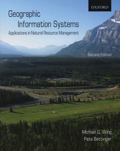
Paperback: 272 Pages (2008-09-15)
list price: US$80.00 -- used & new: US$63.97
(price subject to change: see help)
Asin: 019542610X
Canada | United Kingdom | Germany | France | Japan
Editorial Review

Product Description
Geographic Information Systems: Applications in Natural Resource Management is intended for introductory-course students in forestry and natural resource management, field forestry, biology, and other natural resource or natural resource-related fields. The emphasis of this book is on the application of Geographic Information systems (GIS). It provides detailed coverage of GIS operations such as querying, buffering, clipping, and overlay analysis; as well as background information on the history of GIS, database creation, editing and acquisition, and map development. The applications provided can be extended to any region of the world, although the primary emphasis is on Canada and the rest of North America. This book also examines current GIS trends and the opportunities and challenges likely to face GIS users. ... Read more


20. Geographic Information Systems and Environmental Modeling
by Keith C. Clarke, Brad O. Parks, Michael P. Crane, Brad E. Parks
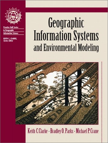
Paperback: 306 Pages (2001-07-05)
list price: US$64.00 -- used & new: US$60.47
(price subject to change: see help)
Asin: 0130408174
Canada | United Kingdom | Germany | France | Japan
Editorial Review

Product Description
This book provides readers with the most comprehensive and authoritative treatment of the topic available.Topics covered include modeling frameworks, paradigms and approaches; model development, calibration and validation; dynamic systems modeling and four-dimensional GIS; and more. Includes case studies in GIS/EM.This book is intended for readers interested in advanced Geographic Information Systems, Spatial Data Processing, or Environmental Modeling. ... Read more


  1-20 of 100 | Next 20

Prices listed on this site are subject to change without notice.
Questions on ordering or shipping? click here for help.

site stats