e99 Online Shopping Mall

Geometry.Net - the online learning center Help  
Home  - Science - Geographic Information Systems (Books)

  Back | 81-100 of 100
A  B  C  D  E  F  G  H  I  J  K  L  M  N  O  P  Q  R  S  T  U  V  W  X  Y  Z  

click price to see details     click image to enlarge     click link to go to the store

 
$74.95
81. Law Enforcement Geographic Information
$77.86
82. Efficient Query Processing in
 
$15.00
83. Exploring Geographic Information
 
$19.99
84. Geographic Information Systems
$63.75
85. Anthropology, Space, and Geographic
 
$30.00
86. Geographic Information Systems
$158.53
87. Archaeology And Geographic Information
 
$5.95
88. Relational Data Modeling for Geographic
$124.00
89. Spatial and Temporal Reasoning
$9.95
90. ESRI Map Book: Applications of
 
$28.60
91. Handbook on Geographic Information
$59.00
92. Geographic Information Systems
$62.39
93. Community Participation and Geographic
$176.35
94. Geographic Information Systems:
 
$22.00
95. Geographic Information Systems
 
$59.70
96. Ssadm for Handling Geographic
 
$5.95
97. VIETNAM: Project feasibility study
 
$5.95
98. Applications of land evaluation
 
99. Introduction to Physical Geography
 
$31.00
100. Geographic Information Systems:

81. Law Enforcement Geographic Information Systems
by Mark Leipnik
 Hardcover: Pages (2002-01)
list price: US$74.95 -- used & new: US$74.95
(price subject to change: see help)
Asin: 1575041464
Canada | United Kingdom | Germany | France | Japan

82. Efficient Query Processing in Geographic Information Systems (Lecture Notes in Computer Science)
by Beng Chin Ooi
Paperback: 208 Pages (1991-03)
list price: US$52.95 -- used & new: US$77.86
(price subject to change: see help)
Asin: 0387534741
Canada | United Kingdom | Germany | France | Japan
Editorial Review

Book Description
This monograph describes methods for extending relational database systems for geographic applications. The ways in which a relational database system is supplemented with unconventional spatial indexing structures, additional spatial subsystems and query processors are described in great detail. The work presents an extensive survey of existing spatial indexing techniques and a taxonomy of the extensions to the multidimensional indexing structures. An extensive experimental analysis of spatial indexes is presented. The work covers the following areas: - the design of geographic information systems (GIS) - extended query languages for GIS - spatial indexing mechanisms - query processing strategies. The author presents his own skd-trees and extended query optimization strategies. The survey of spatial indexing structures for non-zero sized objects provides a framework for workers in the field of spatial information systems to evaluate spatial access methods. The consideration of query optimization will assist understanding of the role of that topic in GIS. ... Read more


83. Exploring Geographic Information Systems
by Nicholas Chrisman
 Paperback: 298 Pages (1996-12-23)
list price: US$62.95 -- used & new: US$15.00
(price subject to change: see help)
Asin: 0471108421
Average Customer Review: 4.0 out of 5 stars
Canada | United Kingdom | Germany | France | Japan
Editorial Review

Book Description
This exploration of geographic information and geographic information systems (GIS) expands the discussion beyond the normal input-processing-output sequence. It begins by examining the manipulations that support analytical uses of GIS, including measurement and frameworks, representations, data quality, transformation and operations, parametric mapping, simple logic and overlay, taxonomy, distance transformations and surfaces. It then moves on to discuss operations that connect the practical exercises in the book to professional applications of GIS techniques in bureaucratic, social and cultural contexts. ... Read more

Customer Reviews (5)

4-0 out of 5 stars A refreshing perspective
This book is the main text for an undergraduate course in GIS in my university department. The book serves as a nice introduction to some fundamentals of GISs and does a particularly good job at linking the theoretical constructs and concepts with specific application domains. There are many examples of the applicability of the theories on specific industrial and governmental projects.

Chrisman is a gifted author and provides a refreshing perspective of how to think about geographic information systems. It all startsrather abstractly with levels of measurement, reference systems and measurement frameworks. Choices in these levels turn out to be what dictates the adoption of field vs. object data models (the classic dichotomy in GISs) and raster vs. vector structures consequently. The author then proceeds in exposing operations of increasing complexity on these structures, and does a very systematic work on categorizing them. A plethora of diagrams, figures, and footnote-definitions of important terms complement the text nicely. The final chapters on the ties of GISs with society and culture are also very interesting. The whole book has a flow and a strong structure, a feature that I value especially in technical books. There are no loose chapters and everything builds on what has been discussed before.

Of course as an introductory textbook it leaves out some areas of investigation and comments only scarcely on others. For example the chapters on comprehensive operations and transformations are just very generic overviews. Models such as spaghetti or topological database structures are also very superficially presented, hence the 4-star rating.

Overall, a very interesting, clearly written, and consice introduction to GISs.

5-0 out of 5 stars An excellent second book for learning GIS
OK, so you've figured out how to drive the software and you've learnt the basic operations. Now, what does it all mean? This book is a great attempt to answer that question.
Nick Chrisman has drawn on his wealth of GIS experience to go beyond the basics. Don't expect to learn them here, you'll have to do that elsewhere. But when it gets down to just what it means, this is the place to be.
If you want GIS to work in a decision-making environment (which is 100% of its real applications, after all), learn from this book. We have used it as the second GIS text at The Ohio State University's Geodetic Science graduate program, and the students have appreciated its approach and content.
BTW, get the second edition (2002), noted here as 'Wie Exploring GIS' for some reason.

5-0 out of 5 stars Outstanding high-level overview
I am an experienced GIS professional and this book is one of my favorites in my library. It is the best single source for understanding the scientific and technological context of GIS. This book has changed the wayI think about GIS.

The comment from the reader from Hong Kong iscompletely off-target. Did this person really read this book?

1-0 out of 5 stars A pathetic attempt to cover the subject.
The author ought to stick to romance novels.

5-0 out of 5 stars Excellent overview of Geographic Information Systems
Nick Chrisman, a legend in the field of geographic information systems, provides a refreshing perspective on GIS.I recommend this book to anyone involved in the field, particularly to those planning on teaching GIS.He places GIS in a societal context that is becoming increasing important as this technology becomes mainstream ... Read more


84. Geographic Information Systems in Fisheries
 Hardcover: 275 Pages (2004-01)
-- used & new: US$19.99
(price subject to change: see help)
Asin: 1888569573
Canada | United Kingdom | Germany | France | Japan

85. Anthropology, Space, and Geographic Information Systems (Spatial Information Systems)
Hardcover: 304 Pages (1996-07-18)
list price: US$111.00 -- used & new: US$63.75
(price subject to change: see help)
Asin: 0195085752
Canada | United Kingdom | Germany | France | Japan
Editorial Review

Book Description
Major advances in the use of geographic information systems have been made in both anthropology and archaeology. Yet there are few published discussions of these new applications and their use in solving complex problems. This book explores these techniques, showing how they have been successfully deployed to pursue research previously considered too difficult--or impossible--to undertake. Among the projects described here are studies of land degradation in the Peruvian Amazon, settlement patterns in the Pacific northwest, ethnic distribution within the Los Angeles garment industry, and prehistoric sociopolitical development among the Anasazi.Following an introduction that discusses the theory of geographic information systems in relation to anthropological inquiry, the book is divided into sections demonstrating actual applications in cultural anthropology, archaeology, paleoanthropology, and physical anthropology. The work will be of much interest within all these communities. ... Read more


86. Geographic Information Systems
by Tor Bernhardsen
 Paperback: 318 Pages (1996-04)
list price: US$50.00 -- used & new: US$30.00
(price subject to change: see help)
Asin: 0470236116
Canada | United Kingdom | Germany | France | Japan
Editorial Review

Book Description
This book discusses the basic concepts and historical development of GIS; data models and data conversion; hardware and software; surveying, photogrammetry and remote sensing; data quality and analysis; and initiating GIS. It includes case studies covering GIS in a number of worldwide locations. ... Read more


87. Archaeology And Geographic Information Systems: A European Perspective
Library Binding: 392 Pages (1995-07-11)
list price: US$189.95 -- used & new: US$158.53
(price subject to change: see help)
Asin: 074840208X
Canada | United Kingdom | Germany | France | Japan
Editorial Review

Book Description
Geographic information systems GIS applications are viewed with increasing interest by the archaeology community and this book, with its diversity of topics and authorship, should be a useful resource. Complementing the volume "Interpreting Space" Taylor & Francis, 1990, which focused on North American archaeology, this title further develops themes within a specifically - though not exclusively - European context.; It is apparent that there are fundamental differences between North American and European archaeological uses of GIS. Primarily these differences lie in the types of evidence for past landscapes that are available for study in the two continents, and secondly in the different approaches to archaeology and specifically the theory and practice of landscape archaeology. This title centres on the role of archaeological theory in cultural resource management CRM and in GIS applications generally. It showcases the important debate which takes the emphasis away from the technology of GIS and places it back within the central concerns of archaeology and particularly European archaeology.; "Archaeology and GIS" includes material on such concerns as CRM applications, landscape archaeology, intra-site applications and explicitly theoretical concerns, thus representing the state of GIS applications in European archaeology. Contributions come from countries such as France, Italy, Hungary, UK, USA, the Netherlands, the Czech Republic, Spain, Slovenia and Finland. ... Read more


88. Relational Data Modeling for Geographic Information Systems.(Technology Information): An article from: Journal of Database Management
by Lawrence A. Jr. West, Brian E. Mennecke
 Digital: 19 Pages (1999-04-01)
list price: US$5.95 -- used & new: US$5.95
(price subject to change: see help)
Asin: B00099OZC6
Canada | United Kingdom | Germany | France | Japan
Editorial Review

Book Description
This digital document is an article from Journal of Database Management, published by Idea Group Publishing on April 1, 1999. The length of the article is 5526 words. The page length shown above is based on a typical 300-word page. The article is delivered in HTML format and is available in your Amazon.com Digital Locker immediately after purchase. You can view it with any web browser.

Citation Details
Title: Relational Data Modeling for Geographic Information Systems.(Technology Information)
Author: Lawrence A. Jr. West
Publication: Journal of Database Management (Refereed)
Date: April 1, 1999
Publisher: Idea Group Publishing
Volume: 10Issue: 2Page: 27

Distributed by Thomson Gale ... Read more


89. Spatial and Temporal Reasoning in Geographic Information Systems (Spatial Information Systems)
Hardcover: 304 Pages (1998-03-05)
list price: US$187.00 -- used & new: US$124.00
(price subject to change: see help)
Asin: 0195103424
Canada | United Kingdom | Germany | France | Japan
Editorial Review

Book Description
In an effort to further investigation into critical development facets of geographic information systems (GIS), this book explores the reasoning processes that apply to geographic space and time. As a result of an iniative sponsored by the National Center for Geographic Information and Analysis (NCGIA), it treats the computational, cognitive and social science applications aspects of spatial and temporal reasoning in GIS. Essays were contributed by scholars from a broad spectrumof disciplines including: geography, cartography, surveying and engineering, computer science, mathematics and environmental and cognitive psychology. ... Read more


90. ESRI Map Book: Applications of Geographic Information Systems
by Editors of ESRI Press
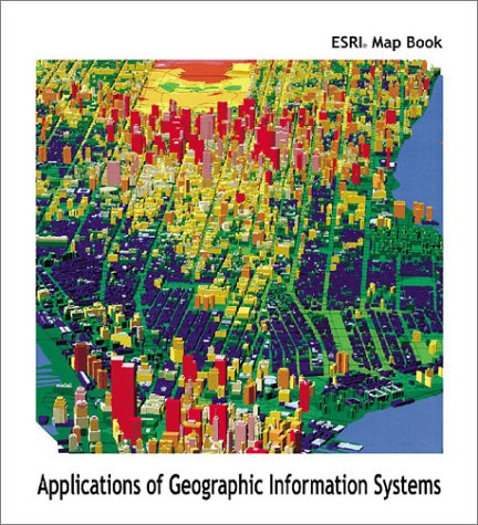
Paperback: 120 Pages (2000-06)
list price: US$19.95 -- used & new: US$9.95
(price subject to change: see help)
Asin: 1879102838
Canada | United Kingdom | Germany | France | Japan
Editorial Review

Book Description
Maps tell stories without words, and as geographic information technology evolves these stories are becoming increasingly complex, intricate, and extraordinarily detailed.

In the thirty years since its inception, GIS has proven itself to be something altogether different from simply a map-making tool. GIS identifies patterns and relationships that can elude the naked eye, reveal trends in agricultural and natural resource management, foster clear, sound environmental conservation, enhance logistical planning, make customer service efficient and effective, and rejuvenate problem-solving from one end of an enterprise to the other. It saves money and time, increases productivity, and generates revenue.

The ESRI Map Book: Applications of Geographic Information Systems Volume 15 is a compilation of some of the best digital maps produced in 1999. These contributions from individual GIS users around the world show how the digital revolution is fueling an explosion of quality spatial data.

The stories of these maps cover more than 20 industry sectors from government to geology to health care to transportation. They include:

-Understanding wetlands depletion
-Tracking ground water contamination
-Reducing juvenile crime
-Preparing for natural disasters
-Determining biodiversity protection plans
-Designing telecommunications networks

Descriptive text accompanies each full-color map, telling how the maps were produced or used. Published annually since 1984, the ESRI Map Book is the only publication dedicated to celebrating the important and innovative mapping achievements of GIS people around the world. ... Read more


91. Handbook on Geographic Information Systems and Digital Mapping
by United Nations Economic Commission for Europe
 Paperback: 208 Pages (2000-12-01)
list price: US$35.00 -- used & new: US$28.60
(price subject to change: see help)
Asin: 9211614260
Canada | United Kingdom | Germany | France | Japan
Editorial Review

Book Description
The rapid recent developments in digital mapping technology and the increasing demand for geo-referenced small area population data have been the main motivation for the present handbook. The Handbook on Geographic Information Systems and Digital Mapping provides guidance on how to ensure consistency and facilitate census operations; support data collection and help monitor census activities during enumeration; and facilitate presentation, analysis and dissemination of census results. Along with an overview of geographic information systems and digital mapping, the publication discusses cost-benefit analysis of an investment in digital cartography and geographical information systems (GIS); the use of GIS during census enumeration; and describes the role of GIS and digital mapping in the post-censual phase. ... Read more


92. Geographic Information Systems in Transportation Research
Hardcover: 456 Pages (2000-11-01)
list price: US$126.00 -- used & new: US$59.00
(price subject to change: see help)
Asin: 0080436307
Canada | United Kingdom | Germany | France | Japan
Editorial Review

Book Description
Computer-based transportation applications and databases have been a fact of life for several decades. Transportation information, however, has often not been accessible in a user-friendly manner, and integrating data from diverse sources has too often been a challenge in itself. Geographic Information Systems (GIS) have revolutionized spatial planning and decision making by using the spatial dimension of the depicted world as a common thread according to which all information can be referenced. The application of GIS to transportation research (GIS-T) is quickly becoming a mature domain of application of the GIS technology and has gained full recognition among transportation practitioners and academics.

This book fills a void by providing an overview of the state-of-the-art of GIS for transportation, from data management issues, to data manipulation and analysis, including considerations brought to the forefront by real-time and mobile computing. The twenty-two original contributions by internationally acclaimed authors will be a key reference for practitioners, students and scholars. ... Read more


93. Community Participation and Geographic Information Systems
Kindle Edition: 383 Pages (2007-04-16)
list price: US$77.99 -- used & new: US$62.39
(price subject to change: see help)
Asin: B000Q360M8
Canada | United Kingdom | Germany | France | Japan
Editorial Review

Book Description

Have you ever considered how much effect information technology has on society throughout the world? Progress often places lower income and marginalized communities at a distinct disadvantage. Community Participation and Geographic Information Systems, offers a detailed look at numerousexamples around the world where communities have actually taken control of the technology and used it to their advantage. This is presented in the form of case studies and models such as Philadelphia's neighborhoods, the Atlanta Project, and neighborhood revitalization in Minneapolis, reflecting public participation in GIS concepts, best practices, constraints, and opportunities.

Download Description
Geographical Information Systems (GIS) and related technologies are starting to have a significant impact on the communities which use them. This book looks at this impact and how communities have used this technology to their own advantage. ... Read more

94. Geographic Information Systems: Applications in Forestry and Natural Resources Management / Peter Bettinger, Michael G. Wing
by Peter Bettinger, Michael G. Wing
Hardcover: 230 Pages (2003-08)
-- used & new: US$176.35
(price subject to change: see help)
Asin: 0071215905
Canada | United Kingdom | Germany | France | Japan

95. Geographic Information Systems and Their Application in Geotechnical Earthquake Engineering: Proceedings of a Workshop : Penta Hotel Atlanta, Georgi
 Paperback: 115 Pages (1993-07)
list price: US$22.00 -- used & new: US$22.00
(price subject to change: see help)
Asin: 0872629732
Canada | United Kingdom | Germany | France | Japan

96. Ssadm for Handling Geographic Information Systems (Information Systems Engineering Library)
by Hmso
 Paperback: 90 Pages (1994-11)
list price: US$60.00 -- used & new: US$59.70
(price subject to change: see help)
Asin: 011330613X
Canada | United Kingdom | Germany | France | Japan

97. VIETNAM: Project feasibility study for proposed $52,000,000 automated mapping, facilities management and geographic information systems (AM/FM/GIS) project ... & Plant Operations in the Developing World
 Digital: 6 Pages (2004-03-01)
list price: US$5.95 -- used & new: US$5.95
(price subject to change: see help)
Asin: B000824FF6
Canada | United Kingdom | Germany | France | Japan
Editorial Review

Book Description
This digital document is an article from WWP-Report on Engineering Construct & Plant Operations in the Developing World, published by Worldwide Projects, Inc. on March 1, 2004. The length of the article is 1523 words. The page length shown above is based on a typical 300-word page. The article is delivered in HTML format and is available in your Amazon.com Digital Locker immediately after purchase. You can view it with any web browser.

Citation Details
Title: VIETNAM: Project feasibility study for proposed $52,000,000 automated mapping, facilities management and geographic information systems (AM/FM/GIS) project is tentatively scheduled for completion by the end of August 2004, US TRADE & DEVELOPMENT AGENCY (USTDA) & KEMA INC. [USA] - Order #: 360304.
Publication: WWP-Report on Engineering Construct & Plant Operations in the Developing World (Newsletter)
Date: March 1, 2004
Publisher: Worldwide Projects, Inc.
Volume: 13Issue: 03

Distributed by Thomson Gale ... Read more


98. Applications of land evaluation and site assessment (LESA) and a geographic information system (GIS) in East Park County, Wyoming. (Research).: An article from: Journal of Soil and Water Conservation
by B.M. Hoobler, G.F. Vance, J.D. Hamerlinck, L.C. Munn, J.A. Hayward
 Digital: Pages (2003-03-01)
list price: US$5.95 -- used & new: US$5.95
(price subject to change: see help)
Asin: B0008DHXMW
Canada | United Kingdom | Germany | France | Japan
Editorial Review

Book Description
This digital document is an article from Journal of Soil and Water Conservation, published by Soil & Water Conservation Society on March 1, 2003. The length of the article is 7421 words. The page length shown above is based on a typical 300-word page. The article is delivered in HTML format and is available in your Amazon.com Digital Locker immediately after purchase. You can view it with any web browser.

Citation Details
Title: Applications of land evaluation and site assessment (LESA) and a geographic information system (GIS) in East Park County, Wyoming. (Research).
Author: B.M. Hoobler
Publication: Journal of Soil and Water Conservation (Refereed)
Date: March 1, 2003
Publisher: Soil & Water Conservation Society
Volume: 58Issue: 2Page: 105(8)

Distributed by Thomson Gale ... Read more


99. Introduction to Physical Geography and Geographic Information Systems
 Paperback: Pages (2000)

Isbn: 0072522089
Canada | United Kingdom | Germany | France | Japan

100. Geographic Information Systems: Proceedings of the Institutions of Civil Engineers
 Hardcover: 56 Pages (1996-12)
list price: US$31.00 -- used & new: US$31.00
(price subject to change: see help)
Asin: 0727725785
Canada | United Kingdom | Germany | France | Japan

  Back | 81-100 of 100
A  B  C  D  E  F  G  H  I  J  K  L  M  N  O  P  Q  R  S  T  U  V  W  X  Y  Z  

Prices listed on this site are subject to change without notice.
Questions on ordering or shipping? click here for help.

site stats