|
|
Help |
| Home - Science - Geomatics (Books) | |
e99 Online Shopping Mall
|
|
Help |
| Home - Science - Geomatics (Books) | |
| 1-20 of 91 | Next 20 |
click price to see details click image to enlarge click link to go to the store
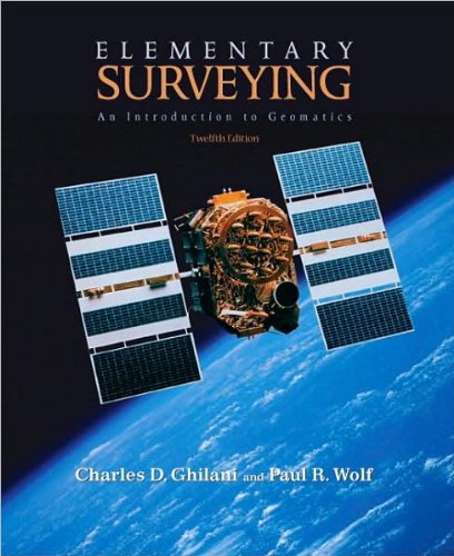
| 1. Elementary Surveying: An Introduction to Geomatics (12th Edition) by Charles D. Ghilani, Paul R. Wolf | |
 | Hardcover: 960
Pages
(2008-01-10)
list price: US$163.00 -- used & new: US$126.00 (price subject to change: see help) Asin: 013615431X Average Customer Review: Canada | United Kingdom | Germany | France | Japan |
|
Editorial Review Product Description Updated throughout, this highly readable best-seller presents basic concepts and practical material in each of the areas fundamental to modern surveying (geomatics) practice. Its depth and breadth are ideal for self-study. Includes a new Chapter 16 on Kinematic GPS. Features several new sections on machine control, localization of GPS surveys, and construction staking using GPS added to Chapters 16, 19, and 23. Moves Astronomical observations chapter to Appendix C to reflect that in recent years, kinematic GPS has replaced astronomical observations for position and azimuth. Emphasizes total stations as the instruments for making angle and distance observations. A useful reference for civil engineers. Customer Reviews (19)
| |
| 2. Introduction to Geometrical and Physical Geodesy: Foundations of Geomatics by Thomas H Meyer | |
 | Hardcover: 260
Pages
(2010-07-01)
list price: US$99.95 -- used & new: US$68.50 (price subject to change: see help) Asin: 1589482158 Average Customer Review: Canada | United Kingdom | Germany | France | Japan |
|
Editorial Review Product Description Customer Reviews (2)
| |
| 3. Geomatics: Webster's Facts and Phrases by Icon Group International | |
 | Paperback: 24
Pages
(2009-05-05)
list price: US$28.95 -- used & new: US$28.95 (price subject to change: see help) Asin: B002C7VOC2 Canada | United Kingdom | Germany | France | Japan |
|
Editorial Review Product Description | |
| 4. Basics of Geomatics by Mario A. Gomarasca | |
 | Hardcover: 656
Pages
(2009-10-27)
list price: US$209.00 -- used & new: US$160.50 (price subject to change: see help) Asin: 1402090137 Canada | United Kingdom | Germany | France | Japan |
|
Editorial Review Product Description This volume presents a comprehensive and complete treatment. In a systematic way the complex topics and techniques are covered that can be assembled under Geospatial Information namely, Geodesy, Cartography, Photogrammetry, Remote Sensing, Informatics, Acquisition Systems, Global Positioning Systems, Digital Image Processing, Geographic Information Systems, Decision Support Systems, and WebGIS. It describes in detail and at an accessible level - too much math has been avoided - the state of current knowledge. Per chapter a detailed bibliography has been included. | |
| 5. Geomatics by Barry F. Kavanagh | |
 | Hardcover: 589
Pages
(2002-04-18)
list price: US$124.40 -- used & new: US$104.88 (price subject to change: see help) Asin: 013032289X Canada | United Kingdom | Germany | France | Japan |
|
Editorial Review Product Description | |
| 6. Geomatics Engineering: A Practical Guide to Project Design by Clement A. Ogaja | |
 | Hardcover: 296
Pages
(2010-09-27)
list price: US$99.95 -- used & new: US$79.96 (price subject to change: see help) Asin: 143981743X Canada | United Kingdom | Germany | France | Japan |
|
Editorial Review Product Description Presenting the nuts and bolts of geomatics projects, this book examines key components and aspects of land surveying and geomatics projects. It reviews the experience of past projects and identifies priority areas of attention for planning new projects. Ideal for students, the text guides readers through the project design and request for proposal process commonly used for soliciting professional geomatics engineering services. The author provides an understanding of professional and ethical responsibility, the impact of engineering solutions in a global and social context, as well as a host of other contemporary issues such as budgetary and scheduling constraints. | |
| 7. Modelling Environmental Dynamics: Advances in Geomatic Solutions (Environmental Science and Engineering / Environmental Science) | |
 | Paperback: 390
Pages
(2010-11-02)
list price: US$209.00 -- used & new: US$209.00 (price subject to change: see help) Asin: 3642088058 Canada | United Kingdom | Germany | France | Japan |
|
Editorial Review Product Description Modelling environmental dynamics is critical to understanding and predicting the evolution of the environment in response to the large number of influences including urbanisation, climate change and deforestation. Simulation and modelling provide support for decision making in environmental management. The first chapter introduces terminology and provides an overview of methodological modelling approaches which may be applied to environmental and complex dynamics. Based on this introduction this book illustrates various models applied to a large variety of themes: deforestation in tropical regions, fire risk, natural reforestation in European mountains, agriculture, biodiversity, urbanism, climate change and land management for decision support, etc. These case studies, provided by a large international spectrum of researchers and presented in a uniform structure, focus particularly on methods and model validation so that this book is not only aimed at researchers and graduates but also at professionals. | |
| 8. Geomatics: Webster's Timeline History, 1750 - 2007 by Icon Group International | |
 | Paperback: 40
Pages
(2009-07-08)
list price: US$28.95 -- used & new: US$28.95 (price subject to change: see help) Asin: 0546984959 Canada | United Kingdom | Germany | France | Japan |
|
Editorial Review Product Description | |
| 9. Geomatics in Tsunami | |
| Hardcover:
Pages
(2006)
-- used & new: US$104.76 (price subject to change: see help) Asin: 8189422316 Canada | United Kingdom | Germany | France | Japan | |
| 10. Geomatic Solutions for Coastal Environments (Environmental Science, Engineering and Technology) | |
| Hardcover: 371
Pages
(2010-09-30)
list price: US$145.00 -- used & new: US$145.00 (price subject to change: see help) Asin: 1616681403 Canada | United Kingdom | Germany | France | Japan | |
| 11. CoastGIS'99: Geomatique et environnement littoral = geomatics and coastal environment, Brest 9-11 septembre 1999 (Actes de colloque) (French Edition) | |
| Paperback: 318
Pages
(2000)
Isbn: 2844330363 Canada | United Kingdom | Germany | France | Japan | |
| 12. Geomatic Methods for the Analysis of Data in the Earth Sciences (Lecture Notes in Earth Sciences) | |
 | Paperback: 256
Pages
(2000-07-31)
list price: US$199.00 -- used & new: US$139.00 (price subject to change: see help) Asin: 3540674764 Canada | United Kingdom | Germany | France | Japan |
|
Editorial Review Product Description | |
| 13. Pipeline Geomatics: Practice & Innovation (Pipeline Engineering Monograph Series) by Steve Adam, Kelsey Davis | |
 | Hardcover: 208
Pages
(2009-09-30)
list price: US$80.00 -- used & new: US$64.95 (price subject to change: see help) Asin: 0791802981 Average Customer Review: Canada | United Kingdom | Germany | France | Japan |
|
Editorial Review Product Description Customer Reviews (1)
| |
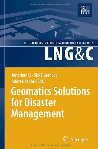
| 14. Geomatics Solutions for Disaster Management (Lecture Notes in Geoinformation and Cartography) | |
 | Hardcover: 444
Pages
(2007-06-12)
list price: US$239.00 -- used & new: US$85.98 (price subject to change: see help) Asin: 3540721061 Canada | United Kingdom | Germany | France | Japan |
|
Editorial Review Product Description Natural and anthropogenic disasters have caused a large number of victims and significant social and economic losses in the last few years. There is no doubt that the risk prevention and disaster management sector needs drastic measures and improvements in order to decrease damage and save lives of inhabitants. Effective utilization of satellite positioning, remote sensing, and GIS in disaster monitoring and management requires research and development in numerous areas: data collection, access and delivery, information extraction and analysis, management and their integration with other data sources (airborne and terrestrial imagery, GIS data, etc.), data standardization, organizational and legal aspects of sharing of remote sensing information. This book provides researchers and practitioners with a good overview of what is being developed in this topical area. | |
| 15. Elementary Surveying an Introduction to Geomatics 11th Edition 2006 by Paul R Wolf, Charles D Ghilani | |
 | Hardcover:
Pages
(2006)
-- used & new: US$47.93 (price subject to change: see help) Asin: B001TA4LFK Canada | United Kingdom | Germany | France | Japan |
| 16. Elementary Surveying : An Introduction to Geomatics - Textbook Only by Paul Richard Wolf | |
 | Hardcover: 900
Pages
(2002)
-- used & new: US$60.75 (price subject to change: see help) Asin: 0005333164 Canada | United Kingdom | Germany | France | Japan |
|
Editorial Review Product Description | |
| 17. C.D. Ghilani's P R. Wolf's Elementary Surveying(Elementary Surveying: An Introduction to Geomatics (12th Edition) [Hardcover])(2008) by C.D. Ghilani P R. Wolf | |
 | Hardcover:
Pages
(2008)
-- used & new: US$302.37 (price subject to change: see help) Asin: B003VVY3DK Canada | United Kingdom | Germany | France | Japan |
| 18. Outlines & Highlights for Elementary Surveying: An Introduction to Geomatics - With CD by Charles D. Ghilani, ISBN: 9780136154310 by Cram101 Textbook Reviews | |
 | Paperback: 116
Pages
(2009-12-08)
list price: US$28.95 -- used & new: US$28.95 (price subject to change: see help) Asin: 1428847278 Canada | United Kingdom | Germany | France | Japan |
|
Editorial Review Product Description | |
| 19. Business/retail geomatics: A developing field.: An article from: Canadian Journal of Regional Science by Maurice Yeates | |
| Digital: 28
Pages
(2001-09-22)
list price: US$5.95 -- used & new: US$5.95 (price subject to change: see help) Asin: B0008IQ8TG Canada | United Kingdom | Germany | France | Japan | |
|
Editorial Review Product Description | |
| 20. Elementary Surveying An Introduction to Geomatics _ 12th edition. by Paul RWolf | |
| Hardcover:
Pages
(2008)
Asin: B003ZPCYHY Canada | United Kingdom | Germany | France | Japan | |
| 1-20 of 91 | Next 20 |