|
|
Help |
| Home - Science - Geomatics (Books) | |
e99 Online Shopping Mall
|
|
Help |
| Home - Science - Geomatics (Books) | |
| Back | 41-60 of 91 | Next 20 |
click price to see details click image to enlarge click link to go to the store
| 41. Thomas H Meyer'sIntroduction to Geometrical and Physical Geodesy: Foundations of Geomatics [Hardcover](2010) by H., T., (Author) Meyer | |
 | Hardcover:
Pages
(2010)
-- used & new: US$168.21 (price subject to change: see help) Asin: B003VSDORE Canada | United Kingdom | Germany | France | Japan |
| 42. Elem Surveyg Intro Geomatics&intro Autocad4 | |
| Hardcover:
Pages
(2005-11)
list price: US$171.07 -- used & new: US$171.07 (price subject to change: see help) Asin: 0132221217 Canada | United Kingdom | Germany | France | Japan | |
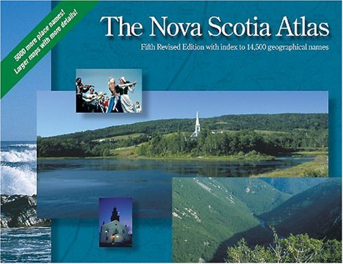
| 43. The Nova Scotia Atlas: Fifth Edition by Service Nova Scotia and Municipal Relations Nova Scotia Geomatics Centre | |
 | Spiral-bound: 144
Pages
(2001-11-16)
list price: US$24.95 -- used & new: US$159.99 (price subject to change: see help) Asin: 0887805213 Average Customer Review: Canada | United Kingdom | Germany | France | Japan |
|
Editorial Review Product Description Customer Reviews (2)
This highly detailed and up-to-date (2001) road atlas covers Nova Scotia at 1:150 000 (1 cm=1.5 km or 1 inch = 2.4 miles) in 90 highly detailed and colourful, yet very clear, map pages.Each map is large (25.5 cm x 18.5 cm or 10 in x 7.25 in) and overlaps a generous but not excessive 1.5 km (1 mi) with the adjacent map pages.The index has over 14 000 geographical names (towns, villages, rivers, lakes, islands, etc.).The book is 33.5 cm x 25.5 cm (13 in x 10 in) in total size, and weighs 780 g (1 lb, 11 oz).It is prepared by the Service Nova Scotia and Municipal Relations, and the Nova Scotia Geomatics Centre. This volume has all of the features that one would expect from a conventional road atlas, including well-labelled highways, railways, ferry routes, cities, towns, villages, historic sites, parks, lakes, rivers, designated beaches, hospitals and airports.What sets it apart, however, is that it displays many features more typical of topographic maps in the convenience of one volume.Natural features such as contour lines, point elevations, wetlands and even the smallest ponds, streams and islands are clearly displayed.Human features, including sections of crown (public) land, airstrips, heliports, firetowers, power lines, pipelines, quarries, aeronautical obstacles and geodetic monuments are also well-marked. What is most impressive, however, is that every road, paved and unpaved, longer than 200 m (600 ft or 1/8 mi) in the province is indicated in a colour and thickness that corresponds to the type of road and surface.These roads include limited access highways (Nova Scotia 100 Highway series), arterial highways (NS Highways 1 to 28), collector highways (NS 200 and 300 Highway series), local highways, local roads, loose surface roads, cart tracks, public hiking trails and rail trails. Needless to say, this detail is an absolute dream for those that like to explore the province off the beaten track, and for those that wish to hike, mountain bike or Nordic ski on old logging roads.The contours and natural features labelled on the pages will also help in determining the topography of a trip. My only wish is that some of the larger non-highway side roads (which the province unfortunately does not number) were labelled on the maps.However, my guess is that the author may have felt that these labels would clutter the pages to the point where they would decrease the quality of the atlas.After travelling in a certain region, I have taken to labelling the roads on the corresponding atlas page with an index number, and then, in the generous margins, cross-referencing the number with the name of the road so that I know where it is in the future. This atlas is fantastic value when one considers the price of individual governmental topographic maps.I am of the opinion that it will satisfy all but the most hardcore back-country adventurer in Nova Scotia (I would still suggest the governmental 1:50 000 map series for individuals planning longer canoe or backpacking trips). Combine the information in this book with excellent and up-to-date books on Hiking Trails of Nova Scotia by Michael Haynes (completely different trails are featured in the 7th AND 8th editions), and Mountain bike! Atlantic Canada by Sarah L. Hale and Jodi E. Bishop, and you are set to explore this beautiful part of the world! Have fun and drive safely! ... Read more | |
| 44. Indigenous peoples, mapping & biodiversity conservation: An analysis of current activities and opportunities for applying geomatics technologies (BSP peoples ... and forest program discussion paper series) by Peter Poole | |
| Unknown Binding: 83
Pages
(1995)
Isbn: 188753119X Canada | United Kingdom | Germany | France | Japan | |
| 45. Geodesy for Geomatics and GIS Professionals | |
| Paperback: 253
Pages
(2003)
Isbn: 1593990871 Canada | United Kingdom | Germany | France | Japan | |
| 46. Geomatics by Wayne Sarasua, Jack C. McCormac | |
| Hardcover: 512
Pages
(2006-11)
list price: US$103.70 Isbn: 0471384887 Canada | United Kingdom | Germany | France | Japan | |
| 47. Geomatics 2001: National Conference on Geomatics in Governance for Development, February 15-17, 2001, Hyderabad : pre-conference publication | |
| Unknown Binding: 146
Pages
(2001)
Asin: B0000CPKXA Canada | United Kingdom | Germany | France | Japan | |
| 48. Elementary Surveying: Intro to Geomatics by Paul R. Wolf | |
| Paperback:
Pages
(2005-05)
list price: US$20.60 Isbn: 0131936131 Canada | United Kingdom | Germany | France | Japan | |
| 49. Defence geomatics, then and now: Celebrating the 50th anniversary of Army Survey Establishment/Mapping and Charting Establishment, 1946-1996 | |
| Unknown Binding: 60
Pages
(1996)
Isbn: 091908852X Canada | United Kingdom | Germany | France | Japan | |
| 50. Geomatics technology roadmap: Special report | |
| Paperback: 49
Pages
(1998)
Isbn: 0662273524 Canada | United Kingdom | Germany | France | Japan | |
| 51. Accuracy in Geomatics: v. 2: Proceedings of the 8th International Symposium on Spatial Accuracy Assessment in Natural Resources and Environmental Sciences | |
| Hardcover: 420
Pages
(2008-06-25)
Isbn: 1846261716 Canada | United Kingdom | Germany | France | Japan | |
| 52. The Royal Institution of Chartered Surveyors Geomatics '99: Proceedings of the Geomatics Division Conference, University of Nottingham, 10-12 September 1999 by Royal Institution of Chartered Surveyors | |
| Unknown Binding: 96
Pages
(1999)
Isbn: 0854069658 Canada | United Kingdom | Germany | France | Japan | |
| 53. Elementary Surveying: An Introductins to Geomatics | |
| Unknown Binding:
Pages
(2005)
Asin: B001TYUF74 Canada | United Kingdom | Germany | France | Japan | |
| 54. Integrating geomatics and participatory techniques for community forest management: Case studies from the Yarsha Khola Watershed, Dolakha district, Nepal (MNR series) by Gavin H Jordan | |
| Unknown Binding: 47
Pages
(1998)
Asin: B0006FEE38 Canada | United Kingdom | Germany | France | Japan | |
| 55. Geomatics'99: Proceedings of the Geomatics Division Conference, University of Nottingham, 10-12 September 1999 by Royal Institution of Chartered Surveyors | |
| Paperback: 95
Pages
(1999)
Isbn: 0854069674 Canada | United Kingdom | Germany | France | Japan | |
| 56. Geomatics research Australasia | |
| Unknown Binding:
Pages
(1995)
Asin: B0000EH99L Canada | United Kingdom | Germany | France | Japan | |
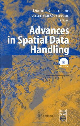
| 57. Advances in Spatial Data Handling: 10th International Symposium on Spatial Data Handling | |
 | Hardcover: 562
Pages
(2002-08-15)
list price: US$219.00 -- used & new: US$219.00 (price subject to change: see help) Asin: 3540438025 Canada | United Kingdom | Germany | France | Japan |
|
Editorial Review Product Description | |
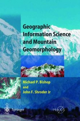
| 58. Geographic Information Science and Mountain Geomorphology (Springer Praxis Books / Geophysical Sciences) by Michael Bishop, John F. Shroder | |
 | Hardcover: 486
Pages
(2004-08-17)
list price: US$229.00 -- used & new: US$155.52 (price subject to change: see help) Asin: 354042640X Canada | United Kingdom | Germany | France | Japan |
|
Editorial Review Product Description | |
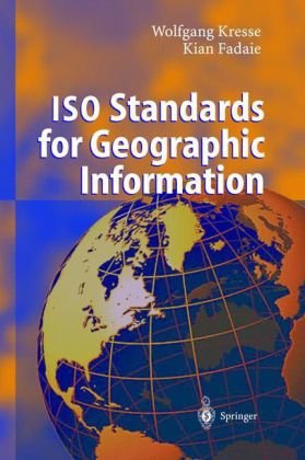
| 59. ISO Standards for Geographic Information by Wolfgang Kresse, Kian Fadaie | |
 | Hardcover: 322
Pages
(2004-01-12)
list price: US$209.00 -- used & new: US$98.00 (price subject to change: see help) Asin: 3540201300 Canada | United Kingdom | Germany | France | Japan |
|
Editorial Review Product Description The book addresses scientists and technical experts who have already some background knowledge in Geographic Information Systems (GIS) and who want to know more about standardisation in GIS, in particular, the role of the ISO. The authors also meet the needs of programmers who are going to implement ISO 19100 standards and who need a better understanding of the overall structure of the standards. Last, but not least, this richly illustrated book will help readers to better understand the rather abstract ISO documents. | |
| 60. New Technologies for Archaeology: Multidisciplinary Investigations in Palpa and Nasca, Peru (Natural Science in Archaeology) | |
 | Hardcover: 512
Pages
(2009-02-13)
list price: US$209.00 -- used & new: US$147.00 (price subject to change: see help) Asin: 3540874372 Canada | United Kingdom | Germany | France | Japan |
|
Editorial Review Product Description This book gives a representative overview of recent developments in archaeometry. It reveals the enormous potential of well executed multidisciplinary research. Furthermore, it is an example of how complex cultural history can be reconstructed in a combined effort of different disciplines. And last but not least it presents a detailed history of human development as well as its interaction with natural environment in the Nasca region, based on South America’s most detailed numeric archaeochronology. | |
| Back | 41-60 of 91 | Next 20 |