e99 Online Shopping Mall

Geometry.Net - the online learning center Help  
Home  - Science - Gis (Books)

  Back | 61-80 of 101 | Next 20
A  B  C  D  E  F  G  H  I  J  K  L  M  N  O  P  Q  R  S  T  U  V  W  X  Y  Z  

click price to see details     click image to enlarge     click link to go to the store

$36.95
61. Mapping Our World: GIS Lessons
$55.58
62. GIS and Spatial Analysis for the
$87.71
63. GIS and Archaeological Site Location
$101.32
64. Statistical Analysis of Geographic
65. Transportation GIS: Includes 12
$30.99
66. Analyzing Our World Using GIS:
$20.00
67. Beginning MapServer: Open Source
$117.28
68. Models in Spatial Analysis (Geographical
$9.35
69. The Spatial Humanities: GIS and
$38.50
70. Spatial Data Analysis: An Introduction
$9.35
71. The Spatial Humanities: GIS and
$38.50
72. Spatial Data Analysis: An Introduction
$2.54
73. Exploring the Ocean Environment:
$24.59
74. GIS Worlds: Creating Spatial Data
 
$349.95
75. GIS Concepts and ArcGIS Methods
$119.20
76. Advanced Spatial Analysis: The
$9.90
77. GIS Means Business Volume 2
$18.99
78. Interoperable and Distributed
$173.94
79. Three Dimensional Applications
$63.94
80. The GIS Book

61. Mapping Our World: GIS Lessons for Educators, ArcGIS Desktop Edition
by Lyn Malone, Anita M. Palmer, Christine L. Voigt
Paperback: 576 Pages (2005-07-01)
list price: US$79.95 -- used & new: US$36.95
(price subject to change: see help)
Asin: 1589481216
Average Customer Review: 4.0 out of 5 stars
Canada | United Kingdom | Germany | France | Japan
Editorial Review

Product Description

Providing a complete resource for any teacher seeking to bring GIS technology into the middle- or high-school classroom, this educational package is a comprehensive collection of world geography lessons, lesson plans, exercises, and assessment tools.
... Read more

Customer Reviews (1)

4-0 out of 5 stars Good read
The book has interesting information and is very detailed. The only problem would be that it is repetitive in the instructions. ... Read more


62. GIS and Spatial Analysis for the Social Sciences: Coding, Mapping, and Modeling (Contemporary Sociological Perspectives)
by Robert Nash Parker
Paperback: 272 Pages (2008-07-10)
list price: US$65.95 -- used & new: US$55.58
(price subject to change: see help)
Asin: 0415989620
Canada | United Kingdom | Germany | France | Japan
Editorial Review

Product Description

This is the first book to provide sociologists, criminologists, political scientists, and other social scientists with the methodological logic and techniques for doing spatial analysis in their chosen fields of inquiry. 

The book contains a wealth of examples as to why these techniques are worth doing, over and above conventional statistical techniques using SPSS or other statistical packages. 

GIS is a methodological and conceptual approach that allows for the linking together of spatial data, or data that is based on a physical space, with non-spatial data, which can be thought of as any data that contains no direct reference to physical locations.

... Read more

63. GIS and Archaeological Site Location Modeling
Hardcover: 496 Pages (2005-12-21)
list price: US$129.95 -- used & new: US$87.71
(price subject to change: see help)
Asin: 0415315484
Average Customer Review: 5.0 out of 5 stars
Canada | United Kingdom | Germany | France | Japan
Editorial Review

Product Description
Although archaeologists are using GIS technology at an accelerating rate, publication of their work has not kept pace. A state-of-the-art exploration the subject, GIS and Archaeological Site Location Modeling pulls together discussions of theory and methodology, scale, data, quantitative methods, and cultural resource management and uses location models and case studies to illustrate these concepts. This book, written by a distinguished group of international authors, reassesses the practice of predictive modeling as it now exists and examines how it has become useful in new ways.

A guide to spatial procedures used in archaeology, the book provides a comprehensive treatment of predictive modeling. It draws together theoretical models and case studies and explains how modeling may be applied to future projects. The book illustrates the various aspects of academic and practical applications of predictive modeling. It also discusses the need to assess the reliability of the results and the implications of reliability assessment on the further development of predictive models.

Of the books available on GIS, some touch on archaeological applications but few cover the topic in such depth. Both up to date and containing case studies from a wide range of geographical locations including Europe, the USA, and Australia, this book sets a baseline for future developments. ... Read more

Customer Reviews (1)

5-0 out of 5 stars Reports of Studies from Around the World
The list of reasons as to why a computer couldn't predict the location of an archaeological site covers at least a page of small type: we don't know where the water was in those times, we don't know the soil type in those days, we don't know the cultural or social values of the time and how they might have influenced site location.

In spite of this, the advent of ever better GIS software and higher performance computers have lead researchers around the world to being using GIS in a predictive manner to help identify potential sites worth investigating.

This book is a summary of research conducted around the world by people attempting to do just that. GIS can of course be used to map teraine and other features such as springs, both those flowing now and those from the past that have left traces. Combining these data with prediction equasions developed by the researcher have produced some interesting studies that point to success.

The book has a series of contributors from around the world: France, Greece, UK, Slovenia, Australia and of course many different organizations in the U.S. This book represents the state of the art in the field as it is known today. ... Read more


64. Statistical Analysis of Geographic Information with ArcView GIS And ArcGIS
by David W. S. Wong, Jay Lee
Hardcover: 464 Pages (2005-10-20)
list price: US$135.00 -- used & new: US$101.32
(price subject to change: see help)
Asin: 0471468991
Average Customer Review: 3.0 out of 5 stars
Canada | United Kingdom | Germany | France | Japan
Editorial Review

Product Description
Statistical Analysis and Modeling of Geographic Information with ArcView GIS is an update to Lee and Wong's Statistical Analysis with ArcView GIS, featuring expanded coverage of classical statistical methods, probability and statistical testing, new student exercises to facilitate classroom use, new exercises featuring interactive ArcView Avenue scripts, and a new overview of compatible spatial analytical functions in ArcGIS 9.0. ... Read more

Customer Reviews (4)

5-0 out of 5 stars Great text and even better software modules
This is an excellent book if interested in performing spatial analysis with ArcView (or any other GIS software I'd guess although the accompanying scripts would be less useful).

Comprehensive and easy - "easy" - to understand. As well, the tools developed by the authors are extremely efficient for many spatial statistical purposes, particularly if still employing ArcView 3.x.

1-0 out of 5 stars BOOK UNUSABLE WITH CURRENT ARCGISSOFTWARE
EXAMPLES ONLY WORK WITH OUTDATED SOFTWARE ARCVIEW 3.3!
Although this book purports to be 'updated' from the earlier edition, the Avenue script 'extensions' and examples in the book and on the accompanying CD only work with ESRI's outdated ArcView3.x, which has been moved to 'Mature Support' status by ESRI. DO NOT BUY THIS BOOK! There is an 11 page appendix that discusses statistical tools in ESRI's current ArcGIS 9.2. These 11 pages in the 441 page book discuss current technology. I feel like a victim of 'bait and switch.' Updated? Current? I don't think so!

1-0 out of 5 stars Hard to follow and use
Even though the book has 2005 copyright, all the examples and data relate to Arcview 3.X. None of the extensions can be used in ArcView 9.0. Without the extensions, it is really, really hard to follow the examples. The book acknowledges that version 9.0 has some statistical items in the ArcView toolbox, but it pretty well stops there. There are two web sites listed in the book to contact for updated information, but one doesn't work at all and the other doesn't show anything regarding software updates. This book has plenty of theory, many application examples, and a good price tag, but it falls short in being updated so that the average commercial user who has Arcview 9.0, 9.1 or 9.2 can get as much good out of it as hoped for. In short, this book had a lot of potential--and is a one-of-kind topic--but just couldn't seem to pull it off, which could have been done with just a little attention to detail for new software that would run on the newer versions of ArcView. Until that updating is done, it should be made clear that the examples and data relate only to Arcview 3.X--if that had been the case, I would not have purchased the book.

5-0 out of 5 stars Clearly written with numerous examples and useful ArcView extension tools for statistical analysis on the included CD.
I used this book for a graduate level course in geospatial statistics.The book is very clearly written and provides just enough background material to enable someone who has not had a statistics course in a while to still understand how statistical analysis of geographic information varies from classical statistics, and then apply the methods to their own geographic data (point, line or polygon). The book covers how to measure dispersion, perform hypothesis testing of point or quadrat distributions and univariate or bivariate spatial data analysis, quadrat analysis, and joint count statistics for spatial autocorrelation.Regarding directional statistics, this book is an authority on how to perform directional and network analysis and whether or not directional bias exists in a set of points using the standard deviational ellipse. You will not find other sources that explain the standard deviational ellipse as clearly as the Wong/Lee book. Also included are step-by-step application examples throughout which aid in grasping the concepts and also provide real tools for analyzing your point, polygon or other geographic data with ESRI ArcView (a 1-year licensed copy of ArcView for educational purposes comes with the ESRI Press book, "Mapping Our World" - currently listing at around $25 from Amazon).In other words, this book comes with tools that enable you to perform statistical analysis of geographic data without having to purchase an ESRI "extension" (extra-cost module to their product) as long as you are willing to work with an older version of ArcView, or the one in "Mapping Our World".There are some typographical mistakes, but they are easy to spot and rarely impact the calculations.Hopefully Wiley will soon include an "errata" link on their web site for this book's typos. I found the coverage of Global and Local Statistics for spatial autocorrelation using Moran's I, Geary's C and the G-statistic especially easy to follow and understand paving the way for deeper understanding of peer-reviewed journal articles dealing with these concepts. I highly recommend this book for anyone needing to gain a strong foundation in spatial statistics, who would also like to understand why classical statistical analysis falls short when working with geospatial datasets. ... Read more


65. Transportation GIS: Includes 12 Case Studies
by Laura Lang
CD-ROM: 118 Pages (1999-06)
list price: US$19.95
Isbn: 1879102471
Average Customer Review: 2.5 out of 5 stars
Canada | United Kingdom | Germany | France | Japan
Editorial Review

Product Description
This book with its illustrated exercises and CD-ROM support material, explain how GIS takes geographic information and makes it visually understandable to users. ... Read more

Customer Reviews (3)

1-0 out of 5 stars This is not a book its a Pamphlet for esri
Don't buy this book unless you want to be overwhelmed by pr for ESRI about projects they have done. Its a snooze.

3-0 out of 5 stars Ask for a free sales brochure...
This book showcases many examples of how GIS can be applied in the field of transportation using ArcView GIS, but it doesn't come with any theory. As such, it is more like an overpriced sales brochure and not a textbook. Nevertheless, the examples are really neat and should inspire any practitioner in the field.

3-0 out of 5 stars Superficial case studies
This book looks at GIS-based applications implemented for various transportation agencies around the US, and one in Korea. It is published by ESRI press, so every example uses ArcGIS & friends. Each chapter begins with a paragraph or two about the agency and the problems it's trying to solve using GIS. Each page has a screenshot with accompanying text that merely describes the screenshot in a fairly superficial way. The kind of generic commentary is typified here: "Using ESRI's ArcView application, the transportation manager can click on icons and review the date of reported accidents."

That really just describes to me how someone uses the software, where I had been hoping for a more high-level, deeper analysis with specific examples. From a production standpoint, this book is fairly poor. Some of the screenshots are of poor quality (e.g., they didn't even bother setting the character encoding properly for the Korean shots, so some of the characters show up as garbled). There's a lot of wasted whitespace, and the pages started to fall out as I reached the end of the book (brittle binding, I guess).

This book will be useful for managers wondering if GIS could help them, who are looking for situations where others have found this to be the case. I don't think it will necessarily give them much understanding of exactly HOW useful it might be or why. Certainly, this will not be of much use to GIS users, in my opinion, since it relatively thin on specifics. ... Read more


66. Analyzing Our World Using GIS: Our World GIS Education, Level 3 (Our World GIS Education)
by Roger Palmer, Anita M Palmer, Lyn Malone
Paperback: 200 Pages (2008-06-01)
list price: US$49.95 -- used & new: US$30.99
(price subject to change: see help)
Asin: 1589481828
Canada | United Kingdom | Germany | France | Japan
Editorial Review

Product Description

The third volume in the Our World GIS Education series promotes inquiry-based learning in world geography and other disciplines through the use of geographic information systems (GIS). Readers will be able to conduct far-ranging geographic exploration with this book and supplemental materials including a resource CD and a 180-day trial DVD of ArcView 9.2 software.
... Read more

67. Beginning MapServer: Open Source GIS Development (Expert's Voice in Open Source) (Volume 0)
by Bill Kropla
Paperback: 448 Pages (2005-08-22)
list price: US$44.99 -- used & new: US$20.00
(price subject to change: see help)
Asin: 1590594908
Average Customer Review: 3.5 out of 5 stars
Canada | United Kingdom | Germany | France | Japan
Editorial Review

Product Description

Beginning MapServer: Open Source GIS Development is the first book of its kind. It offers a comprehensive introduction to MapServer, the development platform for integrating mapping technology into Internet applications. You'll learn how to build and extend dynamic applications using popular languages like PHP, Perl, and Python.

After a thorough introduction to installation and configuration, you'll uncover basic MapServer topics and examples. You'll also learn about advanced MapServer features, and how to query and incorporate dynamic data into your application. The bookculminates with the creation of an actual mapping application.

... Read more

Customer Reviews (7)

4-0 out of 5 stars A bit out of date
This is an excellent hardcopy reference to MapServer, As others have noted, it is five years out of date, which can be confusing. For instance, a map document now requires an explicit MAP block containing the entire data and security fixes have broken some of the reference paths. Setting up the server is not covered in depth, and translating the examples to the MS4W world again can be confusing for the neophyte.

2-0 out of 5 stars Well written, but deprecated.
I've had this book for about a week, and so far my experience has been that not a single example works out of the box with the current version of mapscript.

The worse news, is that most of the documentation on the mapscript website is totally out of date as well.

If revised, then this book would be great, but it isn't just the book.

The are some incongruities between mapscript itself and the API libs in other languages that suggest that the current development environment for mapserver is sufficiently busted, to invite taking a hard look at much more complex map engines.

In a nutshell, I went with mapserver, because it support GDAL, Perl, and appeared to be well documented.

It isn't well documented, the Perl API isn't servicable in the current version, and I haven't tested GDAL yet.

Good Luck

2-0 out of 5 stars Map server
The version of the code sofware change very quickly... the book is old, but is full of content.

4-0 out of 5 stars Excellent
Best guide I've seen on mapserver.Does a fine job of getting a new user going.Could use more trouble shooting.

3-0 out of 5 stars Problematic if you are working on a Windows platform
I purchased this book to help with developing a simple map-enabled web page running on a Windows computer. The book proved very difficult to use in that context.If you are planning on working on a windows computer, you should be aware of some potential shortcomings.

In the spirit of full disclosure, I have considerable GIS experience, but little experience with web development.

The book assumes that you are operating not only on a UNIX-based platform, but also that you will operate in a particular "development environment".The author does provide full instructions for building that development environment on a Unix machine, so if you are starting from scratch, everything will work as described.

However....

You can not readily build the same "development environment" on a Windows computer.I installed a version of MS4W ("Mapserver 4 Windows" on my computer.MS4W is a labor saving package that rapidly sets up a web server and installs most of the other open source software one would like to have available for using Mapsourceeffectively.Unfortunately, the installation differs from the "development environment" assumed by the book.

As a result, there are MANY small but significant differences that crop up in developing the example applications given in the book.Many of these are simply differences in the way files are named or in the structure of the directory tree, but they are annoying and difficult to track down.it took me several DAYS of work and repeated searches for help on on-line MAPSERVER forums to figure things out and get the first several example applications running. I still have not managed to get about half of the examples up and running.

That said, the book offers a nice introduction to many of the central concepts used in Mapserver.It has a good reference section that allows you to look up Mapserver commands, etc.

Ultimately, I was able to develop the simple web-based applications I was after.This book contributed to that, but only after considerable frustration.Several Mapserver tutorials are available on-line.Some are specifically geared to Windows-based systems.They certainly offer a less tortuous, if sometimes less complete, path to getting Mapserver working on a Windows-based system. ... Read more


68. Models in Spatial Analysis (Geographical Information Systems Series (ISTE-GIS))
Hardcover: 319 Pages (2007-05-25)
list price: US$160.00 -- used & new: US$117.28
(price subject to change: see help)
Asin: 1905209096
Canada | United Kingdom | Germany | France | Japan
Editorial Review

Product Description
This title provides a broad overview of the different types of models used in advanced spatial analysis. The models concern spatial organization, location factors and spatial interaction patterns from both static and dynamic perspectives.

Each chapter gives a broad overview of the subject, covering both theoretical developments and practical applications. The advantages of an interdisciplinary approach are illustrated in the way that the viewpoint of each of the individual disciplines are brought together when considering questions relevant to spatial analysis.

The authors of the chapters come from a range of different disciplines (geography, economy, hydrology, ecology, etc.) and are specialists in their field. They use a range of methods and modeling tools developed in mathematics, statistics, artificial intelligence and physics. ... Read more


69. The Spatial Humanities: GIS and the Future of Humanities Scholarship
Paperback: 222 Pages (2010-06-07)
list price: US$24.95 -- used & new: US$9.35
(price subject to change: see help)
Asin: 0253222176
Canada | United Kingdom | Germany | France | Japan
Editorial Review

Product Description

Geographic information systems (GIS) have spurred a renewed interest in the influence of geographical space on human behavior and cultural development. Ideally GIS enables humanities scholars to discover relationships of memory, artifact, and experience that exist in a particular place and across time. Although successfully used by other disciplines, efforts by humanists to apply GIS and the spatial analytic method in their studies have been limited and halting. The Spatial Humanities aims to re-orient -- and perhaps revolutionize -- humanities scholarship by critically engaging the technology and specifically directing it to the subject matter of the humanities. To this end, the contributors explore the potential of spatial methods such as text-based geographical analysis, multimedia GIS, animated maps, deep contingency, deep mapping, and the geo-spatial semantic web.

... Read more

70. Spatial Data Analysis: An Introduction for GIS users
by Christopher Lloyd
Paperback: 272 Pages (2010-02-01)
list price: US$49.95 -- used & new: US$38.50
(price subject to change: see help)
Asin: 0199554323
Average Customer Review: 5.0 out of 5 stars
Canada | United Kingdom | Germany | France | Japan
Editorial Review

Product Description
What is the shortest route between one point and another in a road network? Where is the incidence of disease the highest? How does rainfall correlate with altitude? How does the concentration of a pollutant vary in space, and where do high concentrations correlate with densely populated areas?

Geographical or spatial data play a vital role in many parts of daily life. We are dependent on information about where things are located and about the attributes of those things, either directly, as in the use of a map for navigating around a city, or indirectly, where we use resources like water or gas.

Spatial Data Analysis: An Introduction for GIS Users introduces students to key principles about spatial data, the methods used to explore such data, and the kinds of problems that can be tackled using widely available analytical tools. Taking a gradual, systematic approach, the text opens with coverage of core concepts; these ideas are illustrated and reinforced with careful explanations, numerous worked examples, and case studies throughout the book.

Accessible to students who are new to the field, Spatial Data Analysis focuses on education rather than simple training; it not only shows students how to apply data analysis tools but also demonstrates how those tools work. A Companion Website provides resources for both students and instructors. ... Read more

Customer Reviews (1)

5-0 out of 5 stars good purchase
I got this new book with used price and air international shipping for just one week. The seller deserve best trusting whether you don't mind the time or very urgent for the book. Best seller i meet in Amazon since i brought textbook from Amazon. ... Read more


71. The Spatial Humanities: GIS and the Future of Humanities Scholarship
Paperback: 222 Pages (2010-06-07)
list price: US$24.95 -- used & new: US$9.35
(price subject to change: see help)
Asin: 0253222176
Canada | United Kingdom | Germany | France | Japan
Editorial Review

Product Description

Geographic information systems (GIS) have spurred a renewed interest in the influence of geographical space on human behavior and cultural development. Ideally GIS enables humanities scholars to discover relationships of memory, artifact, and experience that exist in a particular place and across time. Although successfully used by other disciplines, efforts by humanists to apply GIS and the spatial analytic method in their studies have been limited and halting. The Spatial Humanities aims to re-orient -- and perhaps revolutionize -- humanities scholarship by critically engaging the technology and specifically directing it to the subject matter of the humanities. To this end, the contributors explore the potential of spatial methods such as text-based geographical analysis, multimedia GIS, animated maps, deep contingency, deep mapping, and the geo-spatial semantic web.

... Read more

72. Spatial Data Analysis: An Introduction for GIS users
by Christopher Lloyd
Paperback: 272 Pages (2010-02-01)
list price: US$49.95 -- used & new: US$38.50
(price subject to change: see help)
Asin: 0199554323
Average Customer Review: 5.0 out of 5 stars
Canada | United Kingdom | Germany | France | Japan
Editorial Review

Product Description
What is the shortest route between one point and another in a road network? Where is the incidence of disease the highest? How does rainfall correlate with altitude? How does the concentration of a pollutant vary in space, and where do high concentrations correlate with densely populated areas?

Geographical or spatial data play a vital role in many parts of daily life. We are dependent on information about where things are located and about the attributes of those things, either directly, as in the use of a map for navigating around a city, or indirectly, where we use resources like water or gas.

Spatial Data Analysis: An Introduction for GIS Users introduces students to key principles about spatial data, the methods used to explore such data, and the kinds of problems that can be tackled using widely available analytical tools. Taking a gradual, systematic approach, the text opens with coverage of core concepts; these ideas are illustrated and reinforced with careful explanations, numerous worked examples, and case studies throughout the book.

Accessible to students who are new to the field, Spatial Data Analysis focuses on education rather than simple training; it not only shows students how to apply data analysis tools but also demonstrates how those tools work. A Companion Website provides resources for both students and instructors. ... Read more

Customer Reviews (1)

5-0 out of 5 stars good purchase
I got this new book with used price and air international shipping for just one week. The seller deserve best trusting whether you don't mind the time or very urgent for the book. Best seller i meet in Amazon since i brought textbook from Amazon. ... Read more


73. Exploring the Ocean Environment: GIS Investigations for the Earth Sciences (with CD-ROM)
by Michelle K. Hall, C. Scott Walker, Jennifer A. Weeks, Larry P. Kendall
Paperback: 170 Pages (2004-07-29)
list price: US$49.95 -- used & new: US$2.54
(price subject to change: see help)
Asin: 0534423507
Canada | United Kingdom | Germany | France | Japan
Editorial Review

Product Description
EXPLORING THE OCEAN ENVIRONMENT is the latest in a series of GIS Investigation Guides for the Earth Sciences, developed by The SAGUARO Project team. These Guides are designed to be modular, with instructor flexibility in mind, and are recommended for use either as a component of the regular laboratory sessions or as homework assignments. Each of the Guides in the SAGUARO GIS Investigations series leads students in "active learning" through a set of exercises in which students are asked to first explore, then analyze, and finally elaborate on the information from a robust GIS dataset using ArcView® GIS software. This investigation guide lets even novice users tap the power of ArcView® GIS to explore, manipulate, and analyze scientific data, while minimizing the need to master a complex software package. By focusing on teaching with GIS rather than about it, this flexible teaching resource motivates and enables students to "learn by doing." The GIS information has been preprocessed into ready-to-use maps and legends, and some ArcView® procedures have been automated to allow students to focus primarily on the science content.Extensive classroom testing of these GIS Investigations has shown a 10-17 percent increase in student understanding of subject content and spatial skills over traditional methods. Each copy of the text includes a CD containing unlimited access to the SAGUARO projects and data, and a FREE 120-day time-locked version of the ArcView® software to allow students to complete the investigations at home. An extensive Instructor's Manual provides assistance for instructors on incorporating GIS activities into the classroom. ... Read more


74. GIS Worlds: Creating Spatial Data Infrastructures
by Ian Masser
Paperback: 336 Pages (2005-09-01)
list price: US$49.95 -- used & new: US$24.59
(price subject to change: see help)
Asin: 1589481224
Average Customer Review: 5.0 out of 5 stars
Canada | United Kingdom | Germany | France | Japan
Editorial Review

Product Description

In describing the emergence of the spatial data infrastructure (SDI) phenomenon, this book covers the diffusion and evolution of SDIs around the world, and indicates the countries in which SDIs are far along, and those in which more work is needed. The implementation of SDIs from a practical perspective and a method of institution building for regional, continental, and global SDIs is outlined. This guide offers recommendations about how SDI stakeholders around the world can leverage the work already done and maintain the momentum that is currently driving the global SDI phenomenon.
... Read more

Customer Reviews (1)

5-0 out of 5 stars An overview of the concept and its technical evolution
Ian Masser's GIS Worlds: Creating Special Data Infrastructures provides an overview of SDI, which is being used increasingly by countries around the world to promote economic development and sustainable development. SDIs help assemble geographic information important to decision-making, from materials and technology to other descriptions of world processes. GIS Worlds provides an overview of the concept and its technical evolution, describing both local and global impacts and those organizations which are fostering SDI development and applications around the world. ... Read more


75. GIS Concepts and ArcGIS Methods
by David M. Theobald
 Paperback: 444 Pages (2005)
-- used & new: US$349.95
(price subject to change: see help)
Asin: 0967920833
Average Customer Review: 5.0 out of 5 stars
Canada | United Kingdom | Germany | France | Japan

Customer Reviews (1)

5-0 out of 5 stars Best book about ArcGIS, beats anything ESRI produces
This book is heads and shoulders above anything else I've ever seen (so far) about ArcGIS.

This book (and its predecessor _GIS Concepts and ArcView Methods_) is a very successful integration of the principles and power of Geographic Information Systems, along with how to do it in ArcGIS (or ArcView in the case of its predecessor).It gives the high level view as well as the low level steps, but well integrated so that you learn what to do and why to do it at the same time.You also get the middle level information, like what the data structures are and how to use them, etc.And when you want to refer to a method later, it is concisely described.You come out knowing what GIS is, as well as knowing how to do it in ArcGIS.

Most other books about Arc software suffer from an incredibly bloated style that hide principles inside low level instructions, e.g. click on this command, move the cursor here on the screen, etc. filling out the pages with screen shots so that there is very little content per page.And at the end of it all, the feeling is that you've done an exercise, and can copycat the steps, but don't have the principles or the broad view of how to use the program.

If you want to really learn ArcGIS, this is the book to get. ... Read more


76. Advanced Spatial Analysis: The CASA Book of GIS
Paperback: 275 Pages (2003-07-01)
list price: US$39.95 -- used & new: US$119.20
(price subject to change: see help)
Asin: 1589480732
Canada | United Kingdom | Germany | France | Japan
Editorial Review

Product Description
Describing the latest developments in GIS applications at the Centre for Advanced Spatial Analysis (CASA) at the University College, London, this book demonstrates how CASA is advancing spatial decision systems and spatial analysis, which are essential to solving problems and better understanding how people live. How these systems and analyses are drawn from archaeology, architecture, cartography, computer science, environmental science, geography, planning, remote sensing, geomatic engineering, and transport studies is explained. Highlighted are projects such as "Digital Egypt," which describes virtual reality reconstructions for Egyptian archaeological finds, and "Virtual cities," which explores the concepts and nature of virtual cities, from early CAD models to the newly emerging data-rich cities that merge GIS with three-dimensional visualization. ... Read more


77. GIS Means Business Volume 2
by David Boyles
Paperback: 161 Pages (2002-06-15)
list price: US$24.95 -- used & new: US$9.90
(price subject to change: see help)
Asin: 1589480333
Average Customer Review: 3.0 out of 5 stars
Canada | United Kingdom | Germany | France | Japan
Editorial Review

Product Description
Written for both business managers and GIS professionals, this guide reveals the ways that GIS can revolutionize the effectiveness of the 21st-century business enterprise. Demonstrating how a wide variety of businesses and business-related organizations such as chambers of commerce and commerce-friendly cities are using GIS to bolster the bottom line, detailed case studies analyze companies that overcame obstacles to profitability and efficiency by using the geographic and spatial analysis provided by GIS technology. As the technology has expanded, so have the number and diversity of companies that demand GIS capabilities. Such industries include real estate firms, insurance companies, food distributors, and casinos-all applying GIS solutions to logistics, marketing programs, and supply chain issues. ... Read more

Customer Reviews (1)

3-0 out of 5 stars Other
I found this website for anyone that is interested in looking for a GIS job. It's called GISCrossing. It's a great place to look for a job because it has jobs only from employer websites and far more jobs than you will find on other job boards. This makes it a lot more reliable place to find a job. Here's a link to their website :http://www.Giscrossing.com
... Read more


78. Interoperable and Distributed Processing in GIS (Research Monographs in Gis)
by Andrej Vckovaki
Paperback: 200 Pages (1998-07-16)
list price: US$94.95 -- used & new: US$18.99
(price subject to change: see help)
Asin: 0748407928
Average Customer Review: 3.0 out of 5 stars
Canada | United Kingdom | Germany | France | Japan
Editorial Review

Product Description
Shows how the principles & technologies of objectoriented programming, distributed processing & technologies of object-oriented programming, can be embraced to further the reliability & interoperability of datasets for the GIS professional.Paper. ... Read more

Customer Reviews (1)

3-0 out of 5 stars La purete et le GIS
La fin est magnifique.Un chef d'oeuvre a conseiller aux enfants ... Read more


79. Three Dimensional Applications In GIS
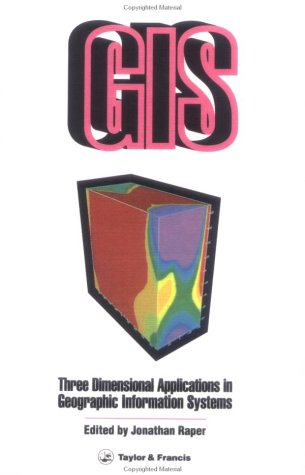
Hardcover: 280 Pages (1989-07-05)
list price: US$173.95 -- used & new: US$173.94
(price subject to change: see help)
Asin: 0850667763
Canada | United Kingdom | Germany | France | Japan
Editorial Review

Product Description
Provides a survey of the approaches used and the problems encountered in the model of real geophysical data. ... Read more


80. The GIS Book
by George Korte
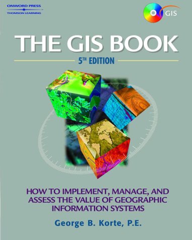
Paperback: 400 Pages (2000-08-30)
list price: US$101.95 -- used & new: US$63.94
(price subject to change: see help)
Asin: 0766828204
Average Customer Review: 4.5 out of 5 stars
Canada | United Kingdom | Germany | France | Japan
Editorial Review

Product Description
Discover what a geographic information system (GIS) is, how it applies to a variety of professions, and the benefits of using GIS for a variety of applications. Praised through four highly successful editions, The GIS Book, 5th Edition now features hands-on exercises enabling readers to use free GIS software and data downloaded over the Internet to gain a first-hand understanding of the power of GIS technology today. New chapters on GIS data sources, data quality, plus managing and maintaining a GIS database have also been added to educate those new to GIS about one of the most important aspects of implementing any GIS project. ... Read more

Customer Reviews (3)

4-0 out of 5 stars For a general intro to GIS, this is a start
My job currently requires me to be fully trained in the area of GIS.My company has done an outstanding job with buying materials, software, training courses, and books to provide support.One of the books they bought was this one.

It's a pretty solid book and gives a great overview of GIS from it's history to getting started with the planning process.While it gives an extensive amount of information on management, background information and other general information, it really fails to go in depth on the technical side.Coming from a programming background I am going to be having more hands on experience with GIS tools.Don't expect this book to really ever get into this.

This book serves as a must read for anyone interested in the GIS area.Managers and project leads will know doubt find everything they need in here.But, if you're going to be actually dealing with a GIS product to develop something, realize you're going to have to purchase additional books.

5-0 out of 5 stars Best overall book on getting started with this techology
This book covers just about everything you need to consider/understand/learn before getting started with GIS technology.And it's not biased towards any particular vendor, which is good.The book is up-to-date and has been a proven guide over time for many, many people.I know one person who teaches using just this book.When consulting with our local city government about getting started using GIS, the last thing I did was give them a copy of this book.They immediately bought one for every person on the team.This book is good for both management and for the technical staff to really understand what decisions need to be made right from the start.This book will save you a lot of time and money by helping you do it right the first time.

5-0 out of 5 stars The GIS Book Review
I've read an earlier edition of this book and it's pretty good.. ... Read more


  Back | 61-80 of 101 | Next 20
A  B  C  D  E  F  G  H  I  J  K  L  M  N  O  P  Q  R  S  T  U  V  W  X  Y  Z  

Prices listed on this site are subject to change without notice.
Questions on ordering or shipping? click here for help.

site stats